Whitemaws Skerry

Island in Caithness

Scotland

Whitemaws Skerry

Stroma island Kennedy mausoleum and cemetery on Stroma - photograph taken from ferry on the way past.
Stroma island Credit: J M Briscoe

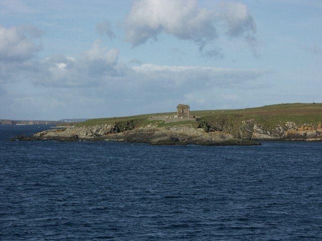
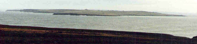
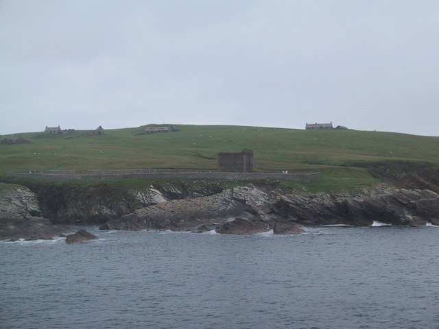
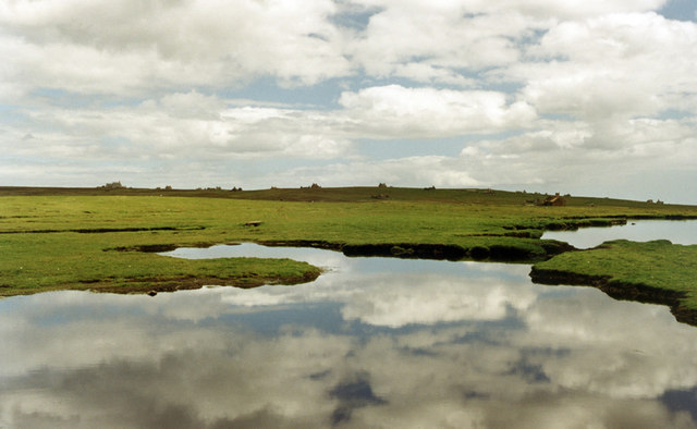
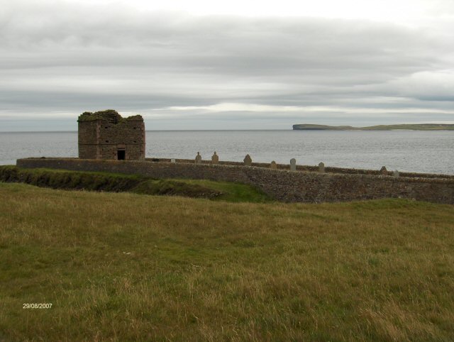
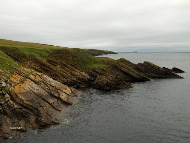
Whitemaws Skerry is a small island located off the north coast of Caithness, Scotland. Situated in the Pentland Firth, it is known for its unique geological features and diverse wildlife. The island is uninhabited and inaccessible to the public due to its protected status as a nature reserve.

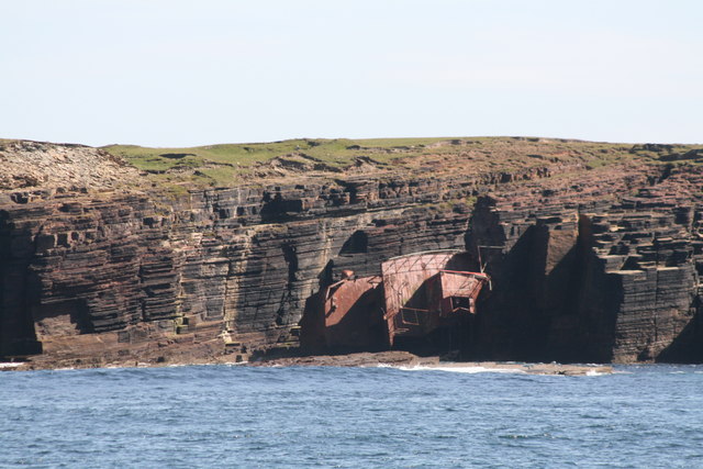
Covering an area of approximately 15 acres, Whitemaws Skerry is characterized by its rugged cliffs and rocky shoreline. The island is composed mainly of Old Red Sandstone, which dates back millions of years, giving it a distinct reddish hue. These cliffs provide nesting sites for numerous seabirds, including puffins, guillemots, and razorbills, making it a popular spot for birdwatchers and ornithologists.

The waters surrounding the island are home to a variety of marine life, such as seals, dolphins, and porpoises. Whitemaws Skerry is also part of a Special Area of Conservation, designated for its rich underwater habitats and important breeding grounds for fish species like cod and haddock.

Due to its isolation and protected status, Whitemaws Skerry remains largely undisturbed by human activity. However, it is regularly monitored and surveyed by conservation organizations to ensure the preservation of its natural beauty and biodiversity.

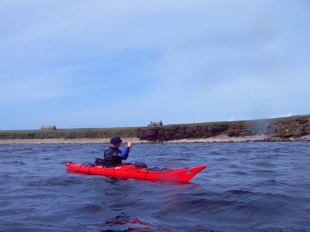
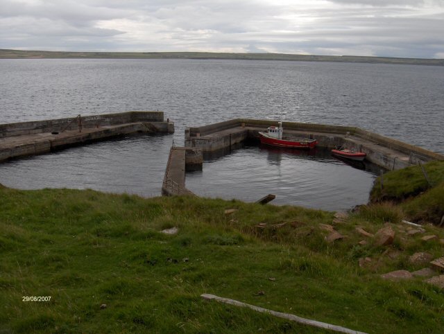
While visitors cannot access the island itself, boat trips and guided tours are available from nearby ports, allowing nature enthusiasts to observe and appreciate the stunning landscapes and wildlife that Whitemaws Skerry has to offer.

If you have any feedback on the listing, please let us know in the comments section below.

Whitemaws Skerry Images

Images are sourced within 2km of 58.676023/-3.1056451 or Grid Reference ND3576. Thanks to Geograph Open Source API. All images are credited.

Stroma island Kennedy mausoleum and cemetery on Stroma - photograph taken from ferry on the way past.
Stroma island
Kennedy mausoleum and cemetery on Stroma - photograph taken from ferry on the way past.
Stroma and the Pentland firth Viewed from the mainland near Huna
Stroma and the Pentland firth
Viewed from the mainland near Huna
Stroma from the sea Shortly after this the Pentland Firth tides started to run, we had to beat a retreat to John O'Groats
Stroma from the sea
Shortly after this the Pentland Firth tides started to run, we had to beat a retreat to John O'Groats
Geo of Nethertown Pier Abandoned Stroma, island in the stream, now inhabited by sheep.
Geo of Nethertown Pier
Abandoned Stroma, island in the stream, now inhabited by sheep.
Stroma cliffs and shipwreck The Danish coaster Bettina Danica shipwrecked in 1994 lies rusting against the cliffs of Stroma.
Stroma cliffs and shipwreck
The Danish coaster Bettina Danica shipwrecked in 1994 lies rusting against the cliffs of Stroma.
Collapsed Sea Cave Collapsed sea cave, creating a subterranean passage.  The photograph shows the cave opening and the land beyond.
Collapsed Sea Cave
Collapsed sea cave, creating a subterranean passage. The photograph shows the cave opening and the land beyond.
Coast of Stroma Abandoned house above rocky coastline of Stroma.
Coast of Stroma
Abandoned house above rocky coastline of Stroma.
Western cliffs of Stroma Looking north towards Orkney, the sea batters the cliffs and under cuts the cliffs creating caves/inlets.
Western cliffs of Stroma
Looking north towards Orkney, the sea batters the cliffs and under cuts the cliffs creating caves/inlets.
Geo, on west of Stroma Small geo on west of Stroma, with signs of water course across the grass and the tip of the War Memorial just visible on the horizon.
Geo, on west of Stroma
Small geo on west of Stroma, with signs of water course across the grass and the tip of the War Memorial just visible on the horizon.
Cottage on Stroma A view of a derelict cottage on the uninhabited island of Stroma, situated in the Pentland Firth.
Cottage on Stroma
A view of a derelict cottage on the uninhabited island of Stroma, situated in the Pentland Firth.
Uppertown, Island of Stroma Photograph taken from the Orkney ferry.
Uppertown, Island of Stroma
Photograph taken from the Orkney ferry.
Telephone box (disused), Stroma This telephone box dates from the 1960's when the last of the islanders left for pastures new. The track to the left of the telephone box goes down to the South Harbour.
Telephone box (disused), Stroma
This telephone box dates from the 1960's when the last of the islanders left for pastures new. The track to the left of the telephone box goes down to the South Harbour.
Stroma Abandoned houses on skyline Stroma.
Stroma
Abandoned houses on skyline Stroma.
The Gloup Stroma Inland feature with access to the sea through underground cave.
The Gloup Stroma
Inland feature with access to the sea through underground cave.
Island of Stroma Nice cave in the cliff face on the Island of Stroma
Island of Stroma
Nice cave in the cliff face on the Island of Stroma
Stroma harbour Stroma harbour was built mainly by local labour in 1954/55 with the Caithness mainland in the background
Stroma harbour
Stroma harbour was built mainly by local labour in 1954/55 with the Caithness mainland in the background
Stroma cemetery The cemetery on the south east corner of Stroma with Duncansby Head in the background
Stroma cemetery
The cemetery on the south east corner of Stroma with Duncansby Head in the background
Stroma shore line The rocky shore on the east side of Stroma
Stroma shore line
The rocky shore on the east side of Stroma
Show me another place!

Whitemaws Skerry is located at Grid Ref: ND3576 (Lat: 58.676023, Lng: -3.1056451)

Unitary Authority: Highland

Police Authority: Highlands and Islands

What 3 Words

///hems.splash.banquets. Near John o' Groats, Highland

Related Wikis

Island of Stroma

Stroma is an uninhabited island in the Pentland Firth, between Orkney and the mainland of Scotland. It forms part of the civil parish of Canisbay in Caithness...

MeyGen

MeyGen (full name MeyGen tidal energy project) is a tidal stream energy plant in the North of Scotland, which is currently being constructed in a phased...

Huna House

Huna House is a Victorian building located in the small village of Huna in Canisbay, north of Caithness. Built in 1870 as the Huna Hotel, it is listed...

Gills Bay

Gills Bay, which is situated about 3 mi (4.8 km) west of John o' Groats with the community of Gills close by, has one of the longest stretches of low-lying...

Related Videos

Island of Stroma On Visit Off The North Coast Of Mainland Scotland

Tour Scotland travel video clip, with Scottish music, of the Island of Stroma on visit off the North Coast of the Scottish mainland.

Lighthouse And Buildings With Music On History Visit To Island of Stroma Pentland Firth Scotland

Tour Scotland 4K short travel video clip, with Scottish music, of the lighthouse and uninhabited buildings on ancestry, genealogy, ...

Nearby Amenities

Located within 500m of 58.676023,-3.1056451
Scarton Point
Natural: cape
Lat/Long: 58.6716522/-3.1052561
Cairn Hill
Ele: 53
Natural: peak
Lat/Long: 58.6745631/-3.1132827
The data included in this document is from www.openstreetmap.org. The data is made available under ODbL.

Have you been to Whitemaws Skerry?

Leave your review of Whitemaws Skerry below (or comments, questions and feedback).