Inner Sound

Sea, Estuary, Creek in Caithness

Scotland

Inner Sound

Stroma island Kennedy mausoleum and cemetery on Stroma - photograph taken from ferry on the way past.
Stroma island Credit: J M Briscoe

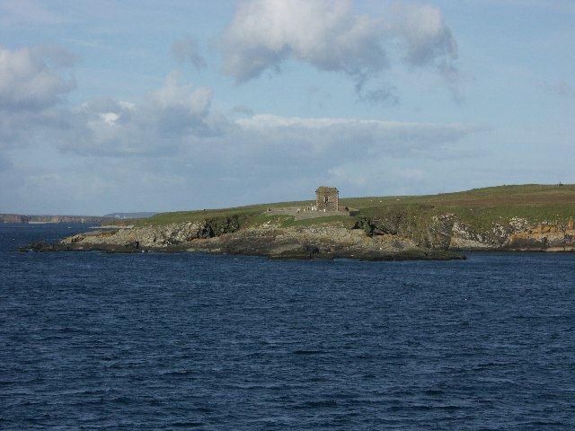
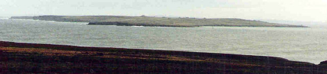
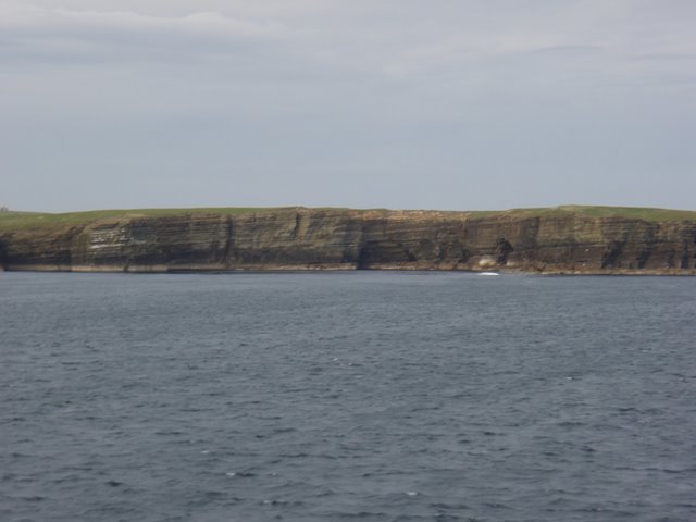
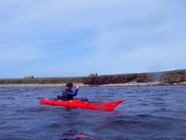
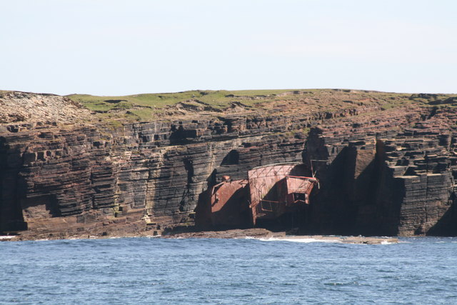
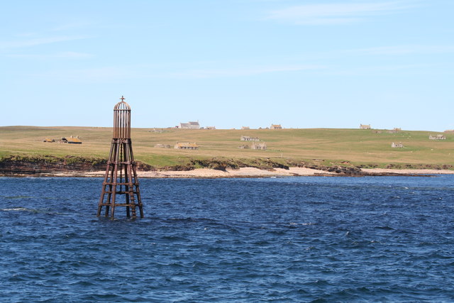
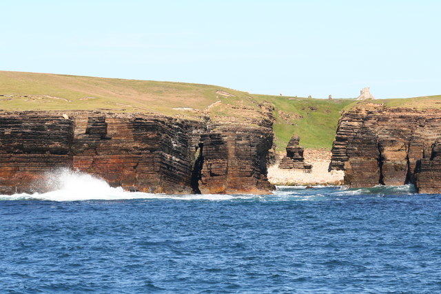
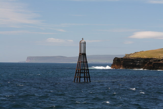
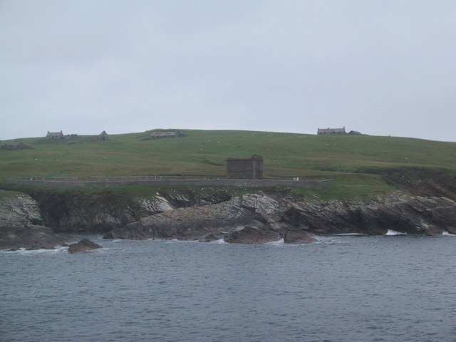
The Inner Sound, located in the Caithness region of Scotland, is a picturesque body of water that encompasses a diverse range of natural features including a sea, estuary, and creek. It is situated between the mainland of Scotland and the Orkney Islands, and serves as a vital waterway connecting the North Sea with the Pentland Firth.

The Inner Sound is characterized by its stunning coastal scenery and abundant wildlife. The sea within the Inner Sound is known for its moderate to strong currents, making it a popular destination for experienced kayakers and sailors. It is also a prime location for fishing, with various species such as cod, haddock, and mackerel being caught in its waters.

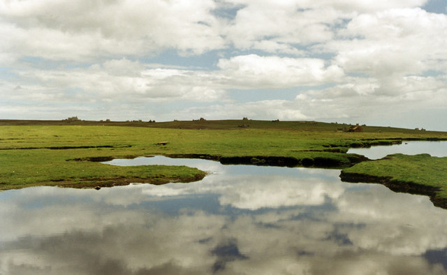
The estuary in the Inner Sound is formed by the confluence of several rivers, including the Wick River and the Thurso River. It is a haven for birdwatchers, as it supports a rich variety of bird species, including herons, oystercatchers, and waders. The estuary is also home to numerous intertidal mudflats and salt marshes, which provide crucial habitats for various marine life.

In addition to the sea and estuary, the Inner Sound also features a charming creek known as the Keiss Harbour. This small inlet is a popular spot for leisure activities such as boating and angling. It offers visitors a tranquil setting and stunning views, with its sheltered waters surrounded by rocky cliffs and sandy beaches.

Overall, the Inner Sound in Caithness is a captivating and diverse coastal area, offering visitors the opportunity to explore its sea, estuary, and creek, while enjoying its natural beauty and abundant wildlife.

If you have any feedback on the listing, please let us know in the comments section below.

Inner Sound Images

Images are sourced within 2km of 58.670059/-3.1181464 or Grid Reference ND3576. Thanks to Geograph Open Source API. All images are credited.

Stroma island Kennedy mausoleum and cemetery on Stroma - photograph taken from ferry on the way past.
Stroma island
Kennedy mausoleum and cemetery on Stroma - photograph taken from ferry on the way past.
Stroma and the Pentland firth Viewed from the mainland near Huna
Stroma and the Pentland firth
Viewed from the mainland near Huna
Mell Head The Island of Stroma in the Pentland Firth is now deserted.  Lots of buildings to be seen on the island.
Mell Head
The Island of Stroma in the Pentland Firth is now deserted. Lots of buildings to be seen on the island.
Stroma from the sea Shortly after this the Pentland Firth tides started to run, we had to beat a retreat to John O'Groats
Stroma from the sea
Shortly after this the Pentland Firth tides started to run, we had to beat a retreat to John O'Groats
Stroma cliffs and shipwreck The Danish coaster Bettina Danica shipwrecked in 1994 lies rusting against the cliffs of Stroma.
Stroma cliffs and shipwreck
The Danish coaster Bettina Danica shipwrecked in 1994 lies rusting against the cliffs of Stroma.
Collapsed Sea Cave Collapsed sea cave, creating a subterranean passage.  The photograph shows the cave opening and the land beyond.
Collapsed Sea Cave
Collapsed sea cave, creating a subterranean passage. The photograph shows the cave opening and the land beyond.
Coast of Stroma Abandoned house above rocky coastline of Stroma.
Coast of Stroma
Abandoned house above rocky coastline of Stroma.
Western cliffs of Stroma Looking north towards Orkney, the sea batters the cliffs and under cuts the cliffs creating caves/inlets.
Western cliffs of Stroma
Looking north towards Orkney, the sea batters the cliffs and under cuts the cliffs creating caves/inlets.
Beacon - Stroma Warning beacon to warn shipping of submerged rocks or 'Skerry' near Mell Head at the south of Stroma.
Beacon - Stroma
Warning beacon to warn shipping of submerged rocks or 'Skerry' near Mell Head at the south of Stroma.
Geo, with stack A 'geo' at the right hand side of the picture; with a stack (locally, also called a 'castle') (of, presumably) harder rock inside.  Even on this calm day you can see an impression of the forces produced by the sea
Geo, with stack
A 'geo' at the right hand side of the picture; with a stack (locally, also called a 'castle') (of, presumably) harder rock inside. Even on this calm day you can see an impression of the forces produced by the sea
Buoy/Beacon by Stroma, Pentland Firth Waves breaking on the rocks by Mell Head, looking towards Hoy, Orkney across the Pentland Firth.
Buoy/Beacon by Stroma, Pentland Firth
Waves breaking on the rocks by Mell Head, looking towards Hoy, Orkney across the Pentland Firth.
Geo, on west of Stroma Small geo on west of Stroma, with signs of water course across the grass and the tip of the War Memorial just visible on the horizon.
Geo, on west of Stroma
Small geo on west of Stroma, with signs of water course across the grass and the tip of the War Memorial just visible on the horizon.
Cottage on Stroma A view of a derelict cottage on the uninhabited island of Stroma, situated in the Pentland Firth.
Cottage on Stroma
A view of a derelict cottage on the uninhabited island of Stroma, situated in the Pentland Firth.
Uppertown, Island of Stroma Photograph taken from the Orkney ferry.
Uppertown, Island of Stroma
Photograph taken from the Orkney ferry.
Telephone box (disused), Stroma This telephone box dates from the 1960's when the last of the islanders left for pastures new. The track to the left of the telephone box goes down to the South Harbour.
Telephone box (disused), Stroma
This telephone box dates from the 1960's when the last of the islanders left for pastures new. The track to the left of the telephone box goes down to the South Harbour.
Stroma Abandoned houses on skyline Stroma.
Stroma
Abandoned houses on skyline Stroma.
Castle Mestag Stroma Remains of Castle Mestag on sea stack Stroma.
Castle Mestag Stroma
Remains of Castle Mestag on sea stack Stroma.
The Gloup Stroma Inland feature with access to the sea through underground cave.
The Gloup Stroma
Inland feature with access to the sea through underground cave.
Show me another place!

Inner Sound is located at Grid Ref: ND3576 (Lat: 58.670059, Lng: -3.1181464)

Unitary Authority: Highland

Police Authority: Highlands and Islands

What 3 Words

///eyeliner.erase.smirking. Near John o' Groats, Highland

Related Wikis

Island of Stroma

Stroma is an uninhabited island in the Pentland Firth, between Orkney and the mainland of Scotland. It forms part of the civil parish of Canisbay in Caithness...

MeyGen

MeyGen (full name MeyGen tidal energy project) will be the world's largest tidal energy plant, which is currently in construction. The first phase of the...

Huna House

Huna House is a Victorian building located in the small village of Huna in Canisbay, north of Caithness. Built in 1870 as the Huna Hotel, it is listed...

Gills Bay

Gills Bay, which is situated about 3 mi (4.8 km) west of John o' Groats with the community of Gills close by, has one of the longest stretches of low-lying...

Canisbay Parish Church

Canisbay Parish Church is a Church of Scotland church in Canisbay, Scotland, that dates back to the early 1600s and is the most northernly church on mainland...

Huna, Caithness

Huna is a small remote crofting township, located 1 mile northeast of Canisbay and 1.5 miles west of John o' Groats in Caithness, in Scotland. It is currently...

Canisbay

Canisbay is a rural hamlet located about one mile (1.5 kilometres) southwest of Huna and two and a half miles (four kilometres) southwest of John o' Groats...

John o' Groats

John O' Groats (Scottish Gaelic: Taigh Iain Ghròt) is a village 2.5 mi (4 km) northeast of Canisbay, Caithness, in the far north of Scotland. John O' Groats...

Nearby Amenities

Located within 500m of 58.670059,-3.1181464
Uppertown
Alt Name: Overtown
Note: deserted village
Place: locality
Source: OS7
Lat/Long: 58.6722744/-3.1193316
The Haven
Place: locality
Lat/Long: 58.6701967/-3.1186903
The data included in this document is from www.openstreetmap.org. The data is made available under ODbL.

Have you been to Inner Sound?

Leave your review of Inner Sound below (or comments, questions and feedback).