Scarton Point
Coastal Feature, Headland, Point in Caithness
Scotland
Scarton Point
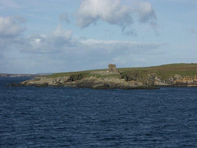
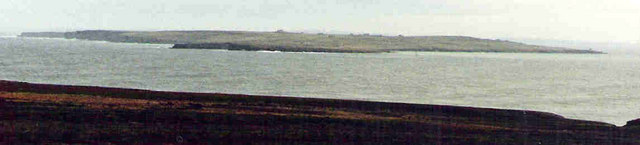
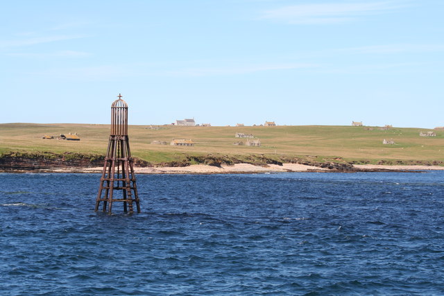
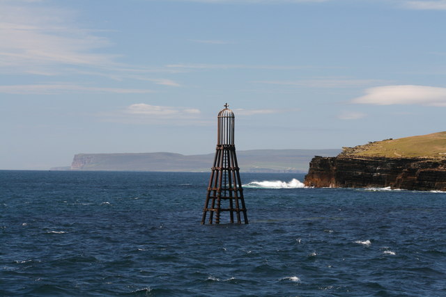
Scarton Point is a prominent coastal feature located in the county of Caithness, in the far north of Scotland. It is a majestic headland that juts out into the North Sea, offering breathtaking views of the surrounding landscape.
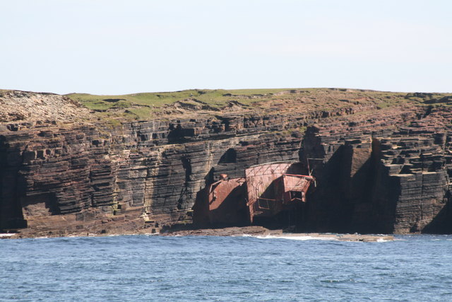
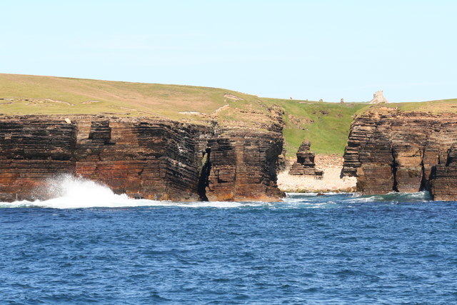
The headland is characterized by its rugged cliffs, which rise to considerable heights, providing a dramatic backdrop against the crashing waves below. These cliffs are composed of sandstone and have been eroded over time, resulting in unique geological formations and fascinating rock formations.
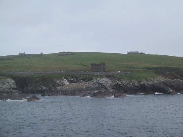
Scarton Point is not only visually striking but also holds historical significance. It was a strategic location during World War II, serving as a lookout point to monitor any potential enemy activity in the North Sea. The remnants of military structures, such as observation posts and gun emplacements, can still be seen today, reminding visitors of its past importance.
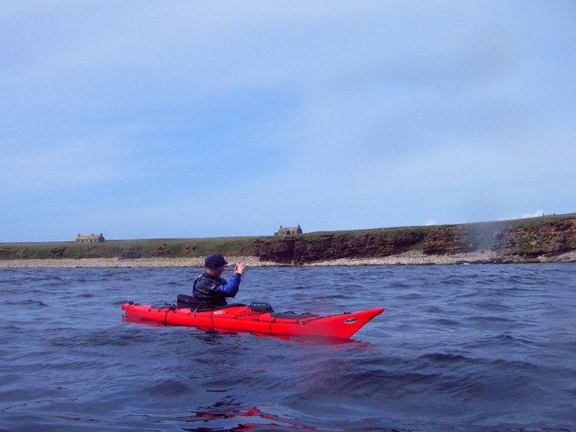
Nature enthusiasts will be delighted by the diverse wildlife found in the area. Seabirds, including puffins, gannets, and fulmars, nest along the cliffs, creating a vibrant and dynamic ecosystem. The surrounding waters are also home to a variety of marine life, with seals often seen basking on the rocks, and occasionally dolphins and porpoises can be spotted offshore.
Access to Scarton Point is relatively easy, with a well-maintained footpath leading from a nearby parking area. Hikers and walkers can enjoy a leisurely stroll along the cliff tops, taking in the stunning vistas and enjoying the tranquility of this remote location.
Overall, Scarton Point is a captivating headland that combines natural beauty, historical significance, and abundant wildlife, making it a must-visit destination for nature lovers and history enthusiasts alike.
If you have any feedback on the listing, please let us know in the comments section below.
Scarton Point Images
Images are sourced within 2km of 58.671326/-3.1066861 or Grid Reference ND3576. Thanks to Geograph Open Source API. All images are credited.


Scarton Point is located at Grid Ref: ND3576 (Lat: 58.671326, Lng: -3.1066861)
Unitary Authority: Highland
Police Authority: Highlands and Islands
What 3 Words
///predict.overpaid.dynasties. Near John o' Groats, Highland
Nearby Locations
Related Wikis

Island of Stroma
Stroma is an uninhabited island in the Pentland Firth, between Orkney and the mainland of Scotland. It forms part of the civil parish of Canisbay in Caithness...

MeyGen
MeyGen (full name MeyGen tidal energy project) will be the world's largest tidal energy plant, which is currently in construction. The first phase of the...
Huna House
Huna House is a Victorian building located in the small village of Huna in Canisbay, north of Caithness. Built in 1870 as the Huna Hotel, it is listed...

Gills Bay
Gills Bay, which is situated about 3 mi (4.8 km) west of John o' Groats with the community of Gills close by, has one of the longest stretches of low-lying...

Huna, Caithness
Huna is a small remote crofting township, located 1 mile northeast of Canisbay and 1.5 miles west of John o' Groats in Caithness, in Scotland. It is currently...

Canisbay Parish Church
Canisbay Parish Church is a Church of Scotland church in Canisbay, Scotland, that dates back to the early 1600s and is the most northernly church on mainland...

John o' Groats
John O' Groats (Scottish Gaelic: Taigh Iain Ghròt) is a village 2.5 mi (4 km) northeast of Canisbay, Caithness, in the far north of Scotland. John O' Groats...
Canisbay
Canisbay is a rural hamlet located about one mile (1.5 kilometres) southwest of Huna and two and a half miles (four kilometres) southwest of John o' Groats...
Related Videos
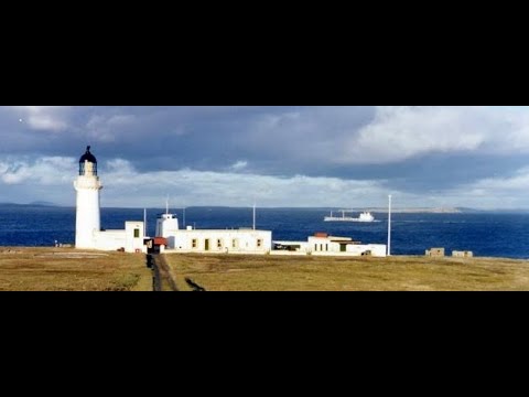
Lighthouse And Buildings With Music On History Visit To Island of Stroma Pentland Firth Scotland
Tour Scotland 4K short travel video clip, with Scottish music, of the lighthouse and uninhabited buildings on ancestry, genealogy, ...

Island of Stroma On Visit Off The North Coast Of Mainland Scotland
Tour Scotland travel video clip, with Scottish music, of the Island of Stroma on visit off the North Coast of the Scottish mainland.
Nearby Amenities
Located within 500m of 58.671326,-3.1066861Have you been to Scarton Point?
Leave your review of Scarton Point below (or comments, questions and feedback).