Cleet of Brough

Island in Caithness

Scotland

Cleet of Brough

Bluebells at Brough
Bluebells at Brough Credit: sylvia duckworth

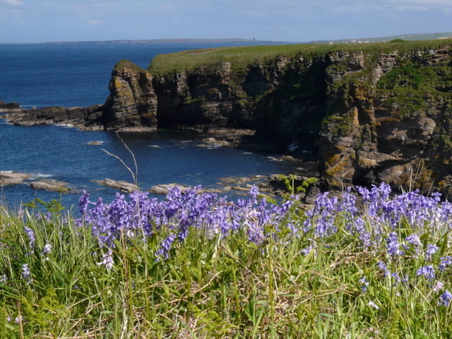
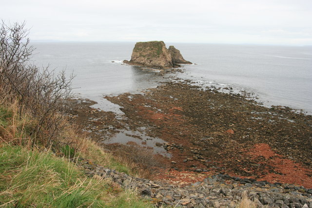
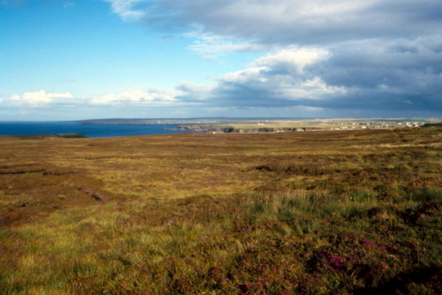
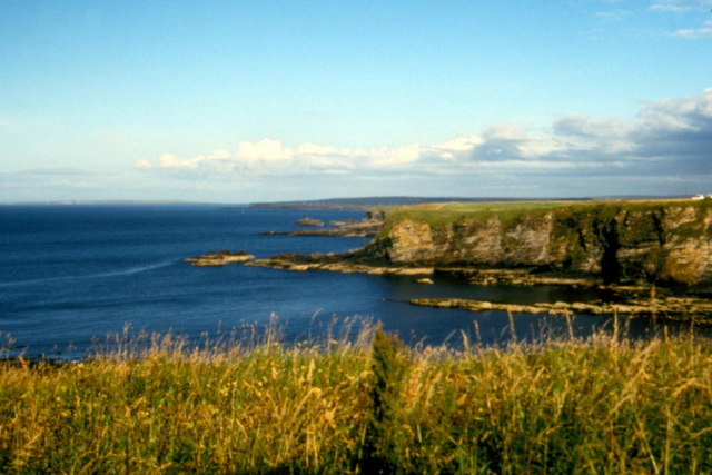
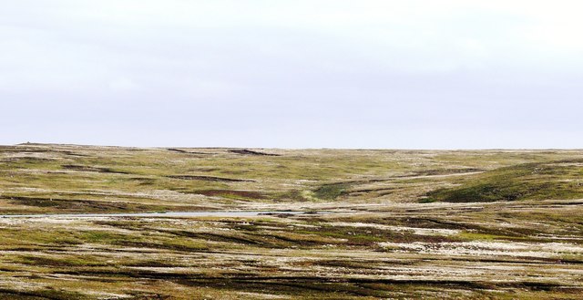
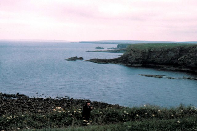
Cleet of Brough is a small and uninhabited island located off the coast of Caithness in the far north of Scotland. It is situated in the Pentland Firth, a stretch of water known for its strong tides and treacherous currents. The island is approximately 1.5 hectares in size and consists mainly of rugged cliffs and rocky outcrops.

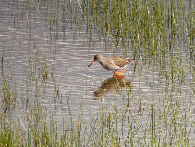
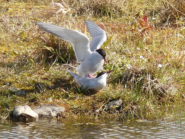
The name "Cleet of Brough" refers to the large number of cormorants, known as "cleets" locally, that used to inhabit the island. These seabirds were attracted to the island due to its abundance of fish and sheltered nesting sites. However, in recent years, the cormorant population has declined significantly, and the island is now mostly devoid of avian life.

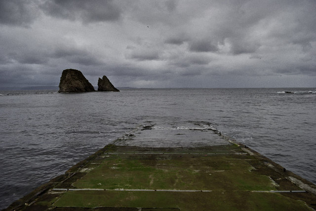
Access to Cleet of Brough is challenging due to its remote location and the dangerous waters surrounding it. The island can only be reached by boat, and visitors are advised to exercise extreme caution when navigating the strong currents. It is essential to check tidal charts and weather conditions before attempting to visit.

Despite its uninhabited status, Cleet of Brough is occasionally visited by birdwatchers, wildlife enthusiasts, and photographers who are drawn to its rugged beauty and potential for spotting seals, porpoises, and other marine wildlife in the surrounding waters.

In conclusion, Cleet of Brough is a small, remote island off the coast of Caithness. It is known for its treacherous waters, rugged cliffs, and historically significant population of cormorants. While no longer teeming with avian life, it remains a destination for those seeking a glimpse of untamed natural beauty and marine wildlife.

If you have any feedback on the listing, please let us know in the comments section below.

Cleet of Brough Images

Images are sourced within 2km of 58.649438/-3.3434186 or Grid Reference ND2274. Thanks to Geograph Open Source API. All images are credited.

Bluebells at Brough
Bluebells at Brough
Redshank at St. John's Pool
Arctic terns Full of the joys of Spring at St. John's Pool.
Arctic terns
Full of the joys of Spring at St. John's Pool.
Daffodils near Brough Looking from the B855 towards Clett and Little Clett, these daffodils adorn the hillside above the track leading down to Brough slipway.
Daffodils near Brough
Looking from the B855 towards Clett and Little Clett, these daffodils adorn the hillside above the track leading down to Brough slipway.
The Clett and Little Clett
Dunnet Head - 1987 Dunnet Head, seen from dirtroad to Burifa' Hill.
Dunnet Head - 1987
Dunnet Head, seen from dirtroad to Burifa' Hill.
Dunnet Head - 1987 Dunnet Head, seen from dirtroad to Burifa' Hill.
Dunnet Head - 1987
Dunnet Head, seen from dirtroad to Burifa' Hill.
Dunnet Head - 1987 Dunnet Head, peat ditch, Sanders Loch visible in the distance.
Dunnet Head - 1987
Dunnet Head, peat ditch, Sanders Loch visible in the distance.
Heather - 1987 Dunnet Head, heather.
Heather - 1987
Dunnet Head, heather.
Dunnet Head, Brough - 1987 Dunnet Head, Brough seen from A855.
Dunnet Head, Brough - 1987
Dunnet Head, Brough seen from A855.
Dunnet Head, Brough - 1987 Dunnet Head, Brough, Little Clett.
Dunnet Head, Brough - 1987
Dunnet Head, Brough, Little Clett.
Dunnet Head, Brough - 1987 Dunnet Head, Brough, The Stacks.
Dunnet Head, Brough - 1987
Dunnet Head, Brough, The Stacks.
Lighthouse Loading Platform The adjacent inscription reads "This platform was used for the loading of carts with oil and other stores for Dunnet Head Lighthouse.  Constructed c1831 by the Northern Lighthouse Board.  Restored by the Brough Bay Association 2011."
Lighthouse Loading Platform
The adjacent inscription reads "This platform was used for the loading of carts with oil and other stores for Dunnet Head Lighthouse. Constructed c1831 by the Northern Lighthouse Board. Restored by the Brough Bay Association 2011."
A typical Caithness lane near Ham
Black Loch with cotton grass In June vast acres of Dunnet Head are covered with snow-like cotton grass.
Black Loch with cotton grass
In June vast acres of Dunnet Head are covered with snow-like cotton grass.
Slipway at Brough
Slipway at Brough
Ham old mill
Ham old mill
Brough - 1975 Brough, The Kame, Grassy Clett.
Brough - 1975
Brough, The Kame, Grassy Clett.
Show me another place!

Cleet of Brough is located at Grid Ref: ND2274 (Lat: 58.649438, Lng: -3.3434186)

Unitary Authority: Highland

Police Authority: Highlands and Islands

What 3 Words

///backup.backdrop.pelt. Near Thurso, Highland

Related Wikis

Brough Castle (Caithness)

Brough Castle is a ruined castle near Brough, Caithness. It is believed to date from the 12th to 14th centuries. == Description == The foundations of...

Brough, Caithness

Brough is a small village (population 66) in Caithness in the North of Scotland. It is located on the B855 single-track road, the most northerly numbered...

Ham, Caithness

Ham is a village in the Caithness region in the Scottish council area of Highland. It has a very short river running from a mill pond to the sea - a total...

Dunnet Head Lighthouse

Dunnet Head Lighthouse is an active 19th century lighthouse that stands on the 300-foot (91 m) cliff top of Easter Head on Dunnet Head. The lighthouse...

Dunnet Church

Dunnet Parish Church is a Church of Scotland church in Dunnet, Caithness, northern Scotland. References to St Mary's Parish Church are known from as far...

Dunnet Head

Dunnet Head (Scottish Gaelic: Ceann Dùnaid) is a peninsula in Caithness, on the north coast of Scotland. Dunnet Head includes the most northerly point...

Dunnet

Dunnet is a village in Caithness, in the Highland area of Scotland. It is within the Parish of Dunnet. == Village == The village centres on the A836–B855...

Skarfskerry

Skarfskerry (or Scarfskerry; Scottish Gaelic: Sgarbh Sgeir) is a settlement located in the far northern county Caithness on a small peninsula northeast...

Nearby Amenities

Located within 500m of 58.649438,-3.3434186
Created By: almien_coastlines
Source: PGS
Lat/Long: 58.648004/-3.336062
Created By: almien_coastlines
Source: PGS
Lat/Long: 58.648256/-3.337538
Created By: almien_coastlines
Source: PGS
Lat/Long: 58.648255/-3.338029
Created By: almien_coastlines
Source: PGS
Lat/Long: 58.647996/-3.339009
Source: PGS
Lat/Long: 58.6477527/-3.3393712
Source: PGS
Lat/Long: 58.6476585/-3.3393014
Source: PGS
Lat/Long: 58.6470729/-3.3410218
Source: PGS
Lat/Long: 58.6469455/-3.3410844
Source: PGS
Lat/Long: 58.6469134/-3.3422111
Source: PGS
Lat/Long: 58.646556/-3.343651
Source: PGS
Lat/Long: 58.6471867/-3.3450883
Source: PGS
Lat/Long: 58.6477035/-3.3458492
Source: PGS
Lat/Long: 58.6479697/-3.346266
Source: PGS
Lat/Long: 58.6484026/-3.3466609
Source: PGS
Lat/Long: 58.6485891/-3.3468867
Source: PGS
Lat/Long: 58.648992/-3.3470522
Source: PGS
Lat/Long: 58.6496111/-3.3470729
Source: PGS
Lat/Long: 58.6499405/-3.3470495
Source: PGS
Lat/Long: 58.6501106/-3.3472153
Source: PGS
Lat/Long: 58.6509652/-3.3470479
Source: PGS
Lat/Long: 58.6515662/-3.3469908
Source: PGS
Lat/Long: 58.6516054/-3.3473035
Source: PGS
Lat/Long: 58.6527478/-3.3469559
Source: PGS
Lat/Long: 58.6531651/-3.347254
The Croft
Tourism: chalet
Lat/Long: 58.6450116/-3.3441784
Power: pole
Lat/Long: 58.6472238/-3.3484394
Power: pole
Lat/Long: 58.6473104/-3.3494709
Power: pole
Lat/Long: 58.647377/-3.3503967
Cafe
Windhaven Cafe
Addr City: Thurso
Addr Postcode: KW14 8YE
Email: windhaven.booking@hotmail.com
Phone: +44 1847 851927
Lat/Long: 58.6457476/-3.3447794
The data included in this document is from www.openstreetmap.org. The data is made available under ODbL.

Have you been to Cleet of Brough?

Leave your review of Cleet of Brough below (or comments, questions and feedback).