Castle of Yesnaby

Island in Orkney

Scotland

Castle of Yesnaby

Yesnaby Head A peaceful day on this windswept headland.  Tidal power ship lies off Hoy.
Yesnaby Head Credit: Alan Reid

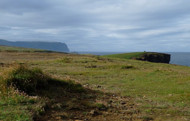
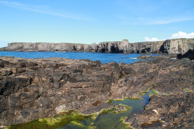
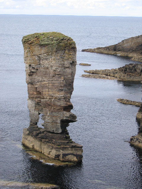
The Castle of Yesnaby is a magnificent sea stack located on the west coast of Orkney, a group of islands in Scotland. Rising dramatically from the wild North Atlantic Ocean, this natural landmark stands proudly, showcasing its rugged beauty against the elements.

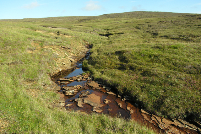
The Castle of Yesnaby is composed of towering cliffs made of sandstone, shaped over centuries by the relentless waves and winds. Its unique structure resembles a medieval castle, hence its name. The stack stands at an impressive height of around 35 meters, providing visitors with breathtaking panoramic views of the surrounding coastline and sea.

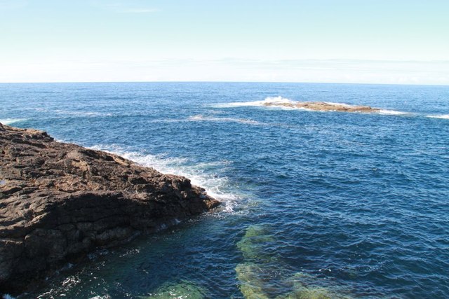
Visiting the Castle of Yesnaby offers an awe-inspiring experience, allowing one to immerse themselves in the raw power of nature. The crashing waves, the salty air, and the sheer grandeur of the sea stack make it a must-see for nature enthusiasts and photographers alike.

Accessing the Castle of Yesnaby requires a short walk from the car park, and caution is advised as the cliffs can be unstable. However, the journey is well worth it, as visitors are treated to a spectacle of nature's raw beauty. The site is also known for its diverse birdlife, with puffins, fulmars, and kittiwakes nesting along the cliffs.

Overall, the Castle of Yesnaby is a captivating natural wonder that showcases the untamed beauty of Orkney's coastline. Its towering cliffs and stunning views make it a popular destination for tourists seeking to connect with the power of nature and immerse themselves in the unique charm of the Scottish islands.

If you have any feedback on the listing, please let us know in the comments section below.

Castle of Yesnaby Images

Images are sourced within 2km of 59.017446/-3.3608235 or Grid Reference HY2115. Thanks to Geograph Open Source API. All images are credited.

Yesnaby Head A peaceful day on this windswept headland.  Tidal power ship lies off Hoy.
Yesnaby Head
A peaceful day on this windswept headland. Tidal power ship lies off Hoy.
Short-eared owl on the prowl Meadow grasses hide a feast
Short-eared owl on the prowl
Meadow grasses hide a feast
Burn of Lyregeo The burn flows over bedrock containing fossil wave ripples.
Burn of Lyregeo
The burn flows over bedrock containing fossil wave ripples.
Inlet near Yesnaby A small inlet south of Yesnaby
Inlet near Yesnaby
A small inlet south of Yesnaby
Rocks and water Colourful sea grass at lowish tide in an inlet by Yesnaby
Rocks and water
Colourful sea grass at lowish tide in an inlet by Yesnaby
Yesnaby Castle A large sea stack
Yesnaby Castle
A large sea stack
The end of The Spade Taken from the rocks at sea level and looking up rather than down the cliffs
The end of The Spade
Taken from the rocks at sea level and looking up rather than down the cliffs
Bo Skerry Bo Skerry taken from the cliff top
Bo Skerry
Bo Skerry taken from the cliff top
Rocks on Inga Ness Rocky shoreline on the north side of Inga Ness
Rocks on Inga Ness
Rocky shoreline on the north side of Inga Ness
Inga Ness The very rocky tip of Inga Ness
Inga Ness
The very rocky tip of Inga Ness
Yesnaby: the Brough of Bigging from the north The Brough of Bigging is the cliff-surrounded peninsula seen here; the inlet in front of it is the Noust of Bigging.  The rocks at Yesnaby are strongly layered and rather unstable.
In the background, the high hills on Hoy.  This was taken at the very end of a long Orcadian midsummer day, and Great Skuas (Bonxies) were processing southwards towards Hoy to roost after a hard day harassing the birds nesting here and further north along the coastline.
Yesnaby: the Brough of Bigging from the north
The Brough of Bigging is the cliff-surrounded peninsula seen here; the inlet in front of it is the Noust of Bigging. The rocks at Yesnaby are strongly layered and rather unstable. In the background, the high hills on Hoy. This was taken at the very end of a long Orcadian midsummer day, and Great Skuas (Bonxies) were processing southwards towards Hoy to roost after a hard day harassing the birds nesting here and further north along the coastline.
Castle of Yesnaby A two-legged sea stack north of Stromness.
Castle of Yesnaby
A two-legged sea stack north of Stromness.
Castle Yesnaby Looking rather like the Old Man of Hoy, but smaller.
Castle Yesnaby
Looking rather like the Old Man of Hoy, but smaller.
Natural Arch at Yesnaby A temporary feature?
Natural Arch at Yesnaby
A temporary feature?
Primula scotica Primula scotica (Scottish primrose) is found only in Caithness, Sutherland and Orkney.
Primula scotica
Primula scotica (Scottish primrose) is found only in Caithness, Sutherland and Orkney.
Yesnaby cliffs View of the cliffs at Yesnaby. The old man of Hoy can be seen in the distance.
Yesnaby cliffs
View of the cliffs at Yesnaby. The old man of Hoy can be seen in the distance.
Cliff and sea cave at Yesnaby
Rocky outcrop near Brough of Bigging
Show me another place!

Castle of Yesnaby is located at Grid Ref: HY2115 (Lat: 59.017446, Lng: -3.3608235)

Unitary Authority: Orkney Islands

Police Authority: Highlands and Islands

What 3 Words

///situation.messy.hype. Near Sandwick, Orkney Islands

Related Wikis

Yesnaby

Yesnaby is an area in Sandwick, on the west coast of Orkney Mainland, Scotland, south of Skara Brae. It is renowned for its spectacular Old Red Sandstone...

Broch of Borwick

The Broch of Borwick is an Iron Age broch located on Mainland, Orkney, Scotland (grid reference HY22411678). It is a scheduled monument. == Location... ==

North Gaulton Castle

North Gaulton Castle is a sea stack off the western coast off the Orkney main island. It is formed from the red sandstone of the area and is about 165...

Loch of Skaill

The Loch of Skaill is a small somewhat triangular, freshwater loch in the parish of Sandwick, Orkney on Mainland Orkney, Scotland. It lies 0.5 mi (0.80...

Nearby Amenities

Located within 500m of 59.017446,-3.3608235
Created By: almien_coastlines mod
Lat/Long: 59.020866/-3.361035
Barrier: kissing_gate
Source: survey;gps
Lat/Long: 59.0167666/-3.3581209
The data included in this document is from www.openstreetmap.org. The data is made available under ODbL.

Have you been to Castle of Yesnaby?

Leave your review of Castle of Yesnaby below (or comments, questions and feedback).