Wheel Rock

Island in Devon East Devon

England

Wheel Rock

Footpath steps Steps off a public footpath at the rear of Ladram Bay caravan park.
Footpath steps Credit: Anthony Vosper

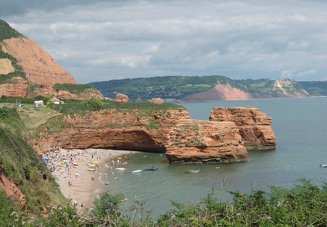
Wheel Rock is a small uninhabited island located approximately 2 miles off the coast of Devon, England. The island measures just 200 meters in length and 100 meters in width, making it a tiny landmass in the vast expanse of the Atlantic Ocean. Its name derives from the distinctive wheel-like rock formation that dominates its landscape.

The island is composed mainly of granite, with steep cliffs rising up to 30 meters on its western side. Wheel Rock is a popular destination for birdwatchers, as it provides a nesting site for various seabird species, including puffins, razorbills, and guillemots. The surrounding waters are also home to a diverse range of marine life, attracting both amateur and professional divers.

Due to its small size and lack of amenities, Wheel Rock is not suitable for human habitation. However, it is often visited by adventure seekers and nature enthusiasts who are captivated by its rugged beauty and abundant wildlife. Access to the island is typically via small boats or kayaks, and visitors are advised to take caution when approaching its rocky shores.

Wheel Rock is part of the Jurassic Coast, a UNESCO World Heritage Site known for its geological significance and stunning coastal landscapes. Its isolation and untouched nature make it a unique spot for those seeking a secluded and unspoiled natural experience.

If you have any feedback on the listing, please let us know in the comments section below.
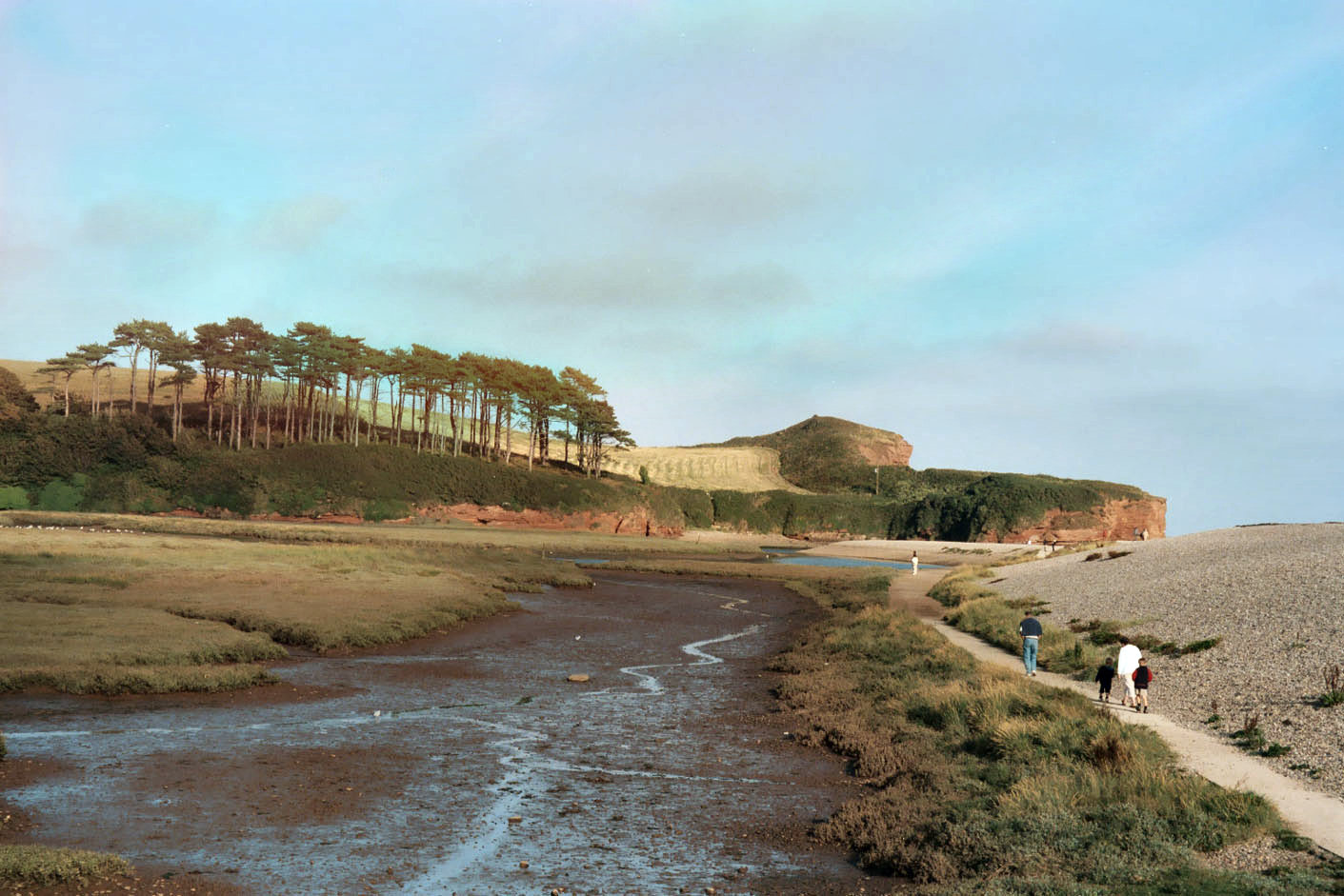
Wheel Rock Images

Images are sourced within 2km of 50.667989/-3.2661119 or Grid Reference SY1086. Thanks to Geograph Open Source API. All images are credited.

Footpath steps Steps off a public footpath at the rear of Ladram Bay caravan park.
Footpath steps
Steps off a public footpath at the rear of Ladram Bay caravan park.
Sandy Cove The outcrop on the right has a deposit of guano, where seagulls often perch
Sandy Cove
The outcrop on the right has a deposit of guano, where seagulls often perch
Sandy Cove and High Peak
Ladram Bay
Ladram Bay
Delivering a playground ship The play area at Ladram Bay Holiday Park was being extended with this playground ship.
Delivering a playground ship
The play area at Ladram Bay Holiday Park was being extended with this playground ship.
Ladram Bay Holiday Park; permanent buildings
South West Coast Path at Smallstones Point The sign points to Otterton, and this path is part of a very popular circular walk from there, south to the coast, back to this junction and inland to the start
South West Coast Path at Smallstones Point
The sign points to Otterton, and this path is part of a very popular circular walk from there, south to the coast, back to this junction and inland to the start
Piscombe Lane The hedge on the left is the boundary of the football ground
Piscombe Lane
The hedge on the left is the boundary of the football ground
The north end of Piscombe Lane
Footpath to Bredon Lane
Sandstone cliffs by the River Otter At this point on the east bank, a broad valley meets the river.  A further view of the bend in the river is in <a href="https://www.geograph.org.uk/photo/2329817">SY0886 : River Otter</a>
Sandstone cliffs by the River Otter
At this point on the east bank, a broad valley meets the river. A further view of the bend in the river is in SY0886 : River Otter
River Otter This is looking downstream to the cliffs in <a href="https://www.geograph.org.uk/photo/2329813">SY0886 : Sandstone cliffs by the River Otter</a>
River Otter
This is looking downstream to the cliffs in SY0886 : Sandstone cliffs by the River Otter
Smallstones Point
Smallstones Point
Stack in Ladram Bay
Stack in Ladram Bay
Landram Road The section of Landram Road from Sea View Farm towards the coast may once have been a road, although no more than 6 feet wide, but is now no more than a footpath.
Landram Road
The section of Landram Road from Sea View Farm towards the coast may once have been a road, although no more than 6 feet wide, but is now no more than a footpath.
Ottery Street leading south from Pinn Lane Corner
Ottery Street, part of NCN2
Passaford Lane This public footpath in a hollow-way leads to Pinn Beacon
Passaford Lane
This public footpath in a hollow-way leads to Pinn Beacon
Show me another place!

Wheel Rock is located at Grid Ref: SY1086 (Lat: 50.667989, Lng: -3.2661119)

Administrative County: Devon

District: East Devon

Police Authority: Devon and Cornwall

What 3 Words

///fits.clip.movies. Near Sidmouth, Devon

Related Wikis

High Peak, Devon

High Peak (also known as Peak Hill) is a hill which is partially eroded, resulting in a cliff face, on the English Channel coast to the southwest of Sidmouth...

Peak House, Sidmouth

Peak House in Sidmouth, Devon, is a building designed by Evelyn Hellicar. It was finished in 1904 and is entirely made of beer stone. It is a Grade II...

Ladram Bay

Ladram Bay is a secluded bay with a pebble beach, on the south coast of Devon, England between the coastal towns of Budleigh Salterton and Sidmouth. It...

River Otter, Devon

The River Otter is a river that rises in the Blackdown Hills just inside the county of Somerset, England near Otterford, then flows south through East...

Nearby Amenities

Located within 500m of 50.667989,-3.2661119
Source: PGS
Lat/Long: 50.665126/-3.2673743
Source: PGS
Lat/Long: 50.6653633/-3.2672813
Source: PGS
Lat/Long: 50.6660815/-3.2670338
Source: PGS
Lat/Long: 50.6661925/-3.2665866
Source: PGS
Lat/Long: 50.6665272/-3.2662329
Source: PGS
Lat/Long: 50.6669396/-3.2657926
Source: PGS
Lat/Long: 50.6683262/-3.2662347
Source: PGS
Lat/Long: 50.669074/-3.2658356
Source: PGS
Lat/Long: 50.6693738/-3.2655631
Source: PGS
Lat/Long: 50.6696627/-3.2652832
Source: PGS
Lat/Long: 50.6699866/-3.2642926
Source: PGS
Lat/Long: 50.6700417/-3.2640997
Source: PGS
Lat/Long: 50.6701229/-3.26394
Source: PGS
Lat/Long: 50.6703275/-3.2633807
Barrier: kissing_gate
Lat/Long: 50.6719086/-3.2658643
Barrier: kissing_gate
Lat/Long: 50.6703605/-3.2682861
Big Picket Rock
Natural: rock
Lat/Long: 50.6641396/-3.2686964
Tortoiseshell Rocks
Natural: rocks
Lat/Long: 50.6702054/-3.2620446
High Peak
Ele: 157
Natural: peak
Wikidata: Q1617809
Wikipedia: en:High Peak, Devon
Lat/Long: 50.6661889/-3.2699754
Bench
Backrest: no
Lat/Long: 50.6691689/-3.2688168
Tourism: viewpoint
Lat/Long: 50.6692322/-3.2688267
Barrier: kissing_gate
Lat/Long: 50.6693709/-3.2689662
High Peak Camp
Archaeological Site: fortification
Historic: archaeological_site
Wheelchair: no
Wikidata: Q17647794
Lat/Long: 50.666335/-3.2701427
Man Made: survey_point
Lat/Long: 50.6661662/-3.2699886
Tourism: viewpoint
Lat/Long: 50.6661523/-3.2699903
The data included in this document is from www.openstreetmap.org. The data is made available under ODbL.

Have you been to Wheel Rock?

Leave your review of Wheel Rock below (or comments, questions and feedback).