Barler Rock
Island in Devon
England
Barler Rock

Barler Rock is a small island located off the coast of Devon, in the southwestern part of England. It is situated in the English Channel and is part of the county of Devon. The island is privately owned and measures approximately 1 square kilometer in area.
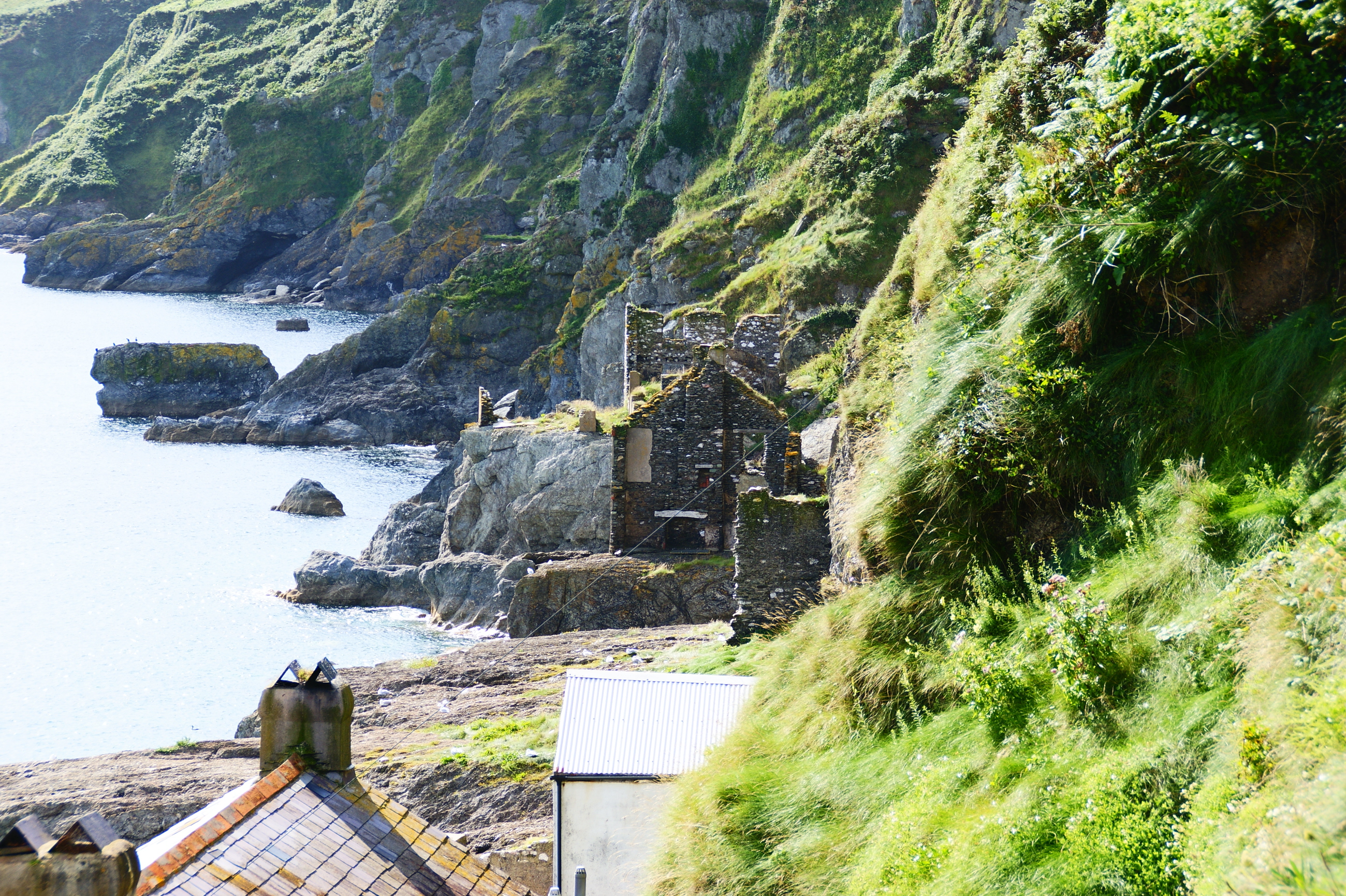
Barler Rock is known for its rugged and rocky terrain, with towering cliffs that provide breathtaking views of the surrounding sea. The island's landscape is characterized by diverse flora and fauna, including various species of seabirds that nest in the cliffs.
Access to Barler Rock is limited, as there are no regular ferry services or public transportation available. However, visitors can reach the island by private boat or by hiring local fishermen for transportation. The island offers a peaceful and serene environment, making it a popular destination for nature lovers and those seeking solitude.
There are no permanent human inhabitants on Barler Rock, although it is occasionally used as a summer retreat by its owners. As a result, there are no facilities or accommodations available on the island. Visitors are advised to bring their own supplies and ensure they adhere to a "leave no trace" policy.
Barler Rock is also known for its rich maritime history, with several shipwrecks dotting the surrounding waters. The island has been a prominent navigational landmark for centuries, aiding sailors in safely navigating the treacherous waters of the English Channel.
In conclusion, Barler Rock is a picturesque and secluded island in Devon, offering stunning natural beauty and a tranquil atmosphere for those fortunate enough to visit.
If you have any feedback on the listing, please let us know in the comments section below.
Barler Rock Images
Images are sourced within 2km of 50.217453/-3.6574737 or Grid Reference SX8136. Thanks to Geograph Open Source API. All images are credited.


Barler Rock is located at Grid Ref: SX8136 (Lat: 50.217453, Lng: -3.6574737)
Administrative County: Devon
Police Authority: Devon and Cornwall
What 3 Words
///cools.ranged.prancing. Near Salcombe, Devon
Related Wikis

Start Point, Devon
Start Point is a promontory in the South Hams district in Devon, England, grid reference SX832370. Close to the most southerly point in the county, it...
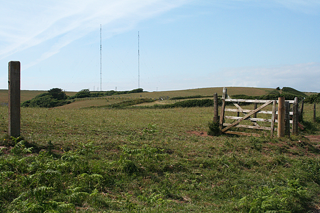
Start Point transmitting station
The Start Point transmitting station is a broadcasting facility at Start Point, Devon, owned by Arqiva. The site is just north-west of the Start Point...
Hallsands
Hallsands is a village and beach in south Devon, England, in a precarious position between cliffs and the sea, between Beesands to the north and Start...

Chivelstone
Chivelstone is a village and civil parish in Devon, England. The parish contains the villages of East Prawle and South Allington as well as the hamlets...

East Prawle
East Prawle is a village in Chivelstone parish in the South Hams district of Devon, England. It is situated on the coast south east of Salcombe, near the...

Beesands
Beesands is a small settlement located midway between Hallsands and Torcross on the coast of Start Bay in South Devon, England. It is best known as a tourist...

RNAS Prawle Point
The RNAS Naval Air Station Prawle Point was a British First World War airfield outside the village of East Prawle in Devon, England and 2.6 miles (4.2...

Prawle Point
Prawle Point (Old English: Prǣwhyll, "lookout hill") is a coastal headland in south Devon, England. It is the southernmost point of Devon. Just to the...
Nearby Amenities
Located within 500m of 50.217453,-3.6574737Have you been to Barler Rock?
Leave your review of Barler Rock below (or comments, questions and feedback).