Ash Island

Island in Kirkcudbrightshire

Scotland

Ash Island

The track to Cuil Farm Cuil Farm is hidden over the brow of the hill.
The track to Cuil Farm Credit: Peter Mackenzie

Ash Island is a small, uninhabited island located off the coast of Kirkcudbrightshire in southwestern Scotland. Situated in the Solway Firth, it is part of the Scottish Southern Uplands. Covering an area of approximately 15 acres, the island is predominantly flat and low-lying, with a maximum elevation of just 10 meters.

Vegetation on Ash Island primarily consists of grassland and scattered ash trees, which give the island its name. The surrounding waters are home to a variety of marine life, including seals and various bird species, making it an ideal spot for birdwatching and wildlife enthusiasts.

Due to its remote location and lack of human activity, Ash Island has remained untouched by development, preserving its natural beauty and providing a peaceful retreat for those seeking solitude. Access to the island is limited, with no regular boat services available. However, it is possible to visit the island by private boat, subject to tides and weather conditions.

Historically, Ash Island was used for grazing livestock, with evidence of old farming structures still visible today. The island has also been a popular spot for fishing, attracting anglers in search of trout and other freshwater fish.

Overall, Ash Island offers a tranquil escape for nature lovers, providing an opportunity to immerse oneself in the stunning coastal landscapes and observe the diverse wildlife that thrives in this remote corner of Kirkcudbrightshire.

If you have any feedback on the listing, please let us know in the comments section below.

Ash Island Images

Images are sourced within 2km of 54.928992/-3.9321397 or Grid Reference NX7661. Thanks to Geograph Open Source API. All images are credited.

The track to Cuil Farm Cuil Farm is hidden over the brow of the hill.
The track to Cuil Farm
Cuil Farm is hidden over the brow of the hill.
Mid Kelton Farm The entrance driveway to Mid Kelton farm.
Mid Kelton Farm
The entrance driveway to Mid Kelton farm.
Minor road to Halmyre The road is part of national cycle route no.7.
Minor road to Halmyre
The road is part of national cycle route no.7.
Minor road to Castle Douglas
Footpath For Castle Douglas This path leads to Crae Hill and Castle Douglas, providing an attractive and easy round trip in this lovely part of Galloway.
Footpath For Castle Douglas
This path leads to Crae Hill and Castle Douglas, providing an attractive and easy round trip in this lovely part of Galloway.
Walking Near Mid Kelton National Cycle Route No7 uses this minor road near Castle Douglas.
Walking Near Mid Kelton
National Cycle Route No7 uses this minor road near Castle Douglas.
Kelton to Gelston road A long straight.
Kelton to Gelston road
A long straight.
Fields, Halmyre South of Castle Douglas
Fields, Halmyre
South of Castle Douglas
Footpath at Kelton With two kissing gates where the path crosses a field entrance.
Footpath at Kelton
With two kissing gates where the path crosses a field entrance.
Halmyre
Halmyre
Cattle crossing the B736 road near Gelston
The B736 looking towards Castle Douglas
Longsheds Equestrian Training Centre Longsheds equestrian training centre is situated between Mid Kelton and Rhonehouse near Castle Douglas. The Solway Hills can be seen in the distance.
Longsheds Equestrian Training Centre
Longsheds equestrian training centre is situated between Mid Kelton and Rhonehouse near Castle Douglas. The Solway Hills can be seen in the distance.
Longsheds Longsheds Farm is situated between Mid Kelton and Rhonehouse near Castle Douglas.
Longsheds
Longsheds Farm is situated between Mid Kelton and Rhonehouse near Castle Douglas.
Threave House, Castle Douglas Built in 1872 by the Gordon family, house and estate given in 1948 to the National Trust for Scotland, who ran a school of gardening there.
Threave House, Castle Douglas
Built in 1872 by the Gordon family, house and estate given in 1948 to the National Trust for Scotland, who ran a school of gardening there.
Threave Estate Walk on former Kirkcudbright Railway The last train on this line ran in 1965. Running through farmland, it forms part of the 4km country walk around the National Trust for Scotland's Threave Estate.
Threave Estate Walk on former Kirkcudbright Railway
The last train on this line ran in 1965. Running through farmland, it forms part of the 4km country walk around the National Trust for Scotland's Threave Estate.
Castle Douglas Lovely Scottish Town
Castle Douglas
Lovely Scottish Town
Entry of former Carlingwark Canal into Carlingwark Loch, Castle Douglas, Dumfries & Galloway The canal was built in the late 18th century to link Carlingwark Loch with the River Dee by Alexander Gordon, a local landowner
Entry of former Carlingwark Canal into Carlingwark Loch, Castle Douglas, Dumfries & Galloway
The canal was built in the late 18th century to link Carlingwark Loch with the River Dee by Alexander Gordon, a local landowner
Show me another place!

Ash Island is located at Grid Ref: NX7661 (Lat: 54.928992, Lng: -3.9321397)

Unitary Authority: Dumfries and Galloway

Police Authority: Dumfries and Galloway

What 3 Words

///sloping.done.enveloped. Near Castle Douglas, Dumfries & Galloway

Related Wikis

Carlingwark Loch

Carlingwark Loch is a small freshwater loch in the historical county of Kirkcudbrightshire, Dumfries and Galloway, Scotland lying just south of Castle...

The Fullarton

The Fullarton is a performing arts theatre and entertainment venue in the town of Castle Douglas in the historical county of Kirkcudbrightshire in Dumfries...

Threave Rovers F.C.

Threave Rovers Football Club are a football club from Castle Douglas in Dumfries and Galloway, Scotland. Formed in October 1953, the club plays its home...

Threave Gardens

Threave Garden and Estate is a series of gardens owned and managed by the National Trust for Scotland, located near Castle Douglas in the historical county...

Castle Douglas St Andrew Street railway station

Castle Douglas St Andrew Street railway station served the town of Castle Douglas, Dumfries and Galloway, Scotland, from 1864 to 1867 on the Kirkcudbright...

Castle Douglas Hospital

Castle Douglas Hospital is a health facility in Academy Street, Castle Douglas, Dumfries and Galloway, Scotland. It is managed by NHS Dumfries and Galloway...
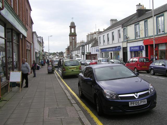
Castle Douglas

Castle Douglas (Scottish Gaelic: Caisteal Dhùghlais) is a town in Dumfries and Galloway, Scotland. It lies in the lieutenancy area of Kirkcudbrightshire...

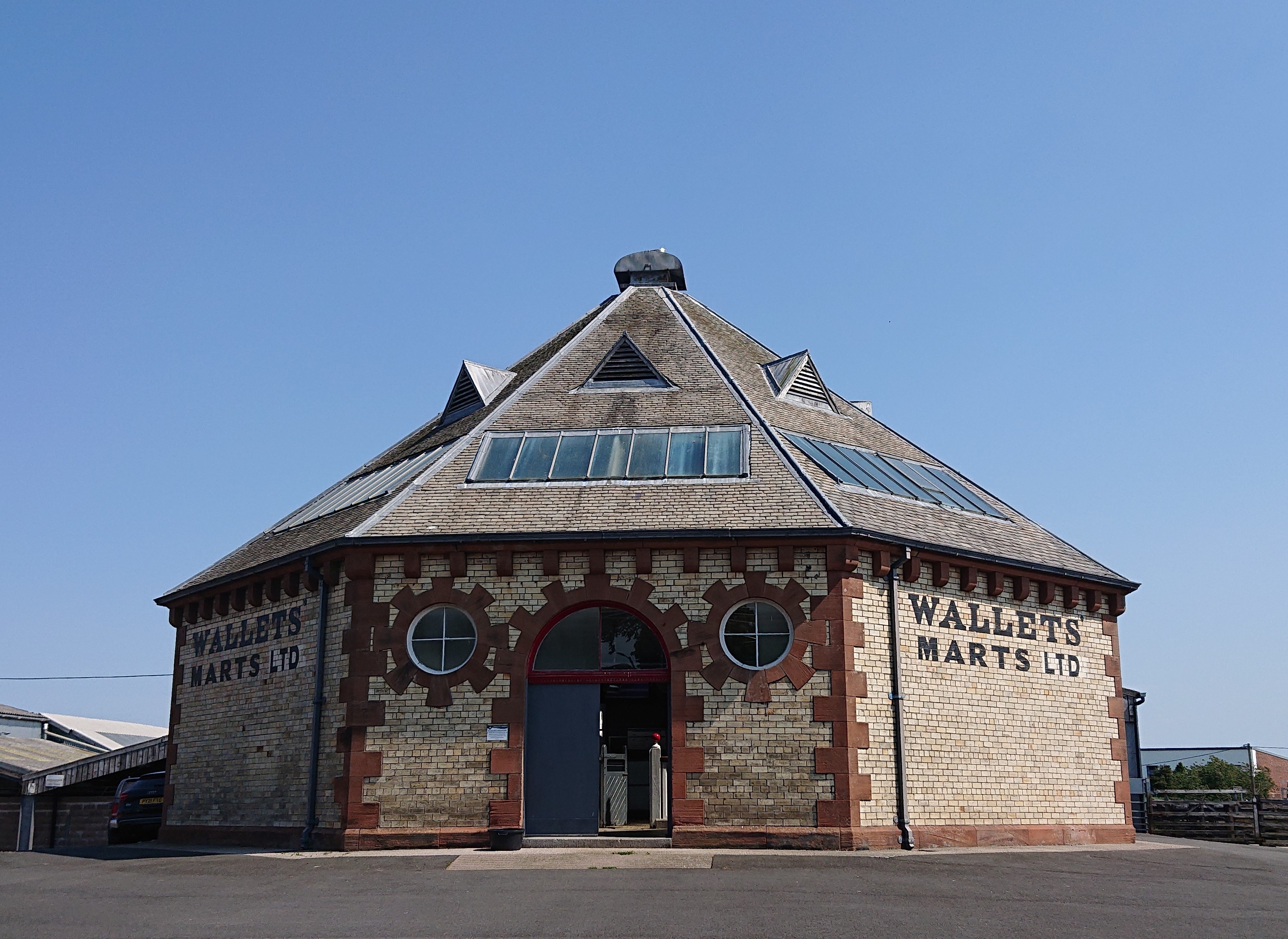
Castle Douglas Auction Mart

The Auction Mart on New Market Street in Castle Douglas is an octagonal building, constructed around 1900 as a cattle market, and used for that purpose...

Nearby Amenities

Located within 500m of 54.928992,-3.9321397
Barrier: kissing_gate
Lat/Long: 54.9284605/-3.92945
Barrier: kissing_gate
Lat/Long: 54.9268405/-3.9281918
Power: pole
Lat/Long: 54.9297059/-3.9377519
Power: pole
Lat/Long: 54.9300336/-3.9371625
Power: pole
Lat/Long: 54.9305532/-3.9367017
Power: pole
Lat/Long: 54.9312026/-3.9363069
Power: pole
Lat/Long: 54.931772/-3.9365921
Power: pole
Lat/Long: 54.9322456/-3.9368408
Power: pole
Lat/Long: 54.9326552/-3.9365452
Power: pole
Lat/Long: 54.9291617/-3.93885
Power: pole
Lat/Long: 54.9286075/-3.939705
The data included in this document is from www.openstreetmap.org. The data is made available under ODbL.

Have you been to Ash Island?

Leave your review of Ash Island below (or comments, questions and feedback).