Pound Stone

Island in Devon

England

Pound Stone

Salcombe : Bay Scenery Looking out into the bay.
Salcombe : Bay Scenery Credit: Lewis Clarke

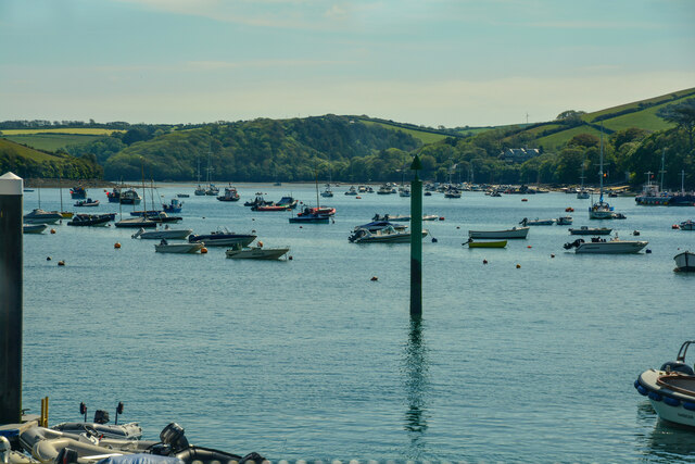
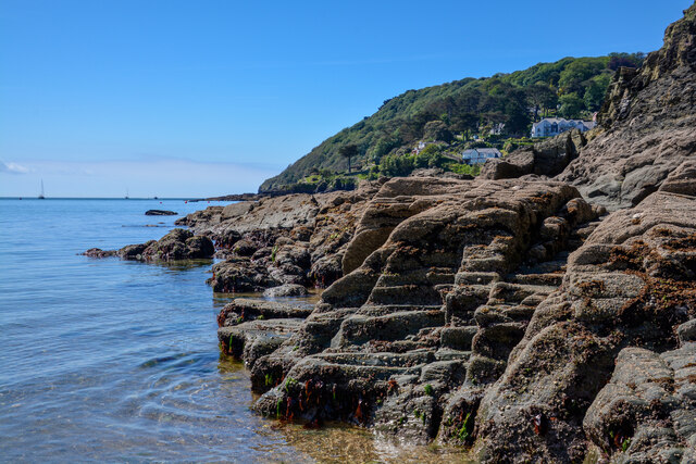
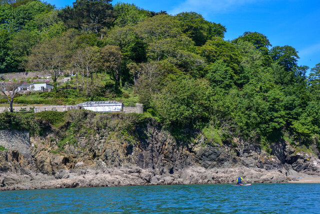
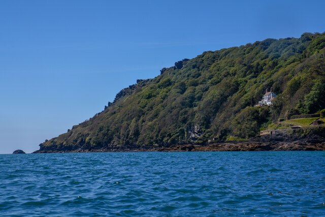
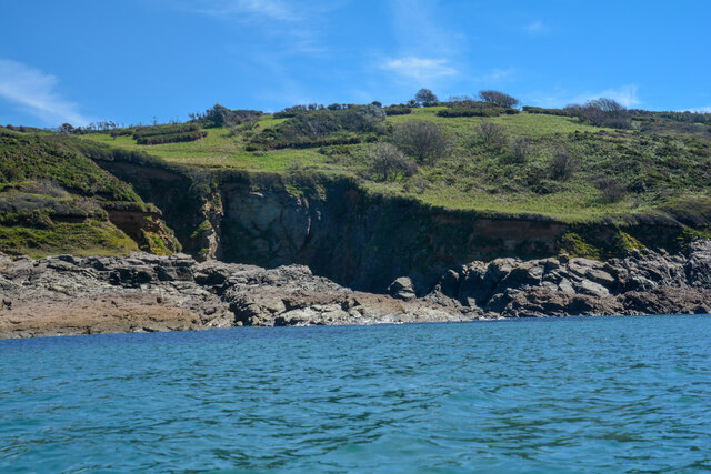
Pound Stone is a small island located off the coast of Devon, England. With an area of only 0.05 square kilometers, it is one of the smallest islands in the region. Pound Stone is situated in the mouth of the river Dart, near the popular town of Dartmouth.

The island gets its name from a large stone structure known as a "pound," which was used in the past to enclose livestock. The pound can still be seen on the island today, although it is no longer in use. Pound Stone is largely uninhabited, with no permanent residents, and is primarily visited by tourists and nature enthusiasts.

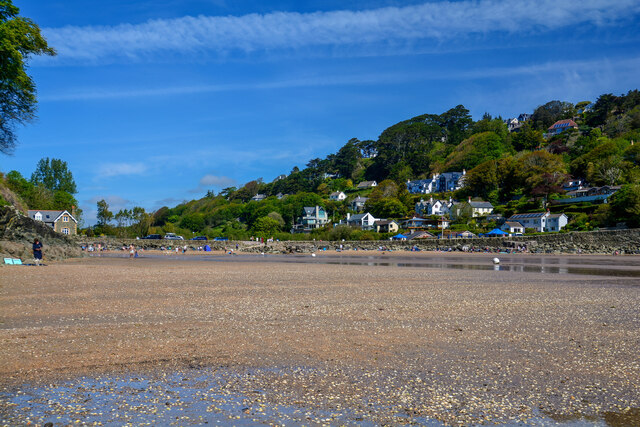
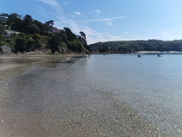
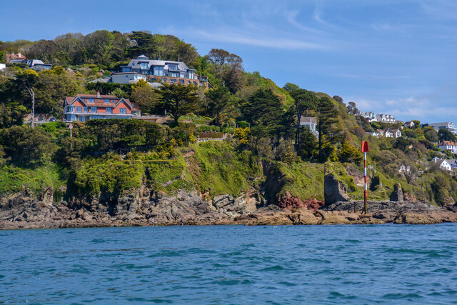
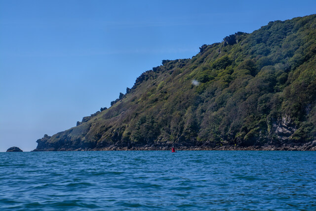
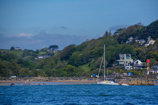
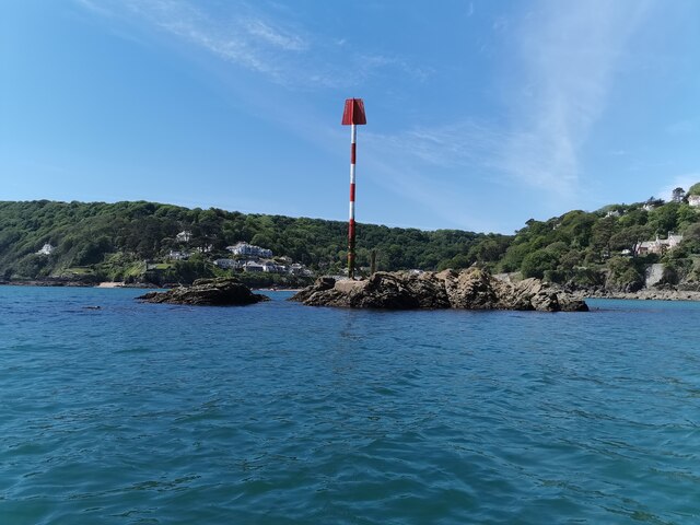
The island is known for its picturesque scenery, with rugged cliffs and beautiful coastal views. It is also home to a variety of bird species, making it a popular spot for birdwatching. The surrounding waters are teeming with marine life, and visitors can often spot seals and dolphins swimming near the island.

Access to Pound Stone is limited, as there are no public ferries or regular transportation services to the island. However, it is possible to reach Pound Stone by private boat or kayak, depending on the tides and weather conditions.

Overall, Pound Stone offers a tranquil retreat for those seeking to escape the bustling city life and immerse themselves in the natural beauty of Devon's coast.

If you have any feedback on the listing, please let us know in the comments section below.
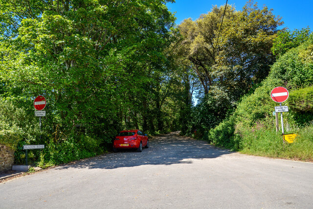
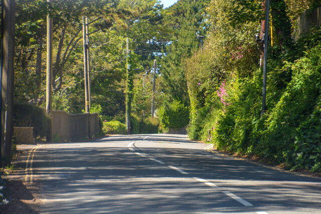
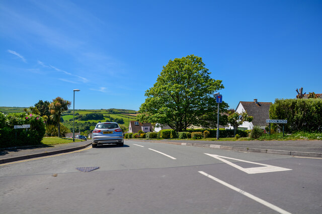
Pound Stone Images

Images are sourced within 2km of 50.227483/-3.777766 or Grid Reference SX7337. Thanks to Geograph Open Source API. All images are credited.

Salcombe : Bay Scenery Looking out into the bay.
Salcombe : Bay Scenery
Looking out into the bay.
Salcombe : Coastal Scenery Looking across the coastline.
Salcombe : Coastal Scenery
Looking across the coastline.
Salcombe : North Sands Looking across the beach.
Salcombe : North Sands
Looking across the beach.
Salcombe : North Sands Looking across the beach.
Salcombe : North Sands
Looking across the beach.
Salcombe : Coastal Scenery Looking towards the rocky shore.
Salcombe : Coastal Scenery
Looking towards the rocky shore.
Salcombe : Bolt Head Looking across the coastline.
Salcombe : Bolt Head
Looking across the coastline.
Salcombe : Coastal Scenery Looking across the coast with Poundstone in view.
Salcombe : Coastal Scenery
Looking across the coast with Poundstone in view.
Salcombe : Bolt Head A view towards Bolt Head.
Salcombe : Bolt Head
A view towards Bolt Head.
East Portlemouth : Sunny Cove Looking towards a beach and cove.
East Portlemouth : Sunny Cove
Looking towards a beach and cove.
East Portlemouth : Coastal Scenery A view towards the rocks.
East Portlemouth : Coastal Scenery
A view towards the rocks.
East Portlemouth : Coastal Scenery A view along the coastline.
East Portlemouth : Coastal Scenery
A view along the coastline.
East Portlemouth : Coastal Scenery A house with a view overlooking the bay.
East Portlemouth : Coastal Scenery
A house with a view overlooking the bay.
Salcombe : Pound Stone A beacon on the stones.
Salcombe : Pound Stone
A beacon on the stones.
Salcombe : Beadon Road Looking along Beadon Road.
Salcombe : Beadon Road
Looking along Beadon Road.
Salcombe : Beadon Road A road with no entry to vehicles from here.
Salcombe : Beadon Road
A road with no entry to vehicles from here.
Salcombe : A381 Looking along the A381.
Salcombe : A381
Looking along the A381.
Salcombe : Tarmac A tarmac area off Main Road.
Salcombe : Tarmac
A tarmac area off Main Road.
Salcombe : Beadon Road Beadon Road off Main Road.
Salcombe : Beadon Road
Beadon Road off Main Road.
Show me another place!

Pound Stone is located at Grid Ref: SX7337 (Lat: 50.227483, Lng: -3.777766)

Administrative County: Devon

Police Authority: Devon and Cornwall

What 3 Words

///disband.improvise.firmer. Near Salcombe, Devon

Related Wikis

Salcombe Castle

Salcombe Castle or Fort Charles is a ruined fortification just off the beach of North Sands in Salcombe, Devon, England, within the South Devon Area of...

Overbeck's

Overbeck's Museum and Garden is an Edwardian house and 2.75 hectare (7 acre) garden at Sharpitor, Salcombe, Devon, England. It is named after its last...

Salcombe

Salcombe is a resort town in the South Hams district of Devon, south west England. The town is close to the mouth of the Kingsbridge Estuary, mostly built...

Salcombe Lifeboat Station

Salcombe Lifeboat Station is the base for Royal National Lifeboat Institution (RNLI) search and rescue operations at Salcombe, Devon in England. The first...

Nearby Amenities

Located within 500m of 50.227483,-3.777766
Source: PGS
Lat/Long: 50.2258375/-3.7842394
Source: PGS
Lat/Long: 50.2290119/-3.7811114
Source: PGS
Lat/Long: 50.229277/-3.7814354
Source: PGS
Lat/Long: 50.2241483/-3.7738648
Source: PGS
Lat/Long: 50.2238658/-3.7737184
Maxwidth: 6'6"
Lat/Long: 50.2300829/-3.7797292
Bench
Lat/Long: 50.2259576/-3.7843481
Bench
Lat/Long: 50.2261121/-3.7842032
Post Box
Brand: Royal Mail
Brand Wikidata: Q638098
Brand Wikipedia: en:Royal Mail
Collection Times: Mo-Sa 11:15; Su off
Operator: Royal Mail
Operator Wikidata: Q638098
Post Box Design: type_b
Post Box Mounting: brick_gate_column
Post Box Type: wall
Ref: TQ8 40
Royal Cypher: EIIR
Royal Cypher Wikidata: Q33102113
Source: survey;streetlevel imagery;aerial imagery
Lat/Long: 50.2279678/-3.7825161
Bench
Backrest: yes
Lat/Long: 50.2294332/-3.7772281
Bench
Lat/Long: 50.2280267/-3.7825893
Toilets
Fee: no
Wheelchair: yes
Lat/Long: 50.2301796/-3.7798232
Bench
Backrest: yes
Lat/Long: 50.2302573/-3.7812227
Post Box
Brand: Royal Mail
Brand Wikidata: Q638098
Brand Wikipedia: en:Royal Mail
Collection Times: Mo-Sa 11:00; Su off
Operator: Royal Mail
Operator Wikidata: Q638098
Post Box Design: type_c
Post Box Mounting: stone_wall
Post Box Type: wall
Ref: TQ8 28
Royal Cypher: EVIIR
Royal Cypher Wikidata: Q33102324
Survey Date: 2022-08-20
Lat/Long: 50.2303436/-3.7803905
Telephone
Booth: K6
Check Date: 2024-03-02
Covered: booth
Lat/Long: 50.2302379/-3.7800177
Post Box
Brand: Royal Mail
Brand Wikidata: Q638098
Brand Wikipedia: en:Royal Mail
Collection Times: Mo-Fr 13:00; Sa 12:00; Su off
Operator: Royal Mail
Operator Wikidata: Q638098
Post Box Design: type_b
Post Box Mounting: stone_wall
Post Box Type: wall
Ref: TQ8 56
Royal Cypher: GR
Royal Cypher Wikidata: Q33102273
Source: survey;streetlevel imagery;aerial imagery
Survey Date: 2022-08-20
Lat/Long: 50.2314887/-3.7804602
Restaurant
The Winking Prawn
Addr City: Salcombe
Addr Housename: The Winking Prawn
Addr Postcode: TQ8 8LD
Addr Street: Cliff Road
Cuisine: seafood
Fhrs Id: 1428734
Source Addr: FHRS Open Data
Lat/Long: 50.2304911/-3.7809377
Bench
Backrest: yes
Lat/Long: 50.2301637/-3.7801114
Blackstone Rock
Seamark Beacon Lateral Category: starboard
Seamark Beacon Lateral Colour: green
Seamark Beacon Lateral System: iala-a
Seamark Light Character: Q
Seamark Light Colour: green
Seamark Light Group: 2
Seamark Light Height: 4
Seamark Light Period: 8
Seamark Light Range: 2
Seamark Light Reference: A 0221
Seamark Name: Blackstone Rock
Seamark Type: beacon_lateral
Source: US NGA Pub. 114. 2011-05-26.
Lat/Long: 50.2267833/-3.7751
Seamark Light 1 Character: Fl
Seamark Light 1 Colour: red
Seamark Light 1 Height: 27
Seamark Light 1 Period: 2
Seamark Light 1 Range: 7
Seamark Light 1 Sector End: 182.5
Seamark Light 1 Sector Start: 2.5
Seamark Light 1 Sequence: 0.5+(1.5)
Seamark Light 2 Character: Fl
Seamark Light 2 Colour: green
Seamark Light 2 Height: 27
Seamark Light 2 Period: 2
Seamark Light 2 Range: 7
Seamark Light 2 Sector End: 357.5
Seamark Light 2 Sector Start: 182.5
Seamark Light 2 Sequence: 0.5+(1.5)
Seamark Light 3 Character: Fl
Seamark Light 3 Colour: white
Seamark Light 3 Height: 27
Seamark Light 3 Period: 2
Seamark Light 3 Range: 10
Seamark Light 3 Sector End: 2.5
Seamark Light 3 Sector Start: 357.5
Seamark Light 3 Sequence: 0.5+(1.5)
Seamark Light Reference: A 0220
Seamark Type: light_minor
Source: US NGA Pub. 114. 2011-05-26.
Lat/Long: 50.2294833/-3.7778333
Post Box
Brand: Royal Mail
Brand Wikidata: Q638098
Brand Wikipedia: en:Royal Mail
Collection Times: Mo-Sa 12:00; Su off
Operator: Royal Mail
Operator Wikidata: Q638098
Post Box Design: type_b
Post Box Mounting: stone_wall
Post Box Type: wall
Ref: TQ8 10
Royal Cypher: EIIR
Royal Cypher Wikidata: Q33102113
Source: survey;streetlevel imagery;aerial imagery
Lat/Long: 50.2244623/-3.7821857
Seamark Buoy Lateral Category: port
Seamark Buoy Lateral Colour: red
Seamark Buoy Lateral Shape: can
Seamark Buoy Lateral System: iala-a
Seamark Light Character: Q
Seamark Light Colour: red
Seamark Type: buoy_lateral
Lat/Long: 50.2245402/-3.7786595
Wolf Rock
Seamark Buoy Lateral Category: starboard
Seamark Buoy Lateral Colour: green
Seamark Buoy Lateral Shape: can
Seamark Buoy Lateral System: iala-a
Seamark Light Character: Q
Seamark Light Colour: green
Seamark Type: buoy_lateral
Lat/Long: 50.2263682/-3.7762124
Seamark Buoy Lateral Category: port
Seamark Buoy Lateral Colour: red
Seamark Buoy Lateral Shape: can
Seamark Buoy Lateral System: iala-a
Seamark Light Character: Q
Seamark Light Colour: red
Seamark Type: buoy_lateral
Lat/Long: 50.2270295/-3.7776232
Seamark Buoy Lateral Category: starboard
Seamark Buoy Lateral Colour: green
Seamark Buoy Lateral Shape: can
Seamark Buoy Lateral System: iala-a
Seamark Light Character: Q
Seamark Light Colour: green
Seamark Type: buoy_lateral
Lat/Long: 50.2272541/-3.775308
Poundstone
Place: locality
Seamark Beacon Lateral Category: port
Seamark Beacon Lateral Colour: red
Seamark Beacon Lateral System: iala-a
Seamark Type: beacon_lateral
Lat/Long: 50.2275142/-3.777881
Old Harry Beacon
Place: locality
Seamark Beacon Lateral Category: port
Seamark Beacon Lateral Colour: red
Seamark Beacon Lateral System: iala-a
Seamark Type: beacon_lateral
Source: OS 1963
Lat/Long: 50.2281649/-3.7763578
Seamark Buoy Lateral Category: port
Seamark Buoy Lateral Colour: red
Seamark Buoy Lateral Shape: can
Seamark Buoy Lateral System: iala-a
Seamark Light Character: Q
Seamark Light Colour: red
Seamark Type: buoy_lateral
Lat/Long: 50.2285808/-3.7751208
Splatcove Point
Place: locality
Lat/Long: 50.2246016/-3.7809705
Historic Transatlantic Cable
Historic: heritage
Lat/Long: 50.2296724/-3.7820759
The Cheesewring
Place: locality
Lat/Long: 50.2304784/-3.7763457
Hipples
Place: locality
Source: OS 1963
Lat/Long: 50.2257341/-3.7728016
Sandhill Point
Place: locality
Lat/Long: 50.230051/-3.7779548
Ripple Sand
Natural: beach
Surface: sand
Lat/Long: 50.2262845/-3.7736261
Bench
Backrest: no
Lat/Long: 50.2261569/-3.7720845
Direction: 175
Generator Method: photovoltaic
Generator Output Electricity: yes
Generator Solar Modules: 10
Generator Source: solar
Generator Type: solar_photovoltaic_panel
Location: roof
Power: generator
Lat/Long: 50.2295883/-3.7775282
Direction: 175
Generator Method: photovoltaic
Generator Output Electricity: yes
Generator Solar Modules: 10
Generator Source: solar
Generator Type: solar_photovoltaic_panel
Location: roof
Power: generator
Lat/Long: 50.2295861/-3.7776219
Direction: SSW
Generator Method: photovoltaic
Generator Output Electricity: yes
Generator Solar Modules: 5
Generator Source: solar
Generator Type: solar_photovoltaic_panel
Location: roof
Power: generator
Lat/Long: 50.2299313/-3.7777088
Direction: 220
Generator Method: photovoltaic
Generator Output Electricity: yes
Generator Solar Modules: 16
Generator Source: solar
Generator Type: solar_photovoltaic_panel
Location: roof
Power: generator
Lat/Long: 50.2306642/-3.7807353
Direction: 215
Generator Method: photovoltaic
Generator Output Electricity: yes
Generator Solar Modules: 10
Generator Source: solar
Generator Type: solar_photovoltaic_panel
Location: roof
Note: panels curved
Power: generator
Lat/Long: 50.2305469/-3.7776663
Direction: 215
Generator Method: photovoltaic
Generator Output Electricity: yes
Generator Source: solar
Generator Type: solar_photovoltaic_panel
Location: roof
Note: panels curved
Power: generator
Lat/Long: 50.2305562/-3.7776533
Direction: SSW
Generator Method: photovoltaic
Generator Output Electricity: yes
Generator Solar Modules: 5
Generator Source: solar
Generator Type: solar_photovoltaic_panel
Location: roof
Power: generator
Lat/Long: 50.2299704/-3.7778428
Direction: 105
Generator Method: photovoltaic
Generator Output Electricity: yes
Generator Solar Modules: 4
Generator Source: solar
Generator Type: solar_photovoltaic_panel
Location: roof
Power: generator
Lat/Long: 50.2247698/-3.7826253
Direction: 95
Generator Method: photovoltaic
Generator Output Electricity: yes
Generator Solar Modules: 19
Generator Source: solar
Generator Type: solar_photovoltaic_panel
Location: roof
Power: generator
Lat/Long: 50.2247305/-3.7826365
Direction: 275
Generator Method: photovoltaic
Generator Output Electricity: yes
Generator Solar Modules: 8
Generator Source: solar
Generator Type: solar_photovoltaic_panel
Location: roof
Power: generator
Lat/Long: 50.2247281/-3.7826849
Bench
Backrest: yes
Lat/Long: 50.2301532/-3.7800763
Bench
Backrest: yes
Lat/Long: 50.2301249/-3.7800092
Bench
Backrest: yes
Lat/Long: 50.2301406/-3.7800464
Life Ring
Emergency: life_ring
Survey Date: 2022-08-20
Lat/Long: 50.22997/-3.7815947
Fire Hydrant
Emergency: fire_hydrant
Fire Hydrant Position: sidewalk
Fire Hydrant Type: underground
Survey Date: 2022-08-20
Lat/Long: 50.2294432/-3.7782336
Fire Hydrant
Emergency: fire_hydrant
Fire Hydrant Position: lane
Fire Hydrant Type: underground
Survey Date: 2022-08-20
Lat/Long: 50.2296308/-3.7786732
Bench
Backrest: yes
Survey Date: 2022-08-20
Lat/Long: 50.2294367/-3.7771691
Bench
Backrest: yes
Survey Date: 2022-08-20
Lat/Long: 50.2301802/-3.7798475
Waste Basket
Survey Date: 2022-08-20
Lat/Long: 50.2301695/-3.7801898
Waste Basket
Survey Date: 2022-08-20
Lat/Long: 50.2301031/-3.7815644
Waste Basket
Survey Date: 2022-08-20
Lat/Long: 50.2300836/-3.781591
Fire Hydrant
Emergency: fire_hydrant
Fire Hydrant Diameter Signed: no
Fire Hydrant Position: sidewalk
Fire Hydrant Type: underground
Survey Date: 2022-08-20
Lat/Long: 50.2305473/-3.7804139
The data included in this document is from www.openstreetmap.org. The data is made available under ODbL.

Have you been to Pound Stone?

Leave your review of Pound Stone below (or comments, questions and feedback).