The Tomb
Island in Devon South Hams
England
The Tomb
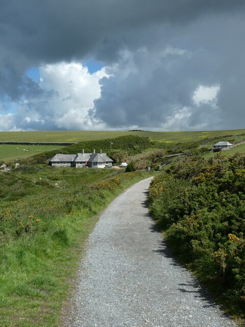
The Tomb is a small island located off the coast of Devon, England. It is part of the South Devon Area of Outstanding Natural Beauty and is renowned for its rugged and dramatic landscape. The island gets its name from a large rock formation resembling a tomb that dominates its skyline.
Covering an area of approximately one square kilometer, The Tomb is mostly composed of granite cliffs and rocky outcrops. The island is uninhabited and lacks any permanent structures, making it a haven for wildlife and a popular destination for birdwatchers and nature enthusiasts. The cliffs provide nesting grounds for various seabirds, including guillemots, razorbills, and kittiwakes.
Access to The Tomb is limited due to its remote location and potentially dangerous currents in the surrounding waters. However, during low tide, it is possible to reach the island by foot from the nearby mainland. Visitors are advised to exercise caution when exploring the island, as the rugged terrain can be treacherous.
The Tomb offers breathtaking panoramic views of the surrounding coastline and the open sea, making it a popular spot for photographers and artists. The island's wild and untouched beauty attracts those seeking solitude and a sense of adventure.
In conclusion, The Tomb is a small, uninhabited island off the coast of Devon known for its rugged cliffs, nesting seabirds, and stunning natural beauty. It serves as a sanctuary for wildlife and provides a unique experience for those who venture to its shores.
If you have any feedback on the listing, please let us know in the comments section below.
The Tomb Images
Images are sourced within 2km of 50.314296/-4.0719985 or Grid Reference SX5248. Thanks to Geograph Open Source API. All images are credited.


The Tomb is located at Grid Ref: SX5248 (Lat: 50.314296, Lng: -4.0719985)
Administrative County: Devon
District: South Hams
Police Authority: Devon and Cornwall
What 3 Words
///driftwood.cheat.super. Near Wembury, Devon
Nearby Locations
Related Wikis

River Yealm
The Yealm is a river in Devon in England that rises 430 m (1,410 ft) above sea level on the Stall Moor mires of south Dartmoor and travels 12 miles (19...
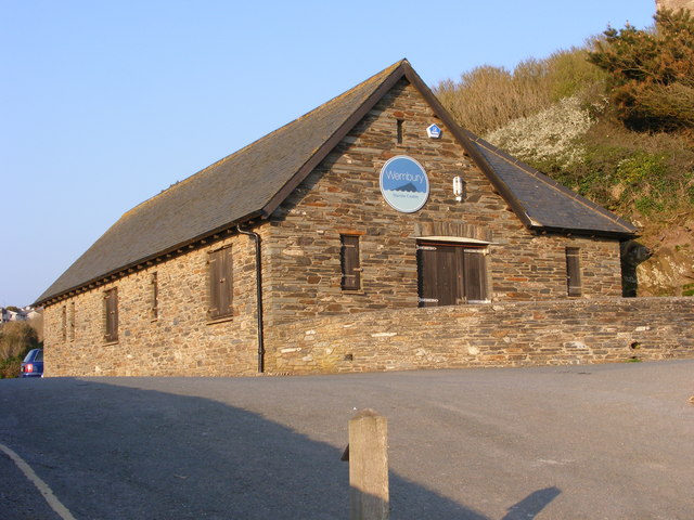
Wembury Marine Centre
Wembury Marine Centre is situated in the small village of Wembury, near Plymouth. Run by Devon Wildlife Trust, it holds rockpool rambles throughout the...

Wembury
Wembury is a village on the south coast of Devon, England, very close to Plymouth Sound. Wembury is located south of Plymouth. Wembury is also the name...

Warren Point, Wembury
Warren Point is a promontory in South Devon, located southeast of Plymouth. The Warren Point foot ferry links Wembury, on the western side of the River...

Casa del Rio
Casa del Rio ("House on the River") is an Art Deco house built in 1936 to a Spanish theme, on the banks of the river Yealm at Newton Ferrers, South Hams...
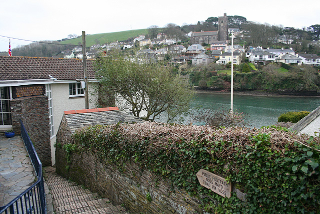
Noss Mayo
Noss Mayo is a village in the civil parish of Newton and Noss in the South Hams district of Devon, England, 6 miles (10 km) south-east of Plymouth, one...

Langdon Court, Devon
Langdon Court is a former manor house, in Wembury, South Devon, England. It consists of a single courtyard mansion from 1693 and a walled formal garden...

St Peter's Church, Noss Mayo
St Peter's Church is a Church of England parish church in Noss Mayo, Devon, England. It was constructed in 1880–82 and designed by the London architect...
Nearby Amenities
Located within 500m of 50.314296,-4.0719985Have you been to The Tomb?
Leave your review of The Tomb below (or comments, questions and feedback).