Gull Rock

Island in Cornwall

England

Gull Rock

View across Pentargon to Beeny Cliff
View across Pentargon to Beeny Cliff Credit: David Martin

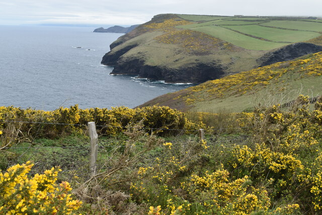
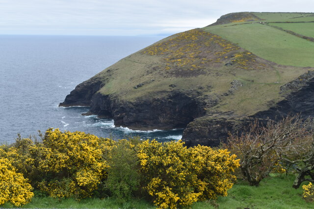
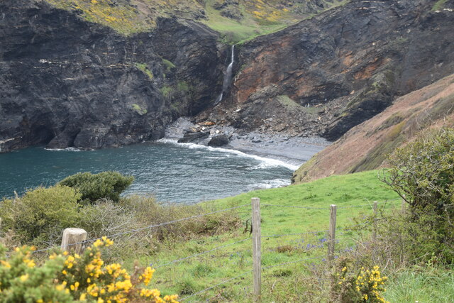
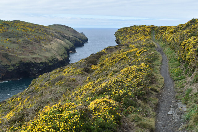
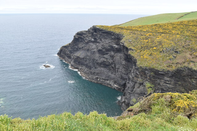
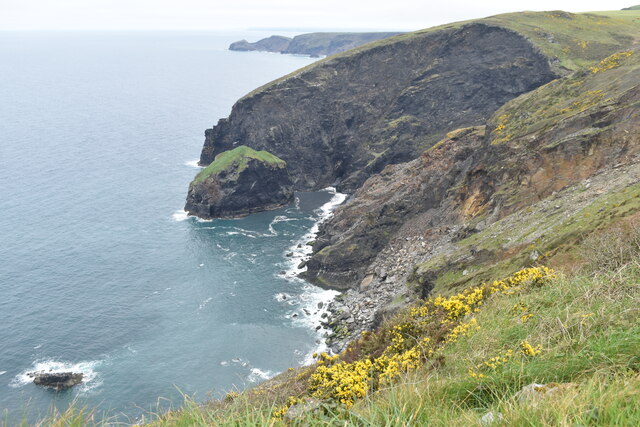
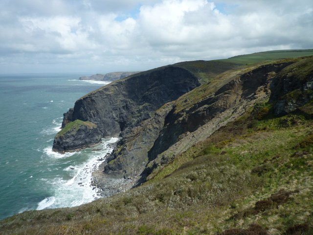
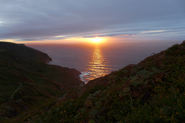
Gull Rock is a small uninhabited island located off the coast of Cornwall, England. Situated approximately 400 meters from Towan Head, Newquay, it is a prominent feature of the Atlantic Ocean, attracting tourists and wildlife enthusiasts alike. The island is named after the large number of seagulls that inhabit its rocky outcrops.

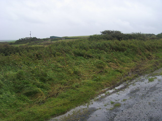
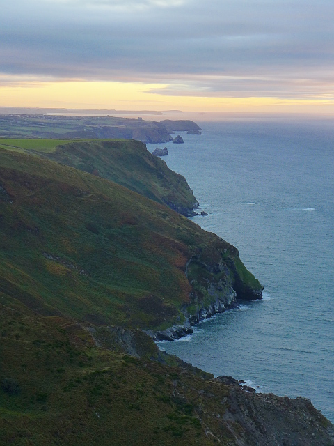
Covering an area of approximately 1.5 acres, Gull Rock is characterized by its rugged and rocky terrain. The island is primarily made up of granite and is surrounded by treacherous waters, making it inaccessible to visitors. However, it is a popular spot for birdwatching, as it serves as a breeding ground for a variety of seabirds, including cormorants, razorbills, and guillemots.

Gull Rock's location in the Atlantic Ocean provides a rich feeding ground for these avian species. The island's cliffs and crevices offer ideal nesting sites, providing protection from predators. Its isolation from human activity has allowed the bird populations to thrive undisturbed.

Despite its small size, Gull Rock is of historical significance. It is believed to have played a role in World War II, serving as a lookout point for enemy aircraft and submarines. Remnants of an observation post from that era can still be seen on the island, serving as a reminder of its past.

In conclusion, Gull Rock is a picturesque and wildlife-rich island off the coast of Cornwall. Its rocky terrain, abundance of seabirds, and historical significance make it a unique and intriguing destination for nature enthusiasts and history buffs.

If you have any feedback on the listing, please let us know in the comments section below.

Gull Rock Images

Images are sourced within 2km of 50.709447/-4.6675032 or Grid Reference SX1193. Thanks to Geograph Open Source API. All images are credited.

View across Pentargon to Beeny Cliff
Cliffs at Pentargon
Cliffs at Pentargon
Waterfall and cliffs at Pentargon
Clifftop path at Pentargon Although walking broadly eastwards, we are here heading west to get around the inlet at Pentargon. The path turns to northwards around Beeny Cliff.
Clifftop path at Pentargon
Although walking broadly eastwards, we are here heading west to get around the inlet at Pentargon. The path turns to northwards around Beeny Cliff.
Cliffs at Pentargon Taken just as the path begins to descend steeply into the valley above the waterfall.
Cliffs at Pentargon
Taken just as the path begins to descend steeply into the valley above the waterfall.
Gorse on Beeny Cliff The South West Coast Path takes a lower route around the cliff, rather close to the edge.  This marked alternate route skirts the top of the access land and feels rather more secure!
Gorse on Beeny Cliff
The South West Coast Path takes a lower route around the cliff, rather close to the edge. This marked alternate route skirts the top of the access land and feels rather more secure!
Cliff top above Saddle Rock The grass-topped stack in the centre is Gull Rock and the headland in the middle distance is Cambeak.
Cliff top above Saddle Rock
The grass-topped stack in the centre is Gull Rock and the headland in the middle distance is Cambeak.
Cliffs above Gull Rock Gull Rock is the grass-topped stack just left of centre.
Cliffs above Gull Rock
Gull Rock is the grass-topped stack just left of centre.
Footpath into valley south of Beeny
Buckator and Gull Rock
Descent to Little Strand
Looking to Newton From the parking by Newton Farm looking to Newton
Looking to Newton
From the parking by Newton Farm looking to Newton
Evening on the coastal path near Beeny
South West Coast Path near Rusey Beach
Sunset near Rusey Beach Taken from the South West Coast Path.
Sunset near Rusey Beach
Taken from the South West Coast Path.
Dusk at the coastal path near Rusey Beach View over Buckator to Tintagel. Rumps Point (Polzeath) and Trevose Head (Constantine Bay) can be seen in the distance.
Dusk at the coastal path near Rusey Beach
View over Buckator to Tintagel. Rumps Point (Polzeath) and Trevose Head (Constantine Bay) can be seen in the distance.
Show me another place!

Gull Rock is located at Grid Ref: SX1193 (Lat: 50.709447, Lng: -4.6675032)

Unitary Authority: Cornwall

Police Authority: Devon and Cornwall

What 3 Words

///forge.scribble.pavilions. Near Tintagel, Cornwall

Related Wikis

Beeny

Beeny is a hamlet in north Cornwall, England, UK. It is in a sheltered valley near the coast two miles (3 km) north-east of Boscastle. == Literary allusions... ==

St Juliot

St Juliot is a civil parish in north-east Cornwall, England, United Kingdom. The parish is entirely rural and the settlements within it are the hamlets...

St Julitta's Church, St Juliot

St Julitta's Church, St Juliot is a Grade II* listed parish church in the Church of England Diocese of Truro in St Juliot, Cornwall. (St Julitta's Church...

Pengold

Pengold is a hamlet near St Gennys in Cornwall, England, UK. Pengold is southwest of Higher Crackington. == References ==

Nearby Amenities

Located within 500m of 50.709447,-4.6675032
Source: PGS
Lat/Long: 50.712255/-4.662492
Source: PGS
Lat/Long: 50.712249/-4.662895
Source: PGS
Lat/Long: 50.7118708/-4.6639984
Source: PGS
Lat/Long: 50.7118621/-4.6649363
Source: PGS
Lat/Long: 50.7115425/-4.6664578
Source: PGS
Lat/Long: 50.711039/-4.666889
Source: PGS
Lat/Long: 50.710705/-4.6671026
Source: PGS
Lat/Long: 50.7101749/-4.6674551
Source: PGS
Lat/Long: 50.7098227/-4.6670766
Source: PGS
Lat/Long: 50.7098062/-4.6664715
Source: PGS
Lat/Long: 50.7096812/-4.6661645
Source: PGS
Lat/Long: 50.7093621/-4.6660926
Source: PGS
Lat/Long: 50.7088169/-4.6657165
Source: PGS
Lat/Long: 50.7086606/-4.6666225
Source: PGS
Lat/Long: 50.7079763/-4.6676433
Source: PGS
Lat/Long: 50.7074382/-4.6672889
Source: PGS
Lat/Long: 50.7071852/-4.6671971
Source: PGS
Lat/Long: 50.7067445/-4.668139
Source: PGS
Lat/Long: 50.7063208/-4.6683125
Source: PGS
Lat/Long: 50.705852/-4.6705243
Source: PGS
Lat/Long: 50.7071427/-4.6707944
Source: PGS
Lat/Long: 50.7071619/-4.67139
Source: PGS
Lat/Long: 50.7071985/-4.6719411
Source: PGS
Lat/Long: 50.7065621/-4.6725481
Buckator
Place: locality
Lat/Long: 50.710947/-4.6670997
Designation: public_footpath
Foot: designated
Prow Ref: St Juliot FP 11
Lat/Long: 50.7095977/-4.6636034
Barrier: kissing_gate
Lat/Long: 50.7052485/-4.6679498
Barrier: kissing_gate
Lat/Long: 50.7055164/-4.6665828
Barrier: kissing_gate
Lat/Long: 50.7058473/-4.6664629
Barrier: kissing_gate
Lat/Long: 50.7081203/-4.6631464
Barrier: stile
Lat/Long: 50.7094301/-4.6638812
The data included in this document is from www.openstreetmap.org. The data is made available under ODbL.

Have you been to Gull Rock?

Leave your review of Gull Rock below (or comments, questions and feedback).