Eilean Seileachan

Island in Argyllshire

Scotland

Eilean Seileachan

A85 along Loch Awe
A85 along Loch Awe Credit: Steven Brown

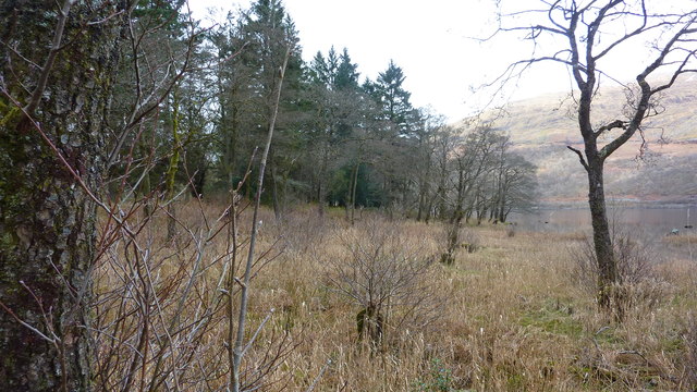
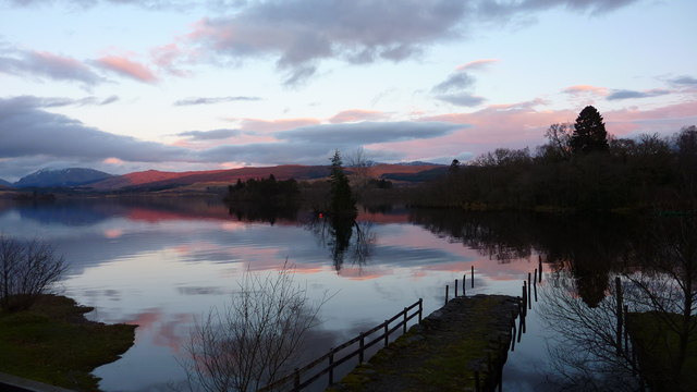
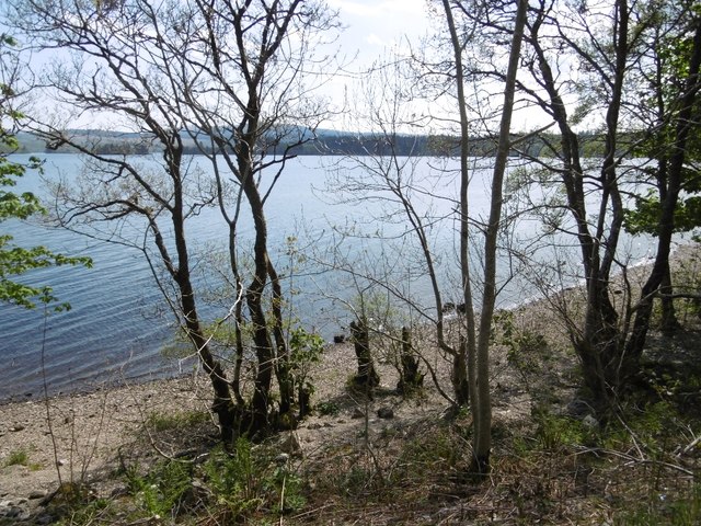
Eilean Seileachan is a small island located in the Argyllshire region of Scotland. It is situated in Loch Creran, a sea loch on the west coast of the country. The island covers an area of approximately 8.5 hectares and is predominantly rocky, with some areas of grassy vegetation.

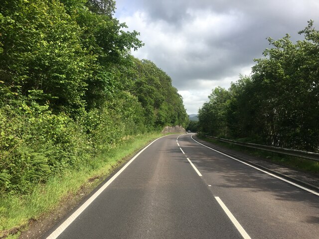
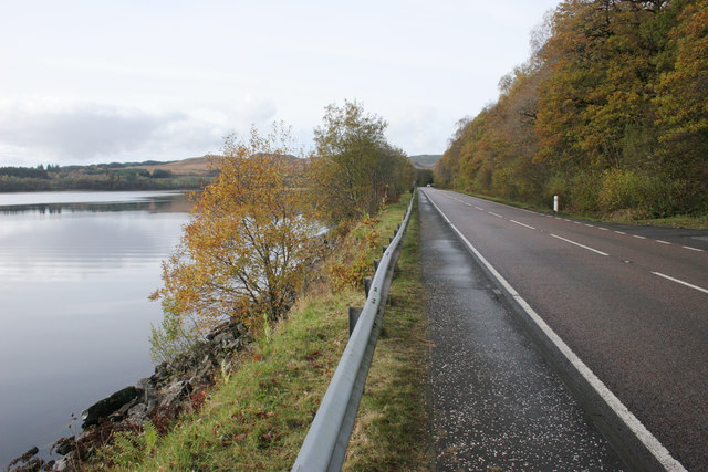
Access to Eilean Seileachan is primarily by boat, as there are no bridges or causeways connecting it to the mainland. The island can be reached from nearby towns such as Benderloch or Oban, which offer boat services to visitors. The journey to the island provides breathtaking views of the surrounding mountains and lochs.

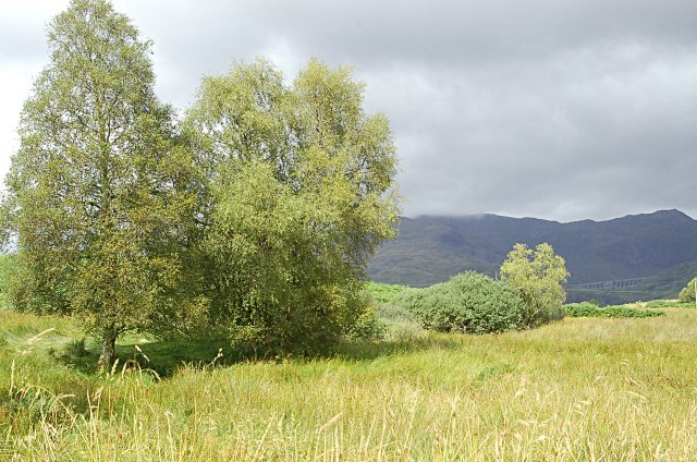
Eilean Seileachan is known for its rich biodiversity. The island is home to a wide variety of bird species, including breeding seabirds such as gulls and terns. It also supports a diverse range of plant life, with heathers, mosses, and grasses covering the landscape.

The island has a long history, with evidence of human settlement dating back to prehistoric times. Ruins of ancient structures, such as stone walls and cairns, can still be found on the island, providing insight into its past inhabitants.

Today, Eilean Seileachan is primarily a nature reserve, managed by local conservation organizations. It offers visitors the opportunity to explore its natural beauty through hiking, birdwatching, and wildlife spotting. The tranquil atmosphere and stunning scenery make it a popular destination for those seeking a peaceful retreat in the heart of the Scottish countryside.

If you have any feedback on the listing, please let us know in the comments section below.

Eilean Seileachan Images

Images are sourced within 2km of 56.371087/-5.0843604 or Grid Reference NN0924. Thanks to Geograph Open Source API. All images are credited.

A85 along Loch Awe
A85 along Loch Awe
Old jetty, Loch Awe Derelict jetty on the western shore of Lochawe.
Old jetty, Loch Awe
Derelict jetty on the western shore of Lochawe.
Abandoned steam launch, Loch Awe A sad sight, the Gertrude Matilda lies derelict amongst the brambles next to an old jetty on the western shore of Loch Awe ( <a title="https://www.geograph.org.uk/photo/4686738" href="https://www.geograph.org.uk/photo/4686738">Link</a> )
Originally named The Lady Rowena, she was built in 1926 at Bowness-on-Windermere. After many years on Windermere, she had a variety of owners before being refitted in 1986 and eventually being acquired by the Loch Awe Steam Packet Co. for hire or charter on the loch.
Further information here: <span class="nowrap"><a title="http://www.steamboatassociation.co.uk/resources/register/html/gert0325.htm" rel="nofollow ugc noopener" href="http://www.steamboatassociation.co.uk/resources/register/html/gert0325.htm">Link</a><img style="margin-left:2px;" alt="External link" title="External link - shift click to open in new window" src="https://s1.geograph.org.uk/img/external.png" width="10" height="10"/></span>
Abandoned steam launch, Loch Awe
A sad sight, the Gertrude Matilda lies derelict amongst the brambles next to an old jetty on the western shore of Loch Awe ( Link ) Originally named The Lady Rowena, she was built in 1926 at Bowness-on-Windermere. After many years on Windermere, she had a variety of owners before being refitted in 1986 and eventually being acquired by the Loch Awe Steam Packet Co. for hire or charter on the loch. Further information here: LinkExternal link
Crannog, Ardanaiseig Bay Sunrise and early morning mist in Ardanaiseig Bay. The small tree covered island is one of many crannogs in Loch Awe. (See <span class="nowrap"><a title="http://www.crannogs.com/index.php/lochawe/survey-report" rel="nofollow ugc noopener" href="http://www.crannogs.com/index.php/lochawe/survey-report">Link</a><img style="margin-left:2px;" alt="External link" title="External link - shift click to open in new window" src="https://s1.geograph.org.uk/img/external.png" width="10" height="10"/></span> <span class="nowrap"><a title="http://www.highland-pony.com/loch%20awe/" rel="nofollow ugc noopener" href="http://www.highland-pony.com/loch%20awe/">Link</a><img style="margin-left:2px;" alt="External link" title="External link - shift click to open in new window" src="https://s1.geograph.org.uk/img/external.png" width="10" height="10"/></span> )
Crannog, Ardanaiseig Bay
Sunrise and early morning mist in Ardanaiseig Bay. The small tree covered island is one of many crannogs in Loch Awe. (See LinkExternal link LinkExternal link )
The Boatshed, Ardanaiseig Hotel The original boatshed at this jetty has been converted into accommodation, which is part of Ardanaiseig Hotel.
The Boatshed, Ardanaiseig Hotel
The original boatshed at this jetty has been converted into accommodation, which is part of Ardanaiseig Hotel.
Ardanaiseig Hotel
Ardanaiseig Hotel
Shore of Loch Awe at Ardanaiseig Quite a contrast to Keith's photo <a href="https://www.geograph.org.uk/photo/758628">NN0925 : North West towards the falls of Cruachan</a>. The water level appears to have risen and this ground is very boggy.
Shore of Loch Awe at Ardanaiseig
Quite a contrast to Keith's photo NN0925 : North West towards the falls of Cruachan. The water level appears to have risen and this ground is very boggy.
Sunset Over Loch Awe Taken from the Boatshed at Ardanaiseig Hotel
Sunset Over Loch Awe
Taken from the Boatshed at Ardanaiseig Hotel
Grounds of Ardanaiseig Hotel & Loch Awe
Carpeted Forest, Ardanaiseig
Grounds of Ardanaiseig Hotel
Beach, Loch Awe The loch was drawn down somewhat during a dry spell.
Beach, Loch Awe
The loch was drawn down somewhat during a dry spell.
A85 by Loch Awe A bend of the old road provides a layby at Coille Leitire.
A85 by Loch Awe
A bend of the old road provides a layby at Coille Leitire.
An old bridge by the A85 The burns here at Coille Leitire are all much reduced in flow as their headwaters have been captured and diverted into the Cruachan hydro scheme dam.
An old bridge by the A85
The burns here at Coille Leitire are all much reduced in flow as their headwaters have been captured and diverted into the Cruachan hydro scheme dam.
A stretch of massive retaining wall between A85 road and the Oban railway above The shore of Loch Awe makes a pinch point.
A stretch of massive retaining wall between A85 road and the Oban railway above
The shore of Loch Awe makes a pinch point.
A85 heading east on north side of Loch Awe
The A85 beside Loch Awe Looking east.
The A85 beside Loch Awe
Looking east.
The A85 beside Loch Awe Looking west.
The A85 beside Loch Awe
Looking west.
Show me another place!

Eilean Seileachan is located at Grid Ref: NN0924 (Lat: 56.371087, Lng: -5.0843604)

Unitary Authority: Argyll and Bute

Police Authority: Argyll and West Dunbartonshire

What 3 Words

///taskbar.coverings.teams. Near Inveraray, Argyll & Bute

Related Wikis

Chapel of St Fyndoca

The Chapel of St Fyndoca (alternate: Fyndoc, or Findoc) is located on the island of Inishail in Loch Awe, Argyll and Bute, Scotland. It was the parish...

Inishail

Inishail (alternate Inchald) is an island and former parish, in Loch Awe, Scotland. == Geography == The island lies at the north end of the loch in the...

Ardanaiseig

Ardanaiseig (Scottish Gaelic: Àird an Aiseig) is a settlement on Loch Awe, Argyll and Bute, Scotland. Loch Awe is one of Scotland's longest freshwater...

Fraoch Eilean, Loch Awe

Fraoch Eilean/Ejlean is a small island situated at the northern end of Loch Awe, a freshwater lake in Argyll and Bute, Scotland. It is notable for being...

Nearby Amenities

Located within 500m of 56.371087,-5.0843604
Chapel of St Fyndoca
Heritage: yes
Historic: archaeological_site
Wikidata: Q5073090
Wikipedia: en:Chapel of St Fyndoca
Lat/Long: 56.374224/-5.0815281
The data included in this document is from www.openstreetmap.org. The data is made available under ODbL.

Have you been to Eilean Seileachan?

Leave your review of Eilean Seileachan below (or comments, questions and feedback).