Bytham, Little

Settlement in Lincolnshire South Kesteven

England

Bytham, Little

Countryside at dusk
Countryside at dusk Credit: Bob Harvey

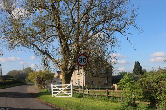
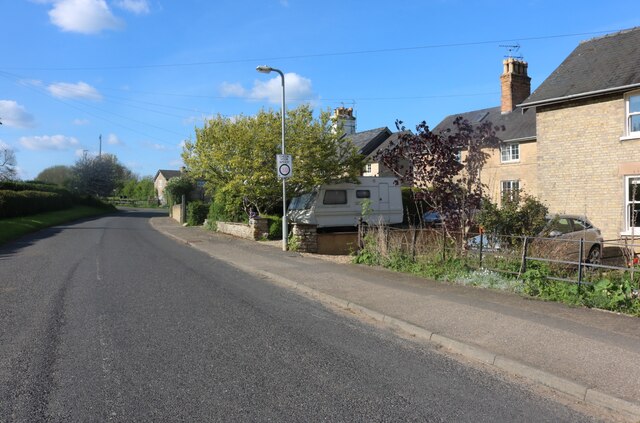
Bytham, Little is a village located in the county of Lincolnshire, in the eastern part of England. Situated approximately 6 miles northeast of the town of Stamford, Bytham, Little is part of the South Kesteven district. The village is nestled in a rural area surrounded by picturesque countryside, offering residents and visitors a tranquil and idyllic setting.

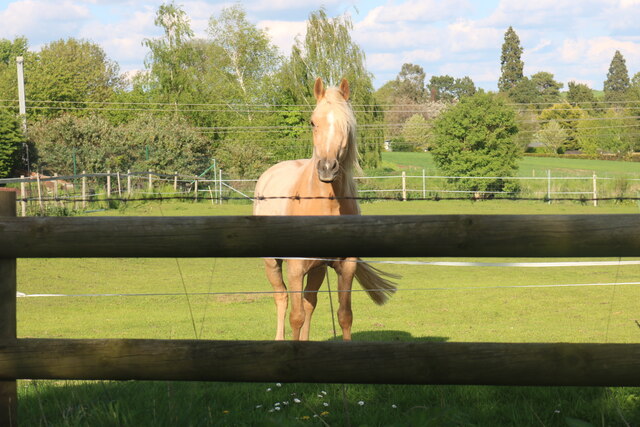
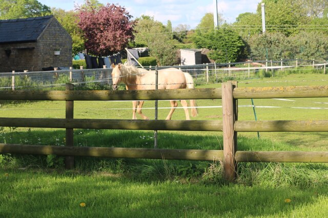
With a population of around 200 inhabitants, Bytham, Little is a small and close-knit community. The village features a mix of traditional and modern houses, providing a charming and characterful atmosphere. The local economy is primarily based on agriculture, with many residents involved in farming activities.

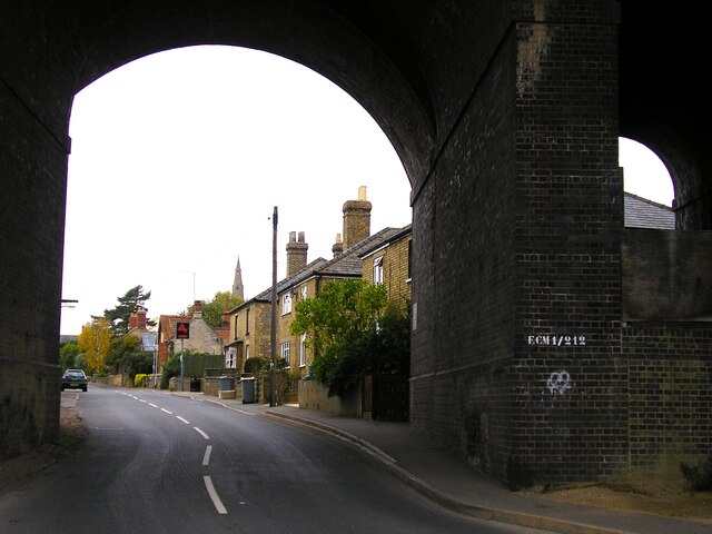
Bytham, Little benefits from its proximity to the larger village of Castle Bytham, which is just over a mile away. Castle Bytham offers a wider range of amenities, including shops, pubs, and a primary school. This allows residents of Bytham, Little to access essential services and facilities without traveling long distances.

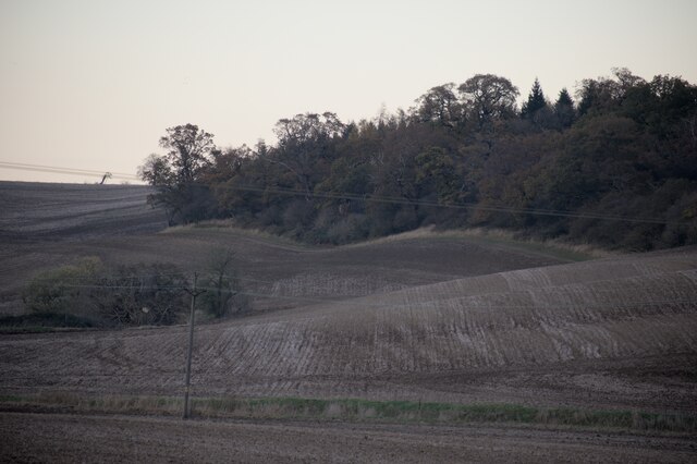
The village is surrounded by natural beauty, with rolling hills, meadows, and fields stretching as far as the eye can see. This scenic landscape provides ample opportunities for outdoor activities such as walking, cycling, and horse riding. Additionally, the nearby River Witham offers opportunities for fishing and boating enthusiasts.

Overall, Bytham, Little is a tranquil and picturesque village, providing a peaceful and rural lifestyle for its residents. Its proximity to Castle Bytham ensures access to essential services, while its beautiful surroundings make it an attractive destination for nature lovers.

If you have any feedback on the listing, please let us know in the comments section below.

Bytham, Little Images

Images are sourced within 2km of 52.750894/-0.498201 or Grid Reference TF0118. Thanks to Geograph Open Source API. All images are credited.

Countryside at dusk
Countryside at dusk
Viaduct, Little Bytham The giant Great Northern Railway viaduct looms large in this small village, and still carries the main East Coast line. It appears to be built of blue engineering brick. I haven't found a date beyond that it is Victorian.
Viaduct, Little Bytham
The giant Great Northern Railway viaduct looms large in this small village, and still carries the main East Coast line. It appears to be built of blue engineering brick. I haven't found a date beyond that it is Victorian.
Country road near Little Bytham
Willoughby Arms, Little Bytham Quite an imposing country pub which originally lay close to a railway station (<a href="https://www.geograph.org.uk/photo/4426796">TF0117 : The Willoughby Arms at Little Bytham, near Bourne, Lincolnshire</a>).
Willoughby Arms, Little Bytham
Quite an imposing country pub which originally lay close to a railway station (TF0117 : The Willoughby Arms at Little Bytham, near Bourne, Lincolnshire).
Getting ready For the last 4 months "works entrance" signs have been appearing in field entrances all over the area, wherever the 400kV lines cross a lane, road, or track.  Now they have started to erect these scaffolds.
Getting ready
For the last 4 months "works entrance" signs have been appearing in field entrances all over the area, wherever the 400kV lines cross a lane, road, or track. Now they have started to erect these scaffolds.
Little Bytham High Street Looking through the road arch of the magnificent Victorian railway viaduct that carries the 4-track East Coast Main Line over the village <a href="https://www.geograph.org.uk/photo/1622243">TF0118 : Railway Viaduct, Little Bytham</a>. The spire of the Church of St. Medard and St. Gildard is in the distance.
Little Bytham High Street
Looking through the road arch of the magnificent Victorian railway viaduct that carries the 4-track East Coast Main Line over the village TF0118 : Railway Viaduct, Little Bytham. The spire of the Church of St. Medard and St. Gildard is in the distance.
At the garden centre  Rassels in Little Bytham.
At the garden centre
Rassels in Little Bytham.
In the hothouse  Annual plants grown on for sale
In the hothouse
Annual plants grown on for sale
Stamford Road, Careby
Horse in Careby He came right over to see me, but I couldn't get any closer as there is a barrier between there and the fence.
Horse in Careby
He came right over to see me, but I couldn't get any closer as there is a barrier between there and the fence.
Horse in Careby He walked straight over when he saw me but there were two sets of fences to stop him getting any closer.
Horse in Careby
He walked straight over when he saw me but there were two sets of fences to stop him getting any closer.
Stamford Road, Careby
Railway bridge on Station Road, Little Bytham
Under the railway bridge on Station Road, Little Bytham
Station Road, Little Bytham
High Street, Little Bytham
The Spinney, Little Bytham Looking towards Foxholes Corner Plantation.
The Spinney, Little Bytham
Looking towards Foxholes Corner Plantation.
Little Bytham: signpost and autumn sunlight The winding B1176 links Grantham (left) and Stamford. The discoloured finger of the signpost points to Witham on the Hill and Bourne.
Little Bytham: signpost and autumn sunlight
The winding B1176 links Grantham (left) and Stamford. The discoloured finger of the signpost points to Witham on the Hill and Bourne.
Show me another place!

Bytham, Little is located at Grid Ref: TF0118 (Lat: 52.750894, Lng: -0.498201)

Division: Parts of Kesteven

Administrative County: Lincolnshire

District: South Kesteven

Police Authority: Lincolnshire

What 3 Words

///commander.stay.partner. Near Clipsham, Rutland

Related Wikis

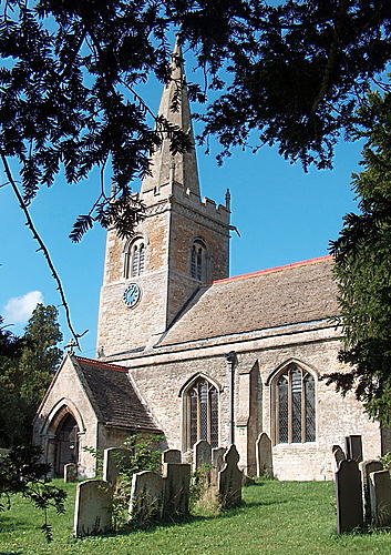
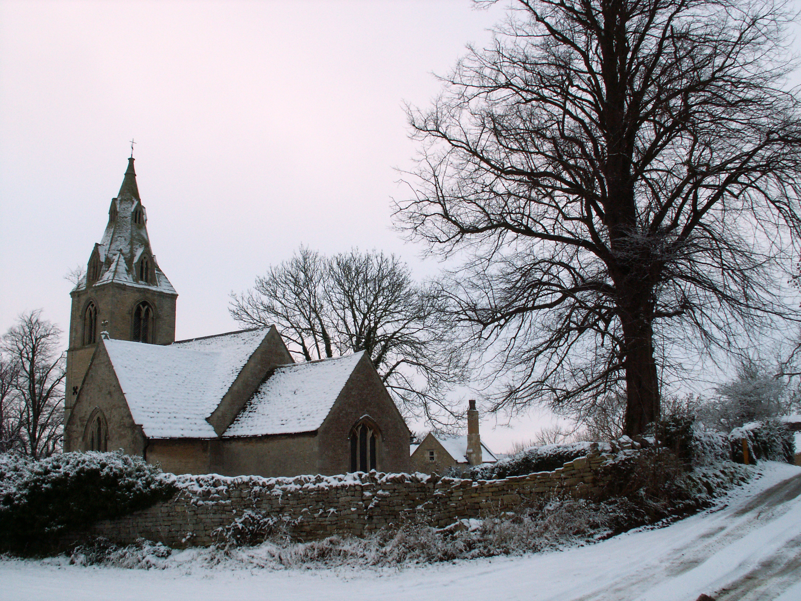
St Medardus and St Gildardus Church, Little Bytham

The church of St Medardus and St Gildardus in Little Bytham, Lincolnshire, England, is a Grade I listed building. It is dedicated to two 6th-century French...

Little Bytham

Little Bytham is a village and civil parish in the South Kesteven district of Lincolnshire, England. The population of the civil parish at the 2011 census...

Little Bytham railway station

Little Bytham railway station was a station in Little Bytham, Lincolnshire on the Great Northern Railway main line. It closed in 1959. The Midland and...

Creeton

Creeton is a village in the civil parish of Counthorpe and Creeton in the South Kesteven district of Lincolnshire, England. It is situated 3 miles (5 km...

Nearby Amenities

Located within 500m of 52.750894,-0.498201
Little Bytham
Is In: Lincolnshire, England, UK
Place: village
Source: NPE
Lat/Long: 52.7509282/-0.4985459
Bus Stop
The Mallard PH
Naptan AtcoCode: 270000010073
Naptan Bearing: NE
Naptan CommonName: The Mallard PH
Naptan Indicator: opp
Naptan Landmark: The Mallard PH
Naptan NaptanCode: linjgtgd
Naptan Street: High Street
Naptan Verified: no
Source: naptan_import
Lat/Long: 52.7511372/-0.4977695
Bus Stop
Tunnel
Bus: yes
Naptan AtcoCode: 270000010074
Naptan Bearing: N
Naptan CommonName: Tunnel
Naptan Indicator: N - bound
Naptan Landmark: Tunnel
Naptan NaptanCode: linjgtgj
Naptan Street: Station Road
Naptan Verified: no
Public Transport: platform
Source: naptan_import
Lat/Long: 52.747076/-0.4944275
Bus Stop
River Bridge
Naptan AtcoCode: 270000014565
Naptan Bearing: SE
Naptan CommonName: River Bridge
Naptan Indicator: SE - bound
Naptan Landmark: River Bridge
Naptan NaptanCode: linjpwmw
Naptan Street: Station Road
Naptan Verified: no
Source: naptan_import
Lat/Long: 52.750237/-0.4976819
Bus Stop
River Bridge
Naptan AtcoCode: 270000014566
Naptan Bearing: NW
Naptan CommonName: River Bridge
Naptan Indicator: NW - bound
Naptan Landmark: River Bridge
Naptan NaptanCode: linjpwpa
Naptan Street: Station Road
Naptan Verified: no
Source: naptan_import
Lat/Long: 52.7502303/-0.49786
Bus Stop
Tunnel
Bus: yes
Naptan AtcoCode: 270002700255
Naptan Bearing: S
Naptan CommonName: Tunnel
Naptan Indicator: S - bound
Naptan Landmark: Tunnel
Naptan Street: Station Road
Naptan Verified: no
Public Transport: platform
Source: naptan_import
Lat/Long: 52.7472544/-0.4943177
Bus Stop
The Mallard PH
Naptan AtcoCode: 2700LLBM1883
Naptan Bearing: SW
Naptan CommonName: The Mallard PH
Naptan Indicator: adj
Naptan Landmark: The Mallard PH
Naptan NaptanCode: linamwag
Naptan Street: High Street
Naptan Verified: no
Source: naptan_import
Lat/Long: 52.7510731/-0.4976828
Ford: yes
Lat/Long: 52.7511365/-0.4959961
Noexit: yes
Lat/Long: 52.7523208/-0.494624
Ele: 43.0000000
Lat/Long: 52.7546964/-0.4966765
Ele: 41.0000000
Lat/Long: 52.7531509/-0.4960328
Ele: 32.0000000
Removed Amenity: telephone
Lat/Long: 52.750956/-0.4979318
Ele: 35.0000000
Lat/Long: 52.7495511/-0.5016496
Ford: yes
Lat/Long: 52.748185/-0.5014633
Ele: 30.0000000
Lat/Long: 52.7483704/-0.5014097
Ele: 31.0000000
Lat/Long: 52.7483716/-0.5001697
Ele: 32.0000000
Lat/Long: 52.7483576/-0.5002274
Barrier: stile
Ele: 31.0000000
Steps: 2
Stile: stepover
Lat/Long: 52.7481489/-0.5012839
Ele: 30.0000000
Lat/Long: 52.7481359/-0.5013288
Barrier: stile
Ele: 31.0000000
Steps: 1
Stile: stepover
Lat/Long: 52.7485692/-0.4997499
Ele: 31.0000000
Lat/Long: 52.7484776/-0.4999377
Ele: 31.0000000
Lat/Long: 52.7482522/-0.5013677
Ele: 31.0000000
Lat/Long: 52.7481643/-0.5013396
Ele: 31.0000000
Lat/Long: 52.7490939/-0.4990429
Ele: 30.0000000
Lat/Long: 52.7491085/-0.498778
Ford: yes
Lat/Long: 52.7490872/-0.4989074
David Harby Motor Engineer
Addr Postcode: NG33 4RA
Addr Street: Station Road
Ele: 34.0000000
Sale: no
Shop: car_repair
Website: https://www.davidharby.co.uk/
Lat/Long: 52.7483073/-0.4950746
Ford: yes
Lat/Long: 52.7484341/-0.5002304
The Spinney
Tourism: picnic_site
Lat/Long: 52.7546292/-0.4971136
Post Box
Location: High Street
Operator: Royal Mail
Lat/Long: 52.750271/-0.5001756
Post Box
Location: Station Road
Operator: Royal Mail
Lat/Long: 52.7499072/-0.4973536
Rasell's Nurseries
Addr Postcode: NG33 4RA
Addr Street: Station Road
Shop: garden_centre
Website: https://www.rasells.co.uk/
Lat/Long: 52.7485192/-0.4950112
AJ Computing
Addr Housename: Unit 1
Addr Postcode: NG33 4RA
Addr Street: Station Road
Office: it
Phone: +44 1780 410998
Website: https://www.aj-computing.co.uk/
Lat/Long: 52.7477984/-0.4950902
Electrical Installations (Lincs) Ltd
Addr Postcode: NG33 4RA
Addr Street: Station Road
Office: electrician
Phone: +44 1780 411171
Website: http://www.electinst.co.uk/
Lat/Long: 52.7476605/-0.4947712
MG Training
Addr Housename: Unit 1
Addr Postcode: NG33 4RA
Addr Street: Station Road
Office: training
Phone: +44 1780 411015
Website: http://www.mgtraining.co.uk
Lat/Long: 52.7478926/-0.4951466
Sheepwash Farm
Place: farm
Source: Bing
Lat/Long: 52.7492075/-0.5008038
Place: farm
Lat/Long: 52.7516852/-0.4988698
Place: farm
Lat/Long: 52.7505943/-0.5016593
Stop
Direction: forward
Lat/Long: 52.7509128/-0.4982203
Power: pole
Lat/Long: 52.7507525/-0.4948234
Power: pole
Lat/Long: 52.750246/-0.4936271
Power: pole
Lat/Long: 52.7531808/-0.4954121
Power: pole
Lat/Long: 52.7532708/-0.4954085
Cafe
The Tea House at Rasell Nurseries
Addr City: Grantham
Addr Housename: Rassell Nurseries
Addr Postcode: NG33 4RA
Addr Street: Station Road
Addr Suburb: Little Bytham
Fhrs Authority: South Kesteven
Fhrs Id: 647409
Fhrs Local Authority Id: 55682
Lat/Long: 52.7489086/-0.4947603
The data included in this document is from www.openstreetmap.org. The data is made available under ODbL.

Have you been to Bytham, Little?

Leave your review of Bytham, Little below (or comments, questions and feedback).