Bull Rock

Island in Pembrokeshire

Wales

Bull Rock

Stepping Stones, Sandy Farm, Pembrokeshire Looking north up the estuary, make sure you get there at low tide to see and use the stepping stones.
Stepping Stones, Sandy Farm, Pembrokeshire Credit: Julian Dowse

Bull Rock is a small uninhabited island located off the coast of Pembrokeshire, Wales. It is situated approximately 2.5 miles west of Skomer Island and can be found in the Irish Sea. The island measures about 76 meters in length and rises up to 20 meters above sea level.

The island is known for its distinctive shape, resembling the head of a bull when viewed from certain angles, hence its name. It is composed mainly of rugged cliffs, with sheer faces rising from the surrounding waters. The cliffs are home to numerous seabird colonies, including razorbills, guillemots, and kittiwakes.

Access to Bull Rock is restricted due to its isolated location and challenging terrain. The island is not open to visitors, as it poses risks to inexperienced climbers and has no designated landing areas. However, boat tours and birdwatching excursions often pass by the island, allowing visitors to admire its unique shape and observe the diverse birdlife from a distance.

Bull Rock is part of the Skomer Island and Skokholm Island Special Protection Area (SPA), designated for its importance as a breeding ground for seabirds. It is also recognized as a Site of Special Scientific Interest (SSSI) due to its geological and ornithological significance.

In summary, Bull Rock is a picturesque and protected island off the coast of Pembrokeshire, renowned for its distinctive shape and rich birdlife. While not accessible to the general public, it offers a unique and valuable habitat for various species of seabirds.

If you have any feedback on the listing, please let us know in the comments section below.
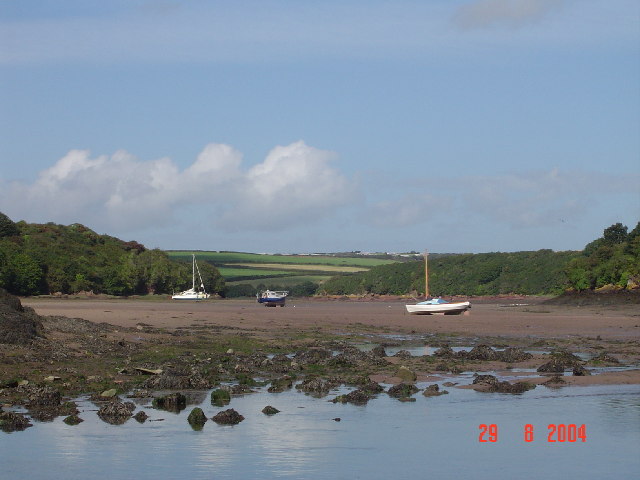
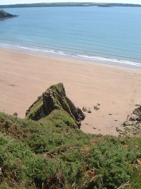
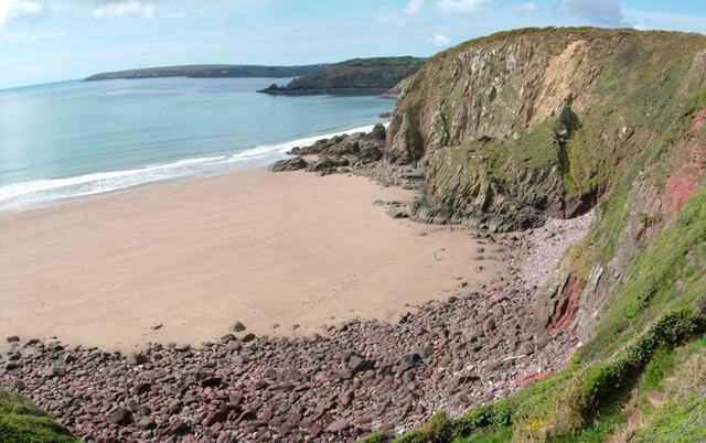
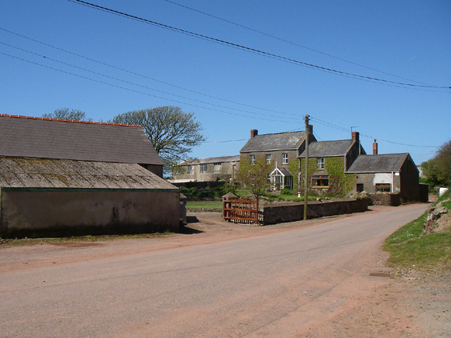
Bull Rock Images

Images are sourced within 2km of 51.716533/-5.1036399 or Grid Reference SM8506. Thanks to Geograph Open Source API. All images are credited.

Stepping Stones, Sandy Farm, Pembrokeshire Looking north up the estuary, make sure you get there at low tide to see and use the stepping stones.
Stepping Stones, Sandy Farm, Pembrokeshire
Looking north up the estuary, make sure you get there at low tide to see and use the stepping stones.
Lindsway Bay Lindsway Bay on the Pembrokeshire Coastal Path. Situated between Monk Haven and Sandy Haven.
Lindsway Bay
Lindsway Bay on the Pembrokeshire Coastal Path. Situated between Monk Haven and Sandy Haven.
St. Ishmael's - Lindsway Bay Beautiful beach. Taken looking west.
St. Ishmael's - Lindsway Bay
Beautiful beach. Taken looking west.
Bicton Bicton farm.
Bicton
Bicton farm.
Church Hall St.Mary's Church Hall built 1912 in the village of Herbrandston.
Church Hall
St.Mary's Church Hall built 1912 in the village of Herbrandston.
Coast Path Looking south along the Pembrokeshire coast path. 
The headland on the horizon is the Angle peninsula.
Coast Path
Looking south along the Pembrokeshire coast path. The headland on the horizon is the Angle peninsula.
Kilroom Bay I'd love to know where this name comes from.
Kilroom Bay
I'd love to know where this name comes from.
Car Park The car park for the site workers at the controversial LPG plant being built in the Pembrokeshire National Park.
Car Park
The car park for the site workers at the controversial LPG plant being built in the Pembrokeshire National Park.
Church Herbranston church.
Church
Herbranston church.
Little Castle Head The headland called Little Castle head.

The 'lump' left of centre is the 'Fort'.
Little Castle Head
The headland called Little Castle head. The 'lump' left of centre is the 'Fort'.
Great Castle Head Great Castle Head from the bottom corner of the wall that is just inside this grid square at SM 847 059. I think the brickwork that can be seen must be the remains of a pill box.
Great Castle Head
Great Castle Head from the bottom corner of the wall that is just inside this grid square at SM 847 059. I think the brickwork that can be seen must be the remains of a pill box.
The crab bridge Sandy Haven Pill This bridge and stepping stones on the coast path have been used by generations of children to collect crabs. The bridge is only above the tide for around 2 hours either side of low tide.
The crab bridge Sandy Haven Pill
This bridge and stepping stones on the coast path have been used by generations of children to collect crabs. The bridge is only above the tide for around 2 hours either side of low tide.
Stack Rock Skerry occupied by a fort/gun emplacement defending Milford Haven. Completed in 1871 replacing an older emplacement built after the defeat of the original Napoleon.
Stack Rock
Skerry occupied by a fort/gun emplacement defending Milford Haven. Completed in 1871 replacing an older emplacement built after the defeat of the original Napoleon.
Stackrock fort Beautifully constructed fort
Stackrock fort
Beautifully constructed fort
Seals on rocks at Stackrock Fort Seals regularly bask here
Seals on rocks at Stackrock Fort
Seals regularly bask here
Stack Rock, Milford Haven This is the second fort on Stack Rock, it was completed on 31 December 1871 at a cost of £96,840.
Stack Rock, Milford Haven
This is the second fort on Stack Rock, it was completed on 31 December 1871 at a cost of £96,840.
Sandy Haven from the beach
Sandy Haven Pill reaching the sea.
Show me another place!

Bull Rock is located at Grid Ref: SM8506 (Lat: 51.716533, Lng: -5.1036399)

Unitary Authority: Pembrokeshire

Police Authority: Dyfed Powys

What 3 Words

///flips.profiled.card. Near Herbrandston, Pembrokeshire

Related Wikis

Herbrandston

Herbrandston is a village, parish and community on the north side of the River Cleddau, in Pembrokeshire, Wales. It is located to the west of Milford Haven...

South Hook Fort

South Hook Fort, on the northern shore of Milford Haven, Pembrokeshire, is a Grade II*-listed building which belongs to a series of forts built as part...

South Hook LNG terminal

South Hook LNG terminal is an LNG regasification terminal near Milford Haven and is the largest LNG terminal in Europe. Together with the smaller Dragon...
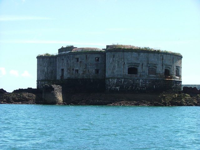
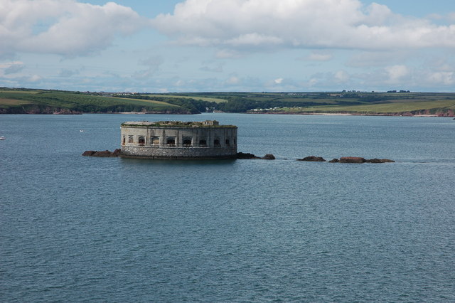
Stack Rock Fort

Stack Rock Fort is a fort built on a small island in the Milford Haven Waterway, Pembrokeshire, Wales. A 3-gun fort was built between 1850 and 1852, and...

Nearby Amenities

Located within 500m of 51.716533,-5.1036399
Seamark Information: Visible 031° 12´ -048° 12´
Seamark Light Character: Oc
Seamark Light Colour: white
Seamark Light Height: 53
Seamark Light Period: 8
Seamark Light Range: 15
Seamark Light Reference: A 5287.1
Seamark Light Sequence: 6+(2)
Seamark Light Visibility: part_obscured
Seamark Type: light_minor
Source: US NGA Pub. 114. 2011-05-26.
Lat/Long: 51.7173/-5.10965
The data included in this document is from www.openstreetmap.org. The data is made available under ODbL.

Have you been to Bull Rock?

Leave your review of Bull Rock below (or comments, questions and feedback).