Barton Turf

Settlement in Norfolk North Norfolk

England

Barton Turf

Barton Broad - Gayes Staithe 1980
Barton Broad - Gayes Staithe 1980 Credit: Roy Hughes

Barton Turf is a small village located in the county of Norfolk, England. Situated within the Broads National Park, it is surrounded by picturesque countryside and lies adjacent to the Barton Broad, the second largest of the Norfolk Broads lakes. The village is approximately 12 miles northeast of Norwich, the county's capital city.

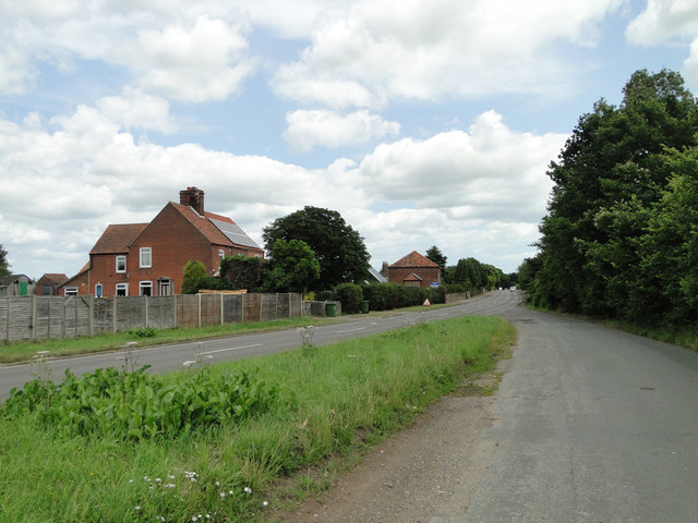
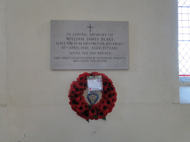
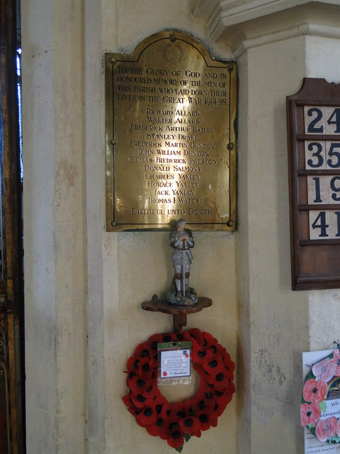
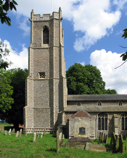
With a population of around 400 residents, Barton Turf exudes a tranquil and idyllic charm. The village is known for its traditional thatched cottages, some of which date back to the 17th century, adding to its quintessential English character. The local St. Michael and All Angels Church is also a notable landmark, displaying a Norman font and stunning stained glass windows.

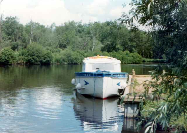
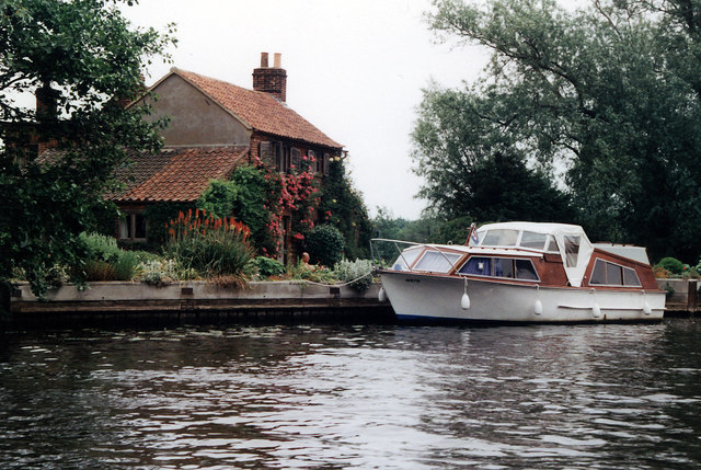
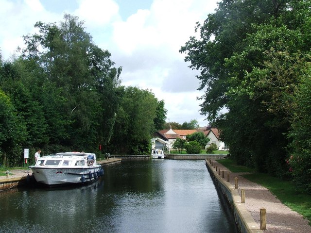
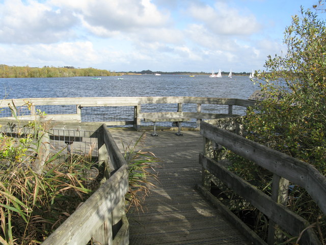
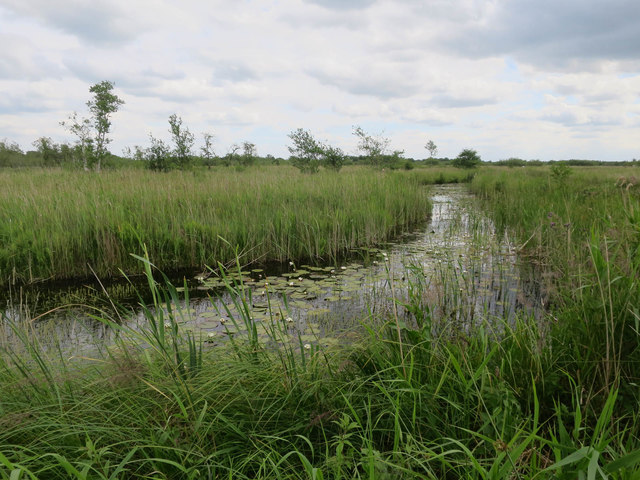
The Barton Broad provides a plethora of recreational opportunities for locals and tourists alike. It is a popular spot for boating and sailing enthusiasts, offering access to the wider network of Broads waterways. Additionally, the surrounding wetlands and nature reserves attract birdwatchers and wildlife enthusiasts, who can spot a variety of bird species and other unique flora and fauna.

Although small in size, Barton Turf has a strong sense of community, with various social events and activities taking place throughout the year. The village has a primary school, a village hall, and a local pub, which serves as a hub for residents. Its proximity to larger towns and cities allows for easy access to amenities and services, making Barton Turf an ideal location for those seeking a peaceful rural lifestyle within reach of urban conveniences.

If you have any feedback on the listing, please let us know in the comments section below.

Barton Turf Images

Images are sourced within 2km of 52.749621/1.486356 or Grid Reference TG3522. Thanks to Geograph Open Source API. All images are credited.

Barton Broad - Gayes Staithe 1980
House Beside Hunsett Mill Seen from a passing yacht - A fine display of Red Hot Pokers and Roses!
House Beside Hunsett Mill
Seen from a passing yacht - A fine display of Red Hot Pokers and Roses!
Cox's Boatyard, Barton Turf
Car park for Barton Broad There is a boardwalk through the marshy area at the southern edge of Barton Broad, reached by a footpath across fields from the car park.
Car park for Barton Broad
There is a boardwalk through the marshy area at the southern edge of Barton Broad, reached by a footpath across fields from the car park.
Little house in the wood Derelict cottage near Barton Broad car park.
Little house in the wood
Derelict cottage near Barton Broad car park.
Notice in a layby on the A1151
Houses on the A1151 at Smallburgh
Barton Turf War Memorial War Memorial to William James BLAKE who died in WW2.
Barton Turf War Memorial
War Memorial to William James BLAKE who died in WW2.
Barton Turf WW1 War memorial The memorial bears twelve names which are also repeated in the lychgate also serving as a memorial to the men.
Barton Turf WW1 War memorial
The memorial bears twelve names which are also repeated in the lychgate also serving as a memorial to the men.
Neatishead Staithe
Neatishead Staithe
Hunsett Mill By the river Ant.
Hunsett Mill
By the river Ant.
Hunsett Mill and Mill House
Hunsett Mill and the River Ant
Hunsett Mill
Hunsett Mill
Barton Broad and Viewpoint View of Barton Broad from the northern end of the boardwalk through the forest beside Barton Broad.
Barton Broad and Viewpoint
View of Barton Broad from the northern end of the boardwalk through the forest beside Barton Broad.
Timber at Workhouse Common
A149 Norwich Road Towards Great Yarmouth.
A149 Norwich Road
Towards Great Yarmouth.
Dyke in Sutton Fen Taken on an RSPB visit to this normally closed reserve. There are a number of good birds on the reserve, but plants are at least as strong a focus of the management, together with insects.
Dyke in Sutton Fen
Taken on an RSPB visit to this normally closed reserve. There are a number of good birds on the reserve, but plants are at least as strong a focus of the management, together with insects.
Show me another place!

Barton Turf is located at Grid Ref: TG3522 (Lat: 52.749621, Lng: 1.486356)

Administrative County: Norfolk

District: North Norfolk

Police Authority: Norfolk

What 3 Words

///cooked.error.tightest. Near Stalham, Norfolk

Nearby Locations

Barton Turf

Related Wikis

Barton Turf

Barton Turf is a village and civil parish in the English county of Norfolk. It is 20 km north-east of the city of Norwich, on the northwestern edge of...

St Michael and All Angels Church, Barton Turf

St Michael and All Angels is the Church of England parish church of Barton Turf in the county of Norfolk in England. See Inside here. It stands about a...
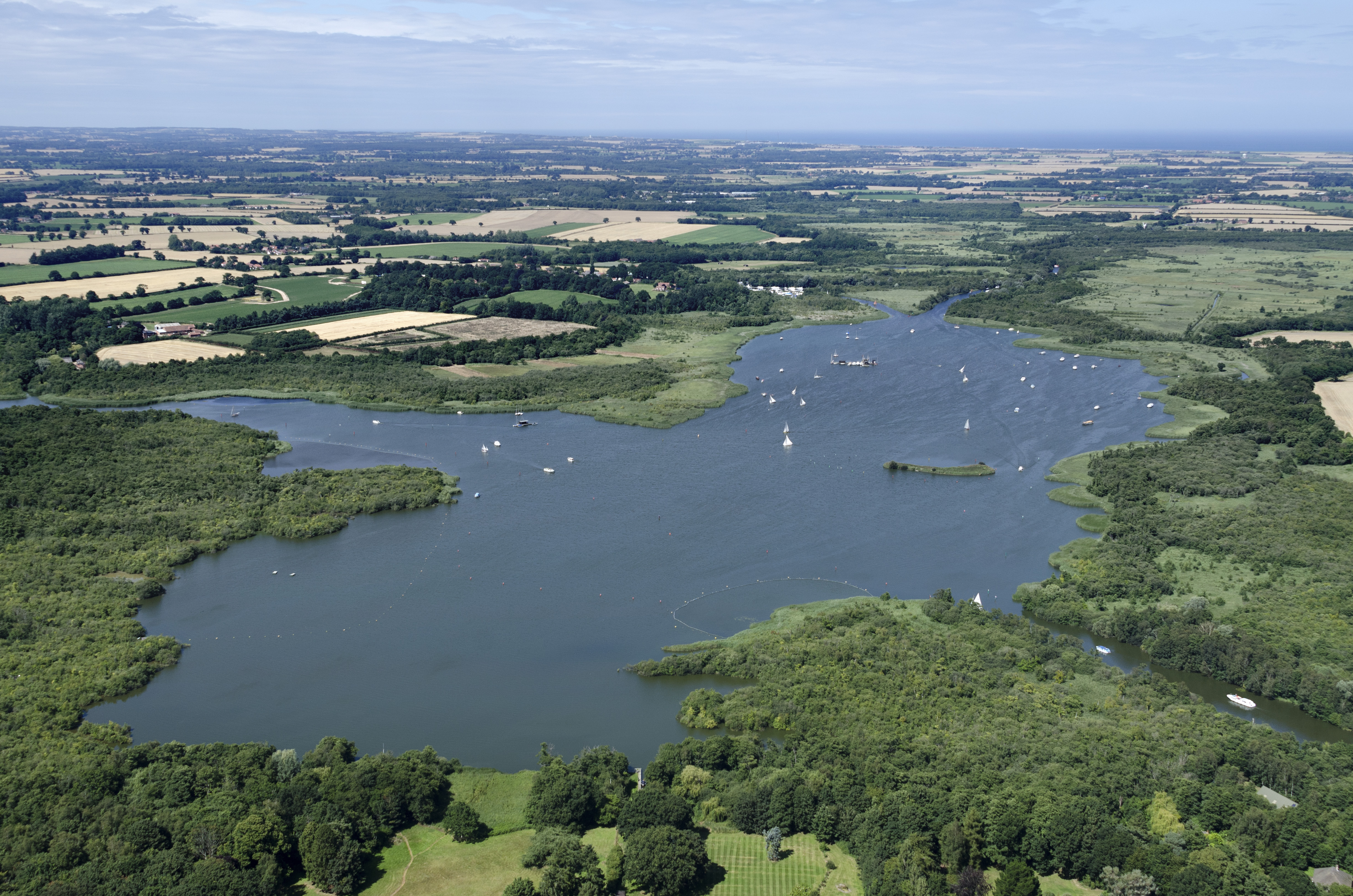
Barton Broad

Barton Broad is a large lake that forms part of the River Ant which gives its name to a 164-hectare (410-acre) nature reserve north-east of Norwich in...

Ant Broads & Marshes National Nature Reserve

Ant Broads & Marshes NNR is a national nature reserve in Norfolk, England established by English Nature. It is named after the River Ant. It is part of...

Ant Broads and Marshes

Ant Broads and Marshes is a 745.3-hectare (1,842-acre) biological Site of Special Scientific Interest north-east of Norwich in Norfolk. Most of it is a...
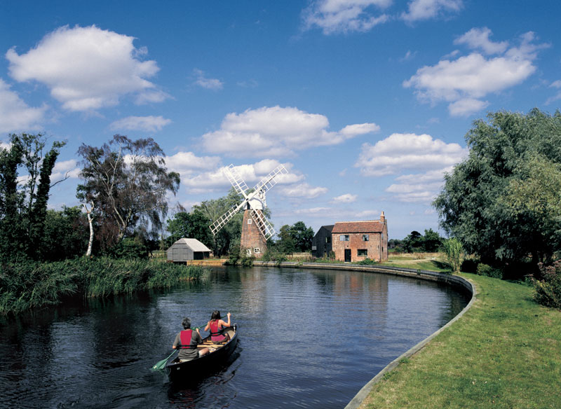
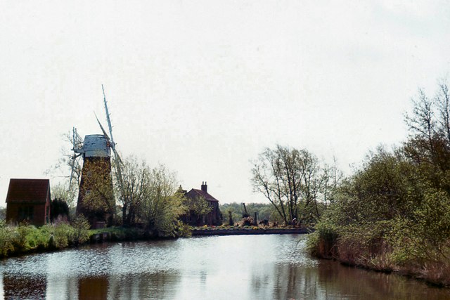
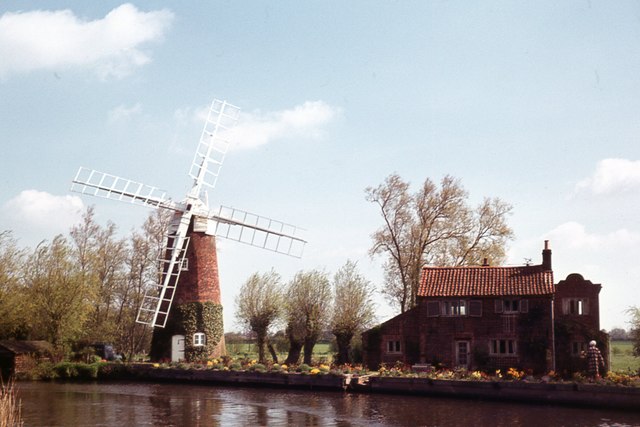
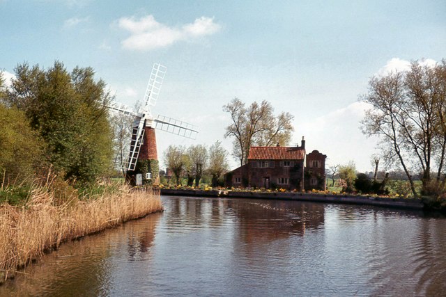
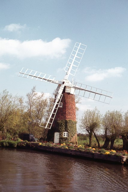
Hunsett Mill

Hunsett Mill is located on the east bank of the River Ant one mile north of Barton Broad in the English county of Norfolk. The Windmill is 1.2 miles south...

Neatishead

Neatishead ( NEET-stəd) is a village and civil parish in the English county of Norfolk. The village is situated some 20 km (12 mi) north-east of the city...

Catfield Fen Reserve

Catfield Fen is a wetland nature reserve near Ludham in the county of Norfolk, England. Butterfly Conservation owns and manages part of this reserve. Part...

Nearby Amenities

Located within 500m of 52.749621,1.486356
Barton Turf
Created By: Potlatch 0.10f
Is In Country: United Kingdom
Is In County: Norfolk
Place: village
Lat/Long: 52.7489976/1.486988
Telephone
Booth: K6
Covered: booth
Man Made: telephone_box
Lat/Long: 52.7486757/1.4851498
Bus Stop
bus shelter, adj
Naptan AtcoCode: 2900B101
Naptan Bearing: SW
Naptan CommonName: bus shelter
Naptan Indicator: adj
Naptan Landmark: bus shelter
Naptan Locality: Barton Turf
Naptan NaptanCode: nfoadptj
Naptan Street: The Street
Shelter: yes
Source: naptan_import;survey
Lat/Long: 52.7486264/1.4850378
Bus Stop
bus shelter, opp
Naptan AtcoCode: 2900B102
Naptan Bearing: NE
Naptan BusStopType: CUS
Naptan CommonName: bus shelter
Naptan Indicator: opp
Naptan Locality: Barton Turf
Naptan NaptanCode: nfoadptm
Naptan Street: The Street
Naptan Verified: no
Source: naptan_import
Lat/Long: 52.7487888/1.4852157
Parking
Lat/Long: 52.7485094/1.4906749
Barton Turf
Inscription: EIIR 1953 / Pennygate / Staithe / Erected ... to celebrate the coronation of Queen Elizabeth II
Man Made: village_sign
Material: metal
Start Date: 1953
Lat/Long: 52.7484012/1.4845423
Bench
Backrest: yes
Material: wood
Seats: 3
Lat/Long: 52.7484828/1.4854025
Notice Board
Board Type: notice
Information: board
Tourism: information
Lat/Long: 52.7486066/1.4850378
Post Box
Collection Times: Mo-Fr 16:00; Sa 09:00
Post Box Type: lamp
Lat/Long: 52.7486152/1.4850597
Toilets
Access: customers
Fee: no
Fee Shower: yes
Female: yes
Male: yes
Operator: Cox's Boatyard
Shower: yes
Toilets Disposal: flush
Toilets Position: seated;urinal
Wheelchair: yes
Lat/Long: 52.7475578/1.491622
Water Point
Drinking Water: yes
Fee: yes
Lat/Long: 52.7484974/1.4913719
Give Way
Lat/Long: 52.7483786/1.4844342
The data included in this document is from www.openstreetmap.org. The data is made available under ODbL.

Have you been to Barton Turf?

Leave your review of Barton Turf below (or comments, questions and feedback).