Achachork

Settlement in Inverness-shire

Scotland

Achachork

Looking south on the A855 north of Portree
Looking south on the A855 north of Portree Credit: Rod Allday

Achachork is a small village located in the county of Inverness-shire, in the Scottish Highlands. Situated just three miles west of the city of Inverness, it is nestled amidst beautiful natural surroundings, offering residents and visitors a peaceful and picturesque setting.

The village is known for its stunning views of the surrounding hills and valleys. The nearby Achachork Forest provides ample opportunities for outdoor activities such as hiking, cycling, and wildlife spotting. The area is also home to several lochs and rivers, offering fishing enthusiasts a chance to indulge in their hobby.

Achachork is a close-knit community, with a small population residing in traditional Highland cottages and modern houses. The village has a strong sense of community spirit, and the locals often come together to organize events and activities for both residents and tourists.

Despite its rural setting, Achachork benefits from its close proximity to Inverness. The city offers a range of amenities including shops, supermarkets, restaurants, and leisure facilities. It is also well-connected by road and rail, making it easy to access other parts of Scotland.

In summary, Achachork is a charming village located in the heart of Inverness-shire. With its stunning natural surroundings, strong community spirit, and easy access to nearby amenities, it offers a peaceful and idyllic lifestyle for its residents, as well as a welcoming destination for visitors seeking a tranquil retreat in the Scottish Highlands.

If you have any feedback on the listing, please let us know in the comments section below.
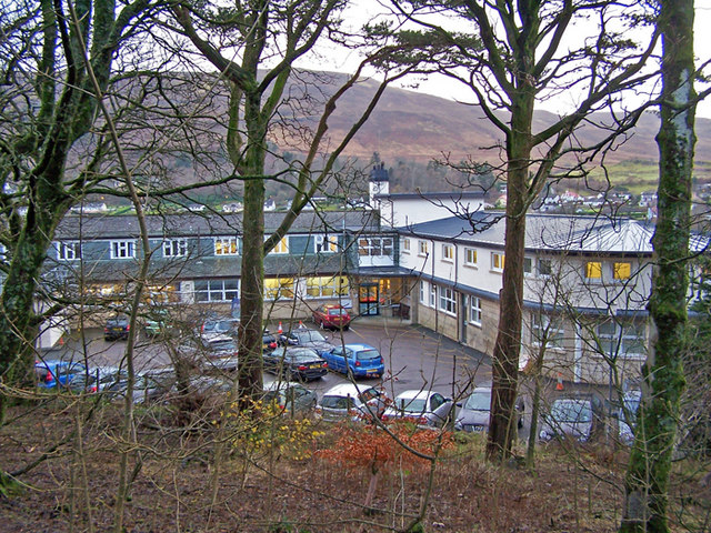
Achachork Images

Images are sourced within 2km of 57.432615/-6.1985065 or Grid Reference NG4845. Thanks to Geograph Open Source API. All images are credited.

Looking south on the A855 north of Portree
Moorland North of Portree
Walkers on the Road to Portree The A855 is approximately 33 miles long, encircling the Trotternish Peninsula at the north end of Skye. It is single-track for much of its length, undergoing fairly frequent repair as it is mostly built on top of a peat moor. Despite nominally being a coast road, the route is more often than not inland, with only glimpses of the sea available, particularly on the east coast of Trotternish. Despite this, however, it is a spectacular drive, and reveals some of Skye's finer features <span class="nowrap"><a title="https://www.sabre-roads.org.uk/wiki/index.php?title=A855" rel="nofollow ugc noopener" href="https://www.sabre-roads.org.uk/wiki/index.php?title=A855">Link</a><img style="margin-left:2px;" alt="External link" title="External link - shift click to open in new window" src="https://s1.geograph.org.uk/img/external.png" width="10" height="10"/></span> (SABRE).
Walkers on the Road to Portree
The A855 is approximately 33 miles long, encircling the Trotternish Peninsula at the north end of Skye. It is single-track for much of its length, undergoing fairly frequent repair as it is mostly built on top of a peat moor. Despite nominally being a coast road, the route is more often than not inland, with only glimpses of the sea available, particularly on the east coast of Trotternish. Despite this, however, it is a spectacular drive, and reveals some of Skye's finer features LinkExternal link (SABRE).
Passing Place on the A855 Motorcyclist and passenger waiting at a passing place on the A855 near Portree.
Passing Place on the A855
Motorcyclist and passenger waiting at a passing place on the A855 near Portree.
A855 near :Portree The A855 is approximately 33 miles long, encircling the Trotternish Peninsula at the north end of Skye. It is single-track for much of its length, undergoing fairly frequent repair as it is mostly built on top of a peat moor. Despite nominally being a coast road, the route is more often than not inland, with only glimpses of the sea available, particularly on the east coast of Trotternish. Despite this, however, it is a spectacular drive, and reveals some of Skye's finer features <span class="nowrap"><a title="https://www.sabre-roads.org.uk/wiki/index.php?title=A855" rel="nofollow ugc noopener" href="https://www.sabre-roads.org.uk/wiki/index.php?title=A855">Link</a><img style="margin-left:2px;" alt="External link" title="External link - shift click to open in new window" src="https://s1.geograph.org.uk/img/external.png" width="10" height="10"/></span> (SABRE).
A855 near :Portree
The A855 is approximately 33 miles long, encircling the Trotternish Peninsula at the north end of Skye. It is single-track for much of its length, undergoing fairly frequent repair as it is mostly built on top of a peat moor. Despite nominally being a coast road, the route is more often than not inland, with only glimpses of the sea available, particularly on the east coast of Trotternish. Despite this, however, it is a spectacular drive, and reveals some of Skye's finer features LinkExternal link (SABRE).
A855 approaching Portree The A855 is approximately 33 miles long, encircling the Trotternish Peninsula at the north end of Skye. It is single-track for much of its length, undergoing fairly frequent repair as it is mostly built on top of a peat moor. Despite nominally being a coast road, the route is more often than not inland, with only glimpses of the sea available, particularly on the east coast of Trotternish. Despite this, however, it is a spectacular drive, and reveals some of Skye's finer features <span class="nowrap"><a title="https://www.sabre-roads.org.uk/wiki/index.php?title=A855" rel="nofollow ugc noopener" href="https://www.sabre-roads.org.uk/wiki/index.php?title=A855">Link</a><img style="margin-left:2px;" alt="External link" title="External link - shift click to open in new window" src="https://s1.geograph.org.uk/img/external.png" width="10" height="10"/></span> (SABRE).
A855 approaching Portree
The A855 is approximately 33 miles long, encircling the Trotternish Peninsula at the north end of Skye. It is single-track for much of its length, undergoing fairly frequent repair as it is mostly built on top of a peat moor. Despite nominally being a coast road, the route is more often than not inland, with only glimpses of the sea available, particularly on the east coast of Trotternish. Despite this, however, it is a spectacular drive, and reveals some of Skye's finer features LinkExternal link (SABRE).
A87, Sluggans The A87 runs 99 miles from Invergarry to Uig on the Isle of Skye <a href="https://www.geograph.org.uk/photo/7374675">NG3863 : End of the A87, Uig</a>.
<span class="nowrap"><a title="https://www.sabre-roads.org.uk/wiki/index.php?title=A87" rel="nofollow ugc noopener" href="https://www.sabre-roads.org.uk/wiki/index.php?title=A87">Link</a><img style="margin-left:2px;" alt="External link" title="External link - shift click to open in new window" src="https://s1.geograph.org.uk/img/external.png" width="10" height="10"/></span>
A87, Sluggans
The A87 runs 99 miles from Invergarry to Uig on the Isle of Skye NG3863 : End of the A87, Uig. LinkExternal link
A87 leaving Portree The A87 runs 99 miles from Invergarry to Uig on the Isle of Skye <a href="https://www.geograph.org.uk/photo/7374675">NG3863 : End of the A87, Uig</a>.
<span class="nowrap"><a title="https://www.sabre-roads.org.uk/wiki/index.php?title=A87" rel="nofollow ugc noopener" href="https://www.sabre-roads.org.uk/wiki/index.php?title=A87">Link</a><img style="margin-left:2px;" alt="External link" title="External link - shift click to open in new window" src="https://s1.geograph.org.uk/img/external.png" width="10" height="10"/></span>
A87 leaving Portree
The A87 runs 99 miles from Invergarry to Uig on the Isle of Skye NG3863 : End of the A87, Uig. LinkExternal link
A87, southbound The A87 runs 99 miles from Invergarry to Uig on the Isle of Skye <a href="https://www.geograph.org.uk/photo/7374675">NG3863 : End of the A87, Uig</a>.
<span class="nowrap"><a title="https://www.sabre-roads.org.uk/wiki/index.php?title=A87" rel="nofollow ugc noopener" href="https://www.sabre-roads.org.uk/wiki/index.php?title=A87">Link</a><img style="margin-left:2px;" alt="External link" title="External link - shift click to open in new window" src="https://s1.geograph.org.uk/img/external.png" width="10" height="10"/></span>
A87, southbound
The A87 runs 99 miles from Invergarry to Uig on the Isle of Skye NG3863 : End of the A87, Uig. LinkExternal link
A87 entering Portree The A87 runs 99 miles from Invergarry to Uig on the Isle of Skye <a href="https://www.geograph.org.uk/photo/7374675">NG3863 : End of the A87, Uig</a>.
<span class="nowrap"><a title="https://www.sabre-roads.org.uk/wiki/index.php?title=A87" rel="nofollow ugc noopener" href="https://www.sabre-roads.org.uk/wiki/index.php?title=A87">Link</a><img style="margin-left:2px;" alt="External link" title="External link - shift click to open in new window" src="https://s1.geograph.org.uk/img/external.png" width="10" height="10"/></span>
A87 entering Portree
The A87 runs 99 miles from Invergarry to Uig on the Isle of Skye NG3863 : End of the A87, Uig. LinkExternal link
A855 towards Staffin
A855 in Portree
A855 in Portree
Co-op carpark, Portree
Scattered bushes in a barren brown field site
Show me another place!

Achachork is located at Grid Ref: NG4845 (Lat: 57.432615, Lng: -6.1985065)

Unitary Authority: Highland

Police Authority: Highlands and Islands

Also known as: Achadh a'Choirce

What 3 Words

///shun.callers.poorly. Near Portree, Highland

Nearby Locations

Achadh a'Choirce Achachork

Related Wikis

Achachork

Achachork (Scottish Gaelic: Achadh a' Choirce) is a small village in the Scottish council area of the Highland. It is lies on the A855 road to the north...

Radio Skye

Radio Skye is a local radio station which broadcasts from Portree to the Isle of Skye, as well as the region of Lochalsh, Wester Ross on the Scottish mainland...

Bun-sgoil Ghàidhlig Phort Righ

Bun-sgoil Ghàidhlig Phort Righ is a Gaelic-medium primary school in Portree on Skye, Scotland. The school opened April 2018, becoming the third purpose...

Portree

Portree (; Scottish Gaelic: Port Rìgh, pronounced [pʰɔrˠʃt̪ˈɾiː]) is the largest town on, and capital of, the Isle of Skye in the Inner Hebrides of Scotland...

ATLAS Arts

ATLAS Arts is a visual arts organisation dedicated to commissioning contemporary arts, culture, heritage, and education based in the Isle of Skye. It was...

Pairc nan Laoch

Pairc nan Laoch is a shinty stadium in Portree, Isle of Skye, Scotland. It is home to Skye Camanachd. == History == Skye Camanachd originally played at...

Portree Hospital

The Portree Hospital is a health facility in Fancyhill, Portree on the Isle of Skye. It is managed by NHS Highland. == History == The facility, which was...

Borve, Skye

Borve or Borbh is a crofting township on the Isle of Skye, Scotland. == Dun Borve == Dun Borve [dùn is 'fort' in Gaelic] is an ancient fort, that was considered...

Nearby Amenities

Located within 500m of 57.432615,-6.1985065
Generator Method: photovoltaic
Generator Output Electricity: yes
Generator Source: solar
Generator Type: solar_photovoltaic_panel
Location: roof
Power: generator
Lat/Long: 57.4345423/-6.2034318
Generator Method: photovoltaic
Generator Output Electricity: yes
Generator Source: solar
Generator Type: solar_photovoltaic_panel
Location: roof
Power: generator
Lat/Long: 57.4323738/-6.1976932
Achachork
Name En: Achachork
Name Gd: Achadh a' Choirce
Place: village
Wikidata: Q1967455
Wikipedia: en:Achachork
Lat/Long: 57.4322212/-6.1966148
The data included in this document is from www.openstreetmap.org. The data is made available under ODbL.

Have you been to Achachork?

Leave your review of Achachork below (or comments, questions and feedback).