Fraoch Eilean

Island in Argyllshire

Scotland

Fraoch Eilean

Luing - Looking across Black Mill Bay to Ardlarach A view across the semicircular Black Mill Bay from the eponymous settlement of Blackmillbay to the land around Ardlarach with Cnoc Mòr rising behind it to the left (west).
Luing - Looking across Black Mill Bay to Ardlarach Credit: Rob Farrow

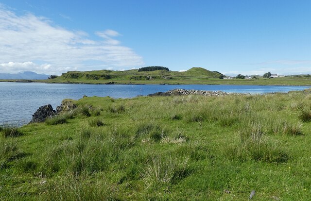
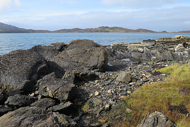
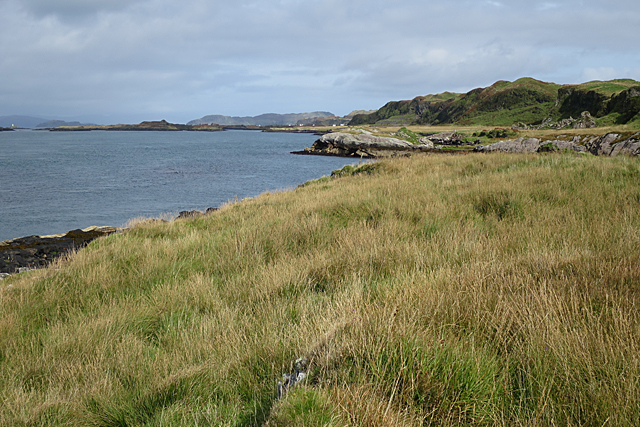
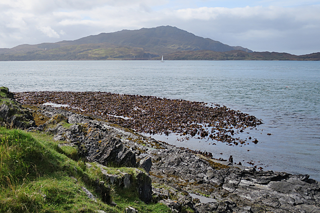
Fraoch Eilean, located in Argyllshire, Scotland, is a picturesque island spanning approximately 7.5 acres. Situated in the stunning Loch Awe, it is part of a chain of islands known collectively as "The Islands of Loch Awe." The island is accessible only by boat, adding to its secluded charm and natural beauty.

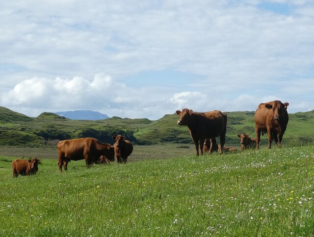
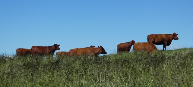
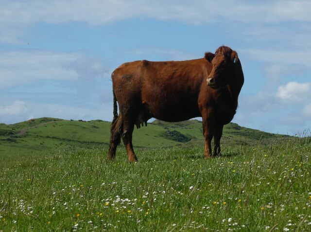
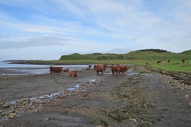
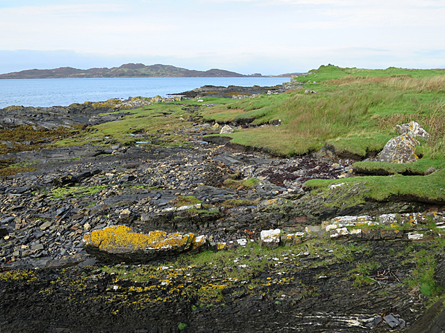
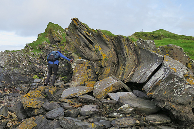
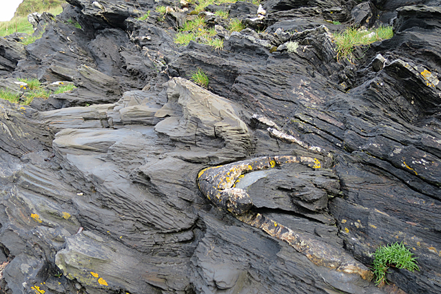
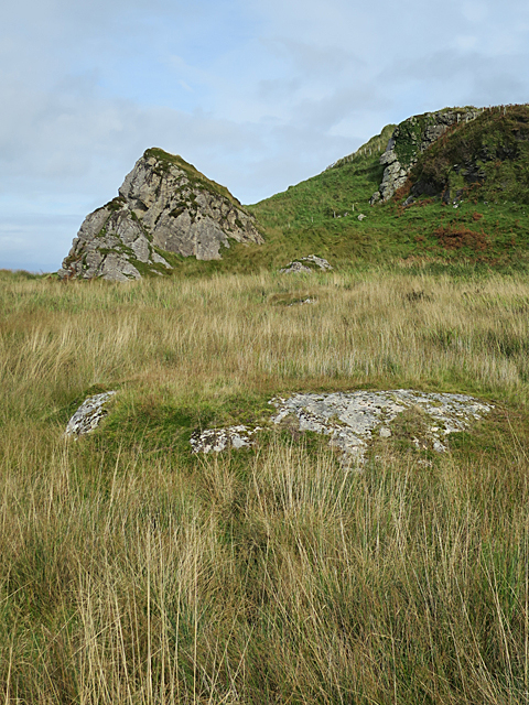
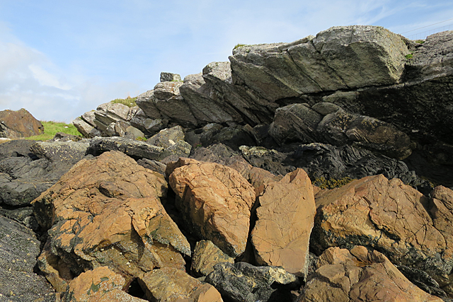
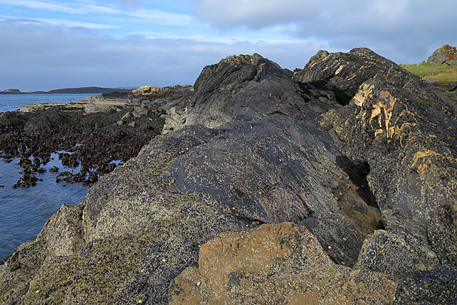
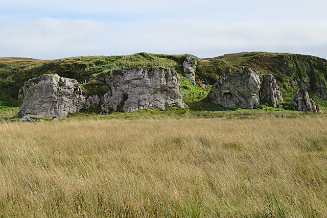
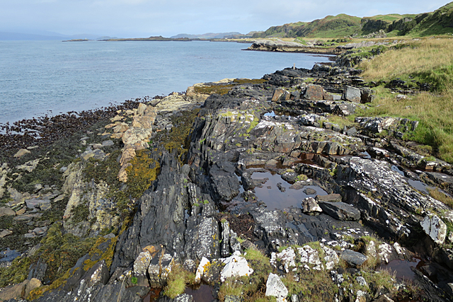
The landscape of Fraoch Eilean is characterized by rolling hills, lush greenery, and rocky outcrops, providing a habitat for an array of wildlife. The island boasts a diverse range of flora and fauna, including various species of birds, deer, and otters. It is a haven for birdwatchers and nature enthusiasts, offering a tranquil retreat from the hustle and bustle of everyday life.

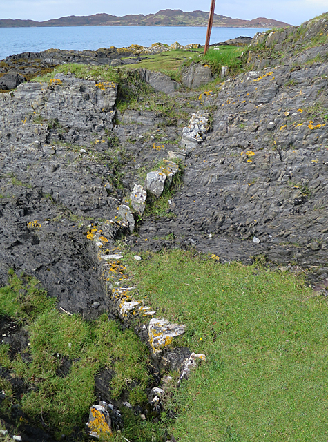
Historically, Fraoch Eilean has been inhabited since ancient times. Ruins of a medieval tower can still be seen on the island, hinting at its rich history. In the 18th century, the island was used for farming and had a small population. Today, it remains uninhabited, making it a popular destination for those seeking solitude and a connection to nature.

Visitors to Fraoch Eilean can enjoy activities such as fishing, boating, and hiking. The calm waters surrounding the island are perfect for fishing enthusiasts, offering the chance to catch trout or salmon. Hiking trails crisscross the island, providing panoramic views of Loch Awe and the surrounding countryside.

Overall, Fraoch Eilean is a captivating island that showcases the natural beauty of the Scottish Highlands. Its serene atmosphere, abundant wildlife, and rich history make it a must-visit destination for nature lovers and history buffs alike.

If you have any feedback on the listing, please let us know in the comments section below.

Fraoch Eilean Images

Images are sourced within 2km of 56.233637/-5.6628993 or Grid Reference NM7310. Thanks to Geograph Open Source API. All images are credited.

Luing - Looking across Black Mill Bay to Ardlarach A view across the semicircular Black Mill Bay from the eponymous settlement of Blackmillbay to the land around Ardlarach with Cnoc Mòr rising behind it to the left (west).
Luing - Looking across Black Mill Bay to Ardlarach
A view across the semicircular Black Mill Bay from the eponymous settlement of Blackmillbay to the land around Ardlarach with Cnoc Mòr rising behind it to the left (west).
Luing - Luing Cattle - a small herd A little group of the good-looking Luing Cattle a breed named after the island. The breed is three quarters Beef Shorthorn and one quarter Highland. They are a very hardy beef cow that can raise their calves in harsh conditions.
See Wikipedia article here: <span class="nowrap"><a title="https://en.wikipedia.org/wiki/Luing_cattle" rel="nofollow ugc noopener" href="https://en.wikipedia.org/wiki/Luing_cattle">Link</a><img style="margin-left:2px;" alt="External link" title="External link - shift click to open in new window" src="https://s1.geograph.org.uk/img/external.png" width="10" height="10"/></span>
Luing Cattle Society webpage here: <span class="nowrap"><a title="https://luingcattlesociety.co.uk" rel="nofollow ugc noopener" href="https://luingcattlesociety.co.uk">Link</a><img style="margin-left:2px;" alt="External link" title="External link - shift click to open in new window" src="https://s1.geograph.org.uk/img/external.png" width="10" height="10"/></span>
See also:
<a href="https://www.geograph.org.uk/photo/7259236">NM7409 : Luing - A small herd of Luing cattle on a ridge</a>
<a href="https://www.geograph.org.uk/photo/7259238">NM7409 : Luing - A Luing cow</a>
Luing - Luing Cattle - a small herd
A little group of the good-looking Luing Cattle a breed named after the island. The breed is three quarters Beef Shorthorn and one quarter Highland. They are a very hardy beef cow that can raise their calves in harsh conditions. See Wikipedia article here: LinkExternal link Luing Cattle Society webpage here: LinkExternal link See also: NM7409 : Luing - A small herd of Luing cattle on a ridge NM7409 : Luing - A Luing cow
Luing - A small herd of Luing cattle on a ridge This little group of the Luing Cattle were moving slowly across the ridge north of the lane from Blackmillbay to Toberonochy on the island from which they get their name.
The breed is three quarters Beef Shorthorn and one quarter Highland. They are a very hardy beef cow that can raise their calves in harsh conditions.
See Wikipedia article here: <span class="nowrap"><a title="https://en.wikipedia.org/wiki/Luing_cattle" rel="nofollow ugc noopener" href="https://en.wikipedia.org/wiki/Luing_cattle">Link</a><img style="margin-left:2px;" alt="External link" title="External link - shift click to open in new window" src="https://s1.geograph.org.uk/img/external.png" width="10" height="10"/></span>
Luing Cattle Society webpage here: <span class="nowrap"><a title="https://luingcattlesociety.co.uk" rel="nofollow ugc noopener" href="https://luingcattlesociety.co.uk">Link</a><img style="margin-left:2px;" alt="External link" title="External link - shift click to open in new window" src="https://s1.geograph.org.uk/img/external.png" width="10" height="10"/></span>
See also:
<a href="https://www.geograph.org.uk/photo/7259232">NM7409 : Luing - Luing Cattle - a small herd</a>
<a href="https://www.geograph.org.uk/photo/7259238">NM7409 : Luing - A Luing cow</a>
Luing - A small herd of Luing cattle on a ridge
This little group of the Luing Cattle were moving slowly across the ridge north of the lane from Blackmillbay to Toberonochy on the island from which they get their name. The breed is three quarters Beef Shorthorn and one quarter Highland. They are a very hardy beef cow that can raise their calves in harsh conditions. See Wikipedia article here: LinkExternal link Luing Cattle Society webpage here: LinkExternal link See also: NM7409 : Luing - Luing Cattle - a small herd NM7409 : Luing - A Luing cow
Luing - A Luing cow This fine beast was munching on the grassland of the Isle of Luing from which the breed gets its name.
The breed is three quarters Beef Shorthorn and one quarter Highland. They are a very hardy beef cow that can raise their calves in harsh conditions.
See Wikipedia article here: <span class="nowrap"><a title="https://en.wikipedia.org/wiki/Luing_cattle" rel="nofollow ugc noopener" href="https://en.wikipedia.org/wiki/Luing_cattle">Link</a><img style="margin-left:2px;" alt="External link" title="External link - shift click to open in new window" src="https://s1.geograph.org.uk/img/external.png" width="10" height="10"/></span>
Luing Cattle Society webpage here: <span class="nowrap"><a title="https://luingcattlesociety.co.uk" rel="nofollow ugc noopener" href="https://luingcattlesociety.co.uk">Link</a><img style="margin-left:2px;" alt="External link" title="External link - shift click to open in new window" src="https://s1.geograph.org.uk/img/external.png" width="10" height="10"/></span>
See also:
<a href="https://www.geograph.org.uk/photo/7259232">NM7409 : Luing - Luing Cattle - a small herd</a>
<a href="https://www.geograph.org.uk/photo/7259236">NM7409 : Luing - A small herd of Luing cattle on a ridge</a>
Luing - A Luing cow
This fine beast was munching on the grassland of the Isle of Luing from which the breed gets its name. The breed is three quarters Beef Shorthorn and one quarter Highland. They are a very hardy beef cow that can raise their calves in harsh conditions. See Wikipedia article here: LinkExternal link Luing Cattle Society webpage here: LinkExternal link See also: NM7409 : Luing - Luing Cattle - a small herd NM7409 : Luing - A small herd of Luing cattle on a ridge
Cattle on the Beach A herd of the famous Luing cattle on the beach at Black Mill Bay. See <span class="nowrap"><a title="http://www.luingcattlesociety.co.uk/index.php?page=history" rel="nofollow ugc noopener" href="http://www.luingcattlesociety.co.uk/index.php?page=history">Link</a><img style="margin-left:2px;" alt="External link" title="External link - shift click to open in new window" src="https://s1.geograph.org.uk/img/external.png" width="10" height="10"/></span> for the history of the breed.
Cattle on the Beach
A herd of the famous Luing cattle on the beach at Black Mill Bay. See LinkExternal link for the history of the breed.
Shore north of Black Mill Bay Most of the rock here is slate, but the rock covered with yellow lichen is part of a much deformed bed of sandstone. The distant island is Lunga.
Shore north of Black Mill Bay
Most of the rock here is slate, but the rock covered with yellow lichen is part of a much deformed bed of sandstone. The distant island is Lunga.
Debrite This peculiar-looking rock is a debrite, or metamorphosed debris flow. Pebbles in the muddy deposit have been stretched and deformed to produce strange shapes, while the mud itself has been altered to slate.
Debrite
This peculiar-looking rock is a debrite, or metamorphosed debris flow. Pebbles in the muddy deposit have been stretched and deformed to produce strange shapes, while the mud itself has been altered to slate.
Sandstone Dyke The pale zigzag is a sandstone dyke. It must have been injected into the mud from the underlying sandstone while the sediment was still fairly liquid, and has since been deformed, lithified and cleaved into what looks like a row of separate blocks.
Sandstone Dyke
The pale zigzag is a sandstone dyke. It must have been injected into the mud from the underlying sandstone while the sediment was still fairly liquid, and has since been deformed, lithified and cleaved into what looks like a row of separate blocks.
Recumbent Fold The curving rock is the remnant of the hinge of a fold in metamorphosed sandstone. The fold has been overturned to lie horizontally. Sedimentary features in the sandstone indicate that the rocks are younging to the east, or in other words the rocks on the left here are older than the rock on the right, and the whole pile has been rotated about 90º and complexly folded by tectonic movements.
Recumbent Fold
The curving rock is the remnant of the hinge of a fold in metamorphosed sandstone. The fold has been overturned to lie horizontally. Sedimentary features in the sandstone indicate that the rocks are younging to the east, or in other words the rocks on the left here are older than the rock on the right, and the whole pile has been rotated about 90º and complexly folded by tectonic movements.
Folds Back-to-back Folds here are picked out by the sandstone bed which is pale in colour and has yellow lichen on it. Above it is a similar fold in the opposite direction in the slate. The slate is cleaved so that it looks as if it is made up of a sheaf of thin leaves. The cleavage is perpendicular to the direction of the force that caused the folding, and it is termed axial planar cleavage because it is in the hinge of the fold. If you look at the darker rock above the folds, you can see lots of tiny folds. Small folds like these on the limbs of larger folds are called parasitic folds.
Folds Back-to-back
Folds here are picked out by the sandstone bed which is pale in colour and has yellow lichen on it. Above it is a similar fold in the opposite direction in the slate. The slate is cleaved so that it looks as if it is made up of a sheaf of thin leaves. The cleavage is perpendicular to the direction of the force that caused the folding, and it is termed axial planar cleavage because it is in the hinge of the fold. If you look at the darker rock above the folds, you can see lots of tiny folds. Small folds like these on the limbs of larger folds are called parasitic folds.
Felsic Intrusion Felsic rock is igneous rock that is low in iron and magnesium and high in silica. It is usually pale in colour. Here at Black Mill Bay the Easdale Slates are cut by several sheets of felsic rock, and the outcrop in the foreground is part of the largest of these. It continues beneath the vegetation to form the Cobblers of Lorn, one of which is the conical rock just left of centre a little further north.
Felsic Intrusion
Felsic rock is igneous rock that is low in iron and magnesium and high in silica. It is usually pale in colour. Here at Black Mill Bay the Easdale Slates are cut by several sheets of felsic rock, and the outcrop in the foreground is part of the largest of these. It continues beneath the vegetation to form the Cobblers of Lorn, one of which is the conical rock just left of centre a little further north.
Coast of Luing The rocks on the shore here are principally Easdale Slate. The pock-marked surface of the largest blocks is probably the result of molluscs boring holes in the surface. In the background is the island of Lunga.
Coast of Luing
The rocks on the shore here are principally Easdale Slate. The pock-marked surface of the largest blocks is probably the result of molluscs boring holes in the surface. In the background is the island of Lunga.
Dyke and Dolostone The reddish boulders in the foreground are composed of dolostone, which is a type of limestone in which some of the calcium has been replaced by magnesium. Above them is a dark layer of slate, and on top is a felsic sheet. Felsic rocks are igneous rocks that contain little or no iron or magnesium, but are rich in feldspar and silica. They are usually pale in colour.
Dyke and Dolostone
The reddish boulders in the foreground are composed of dolostone, which is a type of limestone in which some of the calcium has been replaced by magnesium. Above them is a dark layer of slate, and on top is a felsic sheet. Felsic rocks are igneous rocks that contain little or no iron or magnesium, but are rich in feldspar and silica. They are usually pale in colour.
Mostly Slate The almost black rock is Easdale Slate, with lots of pale veins, probably of calcite. In the foreground is a block of dolostone, a type of limestone in which some of the calcium has been replaced by magnesium.
Mostly Slate
The almost black rock is Easdale Slate, with lots of pale veins, probably of calcite. In the foreground is a block of dolostone, a type of limestone in which some of the calcium has been replaced by magnesium.
Raised Beach Raised beaches are a feature of much of the coast of Scotland, and especially noticeable in parts of Argyll. They occur when sea level falls fairly rapidly relative to the level of the land, leaving former shores high and dry. You can see that there is a level area between the low cliffs and the present shore right up the length of the coast here.
Raised Beach
Raised beaches are a feature of much of the coast of Scotland, and especially noticeable in parts of Argyll. They occur when sea level falls fairly rapidly relative to the level of the land, leaving former shores high and dry. You can see that there is a level area between the low cliffs and the present shore right up the length of the coast here.
The Cobblers of Lorn The row of rock stacks at the shoreward side of the raised beach is a prominent feature of the west coast of Luing, and a useful landmark for sailors. They are parts of a thick sheet of felsic rock that has been intruded into the Easdale Slates which are the commonest type of rock in this area. Felsic rock is pale-coloured igneous rock which is low in iron and magnesium but high in feldspar and silica. The felsic sheet was eroded into stacks by the action of the sea when the relative level of the sea was higher, and what is now grassland was the shore. Compare with <a href="https://www.geograph.org.uk/photo/168924">NM7209 : The Cobblers of Lorne</a>.
The Cobblers of Lorn
The row of rock stacks at the shoreward side of the raised beach is a prominent feature of the west coast of Luing, and a useful landmark for sailors. They are parts of a thick sheet of felsic rock that has been intruded into the Easdale Slates which are the commonest type of rock in this area. Felsic rock is pale-coloured igneous rock which is low in iron and magnesium but high in feldspar and silica. The felsic sheet was eroded into stacks by the action of the sea when the relative level of the sea was higher, and what is now grassland was the shore. Compare with NM7209 : The Cobblers of Lorne.
Fold on the Foreshore The rock pool occupies the eroded hinge zone of a fold in the Easdale Slate. You can just about make out the curve of the beds round the fold.
Fold on the Foreshore
The rock pool occupies the eroded hinge zone of a fold in the Easdale Slate. You can just about make out the curve of the beds round the fold.
Sound of Luing In the foreground is a forest of kelp, probably Oarweed or Tangle. The hill at the far side of the Sound is the island of Scarba.
Sound of Luing
In the foreground is a forest of kelp, probably Oarweed or Tangle. The hill at the far side of the Sound is the island of Scarba.
Show me another place!

Fraoch Eilean is located at Grid Ref: NM7310 (Lat: 56.233637, Lng: -5.6628993)

Unitary Authority: Argyll and Bute

Police Authority: Argyll and West Dunbartonshire

What 3 Words

///result.quarrel.tacky. Near Lochbuie, Argyll & Bute

Related Wikis

Luing

Luing ( LING; Scottish Gaelic: Luinn) is one of the Slate Islands, Firth of Lorn, in the west of Argyll in Scotland, about 16 miles (26 km) south of Oban...

Slate Islands

The Slate Islands are an island group in the Inner Hebrides, lying immediately off the west coast of Scotland, north of Jura and southwest of Oban. The...

Fladda, Slate Islands

Fladda is one of the Slate Islands, off the west coast of Argyll and Bute, Scotland. Fladda is an islet in the Sound of Luing, between Luing and Belnahua...

Ardinamir

Ardinamir is an anchorage and small settlement on the island of Luing in Argyll and Bute, Scotland. == References ==

Nearby Amenities

Located within 500m of 56.233637,-5.6628993
Source: PGS
Lat/Long: 56.2353828/-5.6634588
Source: PGS
Lat/Long: 56.2345308/-5.6636117
Source: PGS
Lat/Long: 56.2348723/-5.6633816
Source: PGS
Lat/Long: 56.2338271/-5.6638984
Source: PGS
Lat/Long: 56.2344122/-5.6636231
Source: PGS
Lat/Long: 56.2338796/-5.6640554
Source: PGS
Lat/Long: 56.2339331/-5.6644181
Source: PGS
Lat/Long: 56.2342299/-5.6646882
Source: PGS
Lat/Long: 56.2345614/-5.6650818
Source: PGS
Lat/Long: 56.2348057/-5.6652149
Source: PGS
Lat/Long: 56.2348663/-5.6651792
Source: PGS
Lat/Long: 56.2352839/-5.6642601
Source: PGS
Lat/Long: 56.2358439/-5.664274
Source: PGS
Lat/Long: 56.2360497/-5.6657468
Source: PGS
Lat/Long: 56.2363244/-5.6662439
Source: PGS
Lat/Long: 56.2366243/-5.6666222
Source: PGS
Lat/Long: 56.236571/-5.6668144
Source: PGS
Lat/Long: 56.2369907/-5.6669771
Source: PGS
Lat/Long: 56.237502/-5.6670053
Source: PGS
Lat/Long: 56.2369631/-5.6621047
Source: PGS
Lat/Long: 56.2365861/-5.6628441
Source: PGS
Lat/Long: 56.2358984/-5.663116
Source: PGS
Lat/Long: 56.2356728/-5.6632827
Source: PGS
Lat/Long: 56.230165/-5.660928
Source: PGS
Lat/Long: 56.2310258/-5.6613443
Source: PGS
Lat/Long: 56.2311806/-5.6613142
Source: PGS
Lat/Long: 56.2319329/-5.6616887
Source: PGS
Lat/Long: 56.2322124/-5.6616824
Source: PGS
Lat/Long: 56.23236/-5.6611419
Source: PGS
Lat/Long: 56.2325083/-5.6606009
Source: PGS
Lat/Long: 56.2327303/-5.6600409
Source: PGS
Lat/Long: 56.2329785/-5.6597992
Source: PGS
Lat/Long: 56.2330979/-5.6599792
Source: PGS
Lat/Long: 56.2334697/-5.6597893
Source: PGS
Lat/Long: 56.233982/-5.6597383
Source: PGS
Lat/Long: 56.2341333/-5.6596493
Source: PGS
Lat/Long: 56.2344749/-5.6595157
Source: PGS
Lat/Long: 56.2346058/-5.659218
Source: PGS
Lat/Long: 56.2349788/-5.6590222
Source: PGS
Lat/Long: 56.2354223/-5.6587701
Source: PGS
Lat/Long: 56.2355958/-5.6586134
Source: PGS
Lat/Long: 56.2363923/-5.6584544
Source: PGS
Lat/Long: 56.236713/-5.6585179
Source: PGS
Lat/Long: 56.2371137/-5.6582958
Source: PGS
Lat/Long: 56.2369284/-5.6575384
Source: PGS
Lat/Long: 56.2358072/-5.6577197
The data included in this document is from www.openstreetmap.org. The data is made available under ODbL.

Have you been to Fraoch Eilean?

Leave your review of Fraoch Eilean below (or comments, questions and feedback).