Eilean Mhic Chiarain

Island in Argyllshire

Scotland

Eilean Mhic Chiarain

Raised Beach Raised beaches are a feature of much of the coast of Scotland, and especially noticeable in parts of Argyll. They occur when sea level falls fairly rapidly relative to the level of the land, leaving former shores high and dry. You can see that there is a level area between the low cliffs and the present shore right up the length of the coast here.
Raised Beach Credit: Anne Burgess

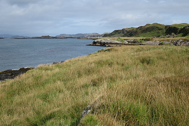
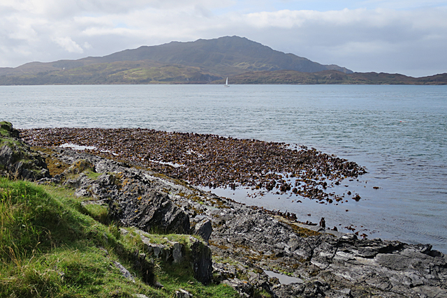
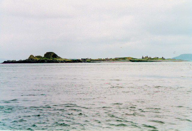
Eilean Mhic Chiarain is a small island located in Argyllshire, Scotland. Situated off the west coast of Scotland, it is part of the Inner Hebrides archipelago. The island covers an area of approximately 26 acres and is surrounded by the beautiful waters of the Atlantic Ocean.

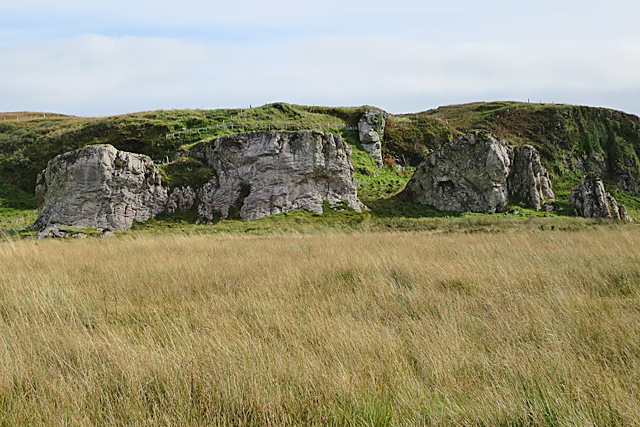
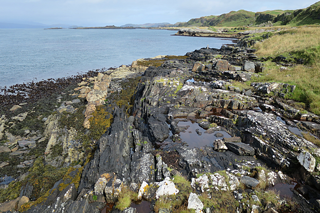
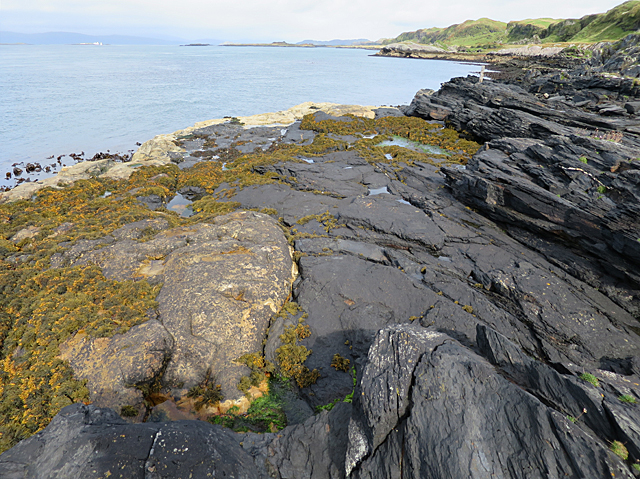
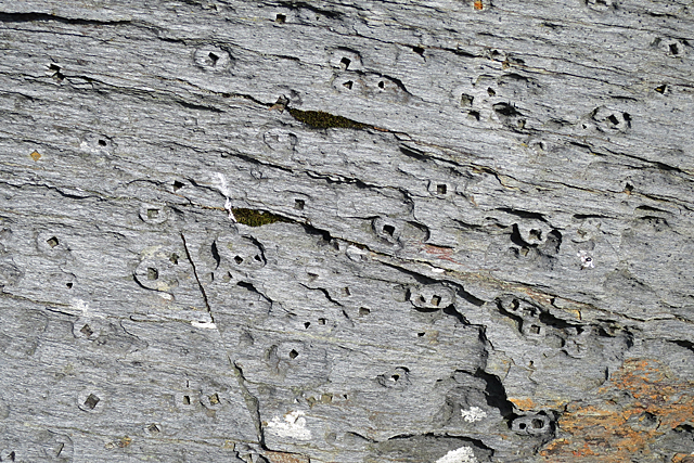
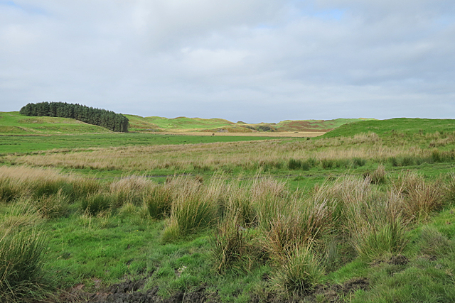
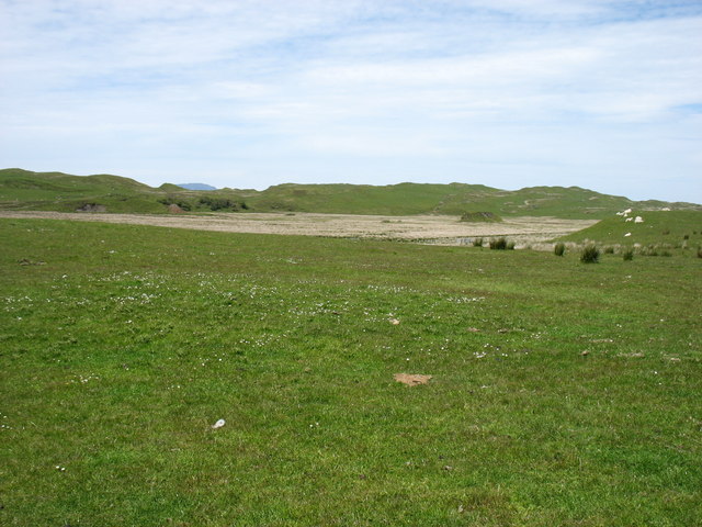
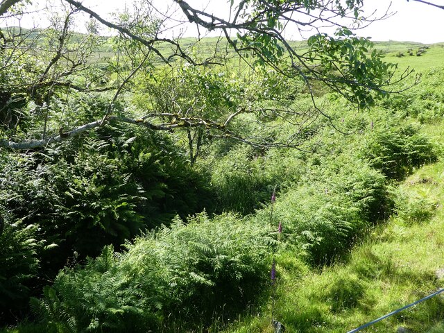
Eilean Mhic Chiarain is characterized by its rugged and rocky terrain, with a diverse range of flora and fauna. The island is home to various species of seabirds, including puffins, razorbills, and guillemots, making it a popular spot for birdwatching enthusiasts. The surrounding waters are also teeming with marine life, offering opportunities for fishing and diving.

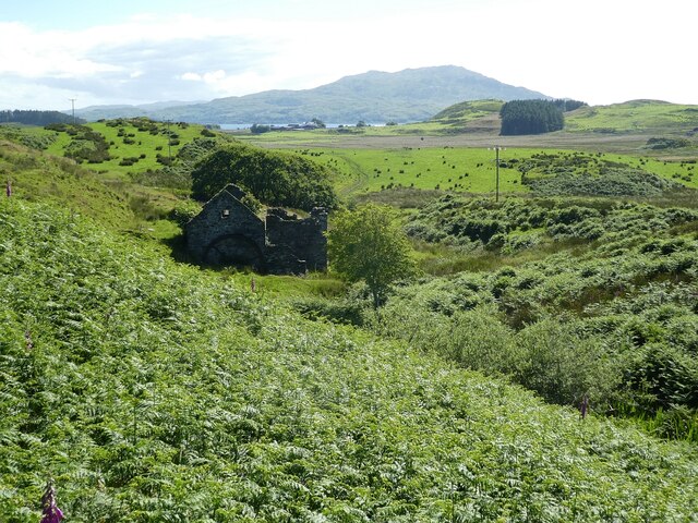
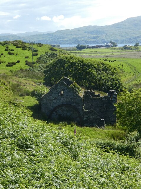
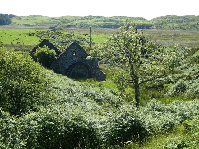
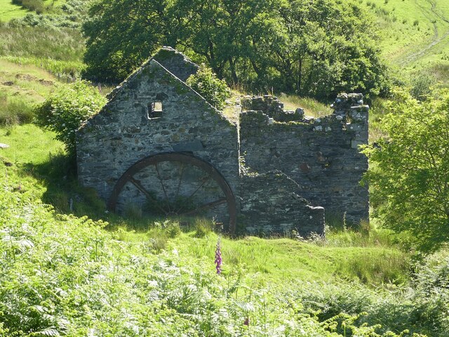
The island's main feature is the remains of a medieval chapel, dedicated to St. Kiaran, which dates back to the 13th century. The chapel's ruins, consisting of a stone wall and a small graveyard, provide a glimpse into the island's rich history and religious significance.

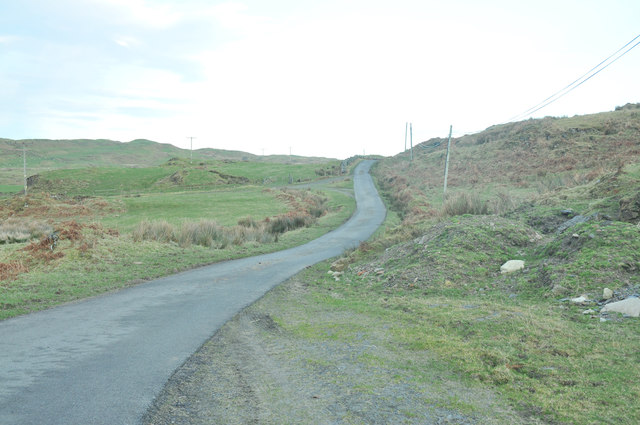
Eilean Mhic Chiarain is accessible by boat, with several companies offering tours and transportation services to the island. Visitors can explore the island's natural beauty, take in the stunning views of the surrounding coastline, and immerse themselves in its tranquil atmosphere.

The island offers a peaceful retreat from the hustle and bustle of mainland life, making it an ideal destination for nature lovers and those seeking solitude. Whether it's exploring the historic ruins, observing wildlife, or simply enjoying the serenity of the island, Eilean Mhic Chiarain offers a unique and enchanting experience.

If you have any feedback on the listing, please let us know in the comments section below.

Eilean Mhic Chiarain Images

Images are sourced within 2km of 56.237112/-5.6645714 or Grid Reference NM7310. Thanks to Geograph Open Source API. All images are credited.

Raised Beach Raised beaches are a feature of much of the coast of Scotland, and especially noticeable in parts of Argyll. They occur when sea level falls fairly rapidly relative to the level of the land, leaving former shores high and dry. You can see that there is a level area between the low cliffs and the present shore right up the length of the coast here.
Raised Beach
Raised beaches are a feature of much of the coast of Scotland, and especially noticeable in parts of Argyll. They occur when sea level falls fairly rapidly relative to the level of the land, leaving former shores high and dry. You can see that there is a level area between the low cliffs and the present shore right up the length of the coast here.
The Cobblers of Lorn The row of rock stacks at the shoreward side of the raised beach is a prominent feature of the west coast of Luing, and a useful landmark for sailors. They are parts of a thick sheet of felsic rock that has been intruded into the Easdale Slates which are the commonest type of rock in this area. Felsic rock is pale-coloured igneous rock which is low in iron and magnesium but high in feldspar and silica. The felsic sheet was eroded into stacks by the action of the sea when the relative level of the sea was higher, and what is now grassland was the shore. Compare with <a href="https://www.geograph.org.uk/photo/168924">NM7209 : The Cobblers of Lorne</a>.
The Cobblers of Lorn
The row of rock stacks at the shoreward side of the raised beach is a prominent feature of the west coast of Luing, and a useful landmark for sailors. They are parts of a thick sheet of felsic rock that has been intruded into the Easdale Slates which are the commonest type of rock in this area. Felsic rock is pale-coloured igneous rock which is low in iron and magnesium but high in feldspar and silica. The felsic sheet was eroded into stacks by the action of the sea when the relative level of the sea was higher, and what is now grassland was the shore. Compare with NM7209 : The Cobblers of Lorne.
Fold on the Foreshore The rock pool occupies the eroded hinge zone of a fold in the Easdale Slate. You can just about make out the curve of the beds round the fold.
Fold on the Foreshore
The rock pool occupies the eroded hinge zone of a fold in the Easdale Slate. You can just about make out the curve of the beds round the fold.
Sound of Luing In the foreground is a forest of kelp, probably Oarweed or Tangle. The hill at the far side of the Sound is the island of Scarba.
Sound of Luing
In the foreground is a forest of kelp, probably Oarweed or Tangle. The hill at the far side of the Sound is the island of Scarba.
Truncated Slate The dark rock here is Easdale Slate, and you can easily make out that it is folded. It has been cut through by the pale rock on the left, which is a felsic sheet. Felsic rock is a pale igneous rock rich in feldspar and silica but low in magnesium and iron.
Truncated Slate
The dark rock here is Easdale Slate, and you can easily make out that it is folded. It has been cut through by the pale rock on the left, which is a felsic sheet. Felsic rock is a pale igneous rock rich in feldspar and silica but low in magnesium and iron.
Pyrite Holes Pyrite is a sulphide of iron, a mineral that forms in anoxic conditions. It crystallises in little cubes a few millimetres across, and its colour when fresh is brassy gold, so that it is commonly called Fool's Gold. When exposed to air, it weathers away quite readily. Each of these square holes once held a pyrite crystal which has weathered out, and most of the holes are surrounded by a ring of chemical alteration. One rusty-looking crystal is still in its hole at the very top of the image.
Pyrite Holes
Pyrite is a sulphide of iron, a mineral that forms in anoxic conditions. It crystallises in little cubes a few millimetres across, and its colour when fresh is brassy gold, so that it is commonly called Fool's Gold. When exposed to air, it weathers away quite readily. Each of these square holes once held a pyrite crystal which has weathered out, and most of the holes are surrounded by a ring of chemical alteration. One rusty-looking crystal is still in its hole at the very top of the image.
Isle of Luing This is a rather featureless part of the centre of Luing, with boggy ground used mainly for grazing.
Isle of Luing
This is a rather featureless part of the centre of Luing, with boggy ground used mainly for grazing.
Cnoc Mòr, Luing Grass pasture at Ardlarach.
Cnoc Mòr, Luing
Grass pasture at Ardlarach.
Cnoc Mòr, Luing Lunga in the background.
Cnoc Mòr, Luing
Lunga in the background.
Minor road from Toberonochy to Cuan
Dun Ablaich, Luing Dun Ablaich is an earthwork, rather oddly in the middle of a large area of marshland.
Dun Ablaich, Luing
Dun Ablaich is an earthwork, rather oddly in the middle of a large area of marshland.
Fladda Lighthouse, from the Sound of Luing A lighthouse on one of the smaller Slate Islands in the Sound of Luing, built in  1860 by the Stevenson brothers <span class="nowrap"><a title="https://en.wikipedia.org/wiki/Fladda,_Slate_Islands" rel="nofollow ugc noopener" href="https://en.wikipedia.org/wiki/Fladda,_Slate_Islands">Link</a><img style="margin-left:2px;" alt="External link" title="External link - shift click to open in new window" src="https://s1.geograph.org.uk/img/external.png" width="10" height="10"/></span>. The land to the left is another Slate Island, Belnahua. The cliffs [ca 250 m] to the right are about 13 km away at An Garradh, the southern edge of Laggan Deer Forest on Mull.
Fladda Lighthouse, from the Sound of Luing
A lighthouse on one of the smaller Slate Islands in the Sound of Luing, built in 1860 by the Stevenson brothers LinkExternal link. The land to the left is another Slate Island, Belnahua. The cliffs [ca 250 m] to the right are about 13 km away at An Garradh, the southern edge of Laggan Deer Forest on Mull.
Luing - Achafoll - Ruined mill The old ruined mill at Achafoll on the Isle of Luing still retains its waterwheel though this has not turned in many years. The view extends across the verdant countryside of the Isle of Luing, with the Isle of Scarba forming a lumpy backdrop.
See also:
<a href="https://www.geograph.org.uk/photo/7258539">NM7410 : Luing - Achafolla - Close-up view of the old mill</a>
<a href="https://www.geograph.org.uk/photo/7258534">NM7410 : Luing - Achafoll - Former watermill</a>
<a href="https://www.geograph.org.uk/photo/7258537">NM7410 : Luing - Achafolla - Old mill in its valley</a>
Luing - Achafoll - Ruined mill
The old ruined mill at Achafoll on the Isle of Luing still retains its waterwheel though this has not turned in many years. The view extends across the verdant countryside of the Isle of Luing, with the Isle of Scarba forming a lumpy backdrop. See also: NM7410 : Luing - Achafolla - Close-up view of the old mill NM7410 : Luing - Achafoll - Former watermill NM7410 : Luing - Achafolla - Old mill in its valley
Luing - Achafoll - Former watermill The old ruined mill at Achafoll on Luing. The distant rising land is the isle of Scarba.
See also <a href="https://www.geograph.org.uk/photo/7218369">NM7410 : Luing - Achafoll - Ruined mill</a>
<a href="https://www.geograph.org.uk/photo/7258537">NM7410 : Luing - Achafolla - Old mill in its valley</a>
and <a href="https://www.geograph.org.uk/photo/7258539">NM7410 : Luing - Achafolla - Close-up view of the old mill</a>
Luing - Achafoll - Former watermill
The old ruined mill at Achafoll on Luing. The distant rising land is the isle of Scarba. See also NM7410 : Luing - Achafoll - Ruined mill NM7410 : Luing - Achafolla - Old mill in its valley and NM7410 : Luing - Achafolla - Close-up view of the old mill
Luing - Achafolla - Old mill in its valley This photogenic old mill at Achafolla on the Isle of Luing has not ground anything for many a year. It is seen here in the valley created by the stream that once fed it.
See also:
<a href="https://www.geograph.org.uk/photo/7218369">NM7410 : Luing - Achafoll - Ruined mill</a>
<a href="https://www.geograph.org.uk/photo/7258534">NM7410 : Luing - Achafoll - Former watermill</a>
<a href="https://www.geograph.org.uk/photo/7258539">NM7410 : Luing - Achafolla - Close-up view of the old mill</a>
Luing - Achafolla - Old mill in its valley
This photogenic old mill at Achafolla on the Isle of Luing has not ground anything for many a year. It is seen here in the valley created by the stream that once fed it. See also: NM7410 : Luing - Achafoll - Ruined mill NM7410 : Luing - Achafoll - Former watermill NM7410 : Luing - Achafolla - Close-up view of the old mill
Luing - Achafolla - Close-up view of the old mill A zoomed shot of the ruinous old watermill at Achafolla.
See also:
<a href="https://www.geograph.org.uk/photo/7218369">NM7410 : Luing - Achafoll - Ruined mill</a>
<a href="https://www.geograph.org.uk/photo/7258534">NM7410 : Luing - Achafoll - Former watermill</a>
<a href="https://www.geograph.org.uk/photo/7258537">NM7410 : Luing - Achafolla - Old mill in its valley</a>
Luing - Achafolla - Close-up view of the old mill
Luing - Hidden burn Deep within the greenery seen here runs a burn which once supplied the water to power <a href="https://www.geograph.org.uk/photo/7258534">NM7410 : Luing - Achafoll - Former watermill</a>
Luing - Hidden burn
Deep within the greenery seen here runs a burn which once supplied the water to power NM7410 : Luing - Achafoll - Former watermill
Rubha Fiola Rubha Fiola is an extension northwards of the Isle of Lunga though separated from it and intervening islands including Fiola Meadhonach and Eilean Iosal at high tide. Although the population of Lunga (including Rubha Fiola) is given as zero, there is a very substantial building on the southern tip of this islet (at NM71201032) which can just be discerned on the far left of this image - I think that this is probably the Rua Fiola Island Exploration Centre, which was hit by scandal in 2014 (see <span class="nowrap"><a title="https://www.dailyrecord.co.uk/news/crime/boss-childrens-adventure-centre-private-3966174" rel="nofollow ugc noopener" href="https://www.dailyrecord.co.uk/news/crime/boss-childrens-adventure-centre-private-3966174">Link</a><img style="margin-left:2px;" alt="External link" title="External link - shift click to open in new window" src="https://s1.geograph.org.uk/img/external.png" width="10" height="10"/></span> )
Rubha Fiola
Rubha Fiola is an extension northwards of the Isle of Lunga though separated from it and intervening islands including Fiola Meadhonach and Eilean Iosal at high tide. Although the population of Lunga (including Rubha Fiola) is given as zero, there is a very substantial building on the southern tip of this islet (at NM71201032) which can just be discerned on the far left of this image - I think that this is probably the Rua Fiola Island Exploration Centre, which was hit by scandal in 2014 (see LinkExternal link )
Show me another place!

Eilean Mhic Chiarain is located at Grid Ref: NM7310 (Lat: 56.237112, Lng: -5.6645714)

Unitary Authority: Argyll and Bute

Police Authority: Argyll and West Dunbartonshire

What 3 Words

///consented.muffin.conveying. Near Lochbuie, Argyll & Bute

Related Wikis

Luing

Luing ( LING; Scottish Gaelic: Luinn) is one of the Slate Islands, Firth of Lorn, in the west of Argyll in Scotland, about 16 miles (26 km) south of Oban...

Fladda, Slate Islands

Fladda is one of the Slate Islands, off the west coast of Argyll and Bute, Scotland. Fladda is an islet in the Sound of Luing, between Luing and Belnahua...

Slate Islands

The Slate Islands are an island group in the Inner Hebrides, lying immediately off the west coast of Scotland, north of Jura and southwest of Oban. The...

Belnahua

Belnahua is one of the Slate Islands, in the Firth of Lorn in Scotland, known for its deserted slate quarries. The bedrock that underpins its human history...

Nearby Amenities

Located within 500m of 56.237112,-5.6645714
Source: PGS
Lat/Long: 56.2353828/-5.6634588
Source: PGS
Lat/Long: 56.2345308/-5.6636117
Source: PGS
Lat/Long: 56.2348723/-5.6633816
Source: PGS
Lat/Long: 56.2338271/-5.6638984
Source: PGS
Lat/Long: 56.2344122/-5.6636231
Source: PGS
Lat/Long: 56.2338796/-5.6640554
Source: PGS
Lat/Long: 56.2339331/-5.6644181
Source: PGS
Lat/Long: 56.2342299/-5.6646882
Source: PGS
Lat/Long: 56.2345614/-5.6650818
Source: PGS
Lat/Long: 56.2348057/-5.6652149
Source: PGS
Lat/Long: 56.2348663/-5.6651792
Source: PGS
Lat/Long: 56.2352839/-5.6642601
Source: PGS
Lat/Long: 56.2358439/-5.664274
Source: PGS
Lat/Long: 56.2360497/-5.6657468
Source: PGS
Lat/Long: 56.2363244/-5.6662439
Source: PGS
Lat/Long: 56.2366243/-5.6666222
Source: PGS
Lat/Long: 56.236571/-5.6668144
Source: PGS
Lat/Long: 56.2369907/-5.6669771
Source: PGS
Lat/Long: 56.237502/-5.6670053
Source: PGS
Lat/Long: 56.2384973/-5.6659933
Source: PGS
Lat/Long: 56.2385682/-5.6663146
Source: PGS
Lat/Long: 56.2387848/-5.6663374
Source: PGS
Lat/Long: 56.2388794/-5.6663079
Source: PGS
Lat/Long: 56.2389692/-5.6662985
Source: PGS
Lat/Long: 56.2391692/-5.6661177
Source: PGS
Lat/Long: 56.239395/-5.6660512
Source: PGS
Lat/Long: 56.2396138/-5.6660767
Source: PGS
Lat/Long: 56.2398286/-5.6656295
Source: PGS
Lat/Long: 56.2397343/-5.6650775
Source: PGS
Lat/Long: 56.2397414/-5.6647479
Source: PGS
Lat/Long: 56.2392494/-5.6642268
Source: PGS
Lat/Long: 56.2394509/-5.6638023
Source: PGS
Lat/Long: 56.2392285/-5.6623355
Source: PGS
Lat/Long: 56.2390735/-5.6621954
Source: PGS
Lat/Long: 56.2369631/-5.6621047
Source: PGS
Lat/Long: 56.2365861/-5.6628441
Source: PGS
Lat/Long: 56.2358984/-5.663116
Source: PGS
Lat/Long: 56.2356728/-5.6632827
Source: PGS
Lat/Long: 56.233982/-5.6597383
Source: PGS
Lat/Long: 56.2341333/-5.6596493
Source: PGS
Lat/Long: 56.2344749/-5.6595157
Source: PGS
Lat/Long: 56.2346058/-5.659218
Source: PGS
Lat/Long: 56.2349788/-5.6590222
Source: PGS
Lat/Long: 56.2354223/-5.6587701
Source: PGS
Lat/Long: 56.2355958/-5.6586134
Source: PGS
Lat/Long: 56.2363923/-5.6584544
Source: PGS
Lat/Long: 56.236713/-5.6585179
Source: PGS
Lat/Long: 56.2371137/-5.6582958
Source: PGS
Lat/Long: 56.2372788/-5.6577793
Source: PGS
Lat/Long: 56.2369284/-5.6575384
Source: PGS
Lat/Long: 56.2358072/-5.6577197
Source: PGS
Lat/Long: 56.2373131/-5.6565961
The data included in this document is from www.openstreetmap.org. The data is made available under ODbL.

Have you been to Eilean Mhic Chiarain?

Leave your review of Eilean Mhic Chiarain below (or comments, questions and feedback).