Gullyn Rock

Island in Cornwall

England

Gullyn Rock

Porthtowan beach
Porthtowan beach Credit: David Smith

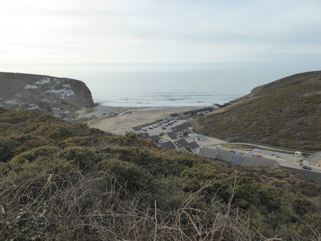
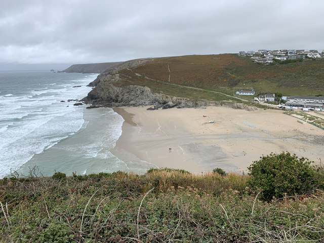
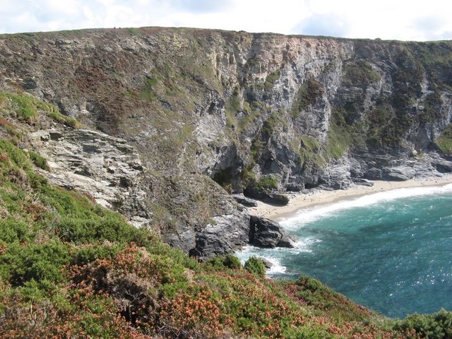
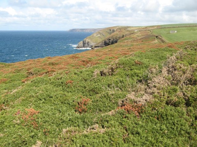
Gullyn Rock is a small island located off the coast of Cornwall, England. It is situated in the Celtic Sea, approximately 5 miles northwest of the town of Penzance. The island has a total area of around 5 hectares and is known for its rugged and dramatic landscape.

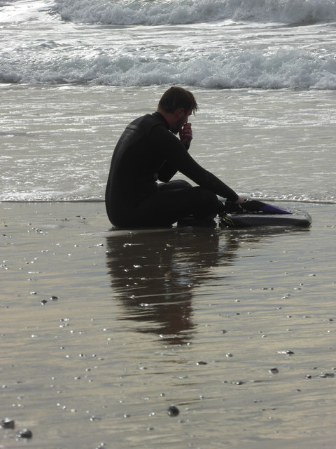
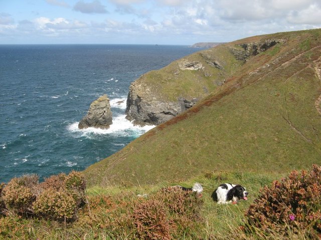
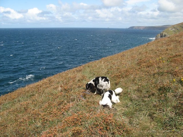
Gullyn Rock is uninhabited and accessible only by boat. It is a popular destination for birdwatchers and nature enthusiasts due to its rich birdlife and diverse flora and fauna. The island is home to a variety of seabirds, including puffins, razorbills, and guillemots, which nest in the cliffs and rocky outcrops.

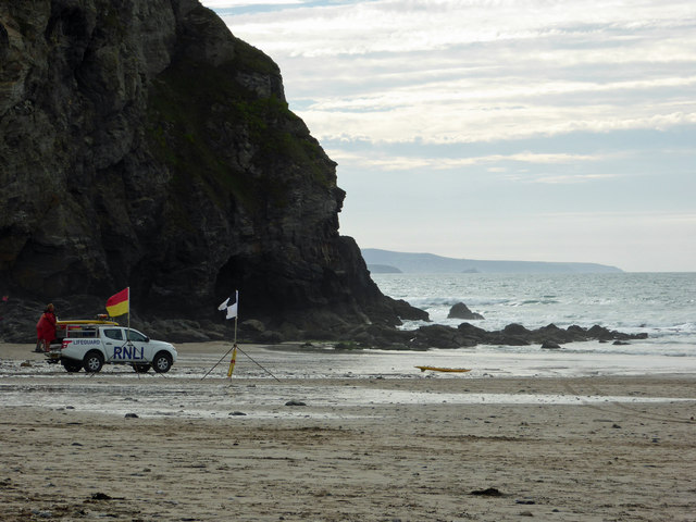
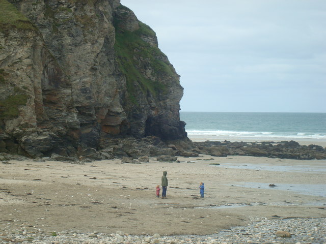
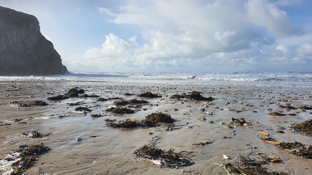
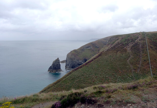
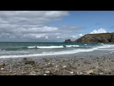
The rocky terrain of Gullyn Rock is characterized by steep cliffs, caves, and rock formations, making it a popular spot for rock climbing and exploration. The island offers stunning panoramic views of the surrounding sea and coastline, making it a favorite spot for photographers and artists.

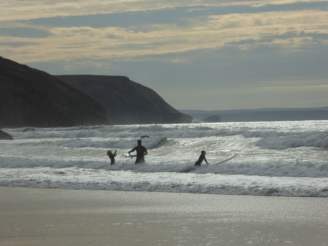
The waters surrounding Gullyn Rock are abundant in marine life, attracting divers and snorkelers. The clear waters provide excellent visibility and the opportunity to spot a variety of fish species and underwater flora.

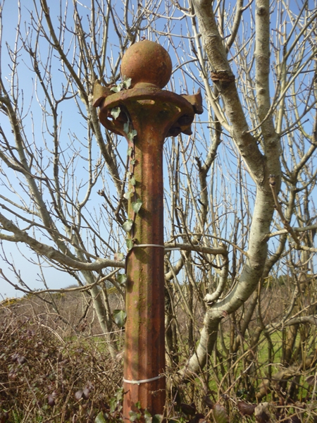
Despite its small size, Gullyn Rock has a rich history. It has been used as a navigational aid for sailors for centuries, with a lighthouse built on the island in 1820. Today, the lighthouse is fully automated and serves as an important warning beacon for ships navigating the treacherous waters around the island.

In conclusion, Gullyn Rock is a picturesque and unspoiled island in Cornwall, offering a range of activities for nature lovers and outdoor enthusiasts. Its stunning natural beauty and rich wildlife make it a must-visit destination for those seeking a unique and immersive experience.

If you have any feedback on the listing, please let us know in the comments section below.

Gullyn Rock Images

Images are sourced within 2km of 50.277103/-5.2649866 or Grid Reference SW6747. Thanks to Geograph Open Source API. All images are credited.

Porthtowan beach
Porthtowan beach
Staggered road junction, Chapel Hill, Porthtowan
Sign and entrance for holiday park, Porthtowan The line of trees on the right screen the camp from the road (and vice versa)
Sign and entrance for holiday park, Porthtowan
The line of trees on the right screen the camp from the road (and vice versa)
Surf's up - Porthtowan Positions are approximate. A pleasant half hour or so was spent watching people enjoy the surf. The RNLI lifeguards were on duty.
Surf's up - Porthtowan
Positions are approximate. A pleasant half hour or so was spent watching people enjoy the surf. The RNLI lifeguards were on duty.
The surfer - Porthtowan
RNLI lifeguards - Porthtowan
Porthtowan - Wheal Lushington engine house The engine house was built for an "all indoors" beam engine that was never installed and now makes a distinctive house. In the foreground is the building housing the RNLI lifeguards and the local lifesaving club.
Porthtowan - Wheal Lushington engine house
The engine house was built for an "all indoors" beam engine that was never installed and now makes a distinctive house. In the foreground is the building housing the RNLI lifeguards and the local lifesaving club.
Family walk on beach October visit to Porthtowan
Family walk on beach
October visit to Porthtowan
Old Direction Sign - Signpost near Nancekuke, Portreath parish Ball finial - no arms; by the UC road, in parish of Portreath (Kerrier District), Nancekuke, North side of road junction.

Cornwall & Scilly HER.
HER Number: MCO56965 <span class="nowrap"><a title="https://www.heritagegateway.org.uk/Gateway/Results_Single.aspx?uid=MCO56965&resourceID=1020" rel="nofollow ugc noopener" href="https://www.heritagegateway.org.uk/Gateway/Results_Single.aspx?uid=MCO56965&resourceID=1020">Link</a><img style="margin-left:2px;" alt="External link" title="External link - shift click to open in new window" src="https://s1.geograph.org.uk/img/external.png" width="10" height="10"/></span>

To be surveyed

Milestone Society National ID: CW_SW6946
Old Direction Sign - Signpost near Nancekuke, Portreath parish
Ball finial - no arms; by the UC road, in parish of Portreath (Kerrier District), Nancekuke, North side of road junction. Cornwall & Scilly HER. HER Number: MCO56965 LinkExternal link To be surveyed Milestone Society National ID: CW_SW6946
Porthtowan Beach
Porthtowan Beach
Mining relics at Wheal Towan A chimney remote from the source of the smoke, which arrived from further down the slope in a pipe up the hillside.
Mining relics at Wheal Towan
A chimney remote from the source of the smoke, which arrived from further down the slope in a pipe up the hillside.
Stone built cap on a mining ventilation shaft A relic of tin mining days at Sally's Bottom.
Stone built cap on a mining ventilation shaft
A relic of tin mining days at Sally's Bottom.
Rocky promontory, Gooden Heane Cove A view from the cliff top over rocks falling to the sea at the northern end of the cove. It would be a fine place to visit by boat, but otherwise no chance! The succession from grey slate at the base of the distant cliff into yellow sandstone at the top is quite marked.
Rocky promontory, Gooden Heane Cove
A view from the cliff top over rocks falling to the sea at the northern end of the cove. It would be a fine place to visit by boat, but otherwise no chance! The succession from grey slate at the base of the distant cliff into yellow sandstone at the top is quite marked.
Dry heath A fine patch of dry heath on Gooden Heane Point, though the heather is no longer in bloom and just hanging onto dry flowers.
Dry heath
A fine patch of dry heath on Gooden Heane Point, though the heather is no longer in bloom and just hanging onto dry flowers.
Coast scene A rest stop for my assistants at this magnificent location overlooking a steep gully. The view of magnificent cliff scenery includes a detached rock with the curious name of Diamond.
Coast scene
A rest stop for my assistants at this magnificent location overlooking a steep gully. The view of magnificent cliff scenery includes a detached rock with the curious name of Diamond.
Heathery slope Intriguingly, the footpath shows a loop on the map around Gooden Heane Point, but it isn't for those of a nervous disposition. I dislike smooth slopes with no obvious end. My assistants loved it as they were able to enjoy a good roll on the stiff heather. The overall aspect is brown with the dead flowers of the Bell Heather, but an unrecognised yellow flower was locally abundant.
Heathery slope
Intriguingly, the footpath shows a loop on the map around Gooden Heane Point, but it isn't for those of a nervous disposition. I dislike smooth slopes with no obvious end. My assistants loved it as they were able to enjoy a good roll on the stiff heather. The overall aspect is brown with the dead flowers of the Bell Heather, but an unrecognised yellow flower was locally abundant.
Porth Towan Sea-weed on the beach at Porth Towan
Porth Towan
Sea-weed on the beach at Porth Towan
The South West Coast Path at Hayle Ulla The path makes a steep descent and rise here alongside the fence of RRH Portreath. Diamond Rock rises out of the sea.
The South West Coast Path at Hayle Ulla
The path makes a steep descent and rise here alongside the fence of RRH Portreath. Diamond Rock rises out of the sea.
Show me another place!

Gullyn Rock is located at Grid Ref: SW6747 (Lat: 50.277103, Lng: -5.2649866)

Unitary Authority: Cornwall

Police Authority: Devon and Cornwall

What 3 Words

///talent.tastier.marbles. Near Mount Hawke, Cornwall

Nearby Locations

Gullyn Rock

Related Wikis

RRH Portreath

Remote Radar Head Portreath or RRH Portreath is an air defence radar station operated by the Royal Air Force. It has a coastal location at Nancekuke Common...

Cambrose

Cambrose is a hamlet east of Portreath in west Cornwall, England, UK.Cambrose is the location of Sally's Bottom, a small valley running down to the coast...

Porthtowan

Porthtowan (Standard Written Form: Porth Tewyn, meaning cove of sand dunes) is a small village in Cornwall, England which is a popular summer tourist destination...

Bridge, Cornwall

Bridge (Cornish: Ponsjulyan) is a village in Cornwall, England, United Kingdom. It is about 1 km east of Portreath (where the 2011 census population is...

Related Videos

BEAUTIFUL TREADMILL SCENERY // 4K 60FPS // CORNWALL COAST // PORTREATH // 7 MILES // NO MIDROLL ADS

Join me for a peaceful and relaxing walk through some of the most beautiful rugged coastline in the world. We will start in ...

Storm Ciaran 'weather bomb' batters Cornish Coast

November 2023 and storm Ciaran, the third named storm of our autumn hits Cornwall as it makes it way along the English ...

"Breakfast on a shovel" Is it worth visiting the Cornwall Gold and Tolgus Mill?

Join us as we continue to explore Cornwall, looking for entertaining, budget friendly days out. In today's video we visit Cornwall ...

Portreath Beach, Cornwall on a Bank Holiday Weekend!

A short stroll on Portreath Beach! A little blowy and not that warm, but still a few people braving it and swimming on this Bank ...

Nearby Amenities

Located within 500m of 50.277103,-5.2649866
Source: PGS
Lat/Long: 50.2800234/-5.2601757
Source: PGS
Lat/Long: 50.2797894/-5.2603927
Source: PGS
Lat/Long: 50.2797942/-5.2616982
Source: PGS
Lat/Long: 50.2793467/-5.2619047
Source: PGS
Lat/Long: 50.2790639/-5.2619043
Source: PGS
Lat/Long: 50.2789594/-5.2613769
Source: PGS
Lat/Long: 50.2788296/-5.260888
Source: PGS
Lat/Long: 50.2784273/-5.2603461
Source: PGS
Lat/Long: 50.2776456/-5.2602181
Source: PGS
Lat/Long: 50.2773622/-5.2600213
Source: PGS
Lat/Long: 50.2768458/-5.2602223
Source: PGS
Lat/Long: 50.2763762/-5.2606637
Source: PGS
Lat/Long: 50.2764069/-5.2615949
Source: PGS
Lat/Long: 50.2763327/-5.2617096
Source: PGS
Lat/Long: 50.276588/-5.261827
Source: PGS
Lat/Long: 50.2766417/-5.2624418
Source: PGS
Lat/Long: 50.2770044/-5.2625967
Source: PGS
Lat/Long: 50.2768741/-5.2633368
Source: PGS
Lat/Long: 50.2765726/-5.2640682
Source: PGS
Lat/Long: 50.2763345/-5.2636532
Source: PGS
Lat/Long: 50.2764549/-5.2631247
Source: PGS
Lat/Long: 50.2755983/-5.2628117
Source: PGS
Lat/Long: 50.2750009/-5.2634783
Source: PGS
Lat/Long: 50.2749248/-5.2640555
Source: PGS
Lat/Long: 50.2750376/-5.2642039
Source: PGS
Lat/Long: 50.2754609/-5.2647863
Source: PGS
Lat/Long: 50.2753456/-5.2656232
Source: PGS
Lat/Long: 50.2751608/-5.2665504
Source: PGS
Lat/Long: 50.2751441/-5.2669882
Source: PGS
Lat/Long: 50.2750821/-5.267666
Source: PGS
Lat/Long: 50.274901/-5.269159
Source: PGS
Lat/Long: 50.2749874/-5.269967
Source: PGS
Lat/Long: 50.2746411/-5.2702944
Source: PGS
Lat/Long: 50.2750996/-5.2709609
Kite's Shaft
Historic: mine_shaft
Mineshaft Type: winding
Ruins: yes
Lat/Long: 50.279154/-5.2596869
The data included in this document is from www.openstreetmap.org. The data is made available under ODbL.

Have you been to Gullyn Rock?

Leave your review of Gullyn Rock below (or comments, questions and feedback).