Pabay

Island in Inverness-shire

Scotland

Pabay

Pabay Viewed from the approach to the Skye Bridge at Plock of Kyle.
Pabay Credit: John Lucas

The requested URL returned error: 429 Too Many Requests

If you have any feedback on the listing, please let us know in the comments section below.

Pabay Images

Images are sourced within 2km of 57.275498/-5.8599492 or Grid Reference NG6727. Thanks to Geograph Open Source API. All images are credited.

Pabay Viewed from the approach to the Skye Bridge at Plock of Kyle.
Pabay
Viewed from the approach to the Skye Bridge at Plock of Kyle.
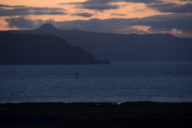
Beacon on Sgeir Gobhlach from Lower Breakish (Breacais Iosal) In the background is the east side of Scalpay and the distinctive profile of Dun Caan on Raasay.
Beacon on Sgeir Gobhlach from Lower Breakish (Breacais Iosal)
In the background is the east side of Scalpay and the distinctive profile of Dun Caan on Raasay.
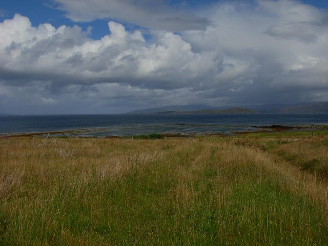
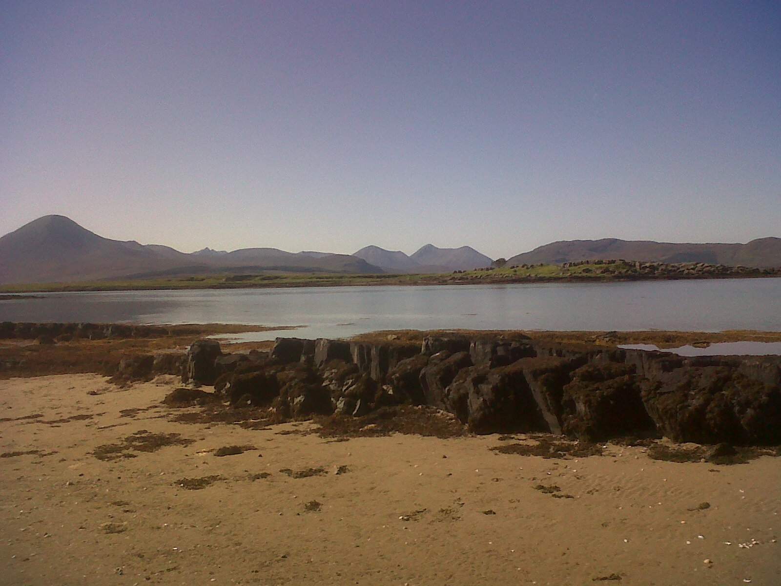
Pabay east coast A rocky shoreline, seen on a glorious spring day.
Pabay east coast
A rocky shoreline, seen on a glorious spring day.
Jetty At Pabay We powered under the Skye Bridge to be dropped off near the shell beach on Pabay to walk to the island highpoint and trig. Then down for collection at Pabay Jetty on a dull wet afternoon.
Jetty At Pabay
We powered under the Skye Bridge to be dropped off near the shell beach on Pabay to walk to the island highpoint and trig. Then down for collection at Pabay Jetty on a dull wet afternoon.
Pabay Vanessa Trig We landed near the shell beach then bagged likely island highpoint before bagging the Vanessa trig. Eventually walked back to use the jetty for our departure.
Pabay Vanessa Trig
We landed near the shell beach then bagged likely island highpoint before bagging the Vanessa trig. Eventually walked back to use the jetty for our departure.
Landing On Pabay We landed near the shell beach on the north of Pabay at low tide.
Landing On Pabay
We landed near the shell beach on the north of Pabay at low tide.
Drainage Ditch On Pabay
Broadford bay and the Skye bridge in the distance
Standing within square NG6726 looking westward past the Pabay Post Box On a bright April day I had the pleasure to visit Pabay. In this image one looks past the one and only Post Box on the Island westward towards the Isles of Skye and Scalpay. The large hill to the left of the Post Box is Beinn na Caillich the summit of which is recorded as 732m. Scalpay is on the righthand side of the image with the Caolas Scalpay between it and Skye.
Standing within square NG6726 looking westward past the Pabay Post Box
On a bright April day I had the pleasure to visit Pabay. In this image one looks past the one and only Post Box on the Island westward towards the Isles of Skye and Scalpay. The large hill to the left of the Post Box is Beinn na Caillich the summit of which is recorded as 732m. Scalpay is on the righthand side of the image with the Caolas Scalpay between it and Skye.
Wind Generator remains on Pabay's west coast. Beyond the hurricane destroyed windmill on Pabay's west coast can be seen the flat topped hill of Dun Caan on the Isle of Raasay.
Wind Generator remains on Pabay's west coast.
Beyond the hurricane destroyed windmill on Pabay's west coast can be seen the flat topped hill of Dun Caan on the Isle of Raasay.
A north westward view from the Isle of Pabay Beyond the north west of the Isle of Pabay are the Isles of Longay to the right, Raasay centre left and Scalpay on the left. The Flat topped hill on Raasay is Dun Caan at 443m height.
A north westward view from the Isle of Pabay
Beyond the north west of the Isle of Pabay are the Isles of Longay to the right, Raasay centre left and Scalpay on the left. The Flat topped hill on Raasay is Dun Caan at 443m height.
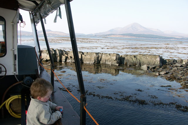
The Isle of Pabay jetty and dock The Glass bottomed boat that brought me over to The Isle of Pabay awaits my return anxiously as the tide is now dangerously low and the navigation in and out of Pabay is very tricky. Only someone with a good knowledge of the reefs can perform this navigation. I am indebted to the owner.
The Isle of Pabay jetty and dock
The Glass bottomed boat that brought me over to The Isle of Pabay awaits my return anxiously as the tide is now dangerously low and the navigation in and out of Pabay is very tricky. Only someone with a good knowledge of the reefs can perform this navigation. I am indebted to the owner.
The track down past the back of Pabay House. With Pabay house to the left, the track leads down from the young plantation and the defunct wind generator, to the steadings, then it bears left round the front of the house and takes one back to the jetty.
The track down past the back of Pabay House.
With Pabay house to the left, the track leads down from the young plantation and the defunct wind generator, to the steadings, then it bears left round the front of the house and takes one back to the jetty.
The end of Pabay jetty is built onto part of the reef. In this image just as we are departing from The Isle of Pabay one looks over the gradually exposing reefs of An Gobhlach. If one looks at the image carefully one can just discern the rock of Sgeir Gobhlach which has a beacon on it. It is the further most exposed part of the reef and is located in grid reference 6625. In the far distance is the hill of Beinn na Caillich on The Isle of Skye.
The end of Pabay jetty is built onto part of the reef.
In this image just as we are departing from The Isle of Pabay one looks over the gradually exposing reefs of An Gobhlach. If one looks at the image carefully one can just discern the rock of Sgeir Gobhlach which has a beacon on it. It is the further most exposed part of the reef and is located in grid reference 6625. In the far distance is the hill of Beinn na Caillich on The Isle of Skye.
The remains of a windmill or wind powered generator on the west coast of Pabay After the Hurricane that we had in January 2005 I visited Pabay to record the damage to this generator. I understand that the manufacturer had guaranteed that it would withstand hurricane strength winds. It did not. The view is almost due west towards The Isle of Scalpay.
The remains of a windmill or wind powered generator on the west coast of Pabay
After the Hurricane that we had in January 2005 I visited Pabay to record the damage to this generator. I understand that the manufacturer had guaranteed that it would withstand hurricane strength winds. It did not. The view is almost due west towards The Isle of Scalpay.
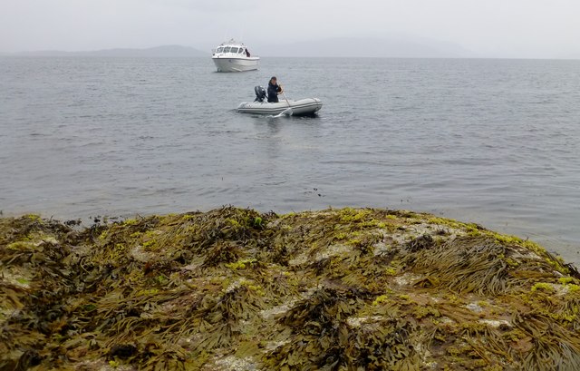
Marked Rock north west of Sgeir Gobhlach and west southwest of An Gobhlach Though this image simply shows some submerged reef with seaweed showing to the right is also a rock that is always above high tide. It is northwest of Sgeir Gobhlach and west southwest of An Gobhlach. An Gobhlach is the reef exposed by low tide off the south western tip of The Isle of Pabay. In the Gaelic Language there is no letter 'V' so to create a similar sound they put the letters 'BH' together. However the rule does not always apply. It depends also on the context in which it is used.
Marked Rock north west of Sgeir Gobhlach and west southwest of An Gobhlach
Though this image simply shows some submerged reef with seaweed showing to the right is also a rock that is always above high tide. It is northwest of Sgeir Gobhlach and west southwest of An Gobhlach. An Gobhlach is the reef exposed by low tide off the south western tip of The Isle of Pabay. In the Gaelic Language there is no letter 'V' so to create a similar sound they put the letters 'BH' together. However the rule does not always apply. It depends also on the context in which it is used.
Shell Beach This is shell beach, as the name suggests it is entirely composed of shells.  Fossils are found on the flat rocks nearby.  Longay is visible offshore here.
Shell Beach
This is shell beach, as the name suggests it is entirely composed of shells. Fossils are found on the flat rocks nearby. Longay is visible offshore here.
Shell Beach Pabay
Shell Beach Pabay
Show me another place!

Pabay is located at Grid Ref: NG6727 (Lat: 57.275498, Lng: -5.8599492)

Unitary Authority: Highland

Police Authority: Highlands and Islands

What 3 Words

///widely.deciding.visit. Near Broadford, Highland

Related Wikis

Pabay

Pabay is a Scottish island just off the coast of Skye. The name Pabay is derived from an old Norse word meaning "priest's isle" and there are the remains...

Ross, Skye and Lochaber (UK Parliament constituency)

Ross, Skye and Lochaber is a constituency of the House of Commons of the Parliament of the United Kingdom (Westminster). It elects one Member of Parliament...

Broadford Airfield

Isle of Skye (Broadford) Airfield (also known as Ashaig Airstrip or Broadford Aerodrome) is a small airfield on the Isle of Skye, Scotland, with a single...

Ashaig

Ashaig (Scottish Gaelic: Aiseag, referring to a ferry) is a small township, situated adjacent to Upper Breakish and Lower Breakish near Broadford on the...

Nearby Amenities

Located within 500m of 57.275498,-5.8599492
Ele: 27
Ele Ft: 89
Natural: peak
Source: OS7
Source Ele: OS7
Lat/Long: 57.2738146/-5.8637166
The data included in this document is from www.openstreetmap.org. The data is made available under ODbL.

Have you been to Pabay?

Leave your review of Pabay below (or comments, questions and feedback).