Sgeir Leth a' Chuain

Island in Argyllshire

Scotland

Sgeir Leth a' Chuain

Deciduous woodland on Garbh Eileach A rare patch of woodland on the Garvellachs in the Firth of Lorn.
Deciduous woodland on Garbh Eileach Credit: M J Richardson

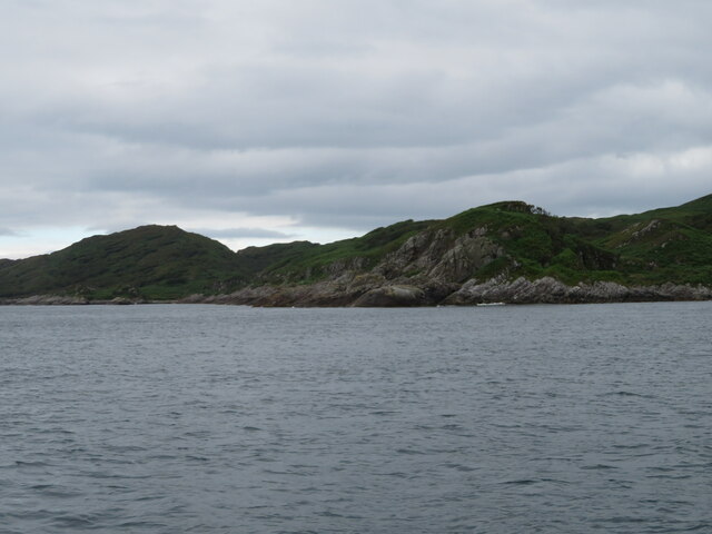
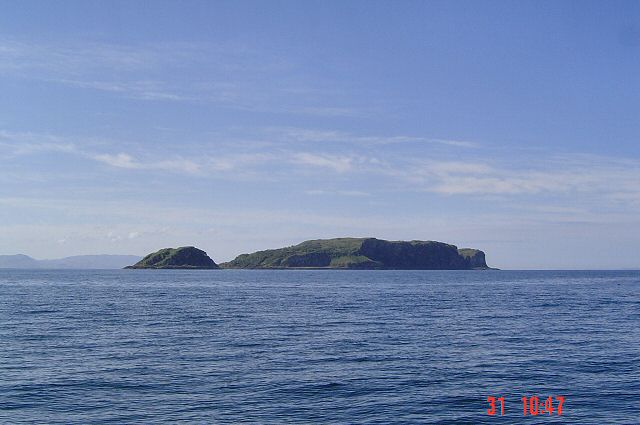
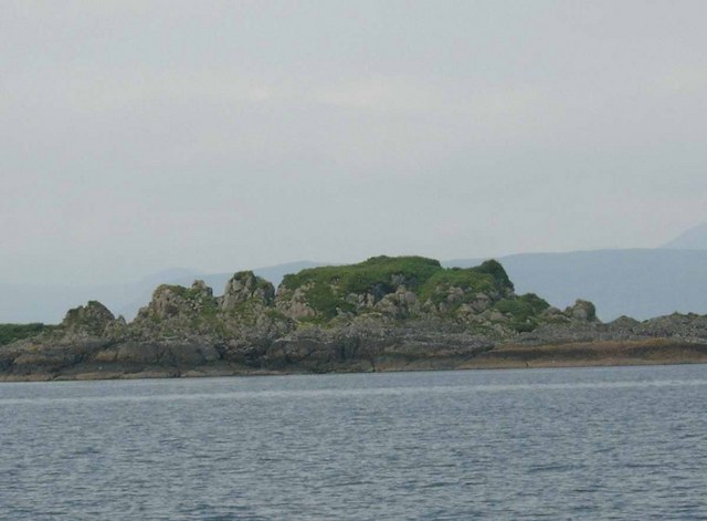
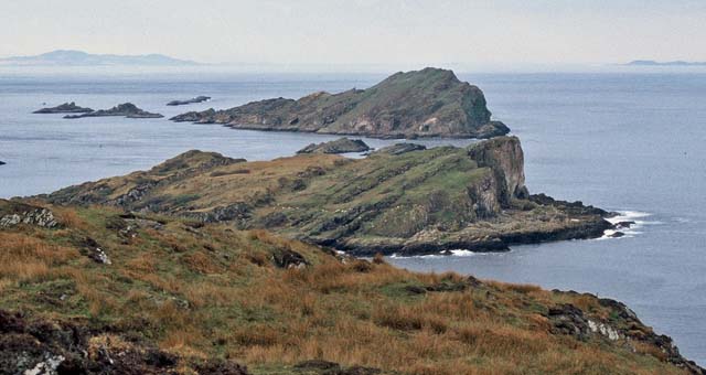
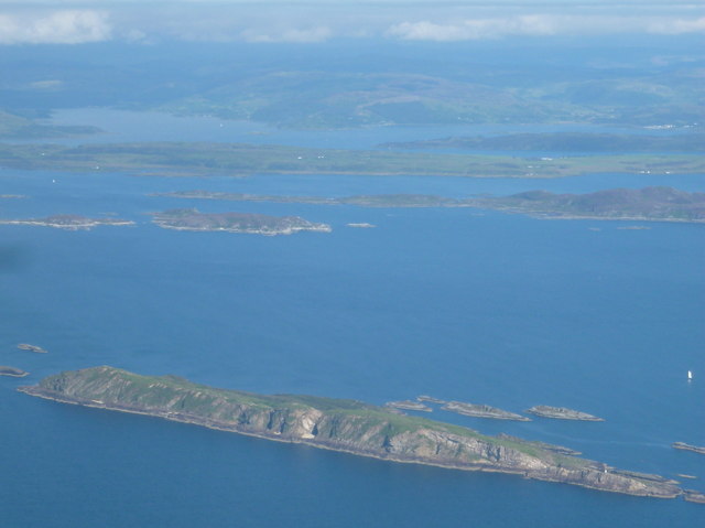
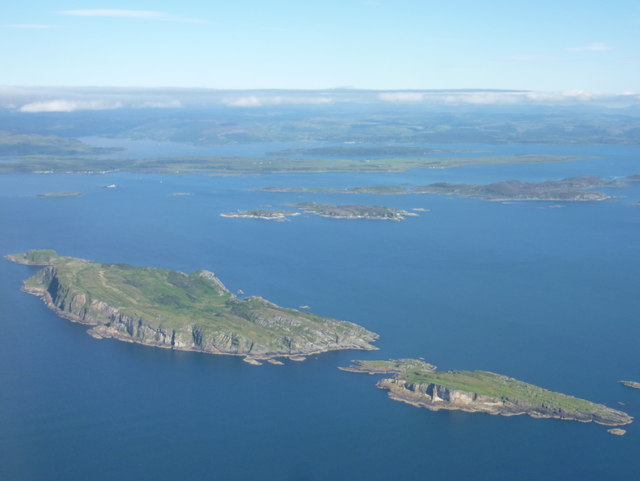
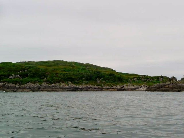
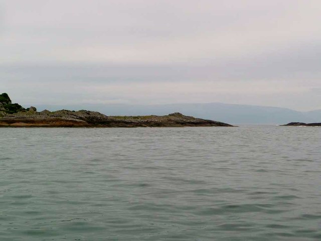
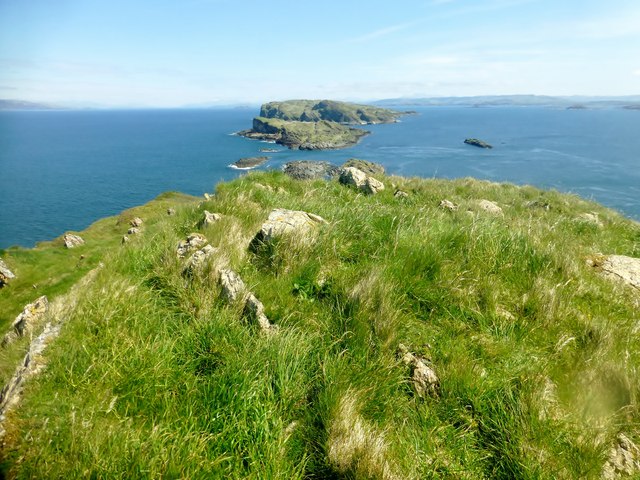
Sgeir Leth a' Chuain is a small uninhabited island located off the west coast of Scotland in Argyllshire. It is part of the Inner Hebrides archipelago and is situated in the Sound of Jura, between the mainland and the Isle of Jura.

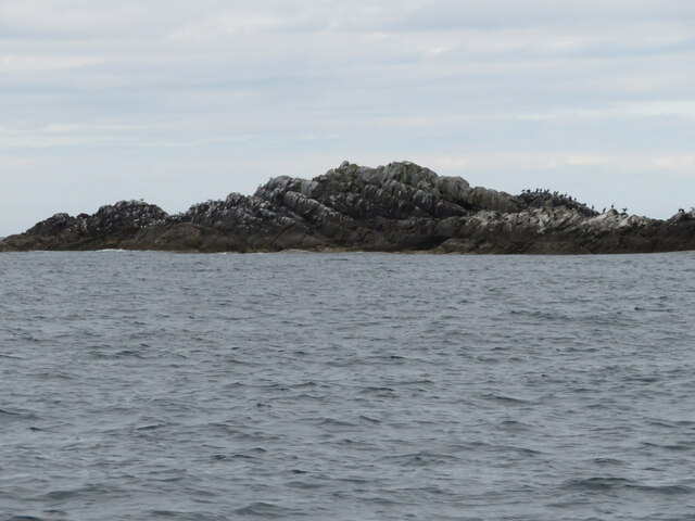
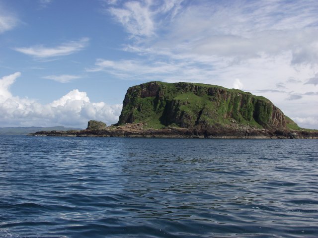
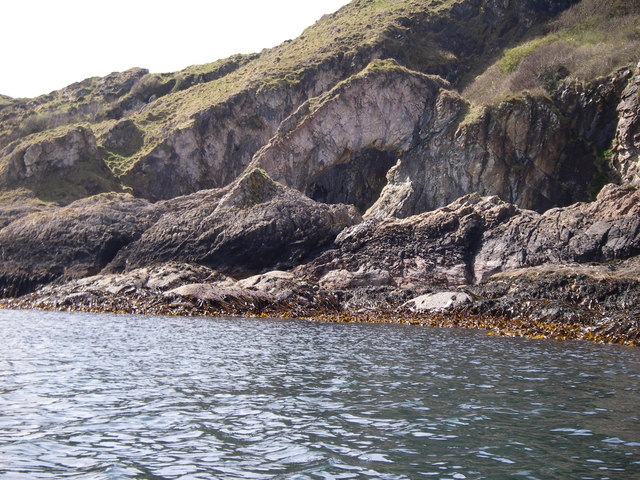
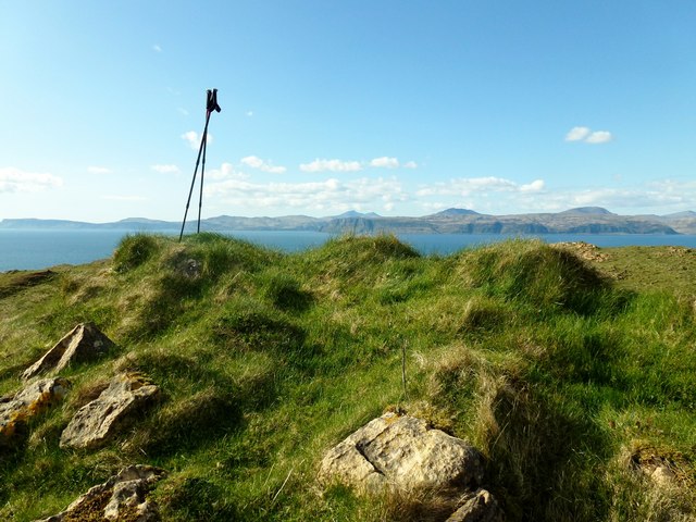
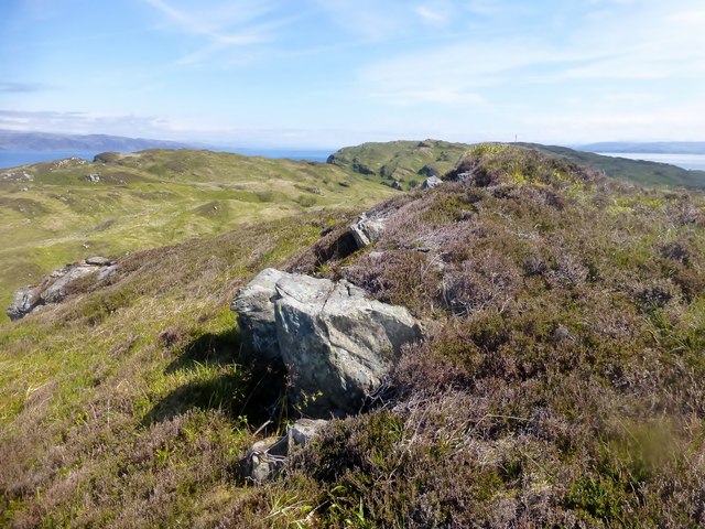
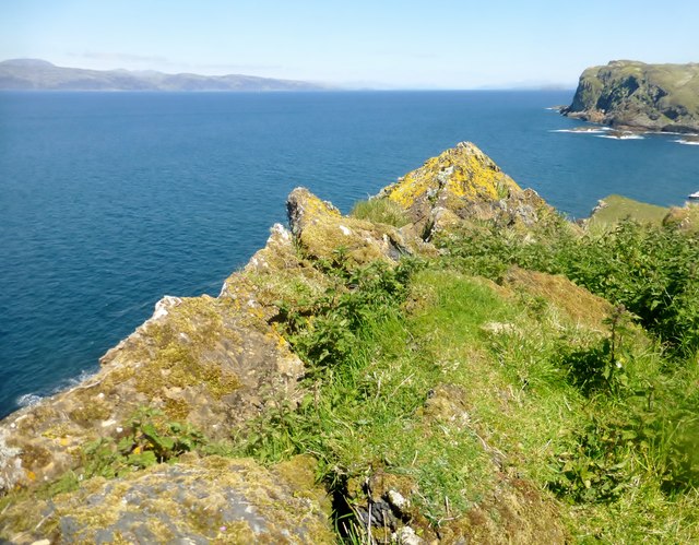
The island covers an area of approximately 4 hectares and is composed mainly of rocky outcrops and rugged terrain. It is characterized by its steep cliffs that rise dramatically from the surrounding waters, providing a habitat for various seabird species, including puffins, guillemots, and razorbills.

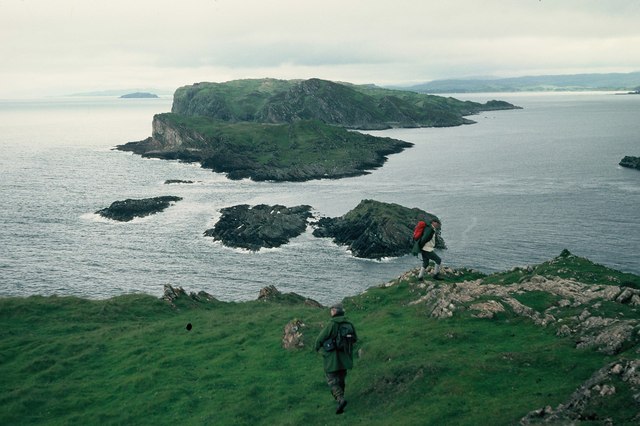
Sgeir Leth a' Chuain is a popular destination for wildlife enthusiasts and birdwatchers due to its rich biodiversity. The surrounding waters are also known for their diverse marine life, with sightings of seals, dolphins, and porpoises being common.

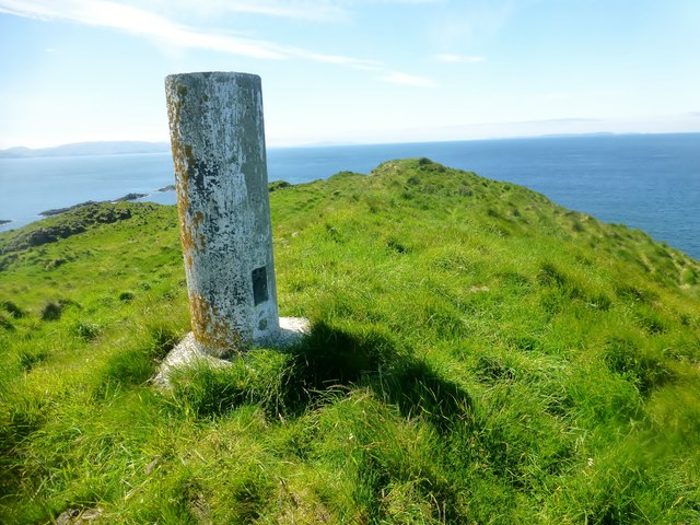
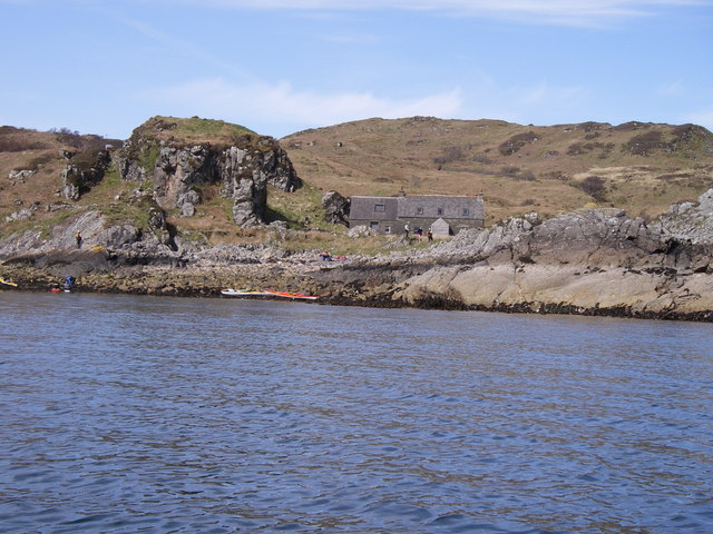
Access to the island is limited, and it can only be reached by boat or kayak. There are no facilities or infrastructure on Sgeir Leth a' Chuain, making it a true wilderness experience for those who visit.

Due to its remote location and untouched natural beauty, the island offers a peaceful and serene environment for nature lovers seeking solitude and tranquility. Its picturesque landscape and abundant wildlife make Sgeir Leth a' Chuain a hidden gem in the Scottish Isles.

If you have any feedback on the listing, please let us know in the comments section below.

Sgeir Leth a' Chuain Images

Images are sourced within 2km of 56.231246/-5.7939615 or Grid Reference NM6410. Thanks to Geograph Open Source API. All images are credited.

Deciduous woodland on Garbh Eileach A rare patch of woodland on the Garvellachs in the Firth of Lorn.
Deciduous woodland on Garbh Eileach
A rare patch of woodland on the Garvellachs in the Firth of Lorn.
Sgeir nam Marag A skerry, east of Eileach an Naoimh and south of A' Chùli, in the Garvellachs with perching Shags. Its location can be seen in <a href="https://www.geograph.org.uk/photo/4518586">NM6410 : Eileach an Naoimh</a>, the dark skerry at mid-right.
Sgeir nam Marag
A skerry, east of Eileach an Naoimh and south of A' Chùli, in the Garvellachs with perching Shags. Its location can be seen in NM6410 : Eileach an Naoimh, the dark skerry at mid-right.
Garvellachs The islands viewed from the NE. These islands are in the Firth of Lorn that separates Mull from the mainland.
Garvellachs
The islands viewed from the NE. These islands are in the Firth of Lorn that separates Mull from the mainland.
The Garvellachs
The Garvellachs
Sea Arch on Garvellachs
Sgeir nam Maraig
Sgeir nam Maraig
Garbh Eileach On the low hill on Garbh Eileach.
Garbh Eileach
On the low hill on Garbh Eileach.
Garbh Eileach from N point of Eileach an Naoimh View over A'Chuli to Garbh Eileach showing the strong tidal race between the islets.
Garbh Eileach from N point of Eileach an Naoimh
View over A'Chuli to Garbh Eileach showing the strong tidal race between the islets.
The Garvellachs: Eilean an Naoimh Looking down from a Colonsay-Oban flight as we pass the Garvellachs. This is the southernmost of the three main islands, reaching 77m above sea level.

Beyond, we see various other islands - from front to back: Eilean Dubh Mòr and Eilean Dubh Bheag to the left; Lunga disappearing off the right of the picture; Luing spanning the entire picture behind that; and Shuna behind Luing (darker, to the right). In the distance, Loch Melfort punctuates the mainland coastline on the left.
The Garvellachs: Eilean an Naoimh
Looking down from a Colonsay-Oban flight as we pass the Garvellachs. This is the southernmost of the three main islands, reaching 77m above sea level. Beyond, we see various other islands - from front to back: Eilean Dubh Mòr and Eilean Dubh Bheag to the left; Lunga disappearing off the right of the picture; Luing spanning the entire picture behind that; and Shuna behind Luing (darker, to the right). In the distance, Loch Melfort punctuates the mainland coastline on the left.
Eileach an Naoimh SW Top Dropped by boat below the chapel then up to Eileach an Naoimh, then onto the Vanessa trig plus TUMP top of Eileach an Naoimh SW Top, plus just had enough time to visit the lighthouse.
Name: Eileach an Naoimh SW Top
Hill number: 11515
Height: 77m / 253ft
Parent (Ma/M): none
Section: 20A: Jura, Scarba and Colonsay
County/UA: Argyll and Bute (UA)
Maritime Area: Scarba, Slate Islands & Firth of Lorn
Class: Tump (0-99m)
Grid ref: NM638097 (est)
Drop: 38m
Col: 39m  NM640099
Eileach an Naoimh SW Top
Dropped by boat below the chapel then up to Eileach an Naoimh, then onto the Vanessa trig plus TUMP top of Eileach an Naoimh SW Top, plus just had enough time to visit the lighthouse. Name: Eileach an Naoimh SW Top Hill number: 11515 Height: 77m / 253ft Parent (Ma/M): none Section: 20A: Jura, Scarba and Colonsay County/UA: Argyll and Bute (UA) Maritime Area: Scarba, Slate Islands & Firth of Lorn Class: Tump (0-99m) Grid ref: NM638097 (est) Drop: 38m Col: 39m NM640099
Beehive Cells On Eileach an Naoimh Eileach an Naoimh means ’Island of the saints’, although doubt exists as to which saints lived on this remote island in the Garvellachs. The physical remains on the island show it to be one of the best-preserved early Christian monasteries in Scotland. Of particular interest is the unusual, beehive-shaped double cell, still standing over 3m high.
Beehive Cells On Eileach an Naoimh
Eileach an Naoimh means ’Island of the saints’, although doubt exists as to which saints lived on this remote island in the Garvellachs. The physical remains on the island show it to be one of the best-preserved early Christian monasteries in Scotland. Of particular interest is the unusual, beehive-shaped double cell, still standing over 3m high.
Garbh Eileach W Summit This was going to be a quick grab because the summit was said to be unambiguous. However, not to be - another festive round of multiple lumps to guess which one could be it. Never mind, the view and weather were unambiguously good.
W top at NM 66860 12319 is probably just lower than ground 70m NW at NM 67273 12530 is as high true southern top at NM 67326 12486.
Garbh Eileach W Summit
This was going to be a quick grab because the summit was said to be unambiguous. However, not to be - another festive round of multiple lumps to guess which one could be it. Never mind, the view and weather were unambiguously good. W top at NM 66860 12319 is probably just lower than ground 70m NW at NM 67273 12530 is as high true southern top at NM 67326 12486.
The Garvellachs: Garbh Eileach and A’ Chùli Looking down from a Colonsay-Oban flight as we pass the Garvellachs. These are the two northernmost of the three main islands.

Beyond, we see various other islands - from front to back: Eilean Dubh Mòr and Eilean Dubh Bheag in the centre; Lunga on the right of the picture; Belnahua isolated on the far left; Luing spanning almost the entire picture behind that; and Shuna behind Luing (darker, just right of centre). In the distance, Loch Melfort punctuates the mainland coastline on the left.
The Garvellachs: Garbh Eileach and A’ Chùli
Looking down from a Colonsay-Oban flight as we pass the Garvellachs. These are the two northernmost of the three main islands. Beyond, we see various other islands - from front to back: Eilean Dubh Mòr and Eilean Dubh Bheag in the centre; Lunga on the right of the picture; Belnahua isolated on the far left; Luing spanning almost the entire picture behind that; and Shuna behind Luing (darker, just right of centre). In the distance, Loch Melfort punctuates the mainland coastline on the left.
A'Chuli A'Chuli is the middle island of the three main Garvallachs.
A'Chuli
A'Chuli is the middle island of the three main Garvallachs.
Northern tip of A'Chuli The middle island of the Garvellachs.
Northern tip of A'Chuli
The middle island of the Garvellachs.
Eileach an Naoimh Dropped by boat below the chapel then up to Eileach an Naoimh, then onto the Vanessa trig plus TUMP top of Eileach an Naoimh SW Top, to just having time to visit the lighthouse.
Name: Eileach an Naoimh
Hill number: 11521
Height: 80m / 262ft
Parent (Ma/M): none
Section: 20A: Jura, Scarba and Colonsay
County/UA: Argyll and Bute (UA)
Maritime Area: Scarba, Slate Islands & Firth of Lorn
Class: Tump (0-99m), SIB
Grid ref: NM644103 (est)
Drop: 80m
Col: Sea
Eileach an Naoimh
Dropped by boat below the chapel then up to Eileach an Naoimh, then onto the Vanessa trig plus TUMP top of Eileach an Naoimh SW Top, to just having time to visit the lighthouse. Name: Eileach an Naoimh Hill number: 11521 Height: 80m / 262ft Parent (Ma/M): none Section: 20A: Jura, Scarba and Colonsay County/UA: Argyll and Bute (UA) Maritime Area: Scarba, Slate Islands & Firth of Lorn Class: Tump (0-99m), SIB Grid ref: NM644103 (est) Drop: 80m Col: Sea
Cnoc Port nan Aidhean Dropped off to south of house by Farsain Cruises from Craobh Haven. Then up Cnoc Port nan Aidhean and onto Cnoc Bealach an Tarabairt before returning to the boat.
Name: Cnoc Port nan Aidhean
Hill number: 11495
Height: 98m / 322ft
Parent (Ma/M): none
Section: 20A: Jura, Scarba and Colonsay
County/UA: Argyll and Bute (UA)
Maritime Area: Scarba, Slate Islands & Firth of Lorn
Class: Tump (0-99m)
Grid ref: NM662116 (est)
Drop: 40m
Col: 58m  NM662117
Cnoc Port nan Aidhean
Dropped off to south of house by Farsain Cruises from Craobh Haven. Then up Cnoc Port nan Aidhean and onto Cnoc Bealach an Tarabairt before returning to the boat. Name: Cnoc Port nan Aidhean Hill number: 11495 Height: 98m / 322ft Parent (Ma/M): none Section: 20A: Jura, Scarba and Colonsay County/UA: Argyll and Bute (UA) Maritime Area: Scarba, Slate Islands & Firth of Lorn Class: Tump (0-99m) Grid ref: NM662116 (est) Drop: 40m Col: 58m NM662117
A' Chùli Dropped off by Farsain Cruises from Craobh Haven, then just a steep climb to this lovely viewpoint on a sunny day.
Name: A' Chùli
Hill number: 11534
Height: 45m / 148ft
Parent (Ma/M): none
Section: 20A: Jura, Scarba and Colonsay
County/UA: Argyll and Bute (UA)
Maritime Area: Scarba, Slate Islands & Firth of Lorn
Class: Tump (0-99m), SIB
Grid ref: NM654113 (est)
Drop: 45m
Col: Sea
A' Chùli
Dropped off by Farsain Cruises from Craobh Haven, then just a steep climb to this lovely viewpoint on a sunny day. Name: A' Chùli Hill number: 11534 Height: 45m / 148ft Parent (Ma/M): none Section: 20A: Jura, Scarba and Colonsay County/UA: Argyll and Bute (UA) Maritime Area: Scarba, Slate Islands & Firth of Lorn Class: Tump (0-99m), SIB Grid ref: NM654113 (est) Drop: 45m Col: Sea
Show me another place!

Sgeir Leth a' Chuain is located at Grid Ref: NM6410 (Lat: 56.231246, Lng: -5.7939615)

Unitary Authority: Argyll and Bute

Police Authority: Argyll and West Dunbartonshire

What 3 Words

///punters.forks.curve. Near Lochbuie, Argyll & Bute

Related Wikis

Garvellachs

The Garvellachs (Scottish Gaelic: Garbh Eileaich) or Isles of the Sea form a small archipelago in the Inner Hebrides of Scotland. Part of the Argyll and...

Eileach an Naoimh

Eileach an Naoimh, also known as Holy Isle, is an uninhabited island in the Inner Hebrides of the west coast of Scotland. It is the southernmost of the...

Garbh Eileach

Garbh Eileach is an uninhabited island in the Inner Hebrides of the west coast of Scotland. It is the largest of the Garvellachs and lies in the Firth...

Dùn Chonnuill

Dùn Chonnuill is a small island in the Garvellachs in the Firth of Lorn, Scotland. Dùn Chonnuill lies north east of Garbh Eileach, the largest of the archipelago...

Have you been to Sgeir Leth a' Chuain?

Leave your review of Sgeir Leth a' Chuain below (or comments, questions and feedback).