Eilean Dubh a' Chumhainn Bhig

Island in Argyllshire

Scotland

Eilean Dubh a' Chumhainn Bhig

Loch na Pearaich Looking southwest over Loch na Pearaich and Loch Tarbert on a glorious summer's day.  The peaks of two of the Paps of Jura are visible in the distance.
Loch na Pearaich Credit: David Hoult

Eilean Dubh a' Chumhainn Bhig, also known as Little Black Rock Island, is a small uninhabited islet located in Argyllshire, Scotland. Situated off the west coast of Scotland, this island is part of the Inner Hebrides archipelago.

Covering an area of approximately 0.05 hectares, Eilean Dubh a' Chumhainn Bhig is a rocky and rugged island characterized by its steep cliffs and sparse vegetation. The island is mostly composed of basalt and has a distinctive black color, which gives it its name.

Due to its remote location and limited accessibility, Eilean Dubh a' Chumhainn Bhig is rarely visited by tourists. However, it is a popular spot for birdwatchers, as it is home to various seabird species, including guillemots, razorbills, and puffins.

The island's isolation makes it an ideal breeding ground for these birds, who take advantage of the sheltered cliffs and surrounding waters teeming with fish. Visitors interested in observing these avian creatures can do so from boats or by taking guided wildlife tours.

Aside from its ornithological significance, Eilean Dubh a' Chumhainn Bhig also boasts stunning natural scenery. Its rocky shores and dramatic cliffs provide a picturesque backdrop against the vast expanse of the Atlantic Ocean.

In summary, Eilean Dubh a' Chumhainn Bhig is a small, uninhabited island off the coast of Argyllshire, Scotland. With its rugged terrain, unique black rock formations, and abundant birdlife, it offers a distinct and captivating experience for nature enthusiasts and birdwatchers.

If you have any feedback on the listing, please let us know in the comments section below.

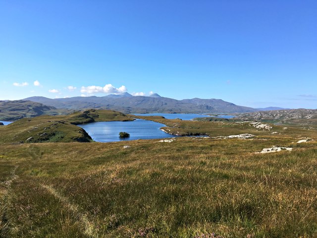
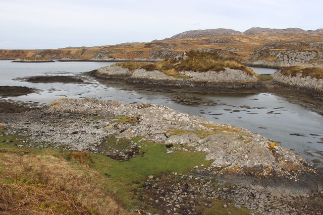
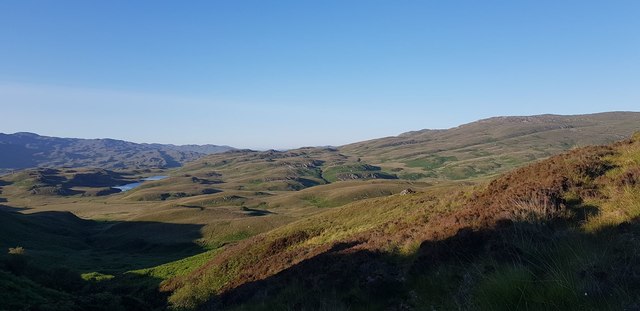
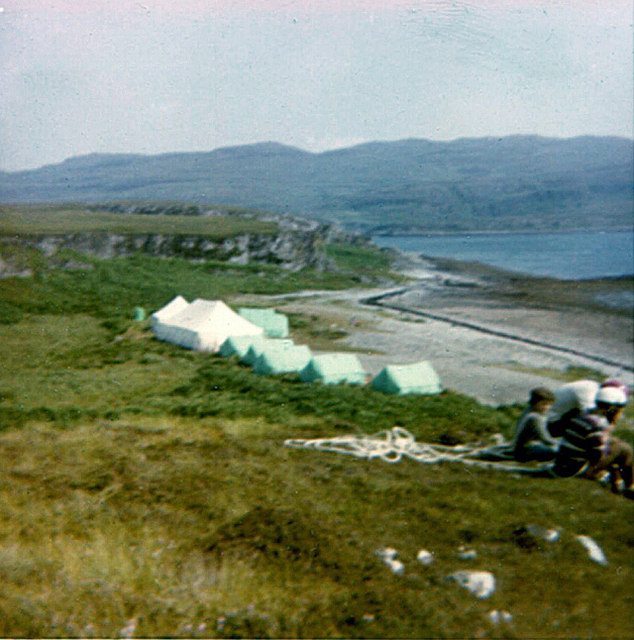
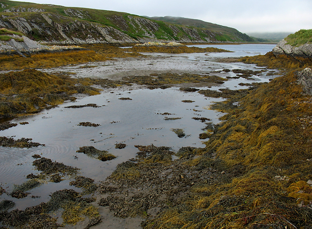
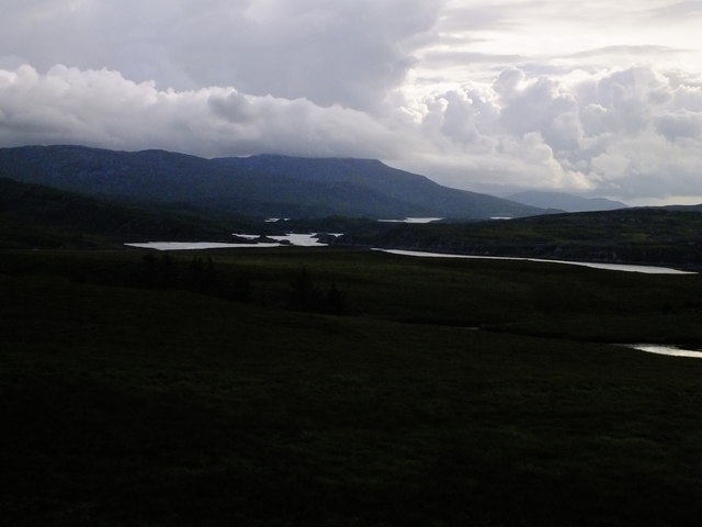
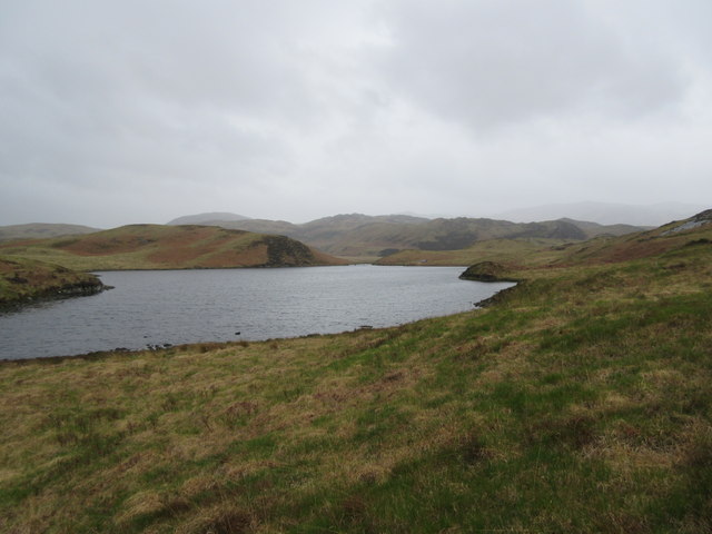
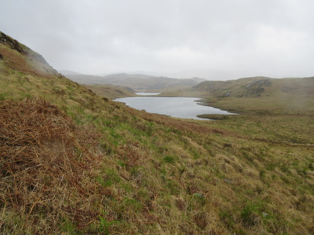
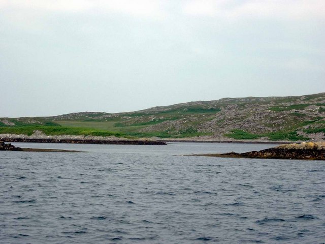
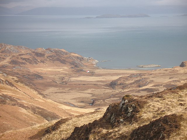
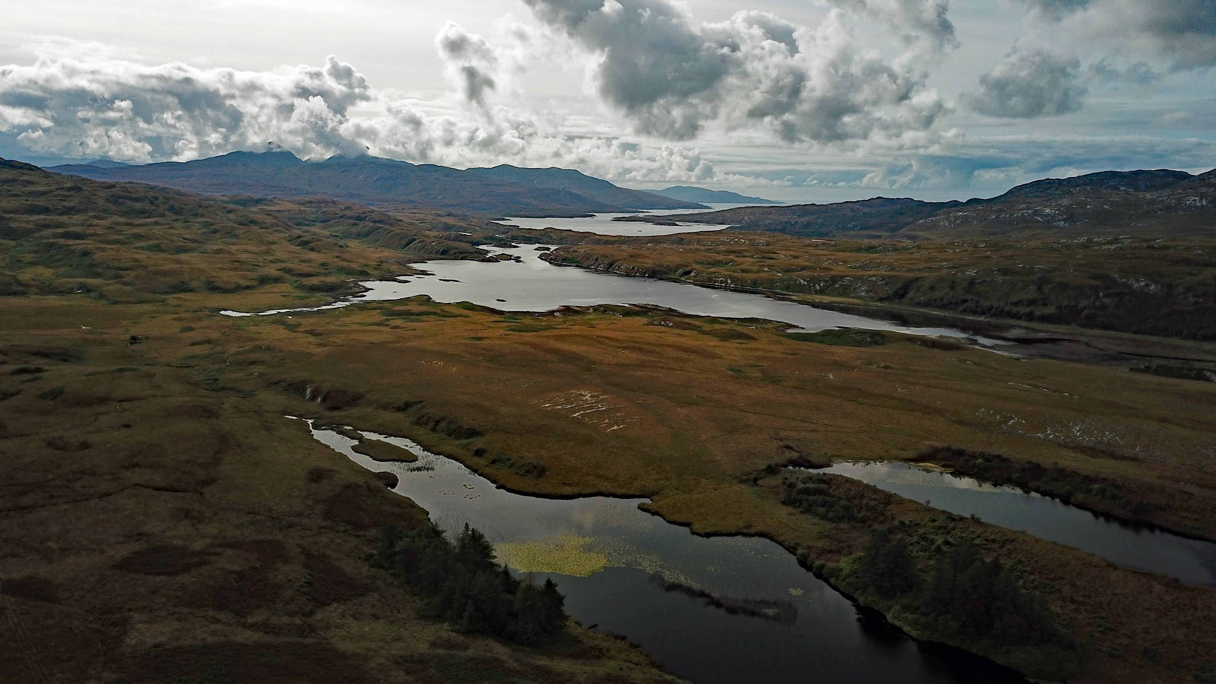
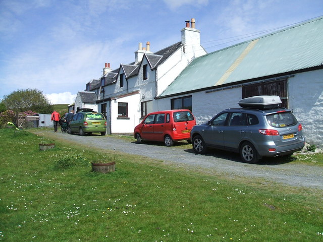
Eilean Dubh a' Chumhainn Bhig Images

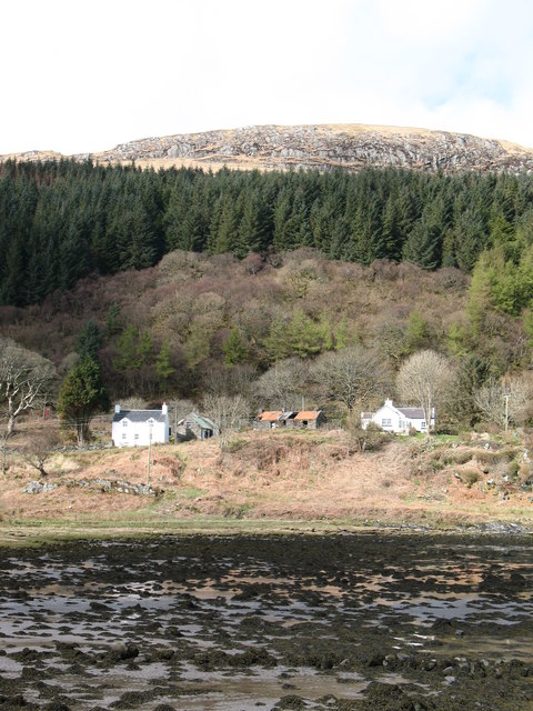
Images are sourced within 2km of 55.968504/-5.8903348 or Grid Reference NR5781. Thanks to Geograph Open Source API. All images are credited.

Loch na Pearaich Looking southwest over Loch na Pearaich and Loch Tarbert on a glorious summer's day.  The peaks of two of the Paps of Jura are visible in the distance.
Loch na Pearaich
Looking southwest over Loch na Pearaich and Loch Tarbert on a glorious summer's day. The peaks of two of the Paps of Jura are visible in the distance.
Islets in Loch Tarbert
Valley of Allt Fearna Mor
The navigable channel of Loch Tarbert
On the shore of Loch Tarbert
Barren view of north Jura Very rugged landscape. Further up the hill to the west, you could see the hills of the Isle of Mull peeping out from the top of the cascade of hills shown in the centre.
Barren view of north Jura
Very rugged landscape. Further up the hill to the west, you could see the hills of the Isle of Mull peeping out from the top of the cascade of hills shown in the centre.
Tents on the beach near Cruib Lodge The temporary campsite was set up for the Schools Hebridean Society <span class="nowrap"><a title="http://www.schools-hebridean-society.co.uk" rel="nofollow ugc noopener" href="http://www.schools-hebridean-society.co.uk">Link</a><img style="margin-left:2px;" alt="External link" title="External link - shift click to open in new window" src="https://s1.geograph.org.uk/img/external.png" width="10" height="10"/></span> expedition in 1973. The exact location of photographer is an estimate as it was a long time ago!
Tents on the beach near Cruib Lodge
The temporary campsite was set up for the Schools Hebridean Society LinkExternal link expedition in 1973. The exact location of photographer is an estimate as it was a long time ago!
Loch Tarbert An inlet on the southern shore of Loch Tarbert on the Isle of Jura.
Loch Tarbert
An inlet on the southern shore of Loch Tarbert on the Isle of Jura.
Loch Tarbert, Jura This is the view from the main road between Lussa and Tarbert of Loch Tarbert. The loch cuts deep into the landscape and the island which is 7 miles or so wide for most of its length is less than a mile wide between the loch and the hamlet of Tarbert.
Loch Tarbert, Jura
This is the view from the main road between Lussa and Tarbert of Loch Tarbert. The loch cuts deep into the landscape and the island which is 7 miles or so wide for most of its length is less than a mile wide between the loch and the hamlet of Tarbert.
Cruib Bothy Cruib Bothy, formerly known as Cruib Lodge, and marked as such on OS maps, belongs to the Ruantallain Estate, but is maintained as an unlocked bothy, free for anyone to use, by the Mountain Bothies Association (MBA).  The MBA assumed responsibility for it in 2012, and it was extensively refurbished at that time, as can be seen by comparing this photograph with the one taken by Gordon Brown in 2006.
Cruib Bothy
Cruib Bothy, formerly known as Cruib Lodge, and marked as such on OS maps, belongs to the Ruantallain Estate, but is maintained as an unlocked bothy, free for anyone to use, by the Mountain Bothies Association (MBA). The MBA assumed responsibility for it in 2012, and it was extensively refurbished at that time, as can be seen by comparing this photograph with the one taken by Gordon Brown in 2006.
Rainy day at Lochana Tana This is the southern lochan of twin lochans (both known as Lochana Tana). It is a fishing loch and even has a boat house towards the far end.
Rainy day at Lochana Tana
This is the southern lochan of twin lochans (both known as Lochana Tana). It is a fishing loch and even has a boat house towards the far end.
Lochana Tana (north) A wet day at Lochana Tana - both of the lochans can be seen.
Lochana Tana (north)
A wet day at Lochana Tana - both of the lochans can be seen.
Inner Loch Tarbert, Isle of Jura Loch Tarbert, a sea loch on Jura, has an outer, middle and inner section.  Navigating a yacht to the middle section is tricky, going on to the inner loch smacks of foolhardieness!  We went in on the dinghy, having anchored in the middle loch. See nearby grid squares for other views.
Inner Loch Tarbert, Isle of Jura
Loch Tarbert, a sea loch on Jura, has an outer, middle and inner section. Navigating a yacht to the middle section is tricky, going on to the inner loch smacks of foolhardieness! We went in on the dinghy, having anchored in the middle loch. See nearby grid squares for other views.
Loch Tarbert, Isle of Jura This narrow 'gut' called the Chumhainn Bhig (Little Strait) connects the middle loch to the passage leading to the inner loch.  You can just see two of the leading marks, beyond the cliff on the left of the picture.
Loch Tarbert, Isle of Jura
This narrow 'gut' called the Chumhainn Bhig (Little Strait) connects the middle loch to the passage leading to the inner loch. You can just see two of the leading marks, beyond the cliff on the left of the picture.
Inner Loch Tarbert, Isle of Jura This picture is taken above the passage connecting the middle and inner lochs, looking into the inner loch.  We had gone ashore to clear bracken from one of the leading marks. We only managed one clearing, then the midges got us!
Inner Loch Tarbert, Isle of Jura
This picture is taken above the passage connecting the middle and inner lochs, looking into the inner loch. We had gone ashore to clear bracken from one of the leading marks. We only managed one clearing, then the midges got us!
Loch Tarbert, Jura This photo shows a pair of the leading marks, plus one other mark, for piloting a boat between middle Loch Tarbert and the inner loch.  This passage is not for the faint-hearted!
Loch Tarbert, Jura
This photo shows a pair of the leading marks, plus one other mark, for piloting a boat between middle Loch Tarbert and the inner loch. This passage is not for the faint-hearted!
Cruib Lodge, Loch Tarbert, Jura
Skerries in Middle Loch Tarbert Eilean Ard on the right, Eilean Dubh a Chumhain Mhoir on the left.
Skerries in Middle Loch Tarbert
Eilean Ard on the right, Eilean Dubh a Chumhain Mhoir on the left.
Show me another place!

Eilean Dubh a' Chumhainn Bhig is located at Grid Ref: NR5781 (Lat: 55.968504, Lng: -5.8903348)

Unitary Authority: Argyll and Bute

Police Authority: Argyll and West Dunbartonshire

What 3 Words

///companies.fidget.lend. Near Craighouse, Argyll & Bute

Related Wikis

Battle of the Western Isles

The Battle of the Western Isles was a series of conflicts in 1585 and 1586 on the islands of Jura, Islay, Mull and Tiree, Scotland as well as the peninsula...

Loch Tarbert, Jura

Loch Tarbert is a sea loch on the west coast of Jura, an island in Scotland. As the name Tarbert suggests, it comes close to cutting the island in half...

Tarbert, Jura

Tarbert is a hamlet on Tarbert Bay, on the east coast of the island of Jura, in the council area of Argyll and Bute, Scotland. The Tarbert estate is owned...

Lagg, Jura

Lagg is a hamlet on Lagg Bay, on the east coast of the island of Jura, in the council area of Argyll and Bute, Scotland. It is on the A846 8 miles (13...

Nearby Amenities

Located within 500m of 55.968504,-5.8903348
Rubh' a' Chumhainn Bhig
Natural: cape
Source: OS_OpenData_StreetView
Lat/Long: 55.9711305/-5.8892087
Source: PGS
Lat/Long: 55.9701537/-5.889321
Source: PGS
Lat/Long: 55.9698444/-5.889857
Created By: dmgroom_coastlines
Source: PGS
Lat/Long: 55.969524/-5.890261
Created By: dmgroom_coastlines
Source: PGS
Lat/Long: 55.969258/-5.890698
Created By: dmgroom_coastlines
Source: PGS
Lat/Long: 55.968991/-5.891135
Created By: dmgroom_coastlines
Source: PGS
Lat/Long: 55.968469/-5.891552
Created By: dmgroom_coastlines
Source: PGS
Lat/Long: 55.968203/-5.891989
Created By: dmgroom_coastlines
Source: PGS
Lat/Long: 55.96768/-5.892407
Created By: dmgroom_coastlines
Source: PGS
Lat/Long: 55.967414/-5.892844
Created By: dmgroom_coastlines
Source: PGS
Lat/Long: 55.966636/-5.893243
Source: PGS
Lat/Long: 55.9661277/-5.8930631
Source: PGS
Lat/Long: 55.9659009/-5.8931579
Source: PGS
Lat/Long: 55.965639/-5.8928002
Cumhann Beag
Natural: bay
Source: OS_OpenData_StreetView
Lat/Long: 55.9697437/-5.8869884
Port na h-Uchdaich
Natural: bay
Source: OS_OpenData_StreetView
Lat/Long: 55.9681543/-5.8829493
The data included in this document is from www.openstreetmap.org. The data is made available under ODbL.

Have you been to Eilean Dubh a' Chumhainn Bhig?

Leave your review of Eilean Dubh a' Chumhainn Bhig below (or comments, questions and feedback).