Browther Rock

Island in Cornwall

England

Browther Rock

Penwith : Boat & Sea A boat is heading back to St Ives Harbour.
Penwith : Boat & Sea Credit: Lewis Clarke

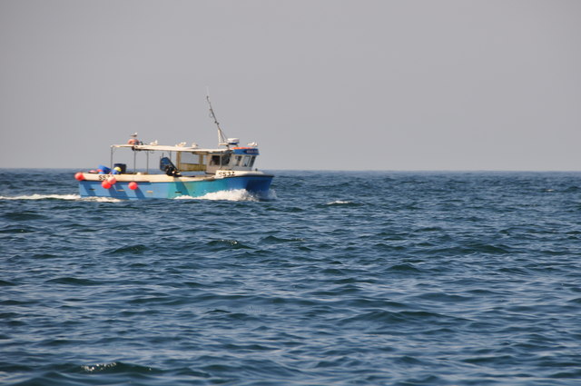
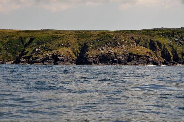
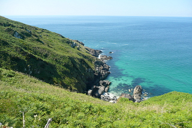
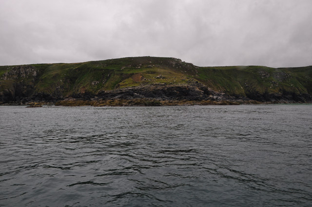
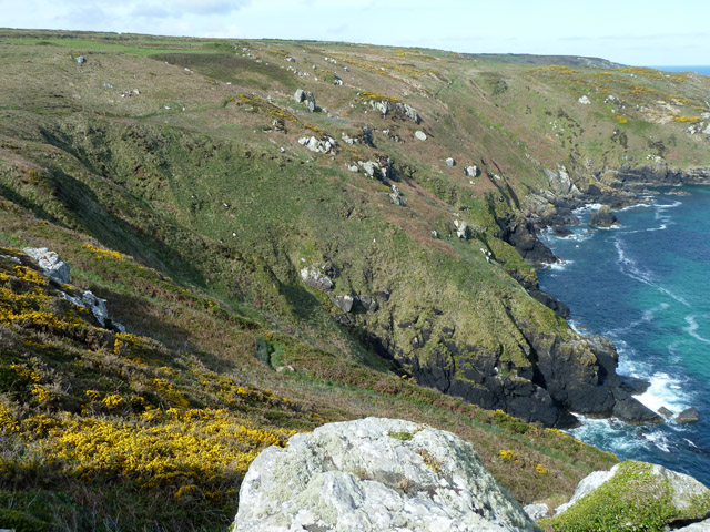
Browther Rock, located off the coast of Cornwall, is a small uninhabited island known for its rugged beauty and rich wildlife. Situated in the Atlantic Ocean, this rocky outcrop is approximately 250 meters in length and rises about 15 meters above sea level at its highest point. The island is accessible only by boat and is a popular destination for nature enthusiasts and birdwatchers.

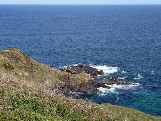
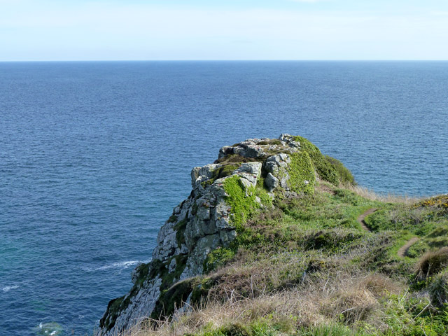
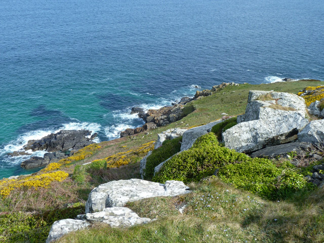
Browther Rock boasts a diverse ecosystem, providing a habitat for various bird species, including puffins, guillemots, and razorbills. These birds nest in the island's cliffs, creating a vibrant scene during breeding season. The waters surrounding the island are also teeming with marine life, attracting seals, dolphins, and occasionally, basking sharks.

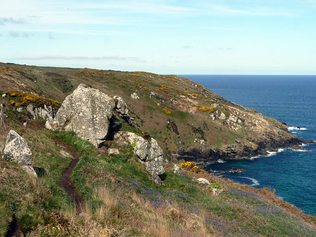
The island's geology is fascinating, with its rocky cliffs displaying layers of sedimentary rocks, giving insights into the region's geological history. Visitors can explore the island's shoreline, which is dotted with tidal pools and small caves carved by the relentless waves over centuries.

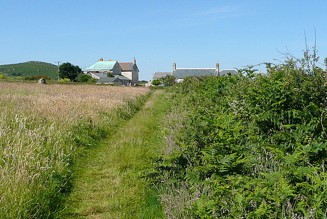
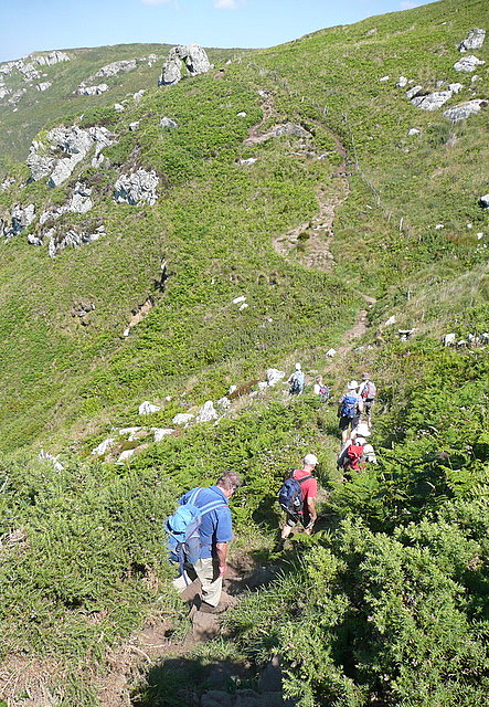
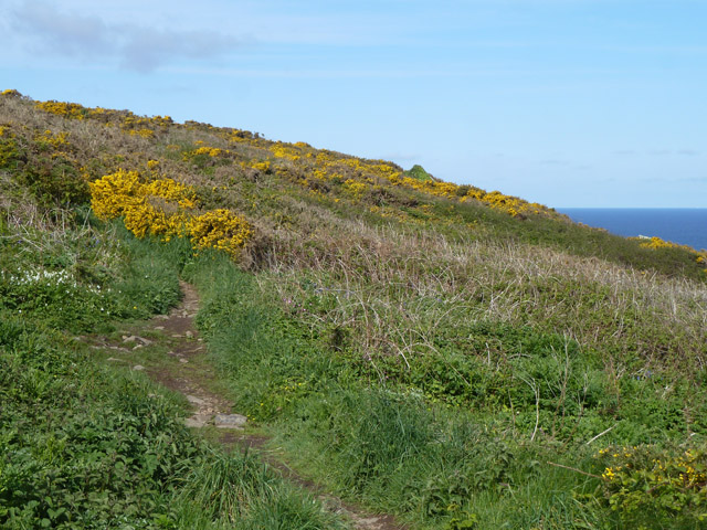
Due to its remote location and lack of amenities, Browther Rock is primarily a day-trip destination. Visitors can enjoy picnics, hiking, and birdwatching while taking in the breathtaking coastal views. However, it is important to note that the island's cliffs can be dangerous, and caution should be exercised when exploring.

Browther Rock exemplifies the unspoiled beauty of Cornwall's coastline, offering a glimpse into the region's natural wonders. Whether it's the calls of nesting seabirds or the dramatic cliffs that captivate visitors, this small island is a haven for those seeking an authentic and wild coastal experience.

If you have any feedback on the listing, please let us know in the comments section below.

Browther Rock Images

Images are sourced within 2km of 50.21984/-5.4934491 or Grid Reference SW5041. Thanks to Geograph Open Source API. All images are credited.

Penwith : Boat & Sea A boat is heading back to St Ives Harbour.
Penwith : Boat & Sea
A boat is heading back to St Ives Harbour.
Penwitch : Hor Point Looking back towards Hor Point and along the Cornish coastline.
Penwitch : Hor Point
Looking back towards Hor Point and along the Cornish coastline.
Penwith : Cornish Coastline Looking towards the coastline of Cornwall.
Penwith : Cornish Coastline
Looking towards the coastline of Cornwall.
Towards Trowan An inland path heads west from St Ives, linking many fields and interspersed with small farms.  This is the first, Trowan, adjacent to a field of coarse grass.
Towards Trowan
An inland path heads west from St Ives, linking many fields and interspersed with small farms. This is the first, Trowan, adjacent to a field of coarse grass.
Cattle on the coastal path Well, almost off the coastal path. They had ventured the seaward side of the path and we had to be careful as we passed that we did not spook them to go further towards the steep drop.
Cattle on the coastal path
Well, almost off the coastal path. They had ventured the seaward side of the path and we had to be careful as we passed that we did not spook them to go further towards the steep drop.
Towards Pen Enys Point The point is in <a href="https://www.geograph.org.uk/gridref/SW4941">SW4941</a>.  We are on the coastal path in this square, with steep bracken-covered slopes to the north leading down to the rocky coastline of Zawn Quoit.
Towards Pen Enys Point
The point is in SW4941. We are on the coastal path in this square, with steep bracken-covered slopes to the north leading down to the rocky coastline of Zawn Quoit.
Along Trowan Cliff The coastal path threads its way, high above the coast, along a thin path through the bracken and gorse.  Ahead is the climb towards Hellesveor.
Along Trowan Cliff
The coastal path threads its way, high above the coast, along a thin path through the bracken and gorse. Ahead is the climb towards Hellesveor.
Pen Enys Point The coast towards the east side of the point.
Pen Enys Point
The coast towards the east side of the point.
West side of Pen Enys Point The largest lump of isolated land is Polgassick Rock.
West side of Pen Enys Point
The largest lump of isolated land is Polgassick Rock.
Trowan A farmstead that seems to be converted into a settlement of several dwellings.
Trowan
A farmstead that seems to be converted into a settlement of several dwellings.
Coastal footpath, Trowan Cliff The blue on the slope is bluebells.
Coastal footpath, Trowan Cliff
The blue on the slope is bluebells.
Hor Point Viewed from one of the several alternative paths to the official SW Coastal Path.
Hor Point
Viewed from one of the several alternative paths to the official SW Coastal Path.
Pen Enys Point - west side Polgassick Rock is mostly hidden by the rock outcrop at the cliff top. Thrift was abundant.
Pen Enys Point - west side
Polgassick Rock is mostly hidden by the rock outcrop at the cliff top. Thrift was abundant.
Cornwall : Hor Point Just about a mile along the north Cornish coast from St Ives lies the rugged Hor Point. In World War Two this location was chosen to site a Chain Home Low radar station M115.
Cornwall : Hor Point
Just about a mile along the north Cornish coast from St Ives lies the rugged Hor Point. In World War Two this location was chosen to site a Chain Home Low radar station M115.
Coastal path, Hellesveor Cliff There is also another path lower down the slope.
Coastal path, Hellesveor Cliff
There is also another path lower down the slope.
Outcrop on Hellesveor Cliff One would have thought this would have a name, but nobody told the mapmakers if it has got one.
Outcrop on Hellesveor Cliff
One would have thought this would have a name, but nobody told the mapmakers if it has got one.
Rocks on Hellesveor Cliff According to the geological map, the lighter near rocks are likely to be 'Unnamed Igneous Intrusion, Devonian - Metagabbro and metamicrogabbro'. The darker rock, which is more general here, is the Mylor Slate formation.
Rocks on Hellesveor Cliff
According to the geological map, the lighter near rocks are likely to be 'Unnamed Igneous Intrusion, Devonian - Metagabbro and metamicrogabbro'. The darker rock, which is more general here, is the Mylor Slate formation.
Trowan Cliff Along here there is a great deal of steep coastal slope and not much sheer bare cliff. Not the place to be careless, though.
Trowan Cliff
Along here there is a great deal of steep coastal slope and not much sheer bare cliff. Not the place to be careless, though.
Show me another place!

Browther Rock is located at Grid Ref: SW5041 (Lat: 50.21984, Lng: -5.4934491)

Unitary Authority: Cornwall

Police Authority: Devon and Cornwall

What 3 Words

///rotations.uptake.curtail. Near St Ives, Cornwall

Related Wikis

SS Alba

SS Alba was a Panamanian-registered ship owned by Burger B. that sank off St Ives in Cornwall, England on 31 January 1938. == Shipwreck == Alba was seeking...

Tate St Ives

Tate St Ives is an art gallery in St Ives, Cornwall, England, exhibiting work by modern British artists with links to the St Ives area. The Tate also took...

Alfred Wallis

Alfred Wallis (18 August 1855 – 29 August 1942) was a British fisherman and artist known for his port landscapes and shipping scenes painted in a naïve...

Barbara Hepworth Museum

The Barbara Hepworth Museum and Sculpture Garden in St Ives, Cornwall preserves the 20th-century sculptor Barbara Hepworth's studio and garden much as...

Nearby Amenities

Located within 500m of 50.21984,-5.4934491
Source: PGS
Lat/Long: 50.2166631/-5.492987
Source: PGS
Lat/Long: 50.2195684/-5.4965659
Man's Head
Place: locality
Lat/Long: 50.2167811/-5.4886703
Bench
Backrest: yes
Source: GPS survey
Lat/Long: 50.2164773/-5.48889
Bench
Backrest: yes
Source: GPS survey
Lat/Long: 50.2163953/-5.4890396
Hiking: yes
Information: guidepost
Source: GPS survey
Tourism: information
Lat/Long: 50.2161392/-5.4920748
Bench
Backrest: yes
Openbenches Id: 6454
Lat/Long: 50.2170102/-5.4940505
Hiking: yes
Information: guidepost
Source: GPS survey
Tourism: information
Lat/Long: 50.2184381/-5.4955272
Hiking: yes
Information: guidepost
Source: GPS survey
Tourism: information
Lat/Long: 50.2182193/-5.4991709
Life Ring
Emergency: life_ring
Ref: SW507413
Lat/Long: 50.21927/-5.4963055
Noexit: yes
Lat/Long: 50.2170231/-5.4980135
Natural: rock
Lat/Long: 50.2161633/-5.4920625
The data included in this document is from www.openstreetmap.org. The data is made available under ODbL.

Have you been to Browther Rock?

Leave your review of Browther Rock below (or comments, questions and feedback).