Eilean Dubh

Island in Argyllshire

Scotland

Eilean Dubh

Heading for Traigh Gheal past Rubha Calachain Rounding the southern end of Erraid on an evening paddle, heading for Traigh Gheal - a fantastic beach with almost no plastic debris despite facing south into the weather. The jointed Ross of Mull granite, of Devonian age, intruded towards the end of the Caledonian orogeny, offers easy rock-hopping opportunities in the very minimal swell we experienced on this trip and weathers to a clean white sand in the shallower inlets like this one. Sea kayak is by far the best way to visit these isolated beaches, as crossing the island involves bog, midges and a certain amount of fighting with willow scrub, as we found when we tried to cross the area to the left of this photo to get to the top of an impressive geo we'd found from below.
Heading for Traigh Gheal past Rubha Calachain Credit: Andy Waddington

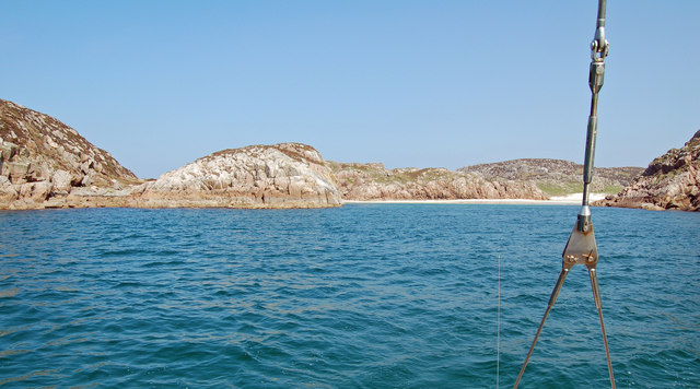
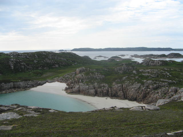
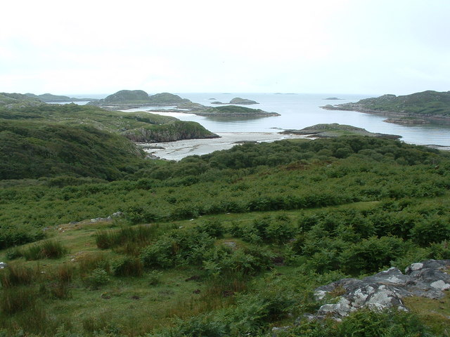
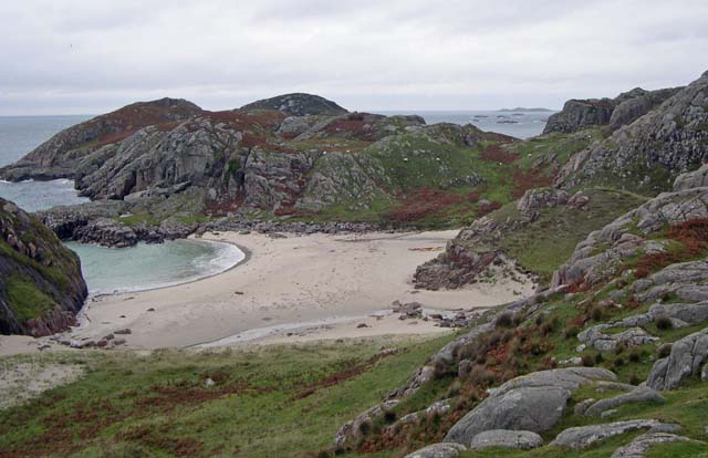
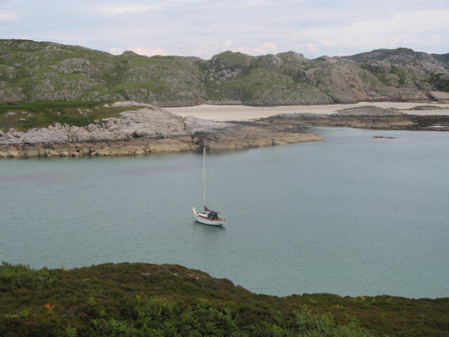
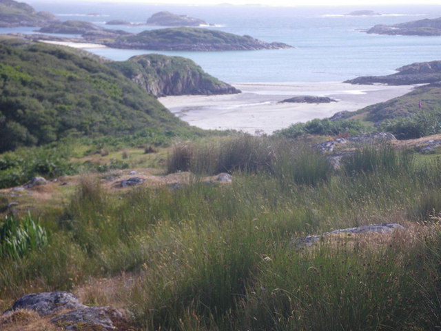
Eilean Dubh is a small island located off the west coast of Scotland, specifically in Argyllshire. It is situated in the Firth of Lorn, near the picturesque village of Oban. The island is known for its rugged and untouched natural beauty, offering breathtaking views of the surrounding landscape.

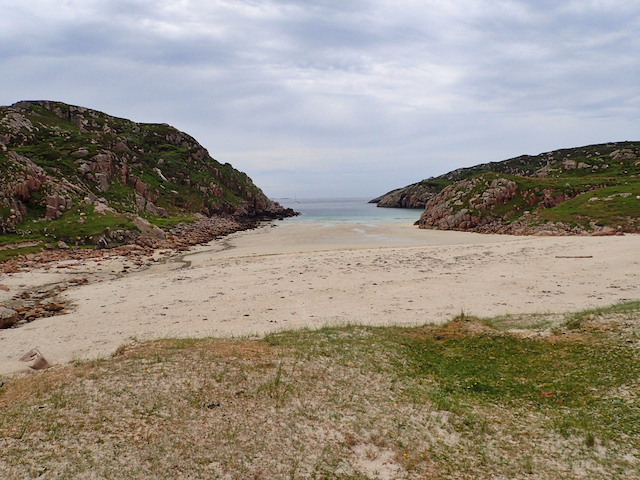
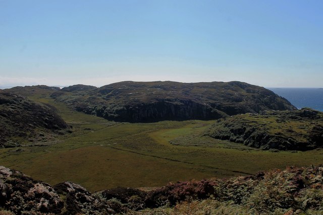
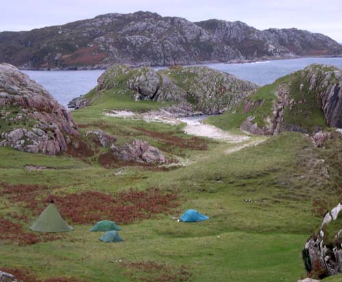
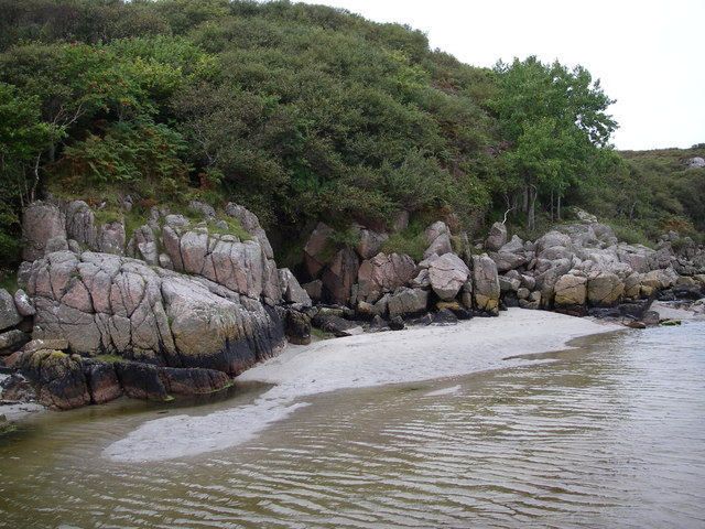
With an area of approximately 1.5 hectares, Eilean Dubh is a relatively small island characterized by rocky cliffs, heather-covered hills, and a diverse range of wildlife. The island is uninhabited and lacks any permanent structures, making it an ideal destination for nature enthusiasts seeking solitude and tranquility.

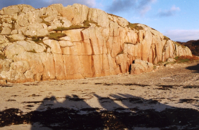
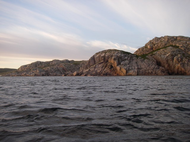
The island's name, Eilean Dubh, translates to "black island" in English, which is derived from the dark-colored rocks that dominate its coastline. These rocks, along with the dense vegetation, provide a habitat for various seabirds, including gulls, fulmars, and cormorants. Additionally, seals can often be spotted lounging on the nearby rocks or swimming in the surrounding waters.

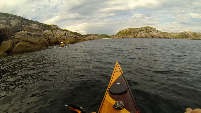
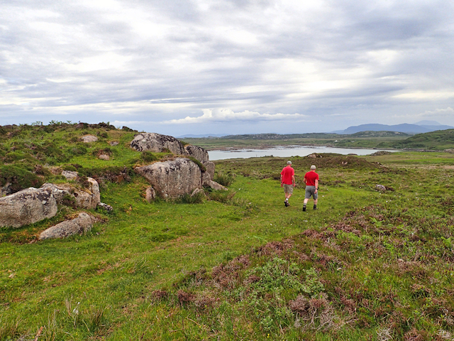
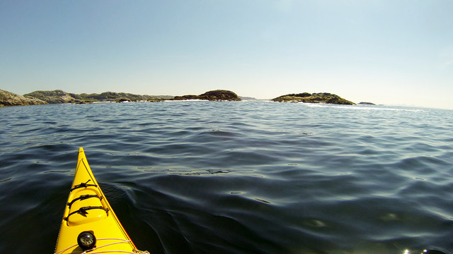
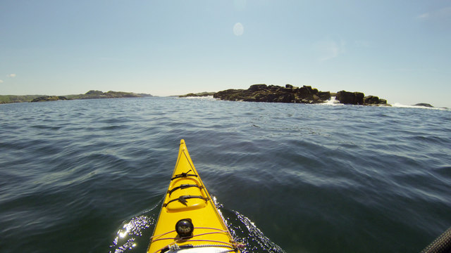
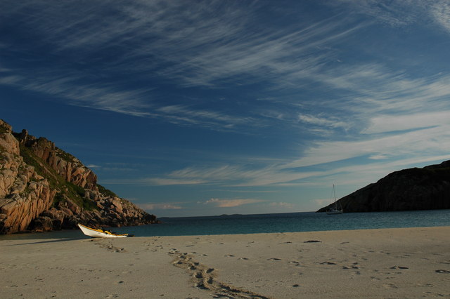
Access to Eilean Dubh is typically by boat, with several tour operators offering trips to the island. Visitors can explore the island's rugged terrain, hike along its trails, or simply enjoy the breathtaking views of the surrounding sea and mountains.

Overall, Eilean Dubh is a hidden gem in Argyllshire, offering a unique opportunity to experience the raw beauty of Scotland's west coast. Its untouched landscape and abundant wildlife make it a must-visit destination for nature lovers and those seeking a peaceful retreat.

If you have any feedback on the listing, please let us know in the comments section below.

Eilean Dubh Images

Images are sourced within 2km of 56.281658/-6.3550826 or Grid Reference NM3018. Thanks to Geograph Open Source API. All images are credited.

Heading for Traigh Gheal past Rubha Calachain Rounding the southern end of Erraid on an evening paddle, heading for Traigh Gheal - a fantastic beach with almost no plastic debris despite facing south into the weather. The jointed Ross of Mull granite, of Devonian age, intruded towards the end of the Caledonian orogeny, offers easy rock-hopping opportunities in the very minimal swell we experienced on this trip and weathers to a clean white sand in the shallower inlets like this one. Sea kayak is by far the best way to visit these isolated beaches, as crossing the island involves bog, midges and a certain amount of fighting with willow scrub, as we found when we tried to cross the area to the left of this photo to get to the top of an impressive geo we'd found from below.
Heading for Traigh Gheal past Rubha Calachain
Rounding the southern end of Erraid on an evening paddle, heading for Traigh Gheal - a fantastic beach with almost no plastic debris despite facing south into the weather. The jointed Ross of Mull granite, of Devonian age, intruded towards the end of the Caledonian orogeny, offers easy rock-hopping opportunities in the very minimal swell we experienced on this trip and weathers to a clean white sand in the shallower inlets like this one. Sea kayak is by far the best way to visit these isolated beaches, as crossing the island involves bog, midges and a certain amount of fighting with willow scrub, as we found when we tried to cross the area to the left of this photo to get to the top of an impressive geo we'd found from below.
Tràigh Gheal (Balfour's Bay) Following in the footsteps of David Balfour, the hero of Robert Louis Stevenson's Kidnapped, as he makes his way back to Edinburgh to confront his wicked uncle.

Stage 1, June 2016 from Erraid to Fishnish on the Isle of Mull.

See <span class="nowrap"><a title="http://www.stevensonway.org.uk" rel="nofollow ugc noopener" href="http://www.stevensonway.org.uk">Link</a><img style="margin-left:2px;" alt="External link" title="External link - shift click to open in new window" src="https://s1.geograph.org.uk/img/external.png" width="10" height="10"/></span>
Tràigh Gheal (Balfour's Bay)
Following in the footsteps of David Balfour, the hero of Robert Louis Stevenson's Kidnapped, as he makes his way back to Edinburgh to confront his wicked uncle. Stage 1, June 2016 from Erraid to Fishnish on the Isle of Mull. See LinkExternal link
Crossing Erraid Following in the footsteps of David Balfour, the hero of Robert Louis Stevenson's Kidnapped, as he makes his way back to Edinburgh to confront his wicked uncle.

Stage 1, June 2016 from Erraid to Fishnish on the Isle of Mull.

See <span class="nowrap"><a title="http://www.stevensonway.org.uk" rel="nofollow ugc noopener" href="http://www.stevensonway.org.uk">Link</a><img style="margin-left:2px;" alt="External link" title="External link - shift click to open in new window" src="https://s1.geograph.org.uk/img/external.png" width="10" height="10"/></span>
Crossing Erraid
Following in the footsteps of David Balfour, the hero of Robert Louis Stevenson's Kidnapped, as he makes his way back to Edinburgh to confront his wicked uncle. Stage 1, June 2016 from Erraid to Fishnish on the Isle of Mull. See LinkExternal link
Rankin's Rocks Most skerries in this part of the world seem to have gaelic names, so this pair are unusual (although there are also Livingston's Rocks a couple of kilometres further east). Perhaps the name commemorates an unfortunate incident involving a sassenach mariner ? At high tide they are the only land in this grid square, so rather than a hazard to be kept well away from, they were an obvious target for a visit. I'd love to have paddled the gap between them, but there seemed to be a reef with big breaking waves on the far side, so perhaps discretion being the better part of valour was the right choice today.
Rankin's Rocks
Most skerries in this part of the world seem to have gaelic names, so this pair are unusual (although there are also Livingston's Rocks a couple of kilometres further east). Perhaps the name commemorates an unfortunate incident involving a sassenach mariner ? At high tide they are the only land in this grid square, so rather than a hazard to be kept well away from, they were an obvious target for a visit. I'd love to have paddled the gap between them, but there seemed to be a reef with big breaking waves on the far side, so perhaps discretion being the better part of valour was the right choice today.
Unnamed skerry south of Erraid With a metre or so of swell, the waves were breaking well over the south side of this skerry as we approached. So much so that on our side, water was pouring down through a gap like a waterfall. We reckoned a plastic river boat would be the only way to paddle that, and it would require a degree of foolhardiness well in excess of that available in our group. Even landing on such a rock in a fibreglass boat would be a bit more adventure than we'd care to undertake...
Unnamed skerry south of Erraid
With a metre or so of swell, the waves were breaking well over the south side of this skerry as we approached. So much so that on our side, water was pouring down through a gap like a waterfall. We reckoned a plastic river boat would be the only way to paddle that, and it would require a degree of foolhardiness well in excess of that available in our group. Even landing on such a rock in a fibreglass boat would be a bit more adventure than we'd care to undertake...
Wet Plain on Erraid A boggy flat section between hills to the east of Balfour's Bay.
Wet Plain on Erraid
A boggy flat section between hills to the east of Balfour's Bay.
Traigh Gheal On Erraid Possibly the finest beach on the planet; pink granite, white sand and turquoise water.
Traigh Gheal On Erraid
Possibly the finest beach on the planet; pink granite, white sand and turquoise water.
Traigh Gheal On Erraid An "occasional" or "settled weather" anchorage, Traigh Gheal is a beautiful spot and an alternative to Tinker's (Fiddler's) Hole. Traigh Gheal is also known as David Balfour's Bay, from the shipwreck story in Robert Louis Stevenson's "Kidnapped".  Stevenson's family, being designers and builders of lighthouses, had a strong association with Erraid.  At the back of the bay there is a granite wall that gives reasonable bouldering and short climbs of around HS/VS standard.
Traigh Gheal On Erraid
An "occasional" or "settled weather" anchorage, Traigh Gheal is a beautiful spot and an alternative to Tinker's (Fiddler's) Hole. Traigh Gheal is also known as David Balfour's Bay, from the shipwreck story in Robert Louis Stevenson's "Kidnapped". Stevenson's family, being designers and builders of lighthouses, had a strong association with Erraid. At the back of the bay there is a granite wall that gives reasonable bouldering and short climbs of around HS/VS standard.
Traigh Gheall Beautiful white beach on Erraid
Traigh Gheall
Beautiful white beach on Erraid
Knockvologan Low winter sunshine on an outcrop of typical pink granite by the beach opposite the Isle of Erraid. <a href="https://www.geograph.org.uk/photo/2984029">NM3019 : Ross of Mull Granite</a> is a more detailed view of part of the same outcrop.
Knockvologan
Low winter sunshine on an outcrop of typical pink granite by the beach opposite the Isle of Erraid. NM3019 : Ross of Mull Granite is a more detailed view of part of the same outcrop.
View from hill at Knockvologan The foreground is Mull, the sea inlet off to the right is the channel between Mull and Erraid.
View from hill at Knockvologan
The foreground is Mull, the sea inlet off to the right is the channel between Mull and Erraid.
Retired hay baling machine In a typical farming way, the old baling machine/contraption at Knockvologan farm is left to age rather ungracefully. It is also used as a storage point for old and new fencing material.
Retired hay baling machine
In a typical farming way, the old baling machine/contraption at Knockvologan farm is left to age rather ungracefully. It is also used as a storage point for old and new fencing material.
Hunkered down on the Ross of Mull
Channel between Eilean Dubh and Ross of Mull
Maritime woodland - sound of Erraid A small but fine example of Maritime woodland on the island of Erraid.  Mostly Oak, Birch, Rowan, Aspen and Willow but also contains Heather, Honeysuckle and Bog Myrtle.
Maritime woodland - sound of Erraid
A small but fine example of Maritime woodland on the island of Erraid. Mostly Oak, Birch, Rowan, Aspen and Willow but also contains Heather, Honeysuckle and Bog Myrtle.
Ross of Mull - another perfect bay! There are countless bays like this along the Ross of Mull - havens for sea kayakers wanting to get away from it all.
Ross of Mull - another perfect bay!
There are countless bays like this along the Ross of Mull - havens for sea kayakers wanting to get away from it all.
Anchorage in Bagh a Chnoic Mhaoileanaich Taken from the slopes of Erraid looking east
Anchorage in Bagh a Chnoic Mhaoileanaich
Taken from the slopes of Erraid looking east
Rough grassland with sea cove in the distance
Show me another place!

Eilean Dubh is located at Grid Ref: NM3018 (Lat: 56.281658, Lng: -6.3550826)

Unitary Authority: Argyll and Bute

Police Authority: Argyll and West Dunbartonshire

What 3 Words

///dugouts.plugged.jeeps. Near Fionnphort, Argyll & Bute

Related Wikis

Erraid

Erraid (Scottish Gaelic: Eilean Earraid) is a tidal island approximately one mile (two kilometres) square located in the Inner Hebrides of Scotland. It...

Aridhglas

Aridhglas is a village on the Ross of Mull, Isle of Mull in Argyll and Bute, Scotland. == References ==

Sound of Iona

The Sound of Iona is a sound between the Inner Hebridean islands of Mull and Iona in western Scotland. It forms part of the Atlantic Ocean. The tidal...

Fionnphort

Fionnphort (English: , Scottish Gaelic: [ˈfjun̪ˠafɔrˠt̪]) is the principal port of the Ross of Mull, and the second largest settlement in the area (its...

Nearby Amenities

Located within 500m of 56.281658,-6.3550826
Source: PGS
Lat/Long: 56.2815037/-6.3596548
Source: PGS
Lat/Long: 56.2813421/-6.3601573
Created By: dmgroom_coastlines
Source: PGS
Lat/Long: 56.2814/-6.36035
Created By: dmgroom_coastlines
Source: PGS
Lat/Long: 56.28128/-6.36082
Created By: dmgroom_coastlines
Source: PGS
Lat/Long: 56.2818/-6.36101
Source: PGS
Lat/Long: 56.2822178/-6.3604365
Created By: dmgroom_coastlines
Source: PGS
Lat/Long: 56.28242/-6.36028
Created By: dmgroom_coastlines
Source: PGS
Lat/Long: 56.28267/-6.3598
Source: PGS
Lat/Long: 56.2821702/-6.3584431
Source: PGS
Lat/Long: 56.2817658/-6.3583487
Source: PGS
Lat/Long: 56.281632/-6.3586916
Source: PGS
Lat/Long: 56.2817003/-6.3594096
Source: PGS
Lat/Long: 56.279932/-6.3574303
Created By: dmgroom_coastlines
Source: PGS
Lat/Long: 56.28019/-6.35767
Source: PGS
Lat/Long: 56.2803822/-6.3579023
Source: PGS
Lat/Long: 56.2806419/-6.3577586
Source: PGS
Lat/Long: 56.2810167/-6.3578337
Source: PGS
Lat/Long: 56.2813049/-6.3577102
Source: PGS
Lat/Long: 56.2813828/-6.3574957
Source: PGS
Lat/Long: 56.2816128/-6.3571765
Source: PGS
Lat/Long: 56.2818113/-6.3570842
Source: PGS
Lat/Long: 56.2819814/-6.3572919
Source: PGS
Lat/Long: 56.2821878/-6.3572394
Source: PGS
Lat/Long: 56.2825681/-6.3569041
Source: PGS
Lat/Long: 56.2828886/-6.3566788
Source: PGS
Lat/Long: 56.2833237/-6.3556777
Source: PGS
Lat/Long: 56.2832826/-6.3551033
Source: PGS
Lat/Long: 56.2834815/-6.3550686
Source: PGS
Lat/Long: 56.2835567/-6.3548054
Created By: dmgroom_coastlines
Source: PGS
Lat/Long: 56.28332/-6.35423
Source: PGS
Lat/Long: 56.2829837/-6.3528693
Created By: dmgroom_coastlines
Source: PGS
Lat/Long: 56.2829/-6.35265
Source: PGS
Lat/Long: 56.281413/-6.3520745
Created By: dmgroom_coastlines
Source: PGS
Lat/Long: 56.2811/-6.35231
Created By: dmgroom_coastlines
Source: PGS
Lat/Long: 56.28098/-6.35255
Source: PGS
Lat/Long: 56.280813/-6.3529756
Source: PGS
Lat/Long: 56.2805263/-6.3532713
Source: PGS
Lat/Long: 56.2801937/-6.3537798
Source: PGS
Lat/Long: 56.280047/-6.3541214
Source: PGS
Lat/Long: 56.2800781/-6.35446
Source: PGS
Lat/Long: 56.2802692/-6.3547262
Source: PGS
Lat/Long: 56.279973/-6.3550129
Created By: dmgroom_coastlines
Source: PGS
Lat/Long: 56.27977/-6.35586
Created By: dmgroom_coastlines
Source: PGS
Lat/Long: 56.27978/-6.35633
Created By: dmgroom_coastlines
Source: PGS
Lat/Long: 56.27978/-6.35678
Created By: dmgroom_coastlines
Source: PGS
Lat/Long: 56.28112/-6.34748
Created By: dmgroom_coastlines
Source: PGS
Lat/Long: 56.28113/-6.34794
Created By: dmgroom_coastlines
Source: PGS
Lat/Long: 56.28127/-6.34816
Created By: dmgroom_coastlines
Source: PGS
Lat/Long: 56.2814/-6.34838
Created By: dmgroom_coastlines
Source: PGS
Lat/Long: 56.28156/-6.34975
Created By: dmgroom_coastlines
Source: PGS
Lat/Long: 56.28232/-6.34947
Created By: dmgroom_coastlines
Source: PGS
Lat/Long: 56.28283/-6.3492
Created By: dmgroom_coastlines
Source: PGS
Lat/Long: 56.28285/-6.35012
Created By: dmgroom_coastlines
Source: PGS
Lat/Long: 56.28336/-6.35031
Created By: dmgroom_coastlines
Source: PGS
Lat/Long: 56.28363/-6.35053
Created By: dmgroom_coastlines
Source: PGS
Lat/Long: 56.2836/-6.34961
Created By: dmgroom_coastlines
Source: PGS
Lat/Long: 56.28385/-6.34936
Created By: dmgroom_coastlines
Source: PGS
Lat/Long: 56.28411/-6.34934
Source: PGS
Lat/Long: 56.2841939/-6.349448
Source: PGS
Lat/Long: 56.2843571/-6.3496121
Source: PGS
Lat/Long: 56.2846215/-6.3496658
Source: PGS
Lat/Long: 56.2848865/-6.349758
Source: PGS
Lat/Long: 56.2859501/-6.3531152
Source: PGS
Lat/Long: 56.2859799/-6.3534049
The data included in this document is from www.openstreetmap.org. The data is made available under ODbL.

Have you been to Eilean Dubh?

Leave your review of Eilean Dubh below (or comments, questions and feedback).