Sgeirean Buidhe Ghil

Island in Argyllshire

Scotland

Sgeirean Buidhe Ghil

Moorland beside unsurfaced road to RSPB reserve A minor road crosses the peninsula of The Oa eventually becoming unsurfaced and presumably unadopted. It reaches the RSPB reserve after a kilometre or so of rough motoring.
Moorland beside unsurfaced road to RSPB reserve Credit: Trevor Littlewood

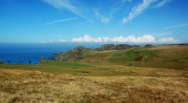
Sgeirean Buidhe Ghil, located in Argyllshire, is a small island situated off the western coast of Scotland. With a total area of approximately 0.5 square kilometers, the island is known for its stunning natural beauty and rich biodiversity.

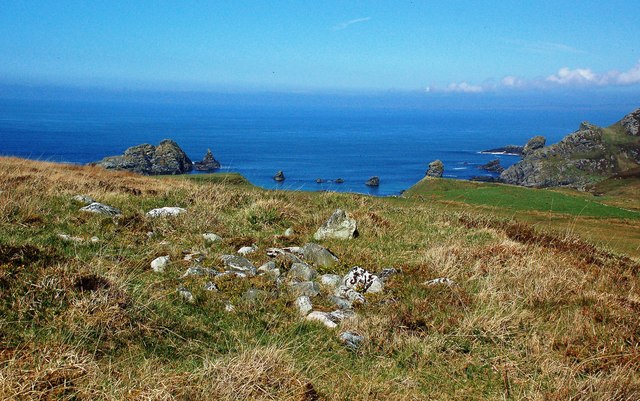
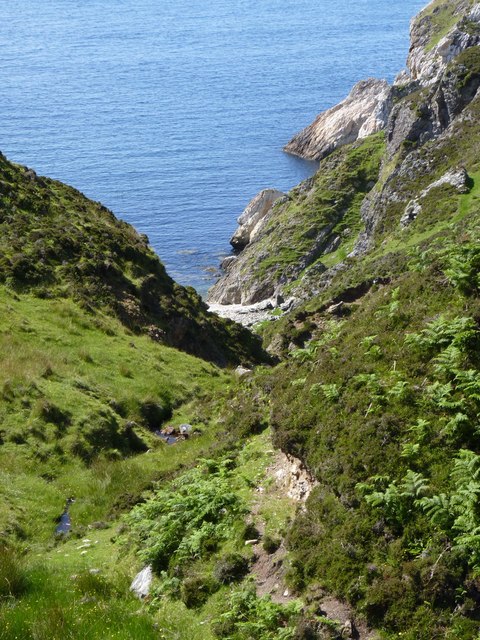
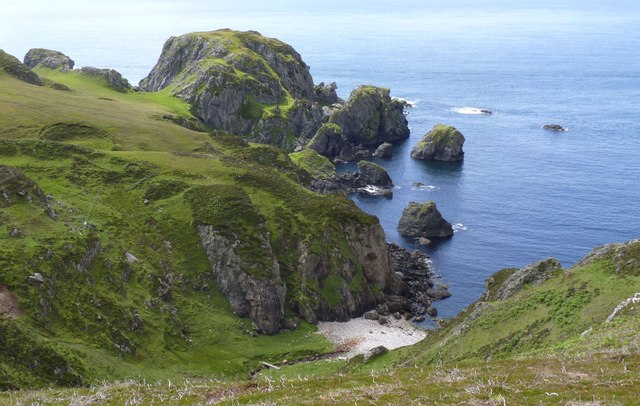
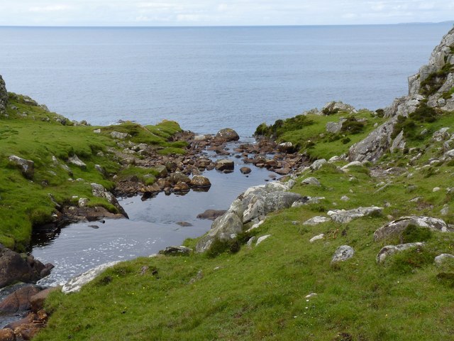
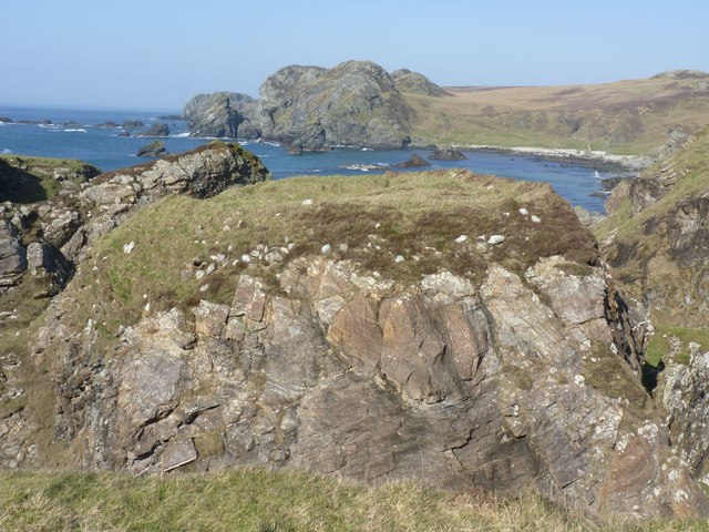
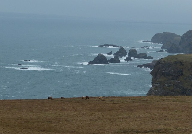
The island's name, Sgeirean Buidhe Ghil, translates to "yellow-white skerries" in English, which accurately describes the landscape. The island is characterized by its rocky shores and numerous skerries, which are small rocky islets that dot the surrounding waters. These skerries provide a safe haven for a wide variety of seabirds, making the island a popular destination for birdwatching enthusiasts.

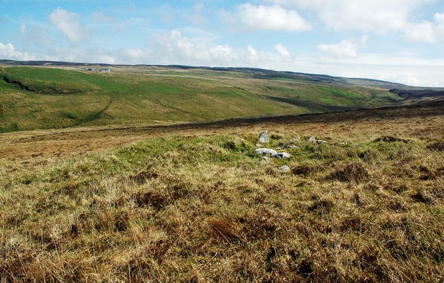
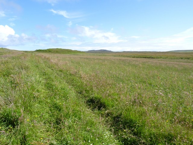
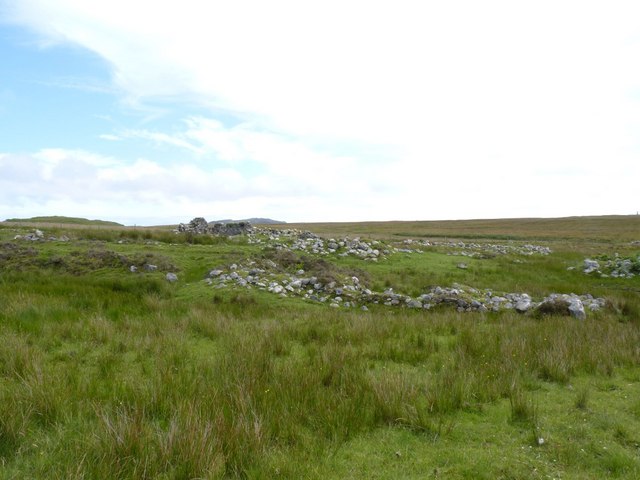
In addition to its avian inhabitants, Sgeirean Buidhe Ghil is also home to a diverse range of plant and animal species. The island's vegetation consists mainly of hardy grasses and mosses, which thrive in the rugged environment. Seals can often be spotted lounging on the rocky shores, while otters can occasionally be seen playing in the surrounding waters.

Due to its remote location and lack of human habitation, Sgeirean Buidhe Ghil remains largely untouched by human activity. Visitors to the island can expect a tranquil and unspoiled environment, perfect for those seeking solitude and a chance to connect with nature.

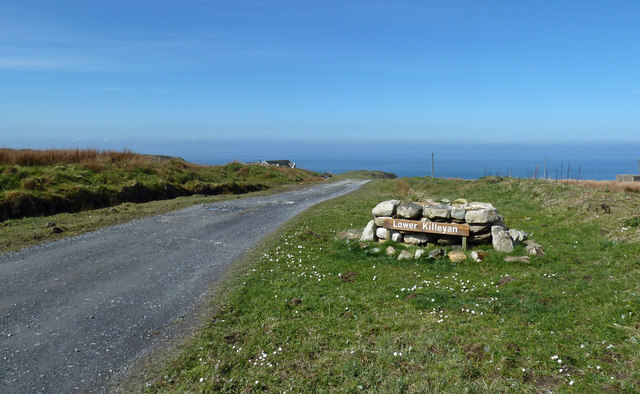
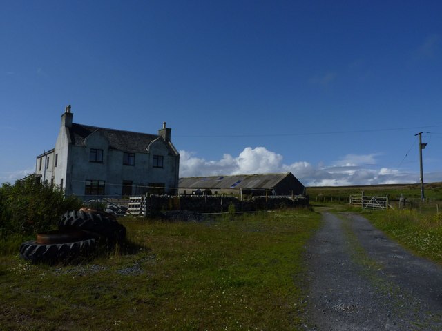
Access to Sgeirean Buidhe Ghil is primarily by private boat or chartered tour, as there are no regular ferry services to the island. Visitors should note that there are no facilities or accommodations on the island, so it is advisable to come prepared with food, water, and appropriate outdoor gear.

Overall, Sgeirean Buidhe Ghil offers a unique and pristine island experience, allowing visitors to immerse themselves in the beauty of Scotland's wild and rugged coastal landscapes.

If you have any feedback on the listing, please let us know in the comments section below.

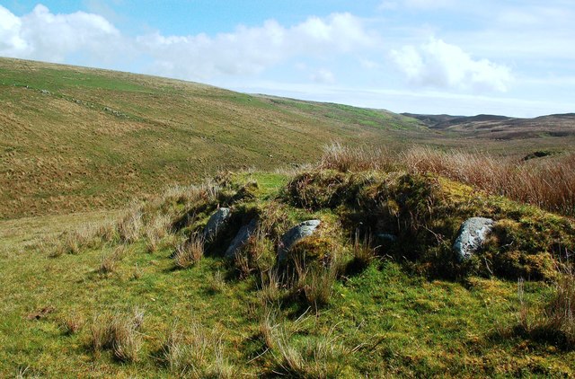
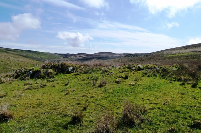
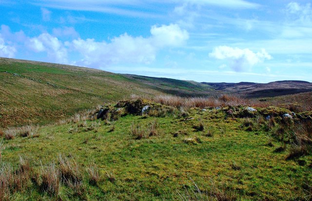
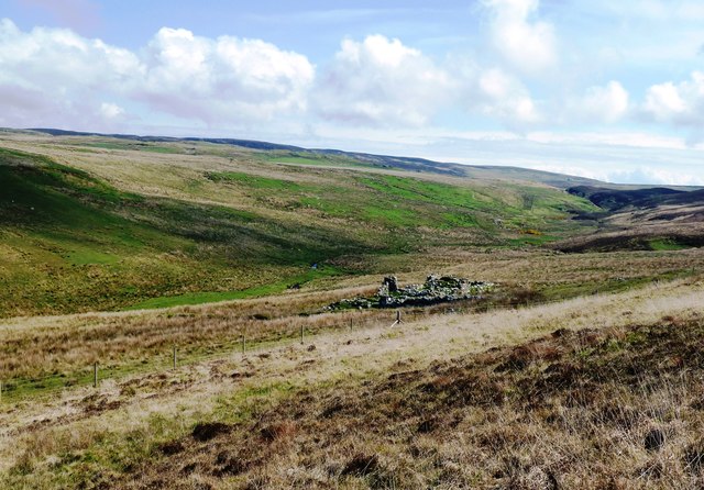
Sgeirean Buidhe Ghil Images

Images are sourced within 2km of 55.613798/-6.3356708 or Grid Reference NR2744. Thanks to Geograph Open Source API. All images are credited.

Moorland beside unsurfaced road to RSPB reserve A minor road crosses the peninsula of The Oa eventually becoming unsurfaced and presumably unadopted. It reaches the RSPB reserve after a kilometre or so of rough motoring.
Moorland beside unsurfaced road to RSPB reserve
A minor road crosses the peninsula of The Oa eventually becoming unsurfaced and presumably unadopted. It reaches the RSPB reserve after a kilometre or so of rough motoring.
Low hill on rough grazing from path to American Monument A path runs from the RSPB reserve at The Oa to the American Monument passing the low hill at the centre of the image on its south side.
Low hill on rough grazing from path to American Monument
A path runs from the RSPB reserve at The Oa to the American Monument passing the low hill at the centre of the image on its south side.
Cill Eathain The site near Killeyan lies on a natural terrace on the south bank of Abhainn Ghil. The roughly circular site enclosed by low turfed stony mounds contains the ruin of a medieval chapel.
Cill Eathain
The site near Killeyan lies on a natural terrace on the south bank of Abhainn Ghil. The roughly circular site enclosed by low turfed stony mounds contains the ruin of a medieval chapel.
Cill Eathain Chapel Site The site near Killeyan lies on a natural terrace on the south bank of Abhainn Ghil. The roughly circular site enclosed by low turfed stony mounds contains the ruin of a medieval chapel. It may also have been used as a burial ground. The Explorer Map shows it as a chapel and uses two small circles to indicate its location.
There’s another collection of stones nearby which might be related to Cill Eathain.
Cill Eathain Chapel Site
The site near Killeyan lies on a natural terrace on the south bank of Abhainn Ghil. The roughly circular site enclosed by low turfed stony mounds contains the ruin of a medieval chapel. It may also have been used as a burial ground. The Explorer Map shows it as a chapel and uses two small circles to indicate its location. There’s another collection of stones nearby which might be related to Cill Eathain.
At Cill Eathain The site near Killeyan lies on a natural terrace on the south bank of Abhainn Ghil. The roughly circular site enclosed by low turfed stony mounds contains the ruin of a medieval chapel from the 8th century. It may also have been used as a burial ground. The Explorer Map shows it as a chapel and uses two small circles to indicate its location.
Moorland sites like this are not always easy to find.
At Cill Eathain
The site near Killeyan lies on a natural terrace on the south bank of Abhainn Ghil. The roughly circular site enclosed by low turfed stony mounds contains the ruin of a medieval chapel from the 8th century. It may also have been used as a burial ground. The Explorer Map shows it as a chapel and uses two small circles to indicate its location. Moorland sites like this are not always easy to find.
Leacann Ruin The abandoned farm building at Leacann near Lower Killeyan.
Leacann Ruin
The abandoned farm building at Leacann near Lower Killeyan.
Killeyan Coastal View Looking over the moorland at Lower Killeyan towards its spectacular rocky coast.
Killeyan Coastal View
Looking over the moorland at Lower Killeyan towards its spectacular rocky coast.
From The Cairn Site At Lower Killeyan The rocky shore at Lower Killeyan viewed from a potentially interesting collection of stones on the moorland. The pile of stones could be a cairn related to the 8th century Cill Eathain chapel site nearby.
From The Cairn Site At Lower Killeyan
The rocky shore at Lower Killeyan viewed from a potentially interesting collection of stones on the moorland. The pile of stones could be a cairn related to the 8th century Cill Eathain chapel site nearby.
Moorland Cairn At Lower Killeyan This collection of stones lies near the medieval chapel site of Cill Eathain - see <a href="https://www.geograph.org.uk/photo/6151273">NR2743 : Cill Eathain Chapel Site</a> It's not possible to tell if the two sites are related to each other.
Moorland Cairn At Lower Killeyan
This collection of stones lies near the medieval chapel site of Cill Eathain - see NR2743 : Cill Eathain Chapel Site It's not possible to tell if the two sites are related to each other.
At Lower Killeyan Visitors are asked to park here as space further on is very limited. The name Killeyan has been Anglicised from the Gaelic Cill Eathain, which refers to a medieval chapel and a burial ground - see <a href="https://www.geograph.org.uk/photo/6151286">NR2743 : At Cill Eathain</a>
At Lower Killeyan
Visitors are asked to park here as space further on is very limited. The name Killeyan has been Anglicised from the Gaelic Cill Eathain, which refers to a medieval chapel and a burial ground - see NR2743 : At Cill Eathain
Giol Farm, The Oa, Islay
Field  near Giol Farm, The Oa, Islay
Field near Giol Farm, The Oa, Islay
Ruin near Giol Farm, Islay
Alt Traighe Leacail A tiny burn running down to a beach on the Oa peninsula, Islay
Alt Traighe Leacail
A tiny burn running down to a beach on the Oa peninsula, Islay
Dun Mor Ghil, The Oa, Islay An ancient fort on the Oa peninsula, Islay
Dun Mor Ghil, The Oa, Islay
An ancient fort on the Oa peninsula, Islay
Abhainn Alt Astail The Astle River/Burn on the Oa Peninsula, Islay - where it drops into the sea.
Abhainn Alt Astail
The Astle River/Burn on the Oa Peninsula, Islay - where it drops into the sea.
Possible Dun at Lower Killeyan, Islay This is described by Scotland's Places as a possible dun - see <span class="nowrap"><a title="http://www.scotlandsplaces.gov.uk/search_item/index.php?service=RCAHMS&id=37284&refer=L3NlYXJjaC9pbmRleC5waHA%2FYWN0aW9uPWRvX3NlYXJjaCZwX3R5cGU9Y29vcmRpbmF0ZXMmcF9uYW1lPU5hdGlvbmFsK0dyaWQrbnIyNzM0MzMmcF9uZ3JfeD0xMjczMDAmcF9uZ3JfeT02NDMzMDAmcF9leHRlbnR2YWx1ZT01MDAmaWRbXT05MzM%3D" rel="nofollow ugc noopener" href="http://www.scotlandsplaces.gov.uk/search_item/index.php?service=RCAHMS&id=37284&refer=L3NlYXJjaC9pbmRleC5waHA%2FYWN0aW9uPWRvX3NlYXJjaCZwX3R5cGU9Y29vcmRpbmF0ZXMmcF9uYW1lPU5hdGlvbmFsK0dyaWQrbnIyNzM0MzMmcF9uZ3JfeD0xMjczMDAmcF9uZ3JfeT02NDMzMDAmcF9leHRlbnR2YWx1ZT01MDAmaWRbXT05MzM%3D">Link</a><img style="margin-left:2px;" alt="External link" title="External link - shift click to open in new window" src="https://s1.geograph.org.uk/img/external.png" width="10" height="10"/></span>
Possible Dun at Lower Killeyan, Islay
This is described by Scotland's Places as a possible dun - see LinkExternal link
Rocks, islets and skerries off the Mull of Oa Dozens of jagged rocks and tiny islets litter the western coast of the Mull of Oa as seen from near <a href="https://www.geograph.org.uk/photo/3932270">NR2741 : The American Monument</a>
Rocks, islets and skerries off the Mull of Oa
Dozens of jagged rocks and tiny islets litter the western coast of the Mull of Oa as seen from near NR2741 : The American Monument
Show me another place!

Sgeirean Buidhe Ghil is located at Grid Ref: NR2744 (Lat: 55.613798, Lng: -6.3356708)

Unitary Authority: Argyll and Bute

Police Authority: Argyll and West Dunbartonshire

What 3 Words

///empire.tricycle.wove. Near Port Ellen, Argyll & Bute

Related Wikis

Eas Mòr, lower

Eas Mor (lower) is a waterfall on the Abhainn Ghil on the island of Islay, in Scotland. It lies on the west coast of The Oa peninsula north of Lower Killeyan...

Eas Mòr, upper

Eas Mor is a waterfall is a waterfall on the Abhainn Ghil on the island of Islay in Scotland. It lies on The Oa peninsula south of Giol and west of Lenavore...

The Oa

The Oa ( OH) (Scottish Gaelic: An Obha) is a rocky peninsula in the southwest of the island of Islay, in Argyll, Scotland. It is an RSPB nature reserve...

Machrie golf course

The Machrie Golf Course, or "The Machrie Links", is located on Islay, in Scotland. The word "machrie" is a corruption of the Scottish Gaelic machair, which...

Have you been to Sgeirean Buidhe Ghil?

Leave your review of Sgeirean Buidhe Ghil below (or comments, questions and feedback).