An Librig

Coastal Feature, Headland, Point in Argyllshire

Scotland

An Librig

Moorland beside unsurfaced road to RSPB reserve A minor road crosses the peninsula of The Oa eventually becoming unsurfaced and presumably unadopted. It reaches the RSPB reserve after a kilometre or so of rough motoring.
Moorland beside unsurfaced road to RSPB reserve Credit: Trevor Littlewood

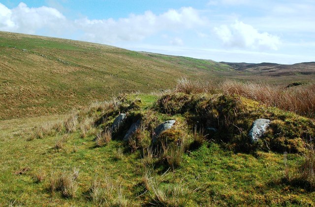
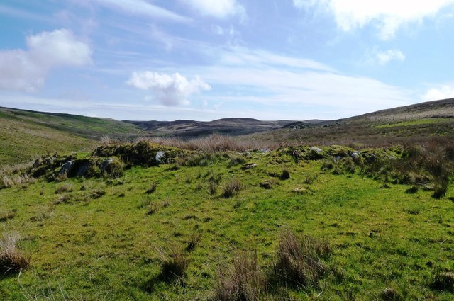
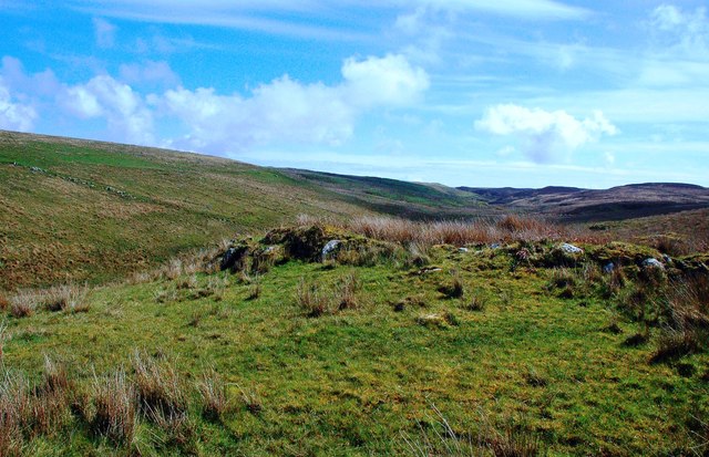
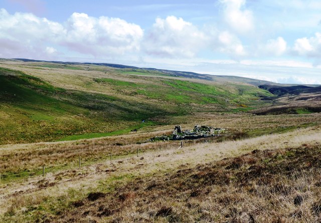
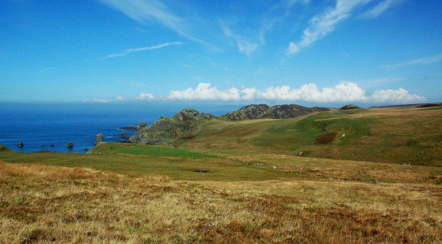
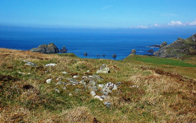
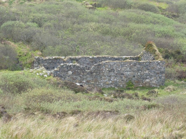
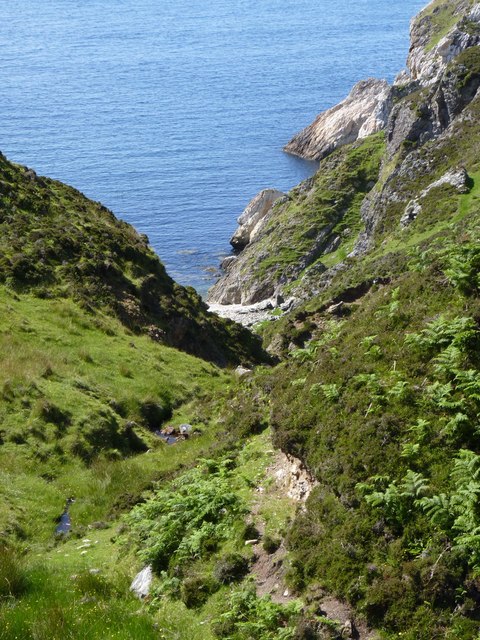
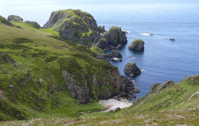
An Librig is a prominent coastal feature located in Argyllshire, Scotland. It is a headland that stretches out into the Atlantic Ocean, forming a distinctive point along the rugged coastline. The headland is comprised of steep cliffs that rise up from the sea, providing breathtaking views of the surrounding landscape.

At approximately 200 meters in height, An Librig stands as a commanding presence in the area, offering a vantage point for observing the vast expanse of the ocean. The rugged terrain and rocky shoreline add to its dramatic beauty, attracting visitors and nature enthusiasts from far and wide.

The headland is known for its diverse wildlife, with numerous seabirds nesting along the cliffs, including puffins, guillemots, and kittiwakes. It is also a popular spot for birdwatching, as migratory species can often be spotted passing through the area during certain times of the year.

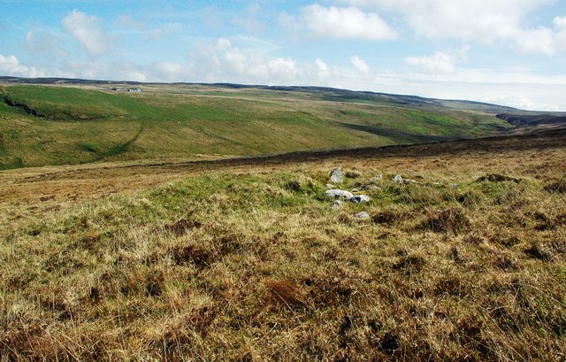
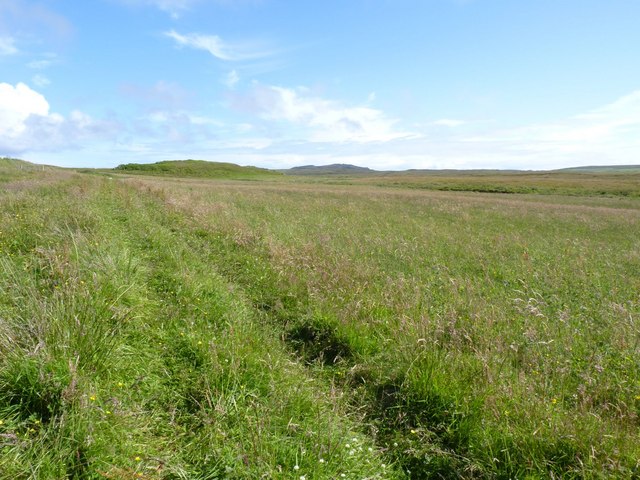
An Librig is easily accessible by foot, with several walking trails leading to the headland. These trails offer a chance to explore the surrounding coastal vegetation, which includes a variety of grasses, wildflowers, and shrubs adapted to the harsh conditions of the coastal environment.

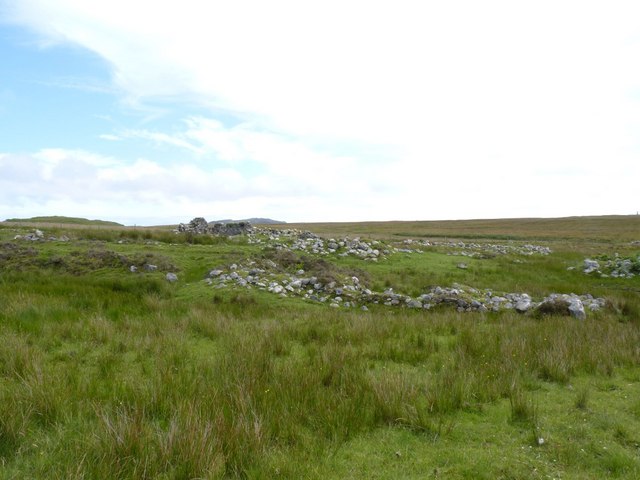
The area surrounding An Librig is rich in history, with archaeological sites dating back thousands of years. Ancient ruins and standing stones can be found in the vicinity, providing a glimpse into the area's past.

Overall, An Librig is a captivating coastal feature that showcases the natural beauty and rich history of Argyllshire. Its dramatic cliffs, diverse wildlife, and stunning views make it a must-visit destination for anyone exploring the Scottish coastline.

If you have any feedback on the listing, please let us know in the comments section below.
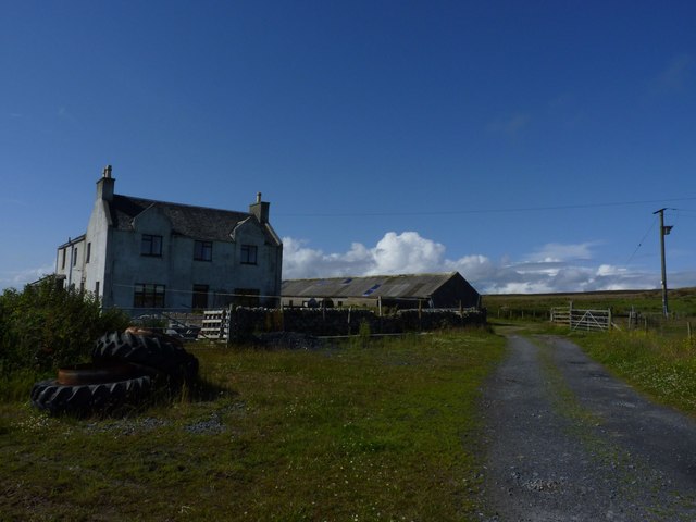
An Librig Images

Images are sourced within 2km of 55.614831/-6.3318756 or Grid Reference NR2744. Thanks to Geograph Open Source API. All images are credited.

Moorland beside unsurfaced road to RSPB reserve A minor road crosses the peninsula of The Oa eventually becoming unsurfaced and presumably unadopted. It reaches the RSPB reserve after a kilometre or so of rough motoring.
Moorland beside unsurfaced road to RSPB reserve
A minor road crosses the peninsula of The Oa eventually becoming unsurfaced and presumably unadopted. It reaches the RSPB reserve after a kilometre or so of rough motoring.
Low hill on rough grazing from path to American Monument A path runs from the RSPB reserve at The Oa to the American Monument passing the low hill at the centre of the image on its south side.
Low hill on rough grazing from path to American Monument
A path runs from the RSPB reserve at The Oa to the American Monument passing the low hill at the centre of the image on its south side.
Cill Eathain The site near Killeyan lies on a natural terrace on the south bank of Abhainn Ghil. The roughly circular site enclosed by low turfed stony mounds contains the ruin of a medieval chapel.
Cill Eathain
The site near Killeyan lies on a natural terrace on the south bank of Abhainn Ghil. The roughly circular site enclosed by low turfed stony mounds contains the ruin of a medieval chapel.
Cill Eathain Chapel Site The site near Killeyan lies on a natural terrace on the south bank of Abhainn Ghil. The roughly circular site enclosed by low turfed stony mounds contains the ruin of a medieval chapel. It may also have been used as a burial ground. The Explorer Map shows it as a chapel and uses two small circles to indicate its location.
There’s another collection of stones nearby which might be related to Cill Eathain.
Cill Eathain Chapel Site
The site near Killeyan lies on a natural terrace on the south bank of Abhainn Ghil. The roughly circular site enclosed by low turfed stony mounds contains the ruin of a medieval chapel. It may also have been used as a burial ground. The Explorer Map shows it as a chapel and uses two small circles to indicate its location. There’s another collection of stones nearby which might be related to Cill Eathain.
At Cill Eathain The site near Killeyan lies on a natural terrace on the south bank of Abhainn Ghil. The roughly circular site enclosed by low turfed stony mounds contains the ruin of a medieval chapel from the 8th century. It may also have been used as a burial ground. The Explorer Map shows it as a chapel and uses two small circles to indicate its location.
Moorland sites like this are not always easy to find.
At Cill Eathain
The site near Killeyan lies on a natural terrace on the south bank of Abhainn Ghil. The roughly circular site enclosed by low turfed stony mounds contains the ruin of a medieval chapel from the 8th century. It may also have been used as a burial ground. The Explorer Map shows it as a chapel and uses two small circles to indicate its location. Moorland sites like this are not always easy to find.
Leacann Ruin The abandoned farm building at Leacann near Lower Killeyan.
Leacann Ruin
The abandoned farm building at Leacann near Lower Killeyan.
Killeyan Coastal View Looking over the moorland at Lower Killeyan towards its spectacular rocky coast.
Killeyan Coastal View
Looking over the moorland at Lower Killeyan towards its spectacular rocky coast.
From The Cairn Site At Lower Killeyan The rocky shore at Lower Killeyan viewed from a potentially interesting collection of stones on the moorland. The pile of stones could be a cairn related to the 8th century Cill Eathain chapel site nearby.
From The Cairn Site At Lower Killeyan
The rocky shore at Lower Killeyan viewed from a potentially interesting collection of stones on the moorland. The pile of stones could be a cairn related to the 8th century Cill Eathain chapel site nearby.
Moorland Cairn At Lower Killeyan This collection of stones lies near the medieval chapel site of Cill Eathain - see <a href="https://www.geograph.org.uk/photo/6151273">NR2743 : Cill Eathain Chapel Site</a> It's not possible to tell if the two sites are related to each other.
Moorland Cairn At Lower Killeyan
This collection of stones lies near the medieval chapel site of Cill Eathain - see NR2743 : Cill Eathain Chapel Site It's not possible to tell if the two sites are related to each other.
At Lower Killeyan Visitors are asked to park here as space further on is very limited. The name Killeyan has been Anglicised from the Gaelic Cill Eathain, which refers to a medieval chapel and a burial ground - see <a href="https://www.geograph.org.uk/photo/6151286">NR2743 : At Cill Eathain</a>
At Lower Killeyan
Visitors are asked to park here as space further on is very limited. The name Killeyan has been Anglicised from the Gaelic Cill Eathain, which refers to a medieval chapel and a burial ground - see NR2743 : At Cill Eathain
Moorland Road On The Oa This lonely road gives access to farms at Killeyan on the island of Islay.
Moorland Road On The Oa
This lonely road gives access to farms at Killeyan on the island of Islay.
Oa Moorland Moorland on the Oa viewed at the beginning of May.
Oa Moorland
Moorland on the Oa viewed at the beginning of May.
Watermill, Glenastle, Islay There are many ruined villages and buildings on the Oa peninsula in south-west Islay. The population of this part of the island in 1830 was around 1500 - there's probably about a tenth of that number now! It is a very poignant experience to wander round this lonely, but beautiful, peninsula and think of times past and yet see the current living world all around which hasn't changed for centuries.
Watermill, Glenastle, Islay
There are many ruined villages and buildings on the Oa peninsula in south-west Islay. The population of this part of the island in 1830 was around 1500 - there's probably about a tenth of that number now! It is a very poignant experience to wander round this lonely, but beautiful, peninsula and think of times past and yet see the current living world all around which hasn't changed for centuries.
Giol Farm, The Oa, Islay
Field  near Giol Farm, The Oa, Islay
Field near Giol Farm, The Oa, Islay
Ruin near Giol Farm, Islay
Alt Traighe Leacail A tiny burn running down to a beach on the Oa peninsula, Islay
Alt Traighe Leacail
A tiny burn running down to a beach on the Oa peninsula, Islay
Dun Mor Ghil, The Oa, Islay An ancient fort on the Oa peninsula, Islay
Dun Mor Ghil, The Oa, Islay
An ancient fort on the Oa peninsula, Islay
Show me another place!

An Librig is located at Grid Ref: NR2744 (Lat: 55.614831, Lng: -6.3318756)

Unitary Authority: Argyll and Bute

Police Authority: Argyll and West Dunbartonshire

What 3 Words

///battling.pets.sculpting. Near Port Ellen, Argyll & Bute

Related Wikis

Eas Mòr, lower

Eas Mor (lower) is a waterfall on the Abhainn Ghil on the island of Islay, in Scotland. It lies on the west coast of The Oa peninsula north of Lower Killeyan...

Eas Mòr, upper

Eas Mor is a waterfall is a waterfall on the Abhainn Ghil on the island of Islay in Scotland. It lies on The Oa peninsula south of Giol and west of Lenavore...

The Oa

The Oa ( OH) (Scottish Gaelic: An Obha) is a rocky peninsula in the southwest of the island of Islay, in Argyll, Scotland. It is an RSPB nature reserve...

Machrie golf course

The Machrie Golf Course, or "The Machrie Links", is located on Islay, in Scotland. The word "machrie" is a corruption of the Scottish Gaelic machair, which...

Port Ellen distillery

Port Ellen distillery is located in Port Ellen on the isle of Islay, Scotland. It initially operated between 1825 and 1983 when production shut down....

Islay Airport

Islay Airport (IATA: ILY, ICAO: EGPI) (also known as Glenegedale Airport) (Scottish Gaelic: Port-adhair Ìle) is located 4.5 nautical miles (8.3 kilometres...

St John's Church, Port Ellen

St John's Church, Port Ellen is a Category B listed building in Port Ellen, Islay, Argyll and Bute, Scotland. == History == The memorial stone for the...

River Laggan

The River Laggan is a small river on the Scottish island of Islay. Having gathered the waters of the Kilennan River, Barr River and Duich River / Torra...

Have you been to An Librig?

Leave your review of An Librig below (or comments, questions and feedback).