Ìosaigh

Island in Inverness-shire

Scotland

Ìosaigh

Coral Beach and Cnoc Mòr a' Ghrobain
Coral Beach and Cnoc Mòr a' Ghrobain Credit: Sandy Gerrard

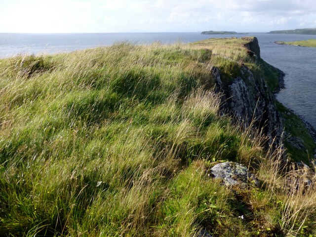
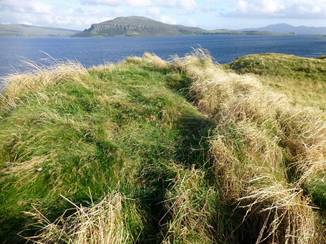
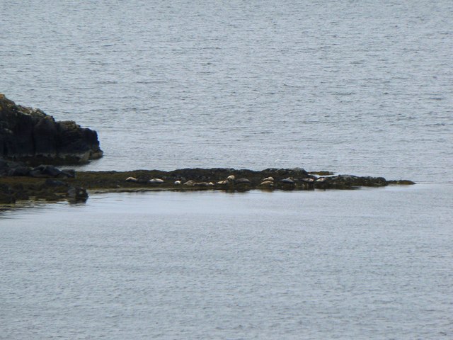
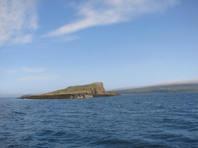
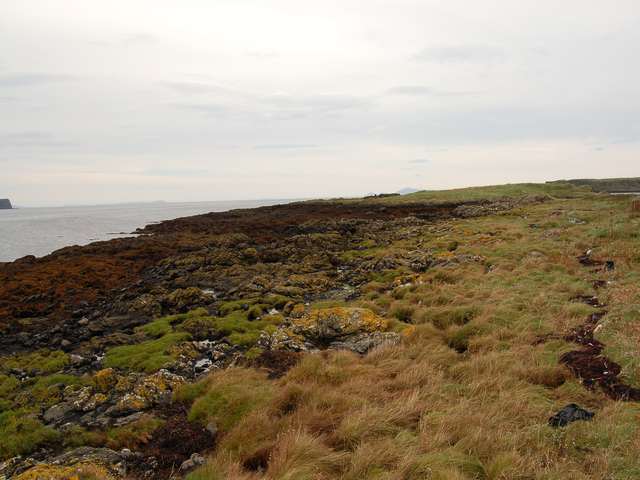
Ìosaigh is a small island located in Inverness-shire, Scotland. It is situated in the Inner Hebrides, off the west coast of the mainland. The island is known for its rugged and beautiful landscape, with rocky cliffs, sandy beaches, and rolling hills.

The main settlement on Ìosaigh is a small village called Port Mor, which is home to a few hundred residents. The village has a school, a church, and a few shops and cafes for the convenience of its inhabitants. Most of the island's economy is based on fishing and tourism, with visitors coming to enjoy the island's natural beauty and peaceful atmosphere.

Ìosaigh is also known for its rich history, with several ancient ruins and archaeological sites scattered across the island. Visitors can explore old stone circles, burial mounds, and the ruins of an ancient monastery, providing a glimpse into the island's past.

Overall, Ìosaigh is a quiet and picturesque island, perfect for those looking to escape the hustle and bustle of modern life and immerse themselves in nature and history.

If you have any feedback on the listing, please let us know in the comments section below.

Ìosaigh Images

Images are sourced within 2km of 57.518754/-6.6459014 or Grid Reference NG2157. Thanks to Geograph Open Source API. All images are credited.

Coral Beach and Cnoc Mòr a' Ghrobain
Sgeir nam Biast A good resting point for birds and seals, but too low for anything to breed.
Sgeir nam Biast
A good resting point for birds and seals, but too low for anything to breed.
Archipelago in Loch Dunvegan Taken from the Trumpan road above Ardmore Bay. View over Loch Bay to the Isles of Clett, Mingay and Isay beneath heavy clouds.
Archipelago in Loch Dunvegan
Taken from the Trumpan road above Ardmore Bay. View over Loch Bay to the Isles of Clett, Mingay and Isay beneath heavy clouds.
Skye's Coral Beach Most of the beach is made not of coral, but of maerl.
Skye's Coral Beach
Most of the beach is made not of coral, but of maerl.
Iosaigh Island from the south
Iosaigh Island Summit Chartered a boat from Stein on a beautiful sunny afternoon to bag this tussocky grassy summit.
Name: Iosaigh
Hill number: 10555
Height: 31m / 102ft
Parent (Ma/M): none
Area: 17A: North Skye and Raasay
Class: 0
Grid ref: NG218568 (est)
Drop: 31m
Col: Sea
Iosaigh Island Summit
Chartered a boat from Stein on a beautiful sunny afternoon to bag this tussocky grassy summit. Name: Iosaigh Hill number: 10555 Height: 31m / 102ft Parent (Ma/M): none Area: 17A: North Skye and Raasay Class: 0 Grid ref: NG218568 (est) Drop: 31m Col: Sea
Isay House In the 16th century the main house on the island was inhabited by the MacLeods of Lewis, and it was here that Roderick Macleod of Lewis implemented his plan to ensure that his grandson would inherit Raasay and the lands of Gairloch. He convened the two powerful families of the time at Isay house for a banquet which he suggested was to inform them of good news. During the feast he invited each person present to accompany him outside of the banquet hall in order to inform them of this news. Upon leaving the hall the victim was promptly stabbed to death. In this way both families were wiped out.
The island was home to a small fishing community in around the 1830s, which included a general store and fishing station, and by 1841 supported 15 families "in considerable comfort". However, like many other small islands, the population of around ninety were removed during the Highland clearances to make way for sheep. The remains of the 18 or more cottages can be clearly seen from the Waternish peninsula, which overlooks the three islands.
Isay House
In the 16th century the main house on the island was inhabited by the MacLeods of Lewis, and it was here that Roderick Macleod of Lewis implemented his plan to ensure that his grandson would inherit Raasay and the lands of Gairloch. He convened the two powerful families of the time at Isay house for a banquet which he suggested was to inform them of good news. During the feast he invited each person present to accompany him outside of the banquet hall in order to inform them of this news. Upon leaving the hall the victim was promptly stabbed to death. In this way both families were wiped out. The island was home to a small fishing community in around the 1830s, which included a general store and fishing station, and by 1841 supported 15 families "in considerable comfort". However, like many other small islands, the population of around ninety were removed during the Highland clearances to make way for sheep. The remains of the 18 or more cottages can be clearly seen from the Waternish peninsula, which overlooks the three islands.
Ruined Houses On Main Street Iosaigh The island was home to a small fishing community in around the 1830s, which included a general store and fishing station, and by 1841 supported 15 families "in considerable comfort". However, like many other small islands, the population of around ninety were removed during the Highland clearances to make way for sheep. The remains of the 18 or more cottages can be clearly seen from the Waternish peninsula, which overlooks the three islands. There were no evidence that sheep graze this island any more.
The island was briefly owned by the singer Donovan in the 1960s.
Ruined Houses On Main Street Iosaigh
The island was home to a small fishing community in around the 1830s, which included a general store and fishing station, and by 1841 supported 15 families "in considerable comfort". However, like many other small islands, the population of around ninety were removed during the Highland clearances to make way for sheep. The remains of the 18 or more cottages can be clearly seen from the Waternish peninsula, which overlooks the three islands. There were no evidence that sheep graze this island any more. The island was briefly owned by the singer Donovan in the 1960s.
Elena C Moored on Iosaigh Elena C is an Aquastar 33 skippered by Gordon MacKay from Stein. Gordon runs Diver's Eye boat trips with a great sense of humour and his kettle is always on.
His website can be accessed here <span class="nowrap"><a title="http://www.divers-eye.co.uk/divers-eye-boat-trips.php" rel="nofollow ugc noopener" href="http://www.divers-eye.co.uk/divers-eye-boat-trips.php">Link</a><img style="margin-left:2px;" alt="External link" title="External link - shift click to open in new window" src="https://s1.geograph.org.uk/img/external.png" width="10" height="10"/></span>
Elena C Moored on Iosaigh
Elena C is an Aquastar 33 skippered by Gordon MacKay from Stein. Gordon runs Diver's Eye boat trips with a great sense of humour and his kettle is always on. His website can be accessed here LinkExternal link
Mingay Island Summit Boat from Stein on a beautiful sunny afternoon then on to Clett to finish.
Name: Mingay
Hill number: 10552
Height: 32m / 105ft
Parent (Ma/M): none
Area: 17A: North Skye and Raasay
Class: 0
Grid ref: NG223576 (est)
Drop: 32m
Col: Sea
Mingay Island Summit
Boat from Stein on a beautiful sunny afternoon then on to Clett to finish. Name: Mingay Hill number: 10552 Height: 32m / 105ft Parent (Ma/M): none Area: 17A: North Skye and Raasay Class: 0 Grid ref: NG223576 (est) Drop: 32m Col: Sea
Lime Kiln, Mingay This is a disused Lime Kiln, and was used to create lime from shells. Not sure of age but probably early 1800's or earlier.  This was the only building evident on this island.
Lime Kiln, Mingay
This is a disused Lime Kiln, and was used to create lime from shells. Not sure of age but probably early 1800's or earlier. This was the only building evident on this island.
Top Of Lime Kiln, Mingay This is a disused Lime Kiln, and was used to create lime from shells. Not sure of age but probably early 1800's or earlier. This was the only building evident on this island.
Top Of Lime Kiln, Mingay
This is a disused Lime Kiln, and was used to create lime from shells. Not sure of age but probably early 1800's or earlier. This was the only building evident on this island.
Clett Island Summit The grassy summit of Clett and our third island summit on a sunny afternoon with Devil's Eye boat trips.
Clett Island Summit
The grassy summit of Clett and our third island summit on a sunny afternoon with Devil's Eye boat trips.
Three Common Shags On Clett This is a medium-large black bird, 68 to 78 centimetres (27 to 31 in) long and with a 95-to-110-centimetre (37 to 43 in) wingspan. It has a longish tail and yellow throat-patch. Adults have a small crest in the breeding season. It is distinguished from the great cormorant by its smaller size, lighter build, thinner bill, and, in breeding adults, by the crest and metallic green-tinged sheen on the feathers. Among those differences are that a shag has a lighter, narrower beak; and the juvenile shag has darker underparts. The European shag's tail has 12 feathers, the great cormorant's 14 feathers. The green sheen on the feathers results in the alternative name green cormorant sometimes being given to the European shag.
Three Common Shags On Clett
This is a medium-large black bird, 68 to 78 centimetres (27 to 31 in) long and with a 95-to-110-centimetre (37 to 43 in) wingspan. It has a longish tail and yellow throat-patch. Adults have a small crest in the breeding season. It is distinguished from the great cormorant by its smaller size, lighter build, thinner bill, and, in breeding adults, by the crest and metallic green-tinged sheen on the feathers. Among those differences are that a shag has a lighter, narrower beak; and the juvenile shag has darker underparts. The European shag's tail has 12 feathers, the great cormorant's 14 feathers. The green sheen on the feathers results in the alternative name green cormorant sometimes being given to the European shag.
Boss of rock at Groban na Sgeire Groban na Sgeire is a promontory to the north of Dunvegan adjacent to the 'coral beach' to be found there. Iosaigh is the island.
Boss of rock at Groban na Sgeire
Groban na Sgeire is a promontory to the north of Dunvegan adjacent to the 'coral beach' to be found there. Iosaigh is the island.
Basalt dyke at Groban na Sgeire A dyke protruding from the point of Groban na Sgeire. The land in the distance is Dunvegan Head, on the left, and Iosaigh island on the right.
Basalt dyke at Groban na Sgeire
A dyke protruding from the point of Groban na Sgeire. The land in the distance is Dunvegan Head, on the left, and Iosaigh island on the right.
Seals hauled out On the rocks at the north end of Lampay Island.
Seals hauled out
On the rocks at the north end of Lampay Island.
Cnoc Mor Ghrobain Hill at the north end of Skye's Coral Beaches.
Cnoc Mor Ghrobain
Hill at the north end of Skye's Coral Beaches.
Show me another place!

Ìosaigh is located at Grid Ref: NG2157 (Lat: 57.518754, Lng: -6.6459014)

Unitary Authority: Highland

Police Authority: Highlands and Islands

What 3 Words

///smirking.corn.crab. Near Glendale, Highland

Nearby Locations

Ìosaigh

Related Wikis

Isay

Isay (Scottish Gaelic: Ìosaigh) is an uninhabited island in the Inner Hebrides of the west coast of Scotland. It lies in Loch Dunvegan, 1 kilometre (1...

Mingay

Mingay is an islet in the Inner Hebrides off Skye and Isay. Together with Isay and Loch Dunvegan, it is designated as a Special Area of Conservation owing...

Lampay

Lampay is an uninhabited tidal island in Loch Dunvegan, off the northwest coast of the Isle of Skye in Scotland. It is separated from the "mainland" of...

Loch Dunvegan

Loch Dunvegan (Scottish Gaelic: Loch Dhùn Bheagain), is a sea loch on the west coast of the island of Skye in the Inner Hebrides of Scotland. Dunvegan...

Have you been to Ìosaigh?

Leave your review of Ìosaigh below (or comments, questions and feedback).