An Stèidh

Island in Argyllshire

Scotland

An Stèidh

Sgorr nam Bàn-naomha, Isle of Canna These ruins are thought to be the remains of a nunnery of the Columban or post-Columban era.
Sgorr nam Bàn-naomha, Isle of Canna Credit: Alpin Stewart

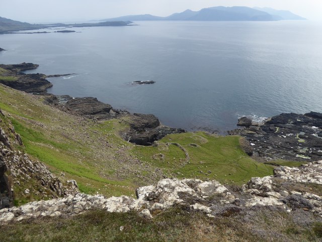
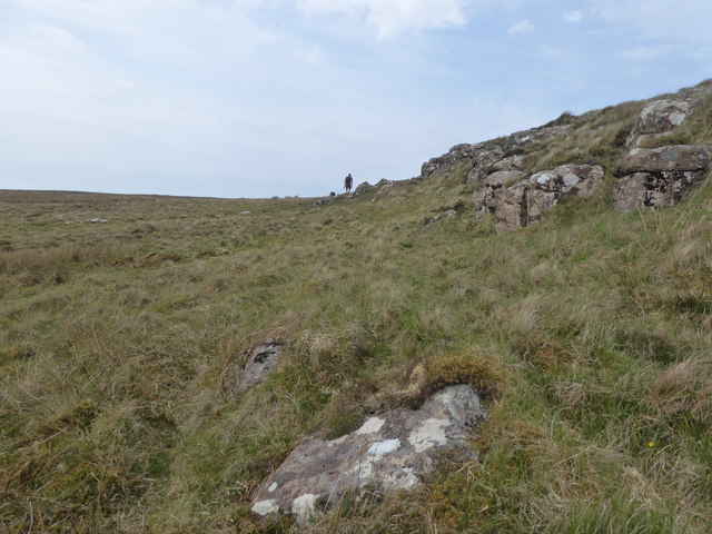
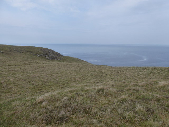
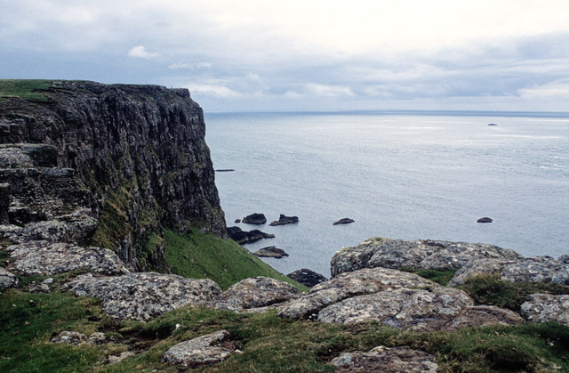
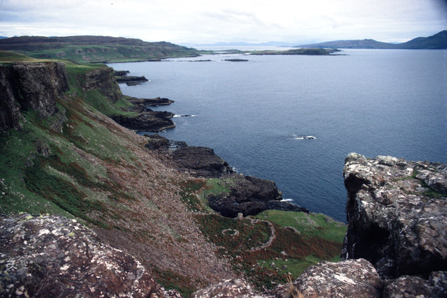
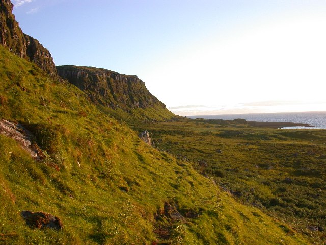
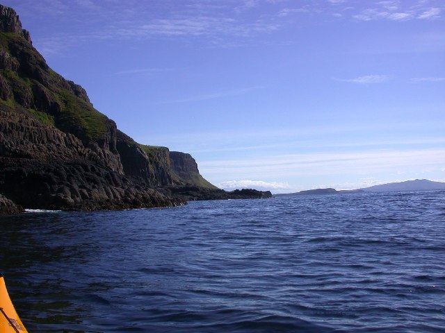
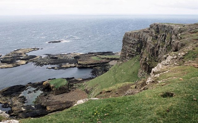
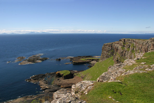
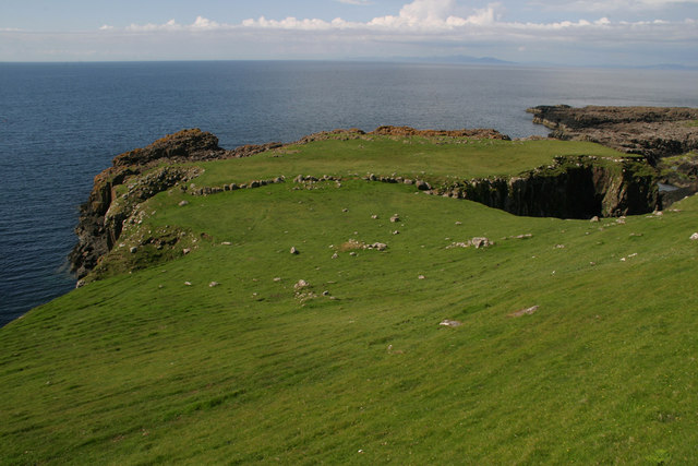
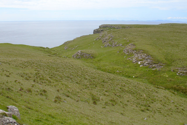
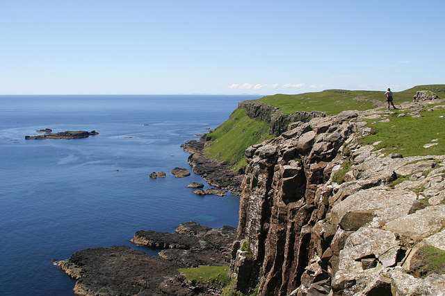
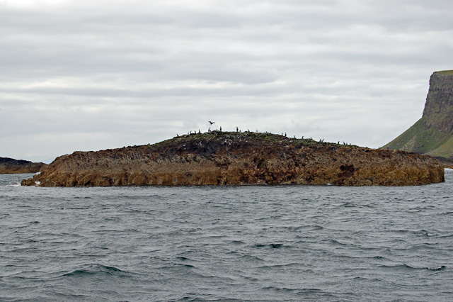
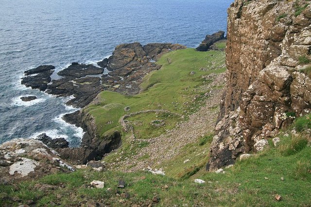
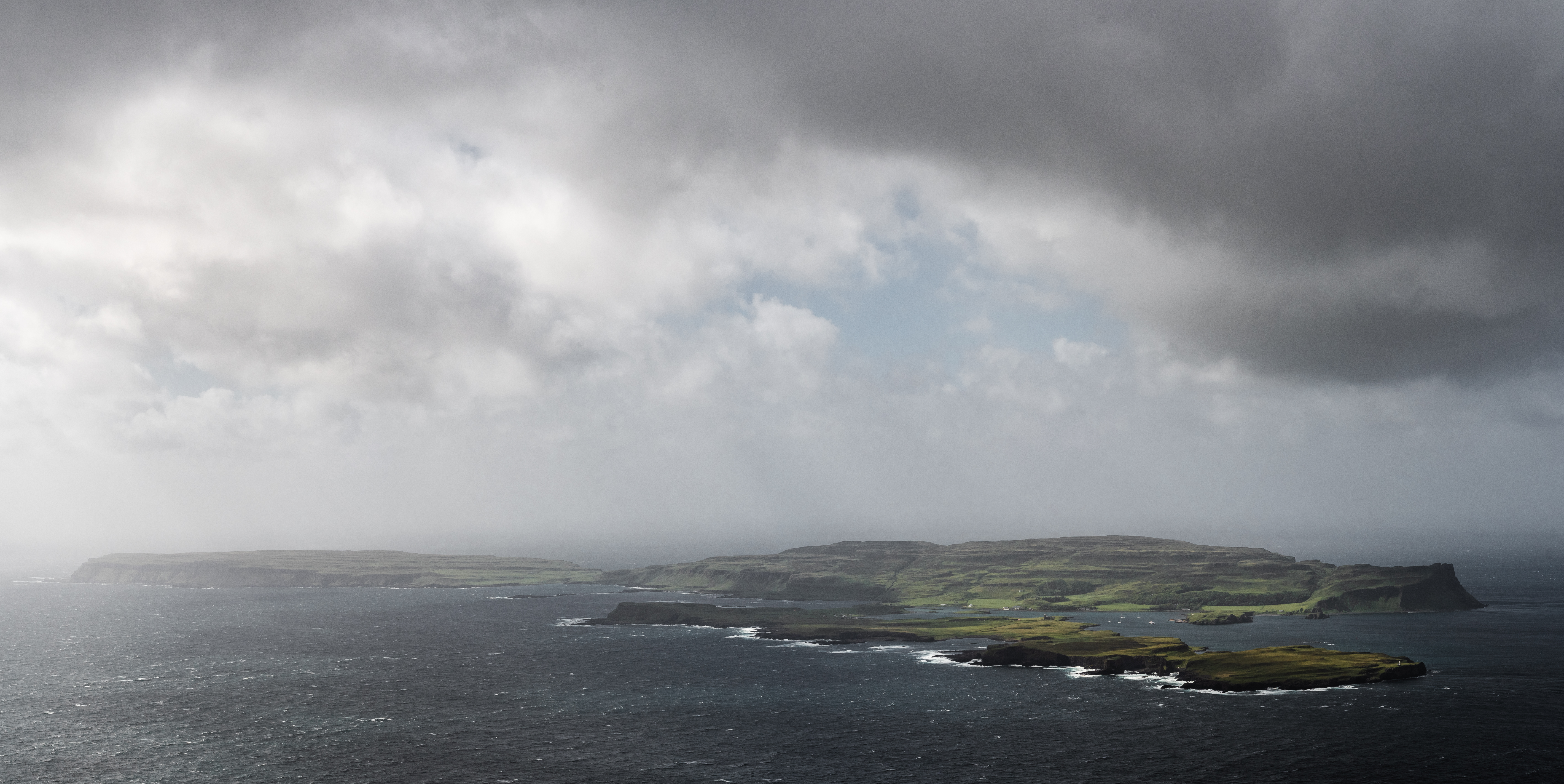
An Stèidh is a small island located in Argyllshire, Scotland. It is part of the Inner Hebrides archipelago and lies in the Sound of Mull. The island covers an area of approximately 20 hectares and is predominantly made up of rugged terrain and rocky cliffs.

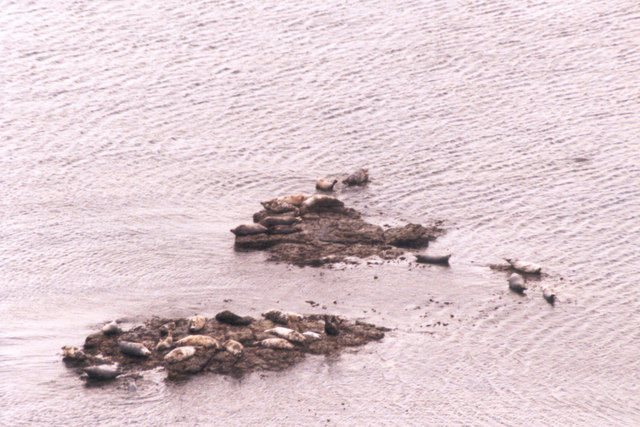
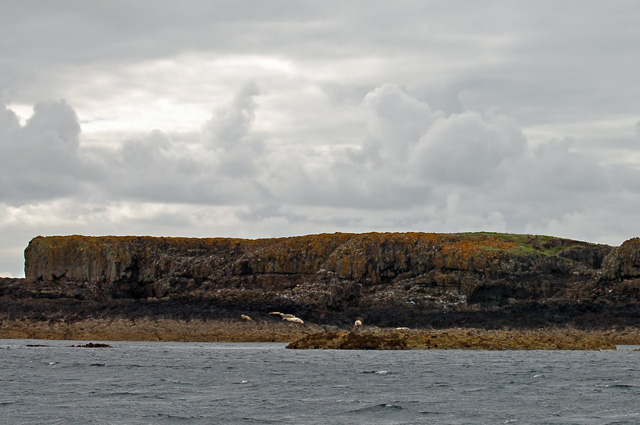
An Stèidh is uninhabited and lacks any permanent structures or amenities. Its remote location and untouched natural beauty make it a popular destination for wildlife enthusiasts and nature lovers. The island is home to a wide variety of bird species, including puffins, guillemots, and razorbills, which nest in the rocky crevices.

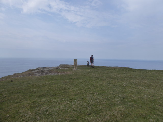
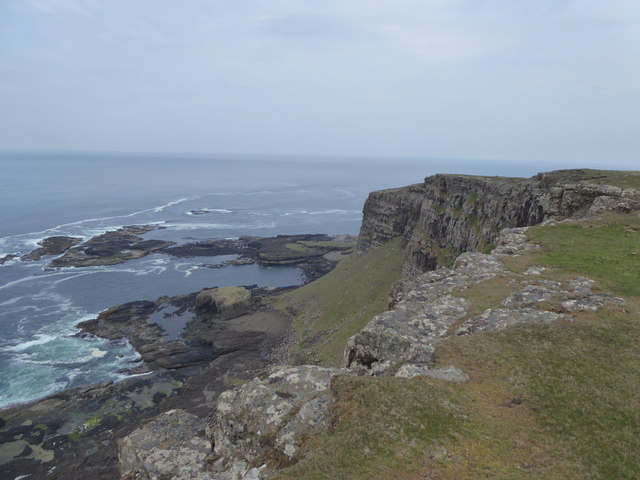
The coastline of An Stèidh is characterized by its dramatic cliffs, which provide breathtaking views of the surrounding sea and neighboring islands. The island offers opportunities for hiking and exploring its diverse flora and fauna. Visitors can also enjoy fishing or simply relax on the pristine sandy beaches.

Access to An Stèidh is primarily by private boat or organized tours, as there are no regular ferry services to the island. It is important to note that being an uninhabited island, there are no facilities such as toilets or shops, so visitors are advised to bring their own supplies.

Overall, An Stèidh is a tranquil and unspoiled island, offering a unique and immersive experience for those seeking solitude and a connection with nature. Its untouched landscapes and abundant wildlife make it a true gem in the Scottish Isles.

If you have any feedback on the listing, please let us know in the comments section below.

An Stèidh Images

Images are sourced within 2km of 57.038619/-6.5931421 or Grid Reference NG2103. Thanks to Geograph Open Source API. All images are credited.

Sgorr nam Bàn-naomha, Isle of Canna These ruins are thought to be the remains of a nunnery of the Columban or post-Columban era.
Sgorr nam Bàn-naomha, Isle of Canna
These ruins are thought to be the remains of a nunnery of the Columban or post-Columban era.
Rocks and grass in the west of Canna
Trig point at the west end of Canna
Looking to Garrisdale Point, Isle of Canna
Grassland at Garrisdale, Isle of Canna
The cliffs of Garrisdale Point, Isle of Canna The pillar of the OS Trig Station can be seen beyond the headland.
The cliffs of Garrisdale Point, Isle of Canna
The pillar of the OS Trig Station can be seen beyond the headland.
The Nunnery, Canna Below the steep cliffs is an ancient site seen from above as two circular rings. Originally it would have been accessed from the sea. The construction comprises an enclosure, the drystone walling of which is 5ft thick. Within the enclosure, four structures are built against the outer wall, while three others are free standing. Of these, only a well-house and mill have so far been determined.
The Nunnery, Canna
Below the steep cliffs is an ancient site seen from above as two circular rings. Originally it would have been accessed from the sea. The construction comprises an enclosure, the drystone walling of which is 5ft thick. Within the enclosure, four structures are built against the outer wall, while three others are free standing. Of these, only a well-house and mill have so far been determined.
North Coast of Canna View West from the remote North West corner of Canna
North Coast of Canna
View West from the remote North West corner of Canna
South West Corner of Canna. South West Corner of Canna, View toward the East.
South West Corner of Canna.
South West Corner of Canna, View toward the East.
Garrisdale Point and Dun Channa Coastline to the SE of Garrisdale Point viewed from the Trig Point.  The historic fort of Dun Canna is visible as a round grassy-topped fortification on the gravel beach
Garrisdale Point and Dun Channa
Coastline to the SE of Garrisdale Point viewed from the Trig Point. The historic fort of Dun Canna is visible as a round grassy-topped fortification on the gravel beach
Garrisdale Point, Isle of Canna A pity you can't hear the haunting song of the seals basking on the rocks below.  The grassy knoll on the shore is Dùn Channa.
Garrisdale Point, Isle of Canna
A pity you can't hear the haunting song of the seals basking on the rocks below. The grassy knoll on the shore is Dùn Channa.
Seals on Eileanan Bhrè-sgorr Very little of these islands remains above sea level at high tide.
Seals on Eileanan Bhrè-sgorr
Very little of these islands remains above sea level at high tide.
The fort near Garrisdale The fort is on Canna's northern shore just below the cliffs and appears to have been a defensive position.  It is a small peninsula with the sea to the west, north and east.  The only overland access to the south is blocked by a six foot thick wall.  Remains of the wall are still visible.
The fort near Garrisdale
The fort is on Canna's northern shore just below the cliffs and appears to have been a defensive position. It is a small peninsula with the sea to the west, north and east. The only overland access to the south is blocked by a six foot thick wall. Remains of the wall are still visible.
Allt Bhrè-sgorr The western side of Canna is a grassy plateau called Sliabh Meadhonach.  Most walkers don't venture inland preferring to stay close to the spectacular clifftops.  Allt Bhrè-sgorr is a small burn about one kilometre east of the trig point at Sron Ruail.  Its waters run south.
Allt Bhrè-sgorr
The western side of Canna is a grassy plateau called Sliabh Meadhonach. Most walkers don't venture inland preferring to stay close to the spectacular clifftops. Allt Bhrè-sgorr is a small burn about one kilometre east of the trig point at Sron Ruail. Its waters run south.
Iola-Sgorr Iola-Sgorr as seen from Am Beannan on our way to Garrisdale Point.
Iola-Sgorr
Iola-Sgorr as seen from Am Beannan on our way to Garrisdale Point.
An Stèidh An Stèidh is a skerry off the south west of Canna. Atlantic grey seals can be seen basking on the shore.
An Stèidh
An Stèidh is a skerry off the south west of Canna. Atlantic grey seals can be seen basking on the shore.
An Stèidh Shags roosting on An Stèidh, a skerry off the south west of Canna. The cliffs of Brè-Sgorr on Canna can be seen on the right.
An Stèidh
Shags roosting on An Stèidh, a skerry off the south west of Canna. The cliffs of Brè-Sgorr on Canna can be seen on the right.
Rubha Sgorr nam Ban-naomha Remains of early christian monastic enclosure situated on a coastal terrace below steep cliffs.. This may have been an hermitage or penitential station associated with an Early Christian church at nearby Canna Harbour.

'Sgor nam Ban-naomha' is derived from the gaelic word sgór which means a flat, grassy ledge between a cliff to landward and the sea and nam Ban-naomha translating as holy women. The site is accessible from the sea only in fine weather. The construction comprises an enclosure, the drystone walling of which is 5ft thick. Within the enclosure, four structures are built against the outer wall, while three others are free standing. Of these, only a well-house and mill have so far been determined.
Rubha Sgorr nam Ban-naomha
Remains of early christian monastic enclosure situated on a coastal terrace below steep cliffs.. This may have been an hermitage or penitential station associated with an Early Christian church at nearby Canna Harbour. 'Sgor nam Ban-naomha' is derived from the gaelic word sgór which means a flat, grassy ledge between a cliff to landward and the sea and nam Ban-naomha translating as holy women. The site is accessible from the sea only in fine weather. The construction comprises an enclosure, the drystone walling of which is 5ft thick. Within the enclosure, four structures are built against the outer wall, while three others are free standing. Of these, only a well-house and mill have so far been determined.
Show me another place!

An Stèidh is located at Grid Ref: NG2103 (Lat: 57.038619, Lng: -6.5931421)

Unitary Authority: Highland

Police Authority: Highlands and Islands

What 3 Words

///alpha.proudest.currently. Near Carbost, Highland

Related Wikis

Canna, Scotland

Canna (; Scottish Gaelic: Canaigh, Eilean Chanaigh) is the westernmost of the Small Isles archipelago, in the Scottish Inner Hebrides. It is linked to...

A' Chill

A' Chill was a village on Canna, in the Scottish Small Isles. The name means "the cell", referring to a Culdee church, and is often anglicised as "Kil...

St Edward's Church, Sanday

St Edward's Church, Sanday, is a deconsecrated, and now disused church on the small isle of Sanday, Inner Hebrides, Scotland. The church was a gift to...

Sanday, Inner Hebrides

Sanday (Scottish Gaelic: Sandaigh; Scots: Sandee) is one of the Small Isles, in the Scottish Inner Hebrides. It is a tidal island linked to its larger...

St Columba's Church, Canna

St Columba's Church is a Category B listed building on the isle of Canna, in the Small Isles, Highland, Scotland. == History == Prior to the building of...

Hyskeir

Hyskeir (Scottish Gaelic: Òigh-sgeir) or Heyskeir is a low-lying rocky islet (a skerry) in the Inner Hebrides, Scotland. The Hyskeir Lighthouse marks the...
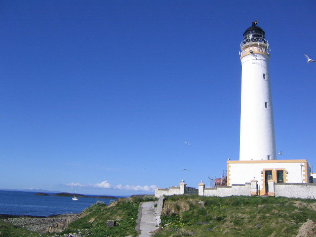
Hyskeir Lighthouse

Hyskeir Lighthouse was established in 1904. The 39 metres (128 ft) metre high lighthouse marks the southern end of the Minch, warning of the presence of...

Garbh Sgeir

Garbh Sgeir (Gaelic: 'rough skerry') is a rock about 100 metres west of the islet Òigh-sgeir, in the Small Isles, Lochaber, Scotland. There is an anchorage...

Nearby Amenities

Located within 500m of 57.038619,-6.5931421
Source: PGS
Lat/Long: 57.04272/-6.59084
Source: PGS
Lat/Long: 57.04274/-6.59224
Source: PGS
Lat/Long: 57.04289/-6.59317
Source: PGS
Lat/Long: 57.04238/-6.59321
Source: PGS
Lat/Long: 57.0422628/-6.5949381
Source: PGS
Lat/Long: 57.041948/-6.5956738
Eileannan Bhre-sgorr
Place: locality
Source: OS_OpenData_StreetView
Lat/Long: 57.0414165/-6.59419
An Steidh
Place: locality
Source: OS_OpenData_StreetView
Lat/Long: 57.0376261/-6.5914389
The data included in this document is from www.openstreetmap.org. The data is made available under ODbL.

Have you been to An Stèidh?

Leave your review of An Stèidh below (or comments, questions and feedback).