Thalta Sgeir

Island in Ross-shire

Scotland

Thalta Sgeir

Beehive Cell - Eilean Fir Chrothair The beautiful little beehive cell on the island of Eilean Fir Chrothair.
Beehive Cell - Eilean Fir Chrothair Credit: Marc Calhoun

Thalta Sgeir is a small uninhabited island located in the Cromarty Firth, near the village of Invergordon in Ross-shire, Scotland. The island is part of the Scottish Highlands and is situated roughly 1.5 kilometers offshore.

Thalta Sgeir covers an area of approximately 0.6 hectares and is composed mainly of rugged rocks and low-lying grassy areas. The island is relatively flat, with a maximum elevation of around 20 meters. It is surrounded by clear blue waters and offers panoramic views of the surrounding coastline.

The island is a popular destination for birdwatchers and wildlife enthusiasts, as it serves as an important habitat for a variety of bird species. Among the birds that can be observed on Thalta Sgeir are guillemots, razorbills, puffins, and gulls. The island is also known to host a small population of seals, which can often be seen basking on the rocks or swimming in the nearby waters.

Due to its small size and lack of amenities, Thalta Sgeir is not suitable for human habitation. However, it is occasionally visited by boat tours and visitors who are interested in exploring its natural beauty and observing the diverse wildlife. The island provides a peaceful and picturesque setting, making it an ideal spot for nature lovers looking to escape the hustle and bustle of everyday life.

In summary, Thalta Sgeir is a small uninhabited island off the coast of Ross-shire, Scotland. It offers breathtaking views, diverse birdlife, and a tranquil environment for those seeking a connection with nature.

If you have any feedback on the listing, please let us know in the comments section below.
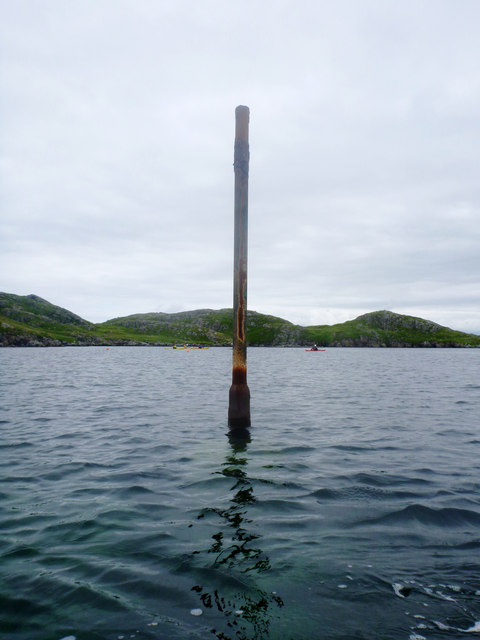
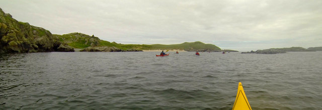
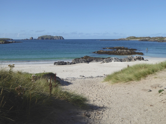
Thalta Sgeir Images

Images are sourced within 2km of 58.274952/-6.8743698 or Grid Reference NB1442. Thanks to Geograph Open Source API. All images are credited.

Beehive Cell - Eilean Fir Chrothair The beautiful little beehive cell on the island of Eilean Fir Chrothair.
Beehive Cell - Eilean Fir Chrothair
The beautiful little beehive cell on the island of Eilean Fir Chrothair.
Rocky coast at Bostadh Looking across Camas Bostadh from near the cemetery wall.
Rocky coast at Bostadh
Looking across Camas Bostadh from near the cemetery wall.
Poll a' Roin A small sandy inlet off Traigh Bostadh; looking north from Cnoc a' Chuispair out to Camas Bostadh and a rocky headland.
Poll a' Roin
A small sandy inlet off Traigh Bostadh; looking north from Cnoc a' Chuispair out to Camas Bostadh and a rocky headland.
Visiting the Tide Bell at Bostadh The idea of the tide bell is to toll as the waves cause movement when the tide is high enough. There are a number of these installations around the UK, which will toll at different times as the tide rises and falls in each of the locations. As the tide gets later by a bit under an hour each day, the bell will toll at night as often as during the day, and for longer at spring tides than neaps. Perhaps it is just as well no-one lives here. Visiting the bell is straightforward at low tide and probably needs a small boat (and ear defenders) at high tide. In between, a certain degree of hardiness is required unless, as with these visitors, you happen to be wearing a drysuit...
Visiting the Tide Bell at Bostadh
The idea of the tide bell is to toll as the waves cause movement when the tide is high enough. There are a number of these installations around the UK, which will toll at different times as the tide rises and falls in each of the locations. As the tide gets later by a bit under an hour each day, the bell will toll at night as often as during the day, and for longer at spring tides than neaps. Perhaps it is just as well no-one lives here. Visiting the bell is straightforward at low tide and probably needs a small boat (and ear defenders) at high tide. In between, a certain degree of hardiness is required unless, as with these visitors, you happen to be wearing a drysuit...
Perch in Caolas Bearnaraigh Beag I was intrigued as I paddled along Caolas Bearnaraigh Beag to see this rusting metal pillar, looking for all the world like a misplaced lamppost. The large-scale map shows rocks here, which certainly weren't obvious from the water in these calm conditions, so this perch fulfils the important purpose of marking the rocks for the benefit of those in boats not of a sufficiently shallow draught to pass over them. There is no light, and I imagine it would be pretty hard to see in the dark, but I suspect that, sea kayakers apart, there is not much other than local traffic here, with skippers who know the water.
Perch in Caolas Bearnaraigh Beag
I was intrigued as I paddled along Caolas Bearnaraigh Beag to see this rusting metal pillar, looking for all the world like a misplaced lamppost. The large-scale map shows rocks here, which certainly weren't obvious from the water in these calm conditions, so this perch fulfils the important purpose of marking the rocks for the benefit of those in boats not of a sufficiently shallow draught to pass over them. There is no light, and I imagine it would be pretty hard to see in the dark, but I suspect that, sea kayakers apart, there is not much other than local traffic here, with skippers who know the water.
Lunch stop on Little Bernera Although well under halfway round our trip exploring sea caves in the islands north of Great Bernera, this would be the last sandy beach offering an easy landing, so a stop was inevitable, if only to stretch the legs and relieve any undue pressure. The sea here is deceptively calm - out on the rocky coasts there was an interesting level of swell, which always makes sea cave exploration "interesting".
Lunch stop on Little Bernera
Although well under halfway round our trip exploring sea caves in the islands north of Great Bernera, this would be the last sandy beach offering an easy landing, so a stop was inevitable, if only to stretch the legs and relieve any undue pressure. The sea here is deceptively calm - out on the rocky coasts there was an interesting level of swell, which always makes sea cave exploration "interesting".
Passing through the cave under Campaigh The large scale OS map shows a "natural arch" right through the island of Campaigh, and from either end, one can see daylight on the other side. When explored, however, one finds that there is a third entrance, which must emerge on the north coast of the island. Unfortunately the passage is so narrow and hading that a kayak cannot get through whatever the state of the tide. Daylight, however, is clearly visible, and perhaps a brave enough swimmer/climber could make their way in or out that way (you'd want a day with very little swell as the water surges up and down quite a bit in the middle of the cave).
Passing through the cave under Campaigh
The large scale OS map shows a "natural arch" right through the island of Campaigh, and from either end, one can see daylight on the other side. When explored, however, one finds that there is a third entrance, which must emerge on the north coast of the island. Unfortunately the passage is so narrow and hading that a kayak cannot get through whatever the state of the tide. Daylight, however, is clearly visible, and perhaps a brave enough swimmer/climber could make their way in or out that way (you'd want a day with very little swell as the water surges up and down quite a bit in the middle of the cave).
The eastern entrance of the cave under Campaigh One of the UK's longer through-passage sea caves, much more significant than indicated by the OS map's "natural arch", the route under Campaigh actually has three connections to the outside world. Kayakers can readily pass (in suitable sea conditions) from/to the open east (seen here) and west entrances which connect along a straight passage, so daylight can be seen right the way through. Midway, there is a skylight through a hading rift to the north coast - not passable by a boat of any size at any state of the tide.
The eastern entrance of the cave under Campaigh
One of the UK's longer through-passage sea caves, much more significant than indicated by the OS map's "natural arch", the route under Campaigh actually has three connections to the outside world. Kayakers can readily pass (in suitable sea conditions) from/to the open east (seen here) and west entrances which connect along a straight passage, so daylight can be seen right the way through. Midway, there is a skylight through a hading rift to the north coast - not passable by a boat of any size at any state of the tide.
East side of Bearnaraigh Beag Setting out from Bostadh on a tour of the islands north of Great Bernera, we quickly passed through Caolas Bearnaraigh and onto the east coast of Little Bernera (Bearnaraigh Beag) and headed for Seildeim (the skerry on the right). This side of the island being low and sheltered, there was not a lot to detain us - the beach came too early in the day for a stop and we were eager to make our way out to islands with more exciting cliff and cave scenery.
East side of Bearnaraigh Beag
Setting out from Bostadh on a tour of the islands north of Great Bernera, we quickly passed through Caolas Bearnaraigh and onto the east coast of Little Bernera (Bearnaraigh Beag) and headed for Seildeim (the skerry on the right). This side of the island being low and sheltered, there was not a lot to detain us - the beach came too early in the day for a stop and we were eager to make our way out to islands with more exciting cliff and cave scenery.
Rock-hopping through skerries between Little Bernera and Gaisgeir Coming round the east side of Little Bernera on a day trip out from Bostadh, we have already poked into our first cave of the day just to the south, and are now dodging between skerries as we enter water with a bit less shelter form today's westerly swell. This particular little channel appears to be above high water on every scale of OS mapping, but is easily wide enough for a narrow-beamed (and highly manoeuvrable) boat like a sea kayak.
Rock-hopping through skerries between Little Bernera and Gaisgeir
Coming round the east side of Little Bernera on a day trip out from Bostadh, we have already poked into our first cave of the day just to the south, and are now dodging between skerries as we enter water with a bit less shelter form today's westerly swell. This particular little channel appears to be above high water on every scale of OS mapping, but is easily wide enough for a narrow-beamed (and highly manoeuvrable) boat like a sea kayak.
The beach at Bostadh The Island of Bearasaigh on the horizon.
The beach at Bostadh
The Island of Bearasaigh on the horizon.
Time and Tide Bell, Bostadh Installed by Marcus Vergette in 2010, this is one of twelve Tide and Tide Bells to be installed round the coast of Great Britain. Silent, of course, at low tide as when this photograph was taken.
Time and Tide Bell, Bostadh
Installed by Marcus Vergette in 2010, this is one of twelve Tide and Tide Bells to be installed round the coast of Great Britain. Silent, of course, at low tide as when this photograph was taken.
Near Bostadh Bostadh is the site of an Iron Age village whose remains appeared following a storm in 1993 when the sand was reconfigured. The site was excavated three years later but encroachment by the sea made it impossible to save. but a reconstruction has been made further up the beach.
Near Bostadh
Bostadh is the site of an Iron Age village whose remains appeared following a storm in 1993 when the sand was reconfigured. The site was excavated three years later but encroachment by the sea made it impossible to save. but a reconstruction has been made further up the beach.
The view from the beach Just below the Iron Age Village recreation is the beach where the original village was found. They chose a place with a good view, but no doubt that was NOT one of their considerations.
The view from the beach
Just below the Iron Age Village recreation is the beach where the original village was found. They chose a place with a good view, but no doubt that was NOT one of their considerations.
Time and Tide Bell, Bostadh This is one of a permanent installation of 12 bells around Britain to be rung by the sea at high tide. According to a nearby notice, it was installed in June 2010. Other bells are at Appledore (Devon), Trinity Buoy Wharf (London) and Aberdyfi (Wales). Other sites in planning are in the Aberdeen area and around Orford Ness.

"The idea of the Time and Tide Bells is to create, celebrate and reinforce connections between various parts of the country, between the land and the sea, and between ourselves and our environment." Perhaps the same could be said of Geograph!
Time and Tide Bell, Bostadh
This is one of a permanent installation of 12 bells around Britain to be rung by the sea at high tide. According to a nearby notice, it was installed in June 2010. Other bells are at Appledore (Devon), Trinity Buoy Wharf (London) and Aberdyfi (Wales). Other sites in planning are in the Aberdeen area and around Orford Ness. "The idea of the Time and Tide Bells is to create, celebrate and reinforce connections between various parts of the country, between the land and the sea, and between ourselves and our environment." Perhaps the same could be said of Geograph!
Road on Great Bernera The road from Bostadh to Breacleit
Road on Great Bernera
The road from Bostadh to Breacleit
Poll a' Roin Sands and rocks at the east end of Traigh Bostadh. Note the modern "Time and Tide Bell" in the middle distance.
<span class="nowrap"><a title="http://www.uigandbernera.com/" rel="nofollow ugc noopener" href="http://www.uigandbernera.com/">Link</a><img style="margin-left:2px;" alt="External link" title="External link - shift click to open in new window" src="https://s1.geograph.org.uk/img/external.png" width="10" height="10"/></span>
Poll a' Roin
Sands and rocks at the east end of Traigh Bostadh. Note the modern "Time and Tide Bell" in the middle distance. LinkExternal link
Show me another place!

Thalta Sgeir is located at Grid Ref: NB1442 (Lat: 58.274952, Lng: -6.8743698)

Unitary Authority: Na h-Eileanan an Iar

Police Authority: Highlands and Islands

What 3 Words

///footballers.flattery.reach. Near Carloway, Na h-Eileanan Siar

Related Wikis

Cealasaigh

Cealasaigh or Kealasay is an islet in outer Loch Ròg, Lewis, Scotland that lies north of Traigh Mhór on Little Bernera and south of Campaigh. To the west...

Campaigh

Campaigh or Campay is a steep and rocky islet in outer Loch Ròg, Lewis, Scotland that lies north of Cealasaigh and Little Bernera. A huge natural arch...

Little Bernera

Little Bernera (Scottish Gaelic: Beàrnaraigh Beag) is a small island situated off the west coast of the Isle of Lewis in the Outer Hebrides.Little Bernera...

Flodaigh (Outer Loch Ròg)

Flodaigh is an islet in outer Loch Ròg, Lewis, Scotland. It lies north west of Great Bernera and Little Bernera, south of Bearasaigh and Seanna Chnoc and...

Have you been to Thalta Sgeir?

Leave your review of Thalta Sgeir below (or comments, questions and feedback).