Siaram Bostadh
Island in Ross-shire
Scotland
Siaram Bostadh

Siaram Bostadh is a small island located in Ross-shire, Scotland. It is situated off the west coast of Scotland, near the Isle of Lewis. The island is known for its stunning natural beauty and tranquil atmosphere, making it a popular destination for nature lovers and those seeking a peaceful retreat.
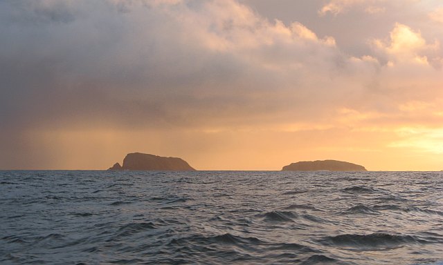
Siaram Bostadh is relatively small, covering an area of approximately 2 square kilometers. The island is characterized by its rugged coastline, with dramatic cliffs and rocky outcrops. Visitors can enjoy breathtaking views of the surrounding sea and neighboring islands from various vantage points.
The island is home to a diverse range of flora and fauna, including various species of seabirds and marine life. It is a designated nature reserve, ensuring the preservation of its unique ecosystems. Walking trails and nature reserves are available for visitors to explore and appreciate the island's natural wonders.
Siaram Bostadh is also known for its archaeological significance. The island is home to ancient ruins and historical sites, including the remains of a Viking settlement. These archaeological finds offer a glimpse into the island's rich history and cultural heritage.
Despite its remote location, Siaram Bostadh is accessible by boat, and there are regular ferry services connecting it to the mainland. Accommodation options on the island are limited, with a few self-catering cottages available for those wishing to stay overnight.
In conclusion, Siaram Bostadh is a picturesque island in Ross-shire, Scotland, offering visitors a chance to experience stunning natural landscapes, wildlife, and a glimpse into its historical past. It is a place of tranquility and natural beauty, attracting nature enthusiasts and history buffs alike.
If you have any feedback on the listing, please let us know in the comments section below.
Siaram Bostadh Images
Images are sourced within 2km of 58.261071/-6.8919867 or Grid Reference NB1340. Thanks to Geograph Open Source API. All images are credited.


Siaram Bostadh is located at Grid Ref: NB1340 (Lat: 58.261071, Lng: -6.8919867)
Unitary Authority: Na h-Eileanan an Iar
Police Authority: Highlands and Islands
What 3 Words
///shock.flank.foreheads. Near Carloway, Na h-Eileanan Siar
Nearby Locations
Related Wikis

Flodaigh (Outer Loch Ròg)
Flodaigh is an islet in outer Loch Ròg, Lewis, Scotland. It lies north west of Great Bernera and Little Bernera, south of Bearasaigh and Seanna Chnoc and...

Little Bernera
Little Bernera (Scottish Gaelic: Beàrnaraigh Beag) is a small island situated off the west coast of the Isle of Lewis in the Outer Hebrides.Little Bernera...
Cealasaigh
Cealasaigh or Kealasay is an islet in outer Loch Ròg, Lewis, Scotland that lies north of Traigh Mhór on Little Bernera and south of Campaigh. To the west...
Bearasaigh
Bearasaigh or Bearasay (and sometimes Berisay) is an islet in outer Loch Ròg, Lewis, Scotland. During the late 16th and early 17th centuries it was used...

Campaigh
Campaigh or Campay is a steep and rocky islet in outer Loch Ròg, Lewis, Scotland that lies north of Cealasaigh and Little Bernera. A huge natural arch...
Bernera Riot
The Bernera Riot occurred in 1874, on the island of Great Bernera, in Scotland in response to the Highland Clearances. The use of the term 'Bernera Riot...
Seanna Chnoc
Seanna Chnoc (English: "old hill"), correctly known as Seana Bheinn is an islet in outer Loch Ròg, Lewis, Scotland. It lies north west of Great Bernera...
Pabaigh Mòr
Pabay Mòr or Pabaigh Mòr is an uninhabited island in the Outer Hebrides of Scotland. == History == The island's name comes from papey, an Old Norse name...
Have you been to Siaram Bostadh?
Leave your review of Siaram Bostadh below (or comments, questions and feedback).