Cnoc Urraman

Hill, Mountain in Ross-shire

Scotland

Cnoc Urraman

Camas Bastadh/Bostadh Spelled differently on the map and gazetteer.
Camas Bastadh/Bostadh Credit: John Lucas

Cnoc Urraman is a prominent hill located in Ross-shire, a historical county in the Highland region of Scotland. It is situated near the small village of Kildary, approximately 25 miles north of Inverness. With an elevation of around 1,000 feet (305 meters), Cnoc Urraman is considered a hill rather than a mountain.

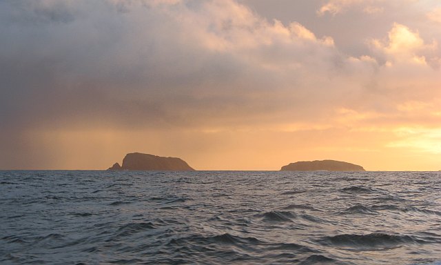
The hill is characterized by its distinctive shape and prominent position in the surrounding landscape. Its slopes are covered in a mixture of heather, grass, and scattered patches of woodland. The summit offers breathtaking panoramic views of the surrounding countryside, including the Cromarty Firth, the Black Isle, and the distant peaks of the Scottish Highlands.

Cnoc Urraman is a popular destination for outdoor enthusiasts, particularly hikers and hillwalkers. The hill is accessible via several well-marked footpaths that lead to the summit, providing a rewarding and relatively easy ascent for visitors of various fitness levels. The surrounding area also offers opportunities for wildlife spotting, with potential sightings of red deer, birds of prey, and other native species.

In addition to its natural beauty, Cnoc Urraman holds historical significance as well. The hill is believed to have been inhabited in ancient times, with remains of Iron Age settlements discovered in the vicinity. These archaeological sites contribute to the rich cultural heritage of the area, attracting history enthusiasts and researchers.

Overall, Cnoc Urraman is a picturesque hill in Ross-shire that offers stunning views, recreational opportunities, and a glimpse into the region's past.

If you have any feedback on the listing, please let us know in the comments section below.

Cnoc Urraman Images

Images are sourced within 2km of 58.256312/-6.8880014 or Grid Reference NB1340. Thanks to Geograph Open Source API. All images are credited.

Camas Bastadh/Bostadh Spelled differently on the map and gazetteer.
Camas Bastadh/Bostadh
Spelled differently on the map and gazetteer.
The cemetery at Bostadh Perhaps not a surprising number of burials for such a remote location, as it is a very desirable place to be laid to rest.
The cemetery at Bostadh
Perhaps not a surprising number of burials for such a remote location, as it is a very desirable place to be laid to rest.
The road to Bostadh With Siaram Bostadh in mid view on the left side.
The road to Bostadh
With Siaram Bostadh in mid view on the left side.
Beehive Cell - Eilean Fir Chrothair The beautiful little beehive cell on the island of Eilean Fir Chrothair.
Beehive Cell - Eilean Fir Chrothair
The beautiful little beehive cell on the island of Eilean Fir Chrothair.
Bostadh Iron Age House The reconstructed house, viewed looking south.
Bostadh Iron Age House
The reconstructed house, viewed looking south.
Information about Bostadh Iron Age Village The Gaelic version.
Information about Bostadh Iron Age Village
The Gaelic version.
Information about Bostadh Iron Age Village The English version.
Information about Bostadh Iron Age Village
The English version.
Public convenience at Bostadh Near the end of the road at the cemetery and Iron Age Village.
Public convenience at Bostadh
Near the end of the road at the cemetery and Iron Age Village.
Camas Bostadh Sand dunes at Bostadh, looking to a cloud-covered Flodaigh.
Camas Bostadh
Sand dunes at Bostadh, looking to a cloud-covered Flodaigh.
Rocky coast at Bostadh Looking across Camas Bostadh from near the cemetery wall.
Rocky coast at Bostadh
Looking across Camas Bostadh from near the cemetery wall.
Beach at Bostadh Looking across Camas Bostadh, with part of Flodaigh on the right.
Beach at Bostadh
Looking across Camas Bostadh, with part of Flodaigh on the right.
Traigh Bostadh Looking across to Cnoc Urraman.
Traigh Bostadh
Looking across to Cnoc Urraman.
Iron Age Village at Bostadh A reconstructed house and, farther up the valley, traces of other houses.
Iron Age Village at Bostadh
A reconstructed house and, farther up the valley, traces of other houses.
View from an Iron Age house Looking over Traigh Bosdtadh to Camus Bostadh and Flodaigh, from the enclosure surrounding the reconstructed house.
View from an Iron Age house
Looking over Traigh Bosdtadh to Camus Bostadh and Flodaigh, from the enclosure surrounding the reconstructed house.
Garden Tiger Moth larva A larva of Arctia caja on the path close to the Iron Age house at Bostadh. Thin plant growth on sand, with clear signs of rabbit grazing.
Garden Tiger Moth larva
A larva of Arctia caja on the path close to the Iron Age house at Bostadh. Thin plant growth on sand, with clear signs of rabbit grazing.
Iron Age House at Bostadh The inland end. Beyond is the path down from the car park.
Iron Age House at Bostadh
The inland end. Beyond is the path down from the car park.
Entrance to the Iron Age House A gap in the surrounding wall leads to the top of steps leading down to an underground entrance.
Entrance to the Iron Age House
A gap in the surrounding wall leads to the top of steps leading down to an underground entrance.
Iron Age House Underground doorway at the foot of the entrance steps. It is possible to go inside when the site is open.
Iron Age House
Underground doorway at the foot of the entrance steps. It is possible to go inside when the site is open.
Show me another place!

Cnoc Urraman is located at Grid Ref: NB1340 (Lat: 58.256312, Lng: -6.8880014)

Unitary Authority: Na h-Eileanan an Iar

Police Authority: Highlands and Islands

What 3 Words

///oval.customers.chew. Near Carloway, Na h-Eileanan Siar

Related Wikis

Little Bernera

Little Bernera (Scottish Gaelic: Beàrnaraigh Beag) is a small island situated off the west coast of the Isle of Lewis in the Outer Hebrides.Little Bernera...

Flodaigh (Outer Loch Ròg)

Flodaigh is an islet in outer Loch Ròg, Lewis, Scotland. It lies north west of Great Bernera and Little Bernera, south of Bearasaigh and Seanna Chnoc and...

Bernera Riot

The Bernera Riot occurred in 1874, on the island of Great Bernera, in Scotland in response to the Highland Clearances. The use of the term 'Bernera Riot...

Cealasaigh

Cealasaigh or Kealasay is an islet in outer Loch Ròg, Lewis, Scotland that lies north of Traigh Mhór on Little Bernera and south of Campaigh. To the west...

Campaigh

Campaigh or Campay is a steep and rocky islet in outer Loch Ròg, Lewis, Scotland that lies north of Cealasaigh and Little Bernera. A huge natural arch...

Bearasaigh

Bearasaigh or Bearasay (and sometimes Berisay) is an islet in outer Loch Ròg, Lewis, Scotland. During the late 16th and early 17th centuries it was used...

Seanna Chnoc

Seanna Chnoc (English: "old hill"), correctly known as Seana Bheinn is an islet in outer Loch Ròg, Lewis, Scotland. It lies north west of Great Bernera...

Vacsay

Vacsay (Scottish Gaelic: Bhacsaigh from Old Norse "bakkiey" meaning "peat bank island") is one of the Outer Hebrides. It is off the west coast of Lewis...

Related Videos

Outer Hebrides, Bostadh Beach

Bostadh Beach, Isle of Lewis, June 19th 2021.

Outer Hebrides, Scotland, June 18th 2021

Ferry from Ullapool to Stornoway, car from Isle of Harris to Isle of Lewis and finally ending at Bosta Beach,

Nearby Amenities

Located within 500m of 58.256312,-6.8880014
Iron Age Settlement
Historic: archaeological_site
Lat/Long: 58.2560959/-6.881871
Iron Age House
Charge: 5 GBP
Fee: yes
Fee Conditional: no @ age < 12
Tourism: museum
Lat/Long: 58.2553441/-6.8817194
Turning Circle
Lat/Long: 58.2561896/-6.8801307
Ford: yes
Lat/Long: 58.2538597/-6.8814728
Time and Tide Bell
Artist Name: Marcus Vergette
Artwork Type: sculpture
Tourism: artwork
Website: http://www.timeandtidebell.co.uk/bosta.htm
Lat/Long: 58.2584333/-6.8819582
The data included in this document is from www.openstreetmap.org. The data is made available under ODbL.

Have you been to Cnoc Urraman?

Leave your review of Cnoc Urraman below (or comments, questions and feedback).