Rubha Cuinish
Landscape Feature in Ross-shire
Scotland
Rubha Cuinish

Rubha Cuinish is a prominent landscape feature located in Ross-shire, Scotland. Situated on the eastern coast of the Isle of Skye, Rubha Cuinish is a peninsula that stretches out into the waters of Loch Dunvegan.
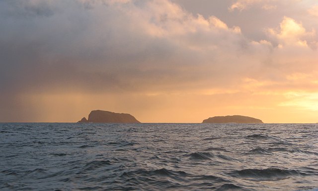
The landscape of Rubha Cuinish is characterized by its rugged and dramatic beauty. The peninsula is adorned with rocky cliffs and outcrops, which provide stunning views of the surrounding area. The coastline is dotted with small sandy coves and pebble beaches, offering visitors a chance to relax and enjoy the tranquil atmosphere.
One of the most striking features of Rubha Cuinish is the presence of several ancient standing stones. These stones, known as the "Stone Circle of Cuinish," are believed to date back to the Neolithic period and are an important archaeological site. They are arranged in a circular formation, and their purpose and significance remain a mystery.
The peninsula is also home to a variety of wildlife. Seals can often be seen basking on the rocks, while seabirds, such as gannets and cormorants, can be spotted diving into the waters in search of food. The surrounding waters are teeming with marine life, making it an ideal spot for fishing and wildlife enthusiasts.
Rubha Cuinish is accessible via a well-maintained coastal path that winds its way around the peninsula. The path offers breathtaking views of the coastline and leads to a viewpoint where visitors can take in the panoramic vistas of the surrounding area.
Overall, Rubha Cuinish is a captivating landscape feature that offers visitors a chance to immerse themselves in the natural beauty and rich history of the Isle of Skye.
If you have any feedback on the listing, please let us know in the comments section below.
Rubha Cuinish Images
Images are sourced within 2km of 58.256451/-6.8909391 or Grid Reference NB1340. Thanks to Geograph Open Source API. All images are credited.


Rubha Cuinish is located at Grid Ref: NB1340 (Lat: 58.256451, Lng: -6.8909391)
Unitary Authority: Na h-Eileanan an Iar
Police Authority: Highlands and Islands
What 3 Words
///shares.strikers.elevate. Near Carloway, Na h-Eileanan Siar
Related Wikis

Little Bernera
Little Bernera (Scottish Gaelic: Beàrnaraigh Beag) is a small island situated off the west coast of the Isle of Lewis in the Outer Hebrides.Little Bernera...

Flodaigh (Outer Loch Ròg)
Flodaigh is an islet in outer Loch Ròg, Lewis, Scotland. It lies north west of Great Bernera and Little Bernera, south of Bearasaigh and Seanna Chnoc and...
Bernera Riot
The Bernera Riot occurred in 1874, on the island of Great Bernera, in Scotland in response to the Highland Clearances. The use of the term 'Bernera Riot...
Cealasaigh
Cealasaigh or Kealasay is an islet in outer Loch Ròg, Lewis, Scotland that lies north of Traigh Mhór on Little Bernera and south of Campaigh. To the west...
Bearasaigh
Bearasaigh or Bearasay (and sometimes Berisay) is an islet in outer Loch Ròg, Lewis, Scotland. During the late 16th and early 17th centuries it was used...

Campaigh
Campaigh or Campay is a steep and rocky islet in outer Loch Ròg, Lewis, Scotland that lies north of Cealasaigh and Little Bernera. A huge natural arch...
Seanna Chnoc
Seanna Chnoc (English: "old hill"), correctly known as Seana Bheinn is an islet in outer Loch Ròg, Lewis, Scotland. It lies north west of Great Bernera...
Pabaigh Mòr
Pabay Mòr or Pabaigh Mòr is an uninhabited island in the Outer Hebrides of Scotland. == History == The island's name comes from papey, an Old Norse name...
Have you been to Rubha Cuinish?
Leave your review of Rubha Cuinish below (or comments, questions and feedback).