Eilean Bhoramuil

Island in Argyllshire

Scotland

Eilean Bhoramuil

Trig point at Calgary Point
Trig point at Calgary Point Credit: Peter Edwards

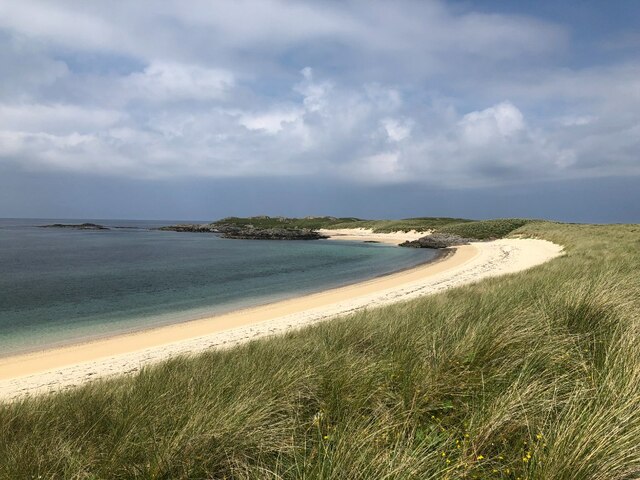
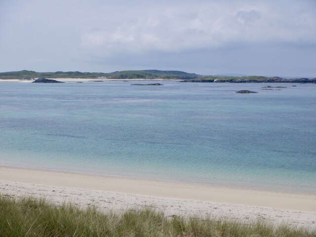
Eilean Bhoramuil is a small uninhabited island located in Argyllshire, Scotland. Situated in the Inner Hebrides, it lies approximately 1.5 miles off the coast of the Argyll mainland. The island covers an area of around 20 acres and is known for its rugged and picturesque landscape.

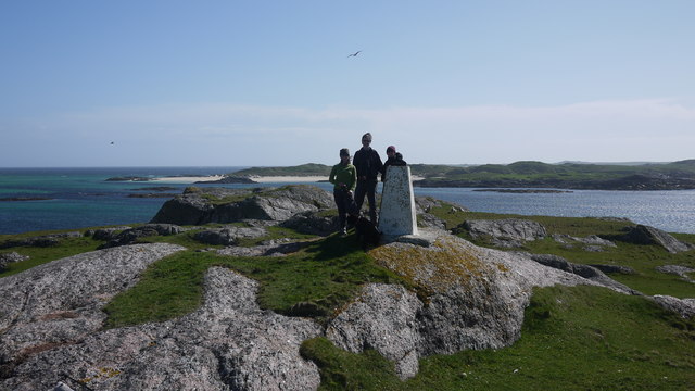
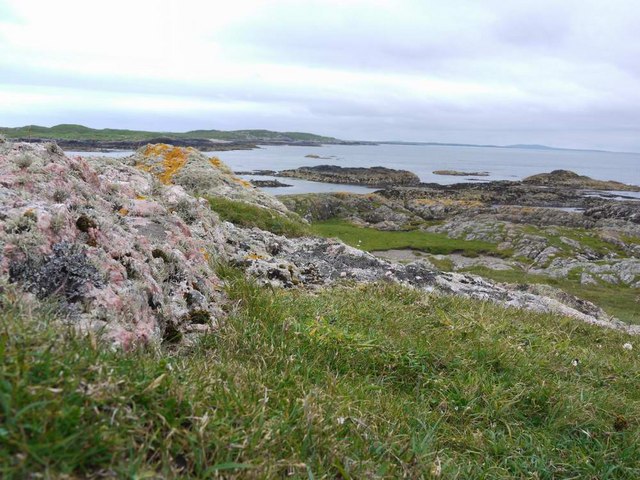
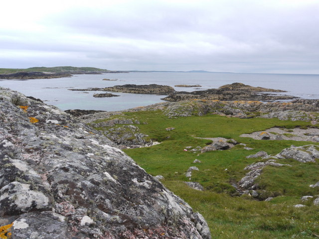
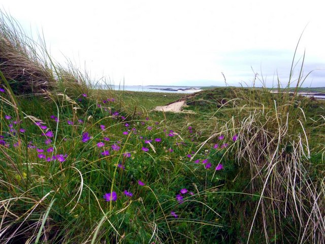
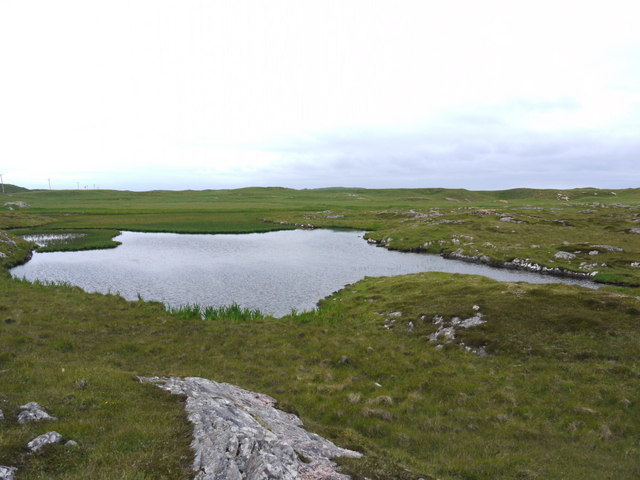
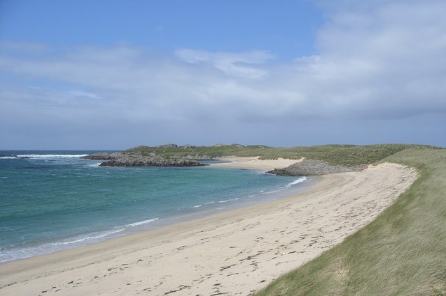
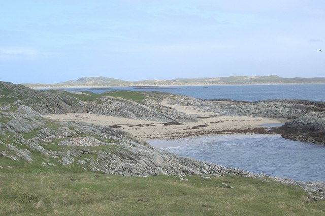
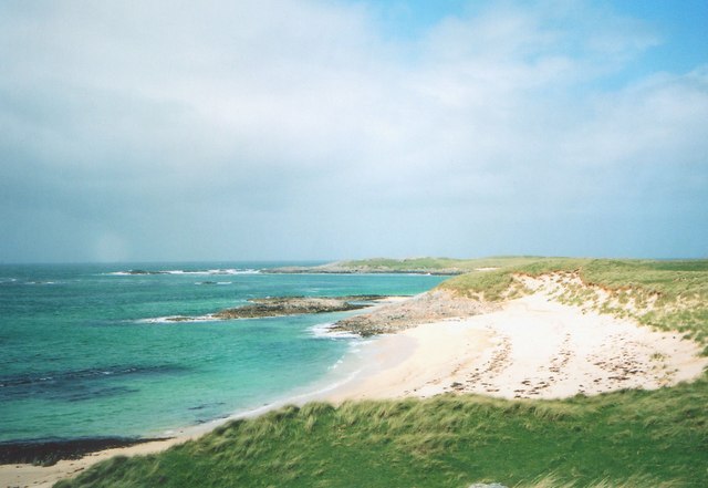
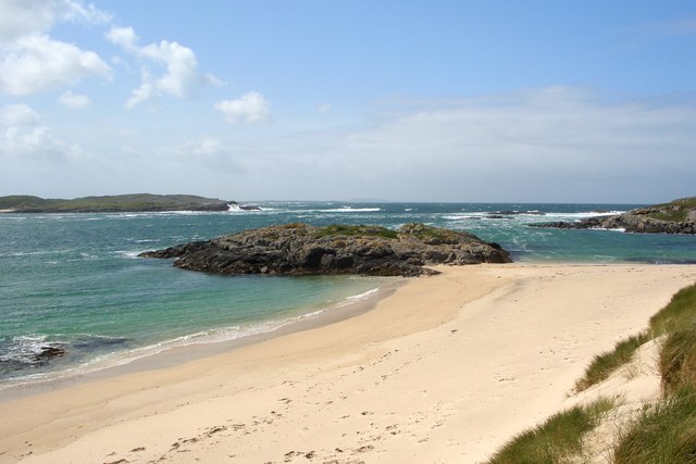
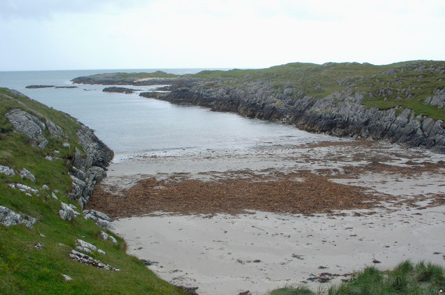
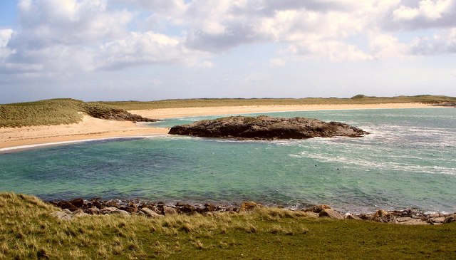
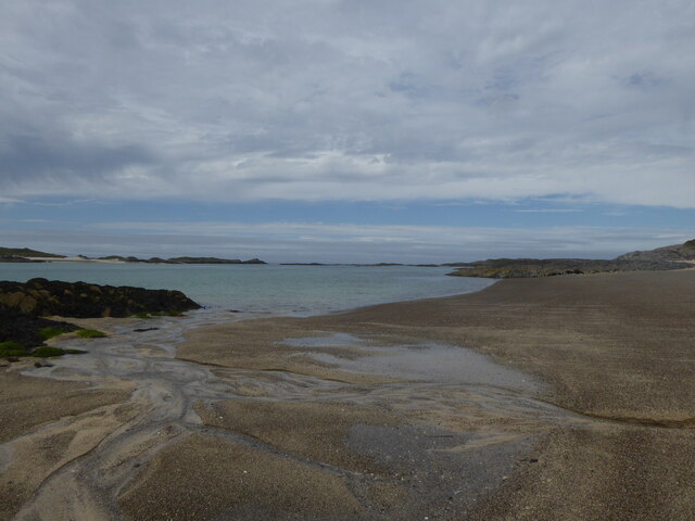
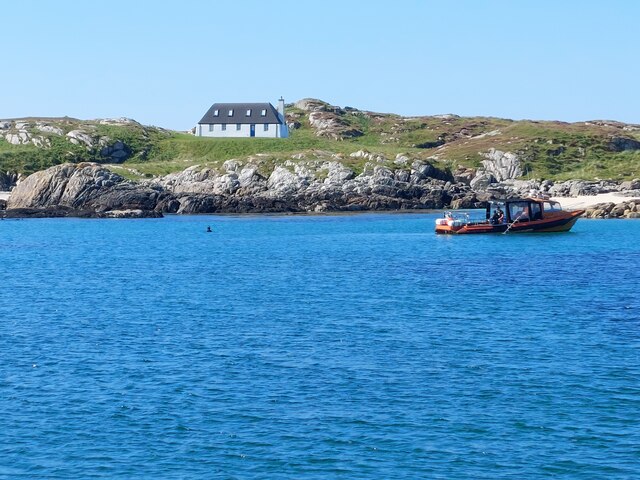
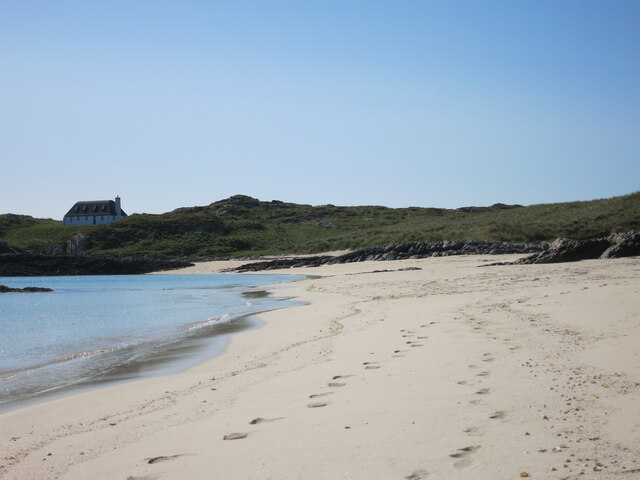
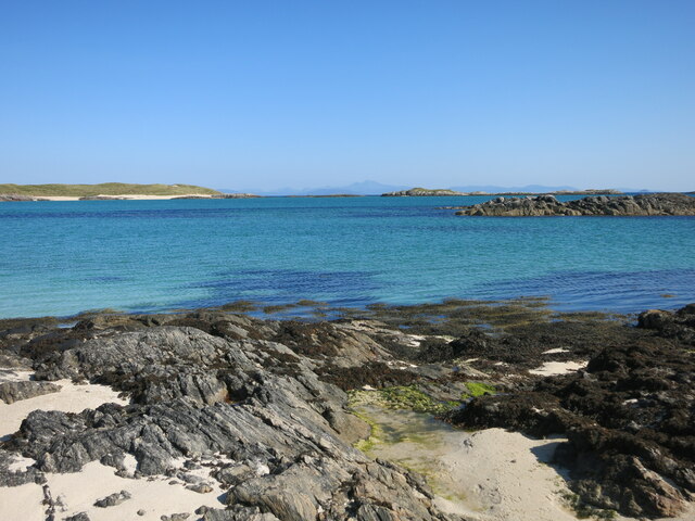
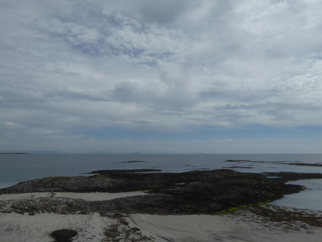
Eilean Bhoramuil is characterized by its rocky shoreline, steep cliffs, and lush greenery. The island is home to a variety of bird species, including seagulls, puffins, and cormorants, making it a popular spot for birdwatching enthusiasts. The surrounding waters are also rich in marine life, attracting divers and snorkelers to explore the underwater world.

Access to Eilean Bhoramuil is mainly by boat, with several tour operators offering trips to the island from nearby ports. Visitors can enjoy scenic walks along the island's paths, taking in the breathtaking views of the surrounding sea and mainland. There are no facilities or amenities on the island, so visitors are advised to bring their own supplies and take all waste back with them.

Eilean Bhoramuil holds historical significance, with remnants of ancient settlements and structures dating back to the Bronze Age. Archaeological surveys have uncovered evidence of human activity, including burial sites and stone circles, providing a glimpse into the island's past.

Overall, Eilean Bhoramuil offers a tranquil and unspoiled natural environment, making it an idyllic destination for those seeking a peaceful getaway or an opportunity to explore Scotland's rich history and wildlife.

If you have any feedback on the listing, please let us know in the comments section below.

Eilean Bhoramuil Images

Images are sourced within 2km of 56.558691/-6.6972541 or Grid Reference NM1150. Thanks to Geograph Open Source API. All images are credited.

Trig point at Calgary Point
Calgary Point Looking over to Gunna
Calgary Point
Looking over to Gunna
Calgary Point Looking over to the island of Gunna and, beyond that, Tiree.
Calgary Point
Looking over to the island of Gunna and, beyond that, Tiree.
Bloody cranesbill and dunes at Traigh nan Siolag Tiree in the distance.
Bloody cranesbill and dunes at Traigh nan Siolag
Tiree in the distance.
Lochan a' Chuirn
Lochan a' Chuirn
Traigh nan Siolag, Coll View northwestwards over the beach Traigh nan Siolag from a position just above the beach. In the middle distance, at the end of the small spit of sand is the tiny tidal islet Eilean an Fheoir.
Traigh nan Siolag, Coll
View northwestwards over the beach Traigh nan Siolag from a position just above the beach. In the middle distance, at the end of the small spit of sand is the tiny tidal islet Eilean an Fheoir.
Port an Duine, Coll View northeastwards over small cove in the north of map square. In the distance (and out of square) are the dunes which lie behind the beach Traigh Chrossapol.
Port an Duine, Coll
View northeastwards over small cove in the north of map square. In the distance (and out of square) are the dunes which lie behind the beach Traigh Chrossapol.
Beach in far south-west of Coll Looking northwestwards over small beach in centre of map square and lying alongside the channel Caolas Ban which separates Coll from Gunna. In the distance (and out of square) is Calgary Point, the most westerly land on Coll.
(Scanned photograph)
Beach in far south-west of Coll
Looking northwestwards over small beach in centre of map square and lying alongside the channel Caolas Ban which separates Coll from Gunna. In the distance (and out of square) is Calgary Point, the most westerly land on Coll. (Scanned photograph)
Eilean an Fheoir, Coll Tiny tidal island in the west of the grid square, here seen when in contact with the sands of one of south-west Coll's beaches.
Eilean an Fheoir, Coll
Tiny tidal island in the west of the grid square, here seen when in contact with the sands of one of south-west Coll's beaches.
Coastline by Port an Duine, Coll Looking approximately southwards from above a small cove along an  east-facing stretch of coastline in Coll's south west.
Coastline by Port an Duine, Coll
Looking approximately southwards from above a small cove along an east-facing stretch of coastline in Coll's south west.
Traigh nan Siolag from the north west Beach in Coll's low-lying south west as seen from a spot near the trig point on the western edge of the grid square.
Traigh nan Siolag from the north west
Beach in Coll's low-lying south west as seen from a spot near the trig point on the western edge of the grid square.
Beach on south west of Coll
House on Gunna Modern house in retro style on Gunna
House on Gunna
Modern house in retro style on Gunna
Beach on South side of Gunna White sand beach on Gunna island, taken on beautiful September day. New build in the style of a black house at one end of the bay - a perfect retreat.
Beach on South side of Gunna
White sand beach on Gunna island, taken on beautiful September day. New build in the style of a black house at one end of the bay - a perfect retreat.
View over entrance to Caolas Ban between Gunna and Coll View over channel between Gunna and Coll, Caolas Ban, with Western edge of Coll to left and Ben More on Mull in the background.
View over entrance to Caolas Ban between Gunna and Coll
View over channel between Gunna and Coll, Caolas Ban, with Western edge of Coll to left and Ben More on Mull in the background.
Rocks off Rubh' a' Chromain, Isle of Coll
Tràigh nan Sìolag A beach on the west end of Coll.
Tràigh nan Sìolag
A beach on the west end of Coll.
Caolas Bàn Sound between Gunna and Coll.
Caolas Bàn
Sound between Gunna and Coll.
Show me another place!

Eilean Bhoramuil is located at Grid Ref: NM1150 (Lat: 56.558691, Lng: -6.6972541)

Unitary Authority: Argyll and Bute

Police Authority: Argyll and West Dunbartonshire

What 3 Words

///pursue.drive.troubles. Near Scarinish, Argyll & Bute

Related Wikis

Gunna, Scotland

Gunna (Gaelic: Gunnaigh) is an island in the Inner Hebrides of Scotland. == Geography and geology == Gunna lies between Coll and Tiree, closer to Coll...

Breachacha crannog

The Breachacha crannog is a crannog located near Loch Breachacha, on the Inner Hebridean island of Coll. The crannog is recognised in the United Kingdom...

Breachacha Castle

Breachacha Castle (also spelled Breacachadh) is either of two structures on the shore of Loch Breachacha, on the Inner Hebridean island of Coll, Scotland...

Coll Airport

Coll Island Airport (IATA: COL, ICAO: EGEL) (Scottish Gaelic: Port-adhair Cholla) is located 5 NM (9.3 km; 5.8 mi) west southwest of Arinagour on the island...

Dùn Beic

Dùn Beic is a dun located on the Inner Hebridean island of Coll. It is located at grid reference NM15495644 and is thought to date to between 1000 BCE...

Dun Mor Vaul

Dun Mor Vaul (or simply Dun Mor; Scottish Gaelic: Dùn Mòr) is an iron-age broch located on the north coast of the island of Tiree, in Scotland. ��2�...

Dùn an Achaidh

Dùn an Achaidh, sometimes Anglicised as Dun Acha, is a dun located near the village of Acha on the Inner Hebridean island of Coll. It is considered the...

Acha, Coll

Acha (Gaelic: An t-Achadh, tranlsating to "The Field") is a small hamlet on the Scottish island of Coll. == References == == See also == Dùn an Achaidh...

Nearby Amenities

Located within 500m of 56.558691,-6.6972541
Natural: rock
Source: OS7
Tidal: yes
Lat/Long: 56.5618401/-6.6971312
Natural: rock
Source: OS7
Tidal: yes
Lat/Long: 56.563055/-6.696141
Natural: rock
Source: OS7
Tidal: yes
Lat/Long: 56.5621033/-6.6928038
Natural: rock
Source: OS7
Tidal: yes
Lat/Long: 56.5613744/-6.6937207
Natural: rock
Source: OS7
Tidal: yes
Lat/Long: 56.5604429/-6.6940507
Natural: rock
Source: OS7
Tidal: yes
Lat/Long: 56.5597342/-6.694234
Natural: rock
Source: OS7
Tidal: yes
Lat/Long: 56.5607466/-6.6933173
Natural: rock
Source: OS7
Tidal: yes
Lat/Long: 56.5601999/-6.6933539
Natural: rock
Source: OS7
Tidal: yes
Lat/Long: 56.5595721/-6.6933173
Natural: rock
Source: OS7
Tidal: yes
Lat/Long: 56.5569395/-6.6955909
The data included in this document is from www.openstreetmap.org. The data is made available under ODbL.

Have you been to Eilean Bhoramuil?

Leave your review of Eilean Bhoramuil below (or comments, questions and feedback).