Grèine Sgeir

Island in Inverness-shire

Scotland

Grèine Sgeir

Traigh Mheilein  beach Apparently it rains in the Hebrides.
Traigh Mheilein beach Credit: Simon Bonney

Grèine Sgeir is a small inhabited island located off the coast of Inverness-shire in Scotland. This picturesque island is known for its stunning natural beauty and rich history.

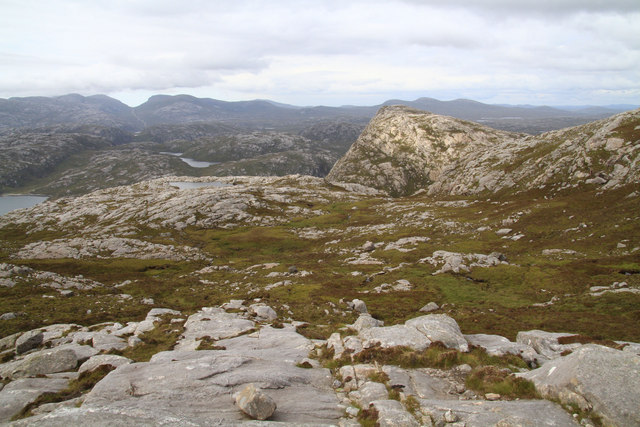
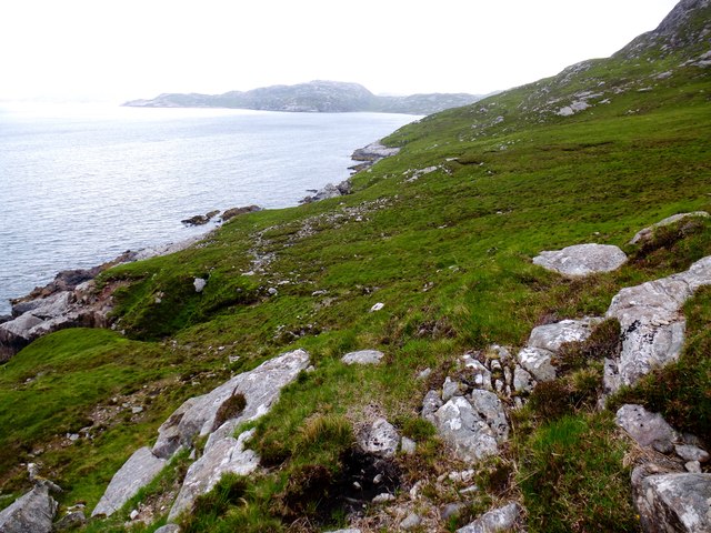
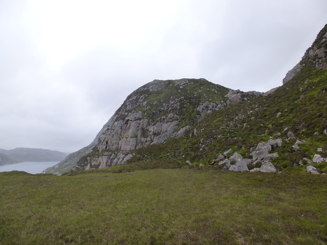
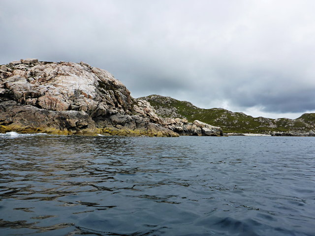
Covering an area of approximately 10 hectares, Grèine Sgeir is home to a small community of residents who enjoy a peaceful and secluded lifestyle. The island is primarily composed of rocky terrain, with a rugged coastline that offers breathtaking views of the surrounding sea.

The island's name, Grèine Sgeir, translates to "sunny rock" in Scottish Gaelic, reflecting the island's reputation for receiving more sunshine than the mainland. This unique microclimate contributes to the island's lush vegetation, which includes various grasses, heather, and wildflowers.

In terms of wildlife, Grèine Sgeir is a haven for seabirds. The island's cliffs and rocky outcrops provide nesting sites for species such as guillemots, razorbills, and puffins. Visitors can observe these beautiful birds in their natural habitat during the breeding season.

Historically, Grèine Sgeir has played a significant role in the local fishing industry. The island was once home to a small fishing community, and remnants of old fishing bothies can still be seen today. Fishing continues to be an important activity for the island's residents, contributing to the local economy.

Accessible by boat, Grèine Sgeir offers a tranquil retreat for those seeking a break from the hustle and bustle of city life. Its unspoiled natural landscapes, diverse wildlife, and rich history make it a destination worth exploring for nature enthusiasts and history buffs alike.

If you have any feedback on the listing, please let us know in the comments section below.

Grèine Sgeir Images

Images are sourced within 2km of 58.028891/-7.0667956 or Grid Reference NB0115. Thanks to Geograph Open Source API. All images are credited.

Traigh Mheilein  beach Apparently it rains in the Hebrides.
Traigh Mheilein beach
Apparently it rains in the Hebrides.
Deserted Beach The beach of Traigh Mheilein with the hills of west Lewis dusted with snow in the distance and the island of Fladaigh at left.
Deserted Beach
The beach of Traigh Mheilein with the hills of west Lewis dusted with snow in the distance and the island of Fladaigh at left.
Grazing sheep, Meilein, Harris Lazy beds can just be made out going from the bottom edge of the photo towards the cliff edge.
Grazing sheep, Meilein, Harris
Lazy beds can just be made out going from the bottom edge of the photo towards the cliff edge.
Unnamed Lochan From Lag Mor The peak in the right middle distance is Tarran Mor, with Loch nan Uidheam immediately behind the subject.
Unnamed Lochan From Lag Mor
The peak in the right middle distance is Tarran Mor, with Loch nan Uidheam immediately behind the subject.
Above Loch Crabhadail Looking over the loch from the higher ground near Meilein.
Above Loch Crabhadail
Looking over the loch from the higher ground near Meilein.
Rocks on the beach at Rubh' an Tighe Beyond is Tarran Mor and Mas Garbh, across Loch Crabhadail.
Rocks on the beach at Rubh' an Tighe
Beyond is Tarran Mor and Mas Garbh, across Loch Crabhadail.
Lochan south of Meilein The hill beyond is Huiseabhal Beag.
Lochan south of Meilein
The hill beyond is Huiseabhal Beag.
Traigh Mheilein
Traigh Mheilein
View Across To Coirnis View across to Coirnis, 77 metres and a P30 hill. This is close to the spot that the RIB tender boat collected us after climbing Meall nan Sidhean.
View Across To Coirnis
View across to Coirnis, 77 metres and a P30 hill. This is close to the spot that the RIB tender boat collected us after climbing Meall nan Sidhean.
View Towards Fladaigh View across the water to Fladaigh and some hills towards the north on the Isle of Lewis.
View Towards Fladaigh
View across the water to Fladaigh and some hills towards the north on the Isle of Lewis.
Loch na Cleabhaig The outflow stream at the eastern end of the loch. It runs barely 200m before disappearing through boulders to the seashore.
Loch na Cleabhaig
The outflow stream at the eastern end of the loch. It runs barely 200m before disappearing through boulders to the seashore.
Offshore reefs from Meilein Surf boils over part submerged reefs near the entrance to Loch Crabhadail. The view is towards the hills of SW Lewis.
Offshore reefs from Meilein
Surf boils over part submerged reefs near the entrance to Loch Crabhadail. The view is towards the hills of SW Lewis.
Stony beach at Rubh' an Tighe Approaching the headland of Rubh' an Tighe, where there is a stony beach backed by loose cliffs of morainic material.
Stony beach at Rubh' an Tighe
Approaching the headland of Rubh' an Tighe, where there is a stony beach backed by loose cliffs of morainic material.
Traigh Mheilein Old lazybeds lead down to the north end of the superb beach at Traigh Mheilein, with the island of Scarp just across the water.
Traigh Mheilein
Old lazybeds lead down to the north end of the superb beach at Traigh Mheilein, with the island of Scarp just across the water.
East coast of Loch Crabhadail Sheep/deer tracks contour around the coast from Haranais towards mouth of Loch Reasort.
East coast of Loch Crabhadail
Sheep/deer tracks contour around the coast from Haranais towards mouth of Loch Reasort.
South coast of Loch Reasort from Grobadh na h-Uinneag Looking east along south side of Loch Reasort. Sheep/deer track leads up around the south of the buttress in centre of photo to upper stretch of Allt na Sgail burn.
South coast of Loch Reasort from Grobadh na h-Uinneag
Looking east along south side of Loch Reasort. Sheep/deer track leads up around the south of the buttress in centre of photo to upper stretch of Allt na Sgail burn.
Fladaigh A low-lying island off Scarp
Fladaigh
A low-lying island off Scarp
Rubha Càrnach
Rubha Càrnach
Show me another place!

Grèine Sgeir is located at Grid Ref: NB0115 (Lat: 58.028891, Lng: -7.0667956)

Unitary Authority: Na h-Eileanan an Iar

Police Authority: Highlands and Islands

What 3 Words

///occupations.teaches.safest. Near Tarbert, Na h-Eileanan Siar

Nearby Locations

Bràigh Mòr Grèine Sgeir

Related Wikis

Scarp, Scotland

Scarp (Scottish Gaelic: An Sgarp) is an uninhabited island in the Outer Hebrides of Scotland, west of Hushinish on Harris. Once inhabited, the island was...

Hushinish

Huisinish or Hushinish (Scottish Gaelic Hùisinis) is a remote place on the west coast of Harris in the Outer Hebrides of Scotland. It lies at the end of...

Tiorga Mor

Tiorga Mor (679 m) is a mountain in Harris, in the Outer Hebrides of Scotland. The most westerly peak of the high mountains of Harris, it is a very rugged...

Eilean Mhealasta

Eilean Mhealasta (Mealista Island) is an uninhabited island off the west coast of Lewis in the Outer Hebrides of Scotland. It takes its name from Mealista...

Have you been to Grèine Sgeir?

Leave your review of Grèine Sgeir below (or comments, questions and feedback).