Sgeirean nan Lagan Tiorma

Island in Ross-shire

Scotland

Sgeirean nan Lagan Tiorma

Mangurstadh Coastline Looking South The cliffs here are spectacular and the Lewisian Gneiss makes for some great climbing.
Mangurstadh Coastline Looking South Credit: RIJones

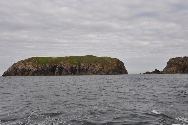
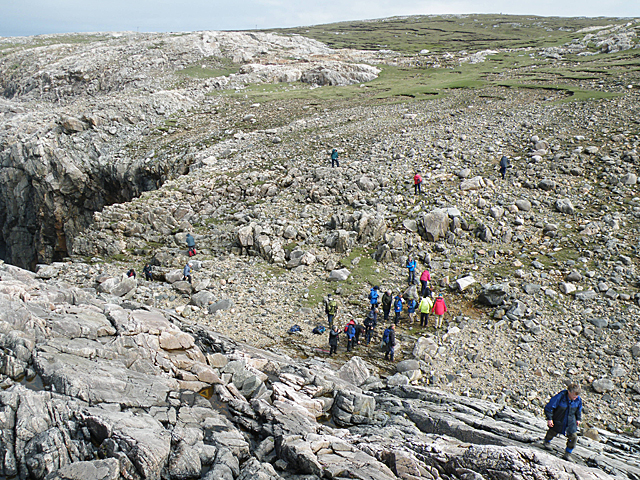
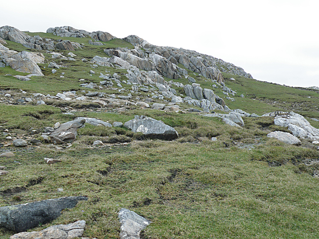
Sgeirean nan Lagan Tiorma, located in Ross-shire, is a group of small islands situated off the west coast of Scotland. These islands are known for their rugged and rocky terrain, making them a popular destination for adventure seekers and nature enthusiasts.

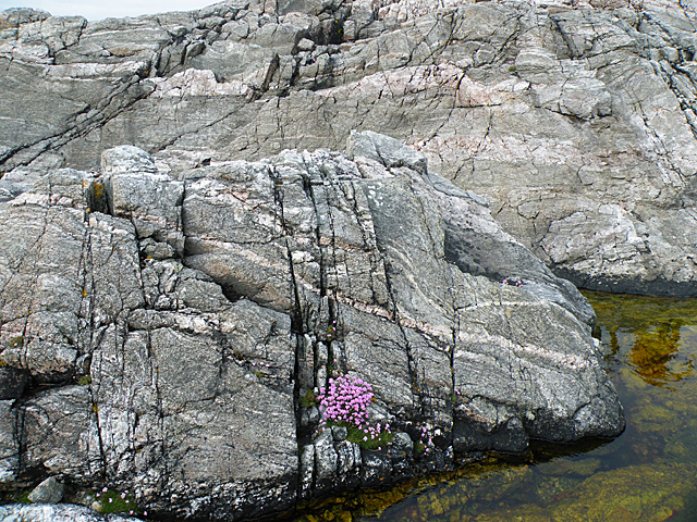
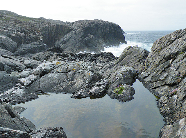
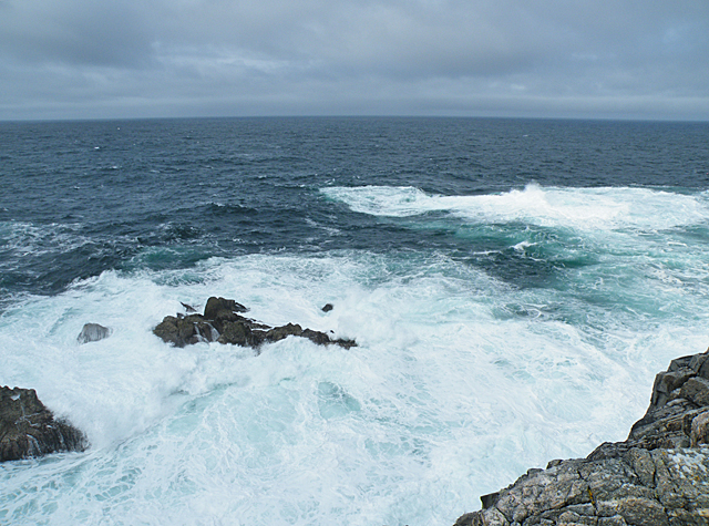
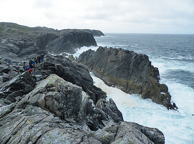
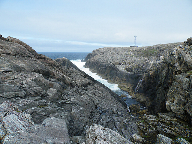
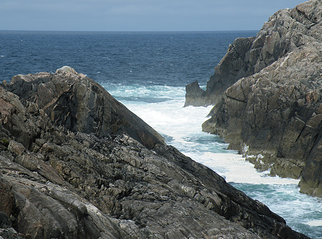
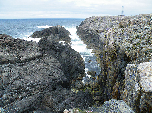
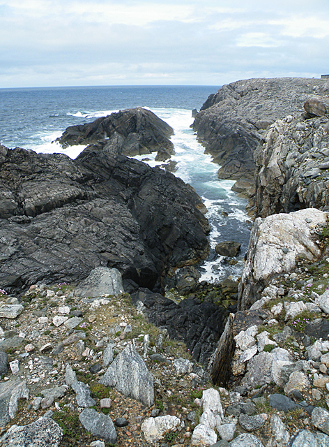
The islands of Sgeirean nan Lagan Tiorma are characterized by their towering cliffs, which provide breathtaking views of the surrounding sea and coastline. The cliffs are home to various species of seabirds, including puffins, guillemots, and razorbills, making them a haven for birdwatchers. Visitors can observe these fascinating creatures in their natural habitat, as well as enjoy the stunning natural beauty of the islands.

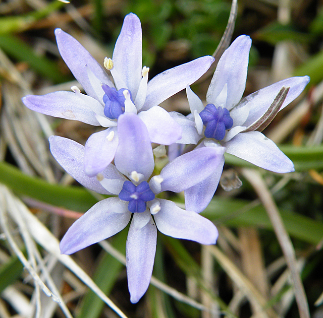
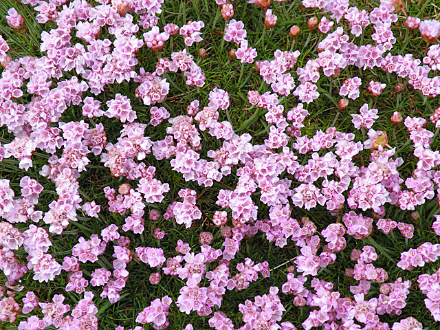
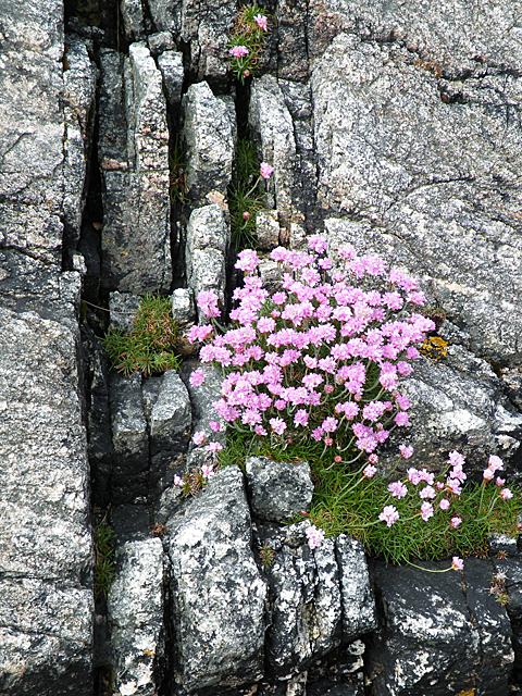
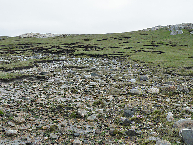
The islands are also home to several species of marine life, including seals and dolphins, which can often be spotted swimming in the surrounding waters. The diverse ecosystem of Sgeirean nan Lagan Tiorma supports a rich variety of flora and fauna, with wildflowers blooming in the summer months and mosses and lichens covering the rocky landscape.

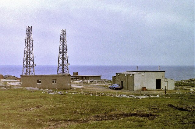
Access to Sgeirean nan Lagan Tiorma is mainly by boat, with regular ferry services available from the mainland. The islands offer opportunities for hiking, birdwatching, and exploring the rugged coastline. Visitors can also enjoy fishing in the surrounding waters or simply relax and take in the tranquil atmosphere of these remote and untouched islands.

Overall, Sgeirean nan Lagan Tiorma is a unique and picturesque destination, offering visitors a chance to immerse themselves in Scotland's natural beauty and observe its diverse wildlife in a stunning coastal setting.

If you have any feedback on the listing, please let us know in the comments section below.

Sgeirean nan Lagan Tiorma Images

Images are sourced within 2km of 58.187344/-7.0903881 or Grid Reference NB0033. Thanks to Geograph Open Source API. All images are credited.

Mangurstadh Coastline Looking South The cliffs here are spectacular and the Lewisian Gneiss makes for some great climbing.
Mangurstadh Coastline Looking South
The cliffs here are spectacular and the Lewisian Gneiss makes for some great climbing.
Eilean Molach Showing the narrow gap between it and mainland Lewis.
Eilean Molach
Showing the narrow gap between it and mainland Lewis.
Radio masts at Mangastra/Mhangarstaidh, Lewis, 1989 Compared to more recent images, it would appear a number of these buildings and one mast have been demolished in the intervening years.
Radio masts at Mangastra/Mhangarstaidh, Lewis, 1989
Compared to more recent images, it would appear a number of these buildings and one mast have been demolished in the intervening years.
Spring Squill (Scilla verna) Surprisingly, given how exposed the headland at Mangarstadh is, and how scarce the soil, there was a carpet of stunted wildflowers including this Spring Squill.
Spring Squill (Scilla verna)
Surprisingly, given how exposed the headland at Mangarstadh is, and how scarce the soil, there was a carpet of stunted wildflowers including this Spring Squill.
Thrift (Armeria maritima) A cushion of thrift provides a splash of colour on the bleak and windswept clifftop. The flower stalks are taller in more benign conditions, but here they are stunted by the wind and weather. I wonder whether any insects brave the wind to pollinate the flowers>
Thrift (Armeria maritima)
A cushion of thrift provides a splash of colour on the bleak and windswept clifftop. The flower stalks are taller in more benign conditions, but here they are stunted by the wind and weather. I wonder whether any insects brave the wind to pollinate the flowers>
Gneiss Rocks This headland is mostly composed of striped grey Lewisian gneiss. The sloping rock face behind the foreground rock is a thrust plane which dips towards the east.
Gneiss Rocks
This headland is mostly composed of striped grey Lewisian gneiss. The sloping rock face behind the foreground rock is a thrust plane which dips towards the east.
Thrift in a Cleft This Thrift plant has found a less exposed spot than <a href="https://www.geograph.org.uk/photo/2432622">NB0033 : Thrift (Armeria maritima)</a>, so has been able to grow into a more 'normal' shape. It is exploiting a crack in the inhospitable Lewisian gneiss, probably created by movement on the adjacent thrust.
Thrift in a Cleft
This Thrift plant has found a less exposed spot than NB0033 : Thrift (Armeria maritima), so has been able to grow into a more 'normal' shape. It is exploiting a crack in the inhospitable Lewisian gneiss, probably created by movement on the adjacent thrust.
Mangarstadh Head Contrast the glassy surface of the rock pool, sheltered from the wind, with the surf crashing on the cliffs beyond. The rock surfaces sloping from lower left to upper right are the faces of thrust planes generated by tectonic movements some 430 million years ago.
Mangarstadh Head
Contrast the glassy surface of the rock pool, sheltered from the wind, with the surf crashing on the cliffs beyond. The rock surfaces sloping from lower left to upper right are the faces of thrust planes generated by tectonic movements some 430 million years ago.
Mangarstadh Head Looking out from the cliffs at Mangarsatdh Head, the offshore rocks are whipping up surf in a strong westerly wind.
Mangarstadh Head
Looking out from the cliffs at Mangarsatdh Head, the offshore rocks are whipping up surf in a strong westerly wind.
Sgeir an Tamna This is the name given to the long offshore rock south-west of Mangurstadh Head. The pronounced slopes to landward are thrust planes created as rocks were pushed from left to right by tectonic movements.
Sgeir an Tamna
This is the name given to the long offshore rock south-west of Mangurstadh Head. The pronounced slopes to landward are thrust planes created as rocks were pushed from left to right by tectonic movements.
Aird Mhangarstadh Aird Mhangarstadh means 'the high point of Mangarstadh' and this view shows the disused telecommunications mast on the top of the Aird. If only the military were required to remove all traces of their ugly structures once they are no longer required!
Aird Mhangarstadh
Aird Mhangarstadh means 'the high point of Mangarstadh' and this view shows the disused telecommunications mast on the top of the Aird. If only the military were required to remove all traces of their ugly structures once they are no longer required!
Geo at Mangarstadh Head The geo is formed along the line of one of the thrust planes in evidence here. The thrusts were the result of tectonic movements some 400 million years ago. Somewhere deep in the crust of the Earth, the sloping surface in the foreground was planed by other layers of rock which were pushed inexorably from left to right, grinding up the rocks in the thrust place to form a characteristic rock named mylonite.
Geo at Mangarstadh Head
The geo is formed along the line of one of the thrust planes in evidence here. The thrusts were the result of tectonic movements some 400 million years ago. Somewhere deep in the crust of the Earth, the sloping surface in the foreground was planed by other layers of rock which were pushed inexorably from left to right, grinding up the rocks in the thrust place to form a characteristic rock named mylonite.
Geo at Mangarstadh Head The long inlet has been carved by the sea along the thrust plane, where the rocks have been weakened by the thrusting.
Geo at Mangarstadh Head
The long inlet has been carved by the sea along the thrust plane, where the rocks have been weakened by the thrusting.
Clifftop at Aird Mòr Mangarstadh Even though high above sea level, the force of storms is enough to prevent the cliff top here becoming vegetated. The slope in the foreground is the surface of a 400-million-year-old thrust, where rocks were pushed westwards during tectonic movements.
Clifftop at Aird Mòr Mangarstadh
Even though high above sea level, the force of storms is enough to prevent the cliff top here becoming vegetated. The slope in the foreground is the surface of a 400-million-year-old thrust, where rocks were pushed westwards during tectonic movements.
Aird Mòr Mangarstadh This almost lunar landscape is the result of ancient earth movements. Rocks were thrust from left to right, and the rocks close to the thrust plane were ground fine and recrystallised into weaker material, which has then been eroded by the sea to form the dip to the left of the sloping layers on the right.
Aird Mòr Mangarstadh
This almost lunar landscape is the result of ancient earth movements. Rocks were thrust from left to right, and the rocks close to the thrust plane were ground fine and recrystallised into weaker material, which has then been eroded by the sea to form the dip to the left of the sloping layers on the right.
Geo at Mangarstadh Head The long inlet has been carved by the sea along the line of a thrust plane, where the rocks have been weakened by the thrusting.
Geo at Mangarstadh Head
The long inlet has been carved by the sea along the line of a thrust plane, where the rocks have been weakened by the thrusting.
Druim Tarasgeo This bare area was formed when storms destroyed the thin layer of vegetation covering the stony ground, and simply blew it away. On these cliff tops there are patches in all states from newly blown away to fully re-vegetated. The predominant plant is Thrift (Armeria maritima).
Druim Tarasgeo
This bare area was formed when storms destroyed the thin layer of vegetation covering the stony ground, and simply blew it away. On these cliff tops there are patches in all states from newly blown away to fully re-vegetated. The predominant plant is Thrift (Armeria maritima).
Druim Tarasgeo Slightly higher up the cliff the vegetation has a stronger hold on the ground, allowing grasses and other species to colonise. However the scars of old blow-outs are easily seen.
Druim Tarasgeo
Slightly higher up the cliff the vegetation has a stronger hold on the ground, allowing grasses and other species to colonise. However the scars of old blow-outs are easily seen.
Show me another place!

Sgeirean nan Lagan Tiorma is located at Grid Ref: NB0033 (Lat: 58.187344, Lng: -7.0903881)

Unitary Authority: Na h-Eileanan an Iar

Police Authority: Highlands and Islands

What 3 Words

///priced.samplers.jump. Near Carloway, Na h-Eileanan Siar

Related Wikis

Stac Dhòmhnaill Chaim

Stac Dhòmnuill Chaim, or Stac Dhòmhnaill Chaim, or Stac Domhnuill Chaim, is a fortified promontory located near Mangursta (or Mangersta, Scottish Gaelic...

Abhainn Dearg distillery

Abhainn Dearg distillery ( AV-in JAIRG) or Red River distillery is a Scotch whisky distillery in Uig, on the west coast of the Isle of Lewis in the Outer...

Ardroil

Ardroil (Scottish Gaelic: Eadar Dhà Fhadhail) is a village on the Isle of Lewis in the Outer Hebrides, Scotland. Ardroil is within the parish of Uig....

Uig, Lewis

Uig (Scottish Gaelic: Ùig [uːkʲ]), also known as Sgìr' Ùig, is a civil parish and community in the west of the Isle of Lewis in the Outer Hebrides, Scotland...

Nearby Amenities

Located within 500m of 58.187344,-7.0903881
Turning Circle
Lat/Long: 58.1857687/-7.0981536
Man Made: tower
Tower Construction: lattice
Lat/Long: 58.1858562/-7.0982565
Power: pole
Lat/Long: 58.1836404/-7.094492
Power: pole
Lat/Long: 58.1841292/-7.0951537
Power: pole
Lat/Long: 58.1847599/-7.0960247
Power: pole
Lat/Long: 58.1853784/-7.0968711
Power: pole
Lat/Long: 58.1858327/-7.0972967
Power: pole
Lat/Long: 58.1861619/-7.0976109
Rubha Gheasbridh
Natural: cape
Lat/Long: 58.1866951/-7.0922355
Gob Rubha Phail
Natural: cape
Lat/Long: 58.1881344/-7.0954327
Rubha Phail
Natural: cape
Lat/Long: 58.1874897/-7.0942633
Torasgeo
Natural: bay
Lat/Long: 58.1861323/-7.0931153
Mhangerstadh Radio Station
Place: locality
Lat/Long: 58.1857562/-7.0977233
The data included in this document is from www.openstreetmap.org. The data is made available under ODbL.

Have you been to Sgeirean nan Lagan Tiorma?

Leave your review of Sgeirean nan Lagan Tiorma below (or comments, questions and feedback).