Gròdaigh

Island in Inverness-shire

Scotland

Gròdaigh

Crogearraidh na Thobha Boggy hill top on the east coast of North Uist.
Crogearraidh na Thobha Credit: Richard Webb

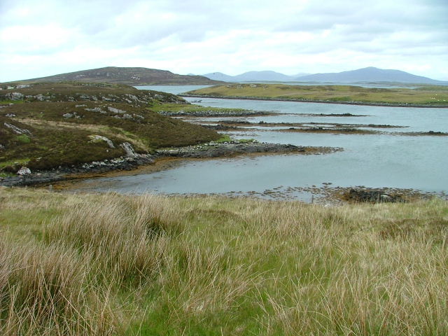
Gròdaigh is a picturesque island located in Inverness-shire, Scotland. Situated off the northwest coast of the Scottish mainland, it is surrounded by the stunning waters of the Inner Hebrides.

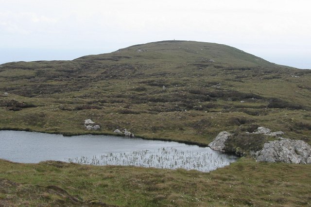
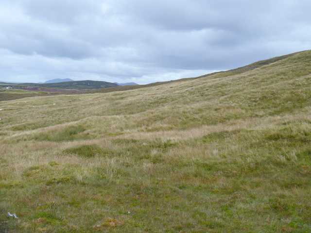
Covering an area of approximately 10 square miles, Gròdaigh is known for its rugged and dramatic landscape. The island is characterized by its tall cliffs, rocky shores, and rolling hills, creating a beautiful and diverse terrain for visitors to explore. The highest point on the island is Creag Mhòr, standing at 1,214 feet, offering breathtaking panoramic views of the surrounding area.

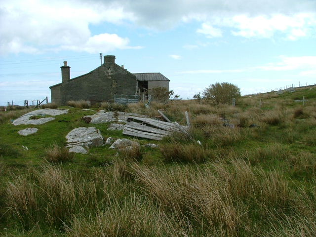
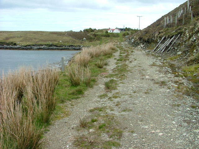
Gròdaigh is home to a small population, mainly living in scattered settlements throughout the island. The community is closely connected and known for its warm hospitality, making visitors feel welcome and at ease during their stay. Traditional Gaelic culture is still prevalent on the island, with locals speaking the language and practicing traditional music and dance.

Nature enthusiasts will find Gròdaigh a haven for wildlife, with a wide variety of bird species, including puffins, eagles, and falcons, nesting along its cliffs. The island's coastal waters are also home to seals, dolphins, and whales, providing opportunities for wildlife-watching excursions and boat trips.

For those interested in history, Gròdaigh has a rich heritage. The island boasts ancient archaeological sites, including standing stones and burial mounds, dating back thousands of years. Visitors can immerse themselves in the island's history by exploring these ancient landmarks and learning about the culture and traditions of its past inhabitants.

Overall, Gròdaigh offers a unique and captivating experience for nature lovers, history enthusiasts, and those seeking a tranquil escape from the bustling mainland.

If you have any feedback on the listing, please let us know in the comments section below.
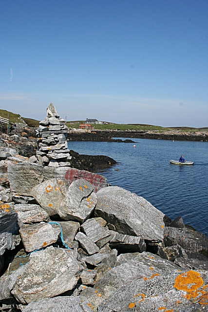
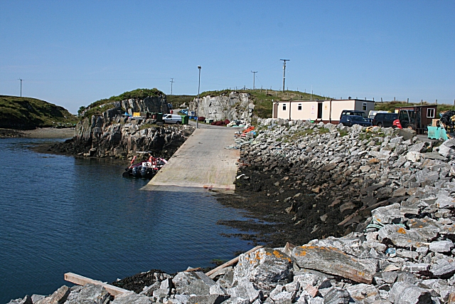
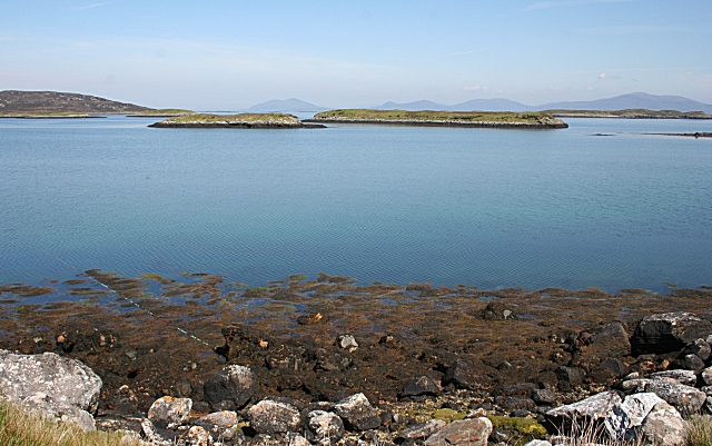
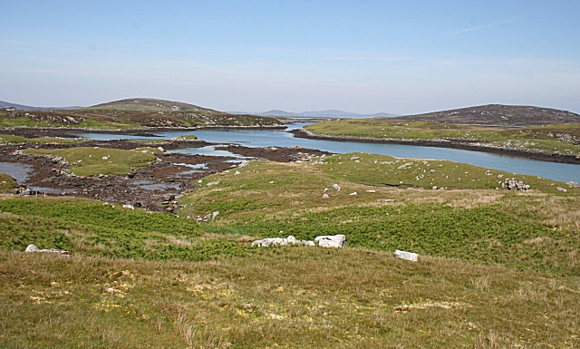
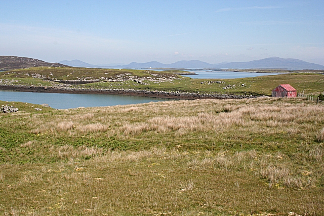
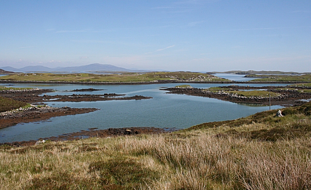
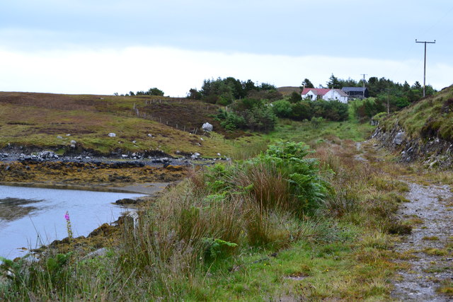
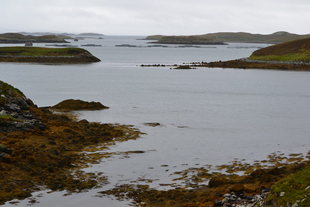
Gròdaigh Images

Images are sourced within 2km of 57.64824/-7.0648207 or Grid Reference NF9773. Thanks to Geograph Open Source API. All images are credited.

Crogearraidh na Thobha Boggy hill top on the east coast of North Uist.
Crogearraidh na Thobha
Boggy hill top on the east coast of North Uist.
Deserted Crofthouse At Bàgh Chàise, a small crofting settlement on North Uist.
Deserted Crofthouse
At Bàgh Chàise, a small crofting settlement on North Uist.
Inlet on The Sound of Harris North of Bàgh Chàise, a small crofting settlement.
Inlet on The Sound of Harris
North of Bàgh Chàise, a small crofting settlement.
Strom. Looking towards Orasaigh Island.
Strom.
Looking towards Orasaigh Island.
Track and House On Bágh a' Cháise.
Track and House
On Bágh a' Cháise.
Cheese Bay Looking north from the harbour wall at Cheese Bay. This style of tall cairn seems popular in the Hebrides.
Cheese Bay
Looking north from the harbour wall at Cheese Bay. This style of tall cairn seems popular in the Hebrides.
Bàgh a'Chàise A fisherman rows ashore from his boat, moored close to the Cheese Bay harbour wall. On the right is the island of Taghaidh, in the next square.
Bàgh a'Chàise
A fisherman rows ashore from his boat, moored close to the Cheese Bay harbour wall. On the right is the island of Taghaidh, in the next square.
Cheese Bay Looking past the south end of the island of Taghaigh towards the distant mountains of South Harris.
Cheese Bay
Looking past the south end of the island of Taghaigh towards the distant mountains of South Harris.
Cheese Bay Slipway This slipway is used by Marine Harvest for access of the fish farms they operate in Bàgh a'Chàise and further offshore.
Cheese Bay Slipway
This slipway is used by Marine Harvest for access of the fish farms they operate in Bàgh a'Chàise and further offshore.
Eileana Dubha Eileana Dubha means 'dark islands' and is applied to the two nearest islets. The distant hills are in South Harris.
Eileana Dubha
Eileana Dubha means 'dark islands' and is applied to the two nearest islets. The distant hills are in South Harris.
Strom and Orasaigh The land on the other side of the inlet of Strom, on the right, is yet another island named Orasaigh. I wonder just how many Hebridean islands bear this same name?
Strom and Orasaigh
The land on the other side of the inlet of Strom, on the right, is yet another island named Orasaigh. I wonder just how many Hebridean islands bear this same name?
Strom This inlet off Bàgh a'Chàise is named on the maps as Strom.
Strom
This inlet off Bàgh a'Chàise is named on the maps as Strom.
Bàgh a'Chàise The headland to the left of the red hut separates the inlet of Strom from Bàgh a'Chàise (Cheese Bay). In the distance are the hills of South Harris.
Bàgh a'Chàise
The headland to the left of the red hut separates the inlet of Strom from Bàgh a'Chàise (Cheese Bay). In the distance are the hills of South Harris.
Orasaigh The island on the other side of the inlet is yet another one named Orasaigh. I wonder just how many Hebridean islands bear this same name?
Orasaigh
The island on the other side of the inlet is yet another one named Orasaigh. I wonder just how many Hebridean islands bear this same name?
Overgrown track and house, Bagh a Chaise
Bagh a Chaise A floating fish farm is visible in the middle distance.
Bagh a Chaise
A floating fish farm is visible in the middle distance.
Slipway at Bàgh a Chàise The base for Marine Harvest's Cheesebay Fish Farm.
Slipway at Bàgh a Chàise
The base for Marine Harvest's Cheesebay Fish Farm.
Western slopes of Crògearraidh na Thobha A fenced area of grass in an otherwise heathery area.
Western slopes of Crògearraidh na Thobha
A fenced area of grass in an otherwise heathery area.
Show me another place!

Gròdaigh is located at Grid Ref: NF9773 (Lat: 57.64824, Lng: -7.0648207)

Unitary Authority: Na h-Eileanan an Iar

Police Authority: Highlands and Islands

What 3 Words

///grew.fighters.aimed. Near Lochmaddy, Na h-Eileanan Siar

Related Wikis

Hermetray

Hermetray (Scottish Gaelic: Theàrnatraigh) is an uninhabited island off North Uist, in the Outer Hebrides of Scotland. == Geography and geology == Hermetray...

Tahay

Tahay (Scottish Gaelic: Taghaigh) is an island in the Outer Hebrides of Scotland. The name originates from the Old Norse tagg-øy meaning island with a...

South Lewis, Harris and North Uist National Scenic Area

South Lewis, Harris and North Uist is a large national scenic area (NSA) in the Western Isles of Scotland. It is one of 40 such areas in Scotland, which...

Sursaigh

Sursaigh (Scottish Gaelic: Sursaigh) is an island off North Uist in the Sound of Harris, Scotland. It lies 8 kilometres (5.0 mi) northeast of the village...

Have you been to Gròdaigh?

Leave your review of Gròdaigh below (or comments, questions and feedback).