Siolaigh Mòr

Island in Inverness-shire

Scotland

Siolaigh Mòr

Junction on the path to Aird Horragaigh, South Uist From the end of the tarred road, an excellent grass track heads south. Although it deteriorates a little, it still makes a great afternoon walk.
Junction on the path to Aird Horragaigh, South Uist Credit: AlastairG

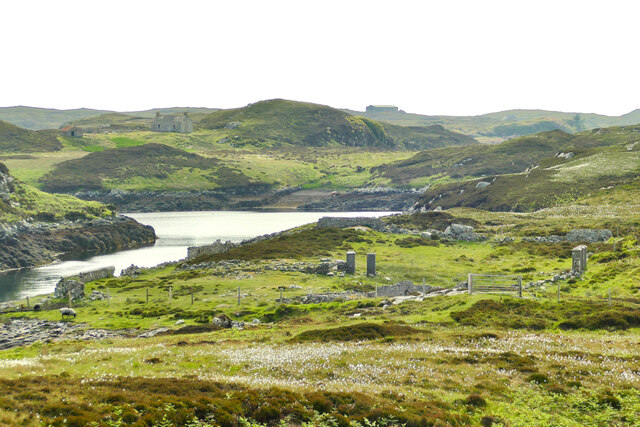
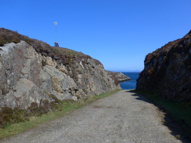
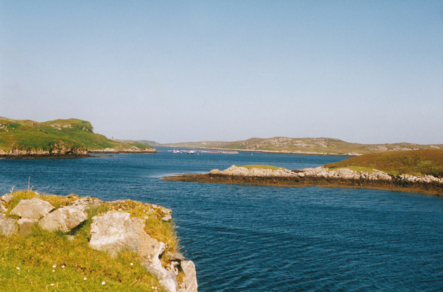
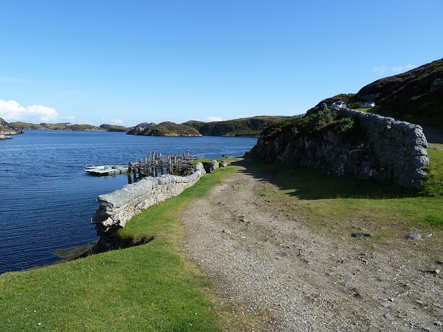
Siolaigh Mòr is a small island located in the Inner Hebrides of Scotland, specifically in Inverness-shire. The island is known for its rugged, rocky terrain and stunning coastal views. Siolaigh Mòr is relatively uninhabited, with only a few small settlements scattered throughout the island.

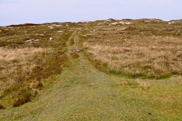
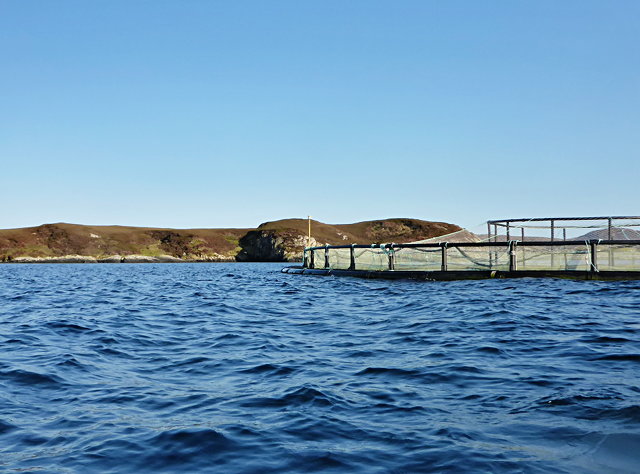
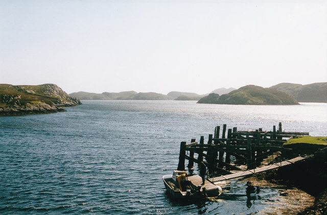
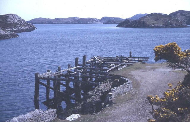
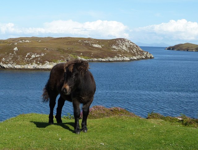
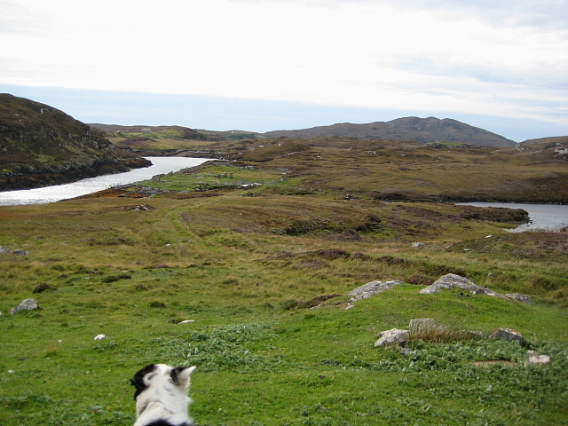
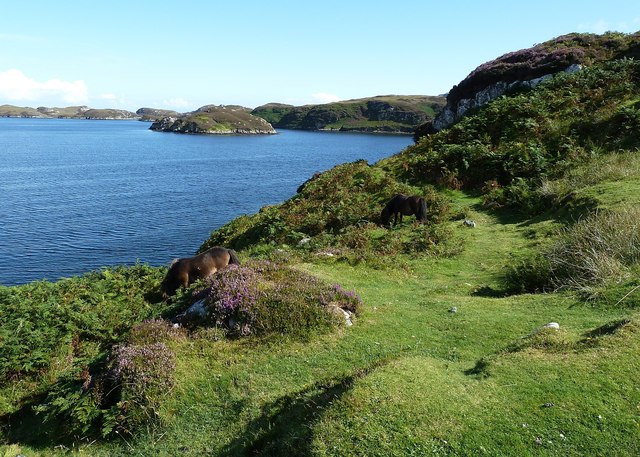
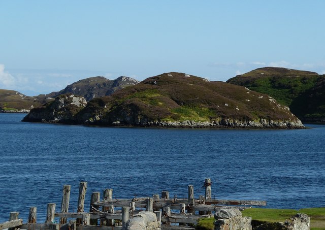
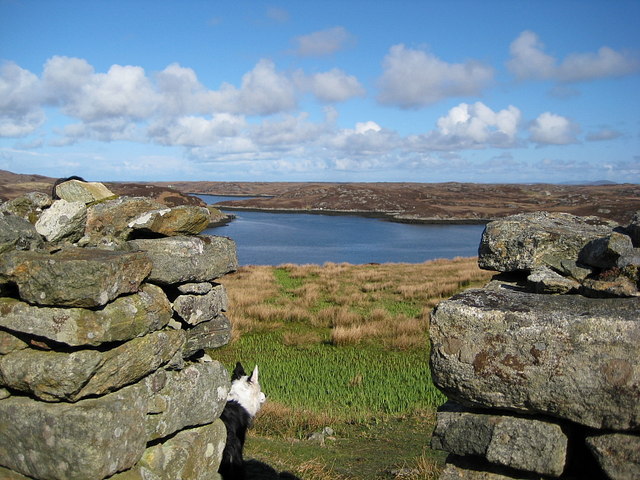
The landscape of Siolaigh Mòr is characterized by rolling hills, cliffs, and pristine beaches. The island is home to a variety of wildlife, including seabirds, seals, and otters. The waters surrounding the island are teeming with marine life, making it a popular destination for fishing and wildlife watching.

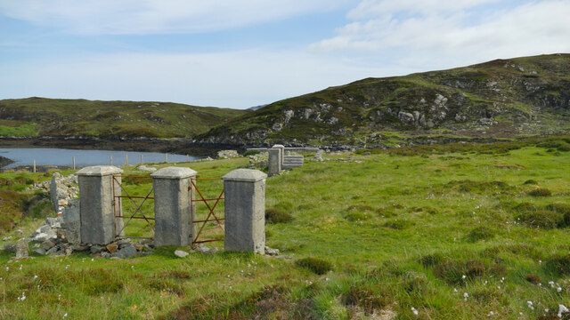
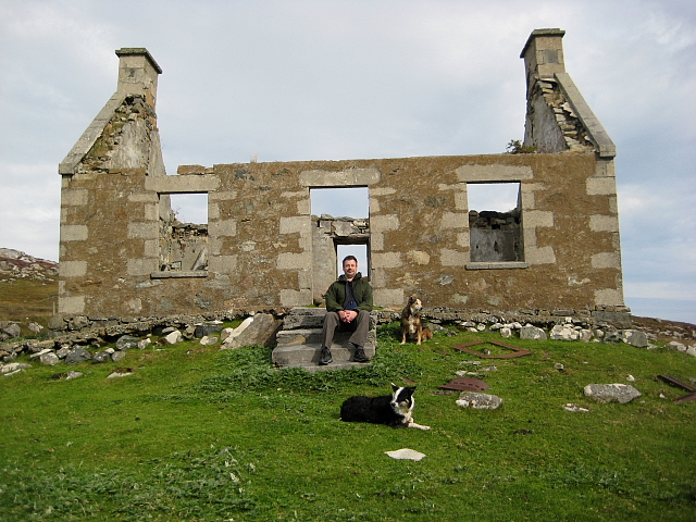
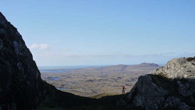
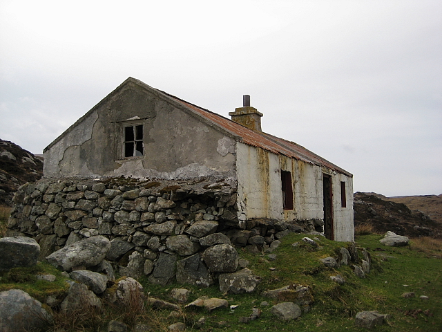
Visitors to Siolaigh Mòr can enjoy hiking along the island's many trails, exploring the ancient ruins, and relaxing on the beaches. The island also offers opportunities for birdwatching, kayaking, and sailing. Accommodation on the island is limited, with a few small guesthouses and cottages available for rent.

Overall, Siolaigh Mòr is a peaceful and scenic destination for nature lovers and outdoor enthusiasts looking to escape the hustle and bustle of everyday life.

If you have any feedback on the listing, please let us know in the comments section below.

Siolaigh Mòr Images

Images are sourced within 2km of 57.327252/-7.2471678 or Grid Reference NF8438. Thanks to Geograph Open Source API. All images are credited.

Junction on the path to Aird Horragaigh, South Uist From the end of the tarred road, an excellent grass track heads south. Although it deteriorates a little, it still makes a great afternoon walk.
Junction on the path to Aird Horragaigh, South Uist
From the end of the tarred road, an excellent grass track heads south. Although it deteriorates a little, it still makes a great afternoon walk.
19th century East Gerinish school at Aird Horragaigh The school gates at East Gerinish. Why two gates? One for the girls and one for the boys. Amazing, especially as many would have walked miles to school in mixed groups.
19th century East Gerinish school at Aird Horragaigh
The school gates at East Gerinish. Why two gates? One for the girls and one for the boys. Amazing, especially as many would have walked miles to school in mixed groups.
Schoolmaster's house, East Gerinish Standing on the hillside near a ruined croft, the schoolmaster's house would have had a commanding view over the school below.  <a href="https://www.geograph.org.uk/photo/7514077">NF8339 : View of East Gerinish school from the schoolmaster's house</a>
Schoolmaster's house, East Gerinish
Standing on the hillside near a ruined croft, the schoolmaster's house would have had a commanding view over the school below. NF8339 : View of East Gerinish school from the schoolmaster's house
View of East Gerinish school from the schoolmaster's house The schoolmaster would have missed nothing from this viewpoint.  <a href="https://www.geograph.org.uk/photo/7514071">NF8339 : Schoolmaster's house, East Gerinish</a> The three pillars on the right on the school 'enclosure' frame the girls' and boys' gates.  <a href="https://www.geograph.org.uk/photo/7514055">NF8339 : 19th century East Gerinish school at Aird Horragaigh</a>
View of East Gerinish school from the schoolmaster's house
The schoolmaster would have missed nothing from this viewpoint. NF8339 : Schoolmaster's house, East Gerinish The three pillars on the right on the school 'enclosure' frame the girls' and boys' gates. NF8339 : 19th century East Gerinish school at Aird Horragaigh
Fish farming near Eilean Ornais
The road to Loch Sgioport With the sea loch itself visible ahead.
The road to Loch Sgioport
With the sea loch itself visible ahead.
An old pier The pier is still in use but the gare timbers did look rather precarious to me as a non sailor.
An old pier
The pier is still in use but the gare timbers did look rather precarious to me as a non sailor.
What a wonderful view Looking in the other direction from the pier at Loch Sgioport. I notice in more recent submissions that the pier is in an even more decayed condition.
What a wonderful view
Looking in the other direction from the pier at Loch Sgioport. I notice in more recent submissions that the pier is in an even more decayed condition.
Old pier at the end of the B890, Loch Sgiopoirt
Pony at Rubha Mòr Rubha Mòr is at the end of the B890 as it reaches Loch Sgiopoirt (alternative names: Scioport, Skipport etc.) on the eastern coast of South Uist.
This little pony was very friendly and posed nicely for me when requested !
Pony at Rubha Mòr
Rubha Mòr is at the end of the B890 as it reaches Loch Sgiopoirt (alternative names: Scioport, Skipport etc.) on the eastern coast of South Uist. This little pony was very friendly and posed nicely for me when requested !
Disused pier, Rubha Mòr The B890 peters out as it reaches Loch Sgioport, but a track continues winding down to this old abandoned pier. The sea loch stretches ahead on this beautiful eastern coast of South Uist.
Disused pier, Rubha Mòr
The B890 peters out as it reaches Loch Sgioport, but a track continues winding down to this old abandoned pier. The sea loch stretches ahead on this beautiful eastern coast of South Uist.
Bagh a Mhanaich Bagh a Mhanaich and the site of the old school house (in the middle distance along side the water).
Bagh a Mhanaich
Bagh a Mhanaich and the site of the old school house (in the middle distance along side the water).
Ruined Croft House Overlooking the site of the school house. There are several older ruins just to the north.
Ruined Croft House
Overlooking the site of the school house. There are several older ruins just to the north.
Ponies graze above Loch Sgiopoirt Loch Sgiopoirt is a deeply indented sea loch on the east coast of South Uist. Several ponies were grazing contentedly on this headland. The islet in the background is Eilean Haey.
Ponies graze above Loch Sgiopoirt
Loch Sgiopoirt is a deeply indented sea loch on the east coast of South Uist. Several ponies were grazing contentedly on this headland. The islet in the background is Eilean Haey.
Eilean Haey from Rubha Mòr Eilean Haey is a little island in the mouth of the sea loch Sgiopoirt. This view is taken over the remains of the old pier at Rubha Mòr.
Eilean Haey from Rubha Mòr
Eilean Haey is a little island in the mouth of the sea loch Sgiopoirt. This view is taken over the remains of the old pier at Rubha Mòr.
Climbing to the ridge at Maol Martaig
Shieling, Caolas Mor An almost habitable shieling/house at Caolas Mor
Shieling, Caolas Mor
An almost habitable shieling/house at Caolas Mor
Caolas Mor From the ruined shieling at the end of the made track. From here onwards the intrepid walker has to start squelching!
Caolas Mor
From the ruined shieling at the end of the made track. From here onwards the intrepid walker has to start squelching!
Show me another place!

Siolaigh Mòr is located at Grid Ref: NF8438 (Lat: 57.327252, Lng: -7.2471678)

Unitary Authority: Na h-Eileanan an Iar

Police Authority: Highlands and Islands

What 3 Words

///intention.truth.swift. Near Balivanich, Na h-Eileanan Siar

Related Wikis

Hecla (South Uist)

Hecla or Thacla is a mountain on the island of South Uist in the Outer Hebrides of Scotland. With a height of 606 metres (1,988 ft), it is the second-highest...

Ushenish Lighthouse

The Ushenish Lighthouse is an active lighthouse located in South Uist, Outer Hebrides, Scotland. == History == Ushenish Lighthouse was designed by engineers...

Loch Druidibeg

Loch Druidibeag is a freshwater loch situated on the island of South Uist, in the Outer Hebrides of Scotland. The loch is near the northern end of the...

South Uist Machair and Lochs

The South Uist Machair and Lochs is a protected wetland area on the west coast of South Uist in the Outer Hebrides of Scotland. A total of 5,019 hectares...

Nearby Amenities

Located within 500m of 57.327252,-7.2471678
Loch Sgiopoirt
Natural: bay
Lat/Long: 57.3280271/-7.2544527
The data included in this document is from www.openstreetmap.org. The data is made available under ODbL.

Have you been to Siolaigh Mòr?

Leave your review of Siolaigh Mòr below (or comments, questions and feedback).