Benbecula

Island in Inverness-shire

Scotland

Benbecula

Flag irises and Loch Ba Una By the track to Sgaraileod.
Flag irises and Loch Ba Una Credit: Gordon Brown

Benbecula is a small island located in the Outer Hebrides of Scotland, specifically in the county of Inverness-shire. It is situated between the islands of North Uist and South Uist and is connected to them by causeways. Covering an area of approximately 11 square miles, Benbecula has a population of around 1,300 people.

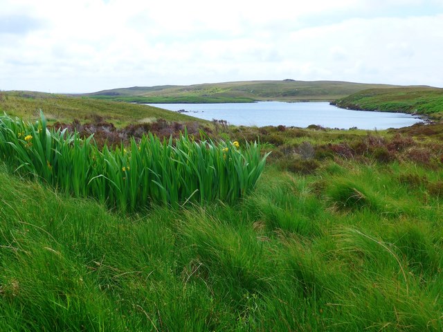
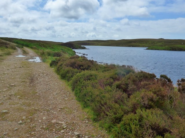
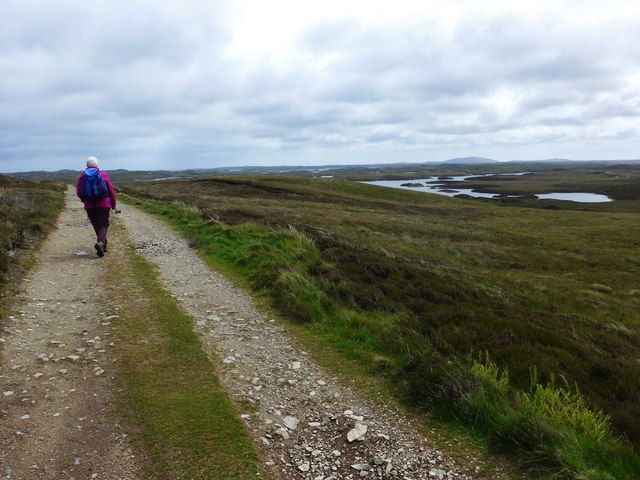
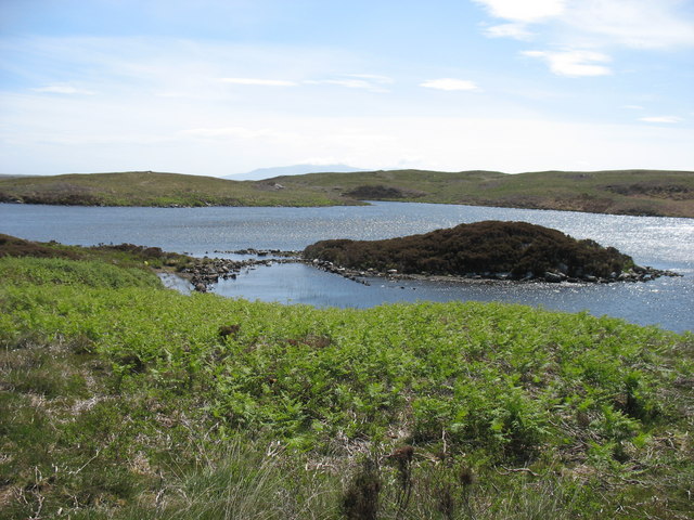
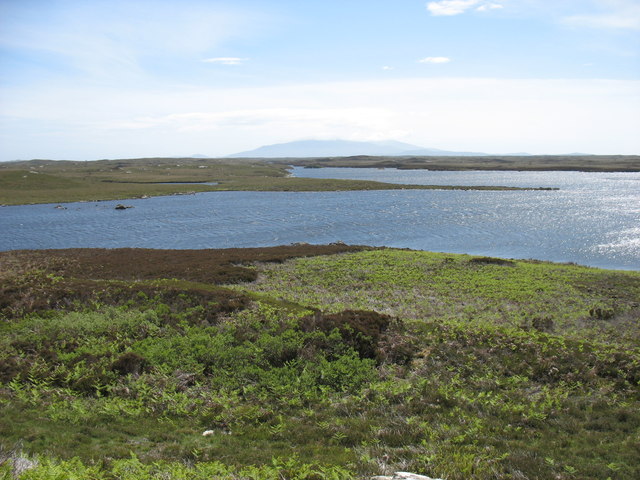
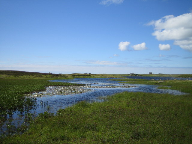
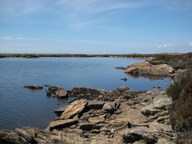
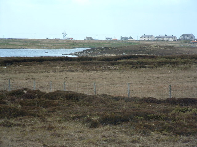
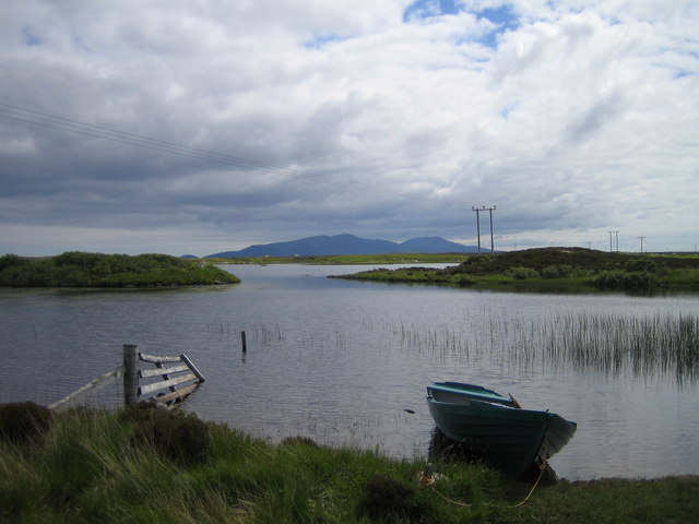
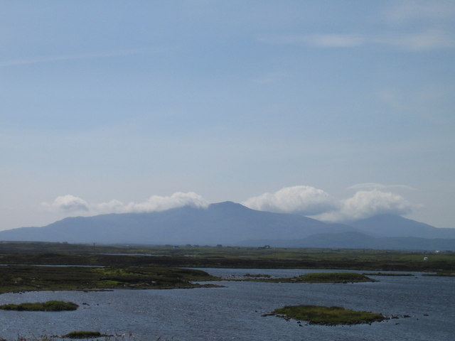
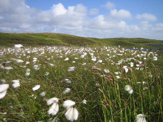
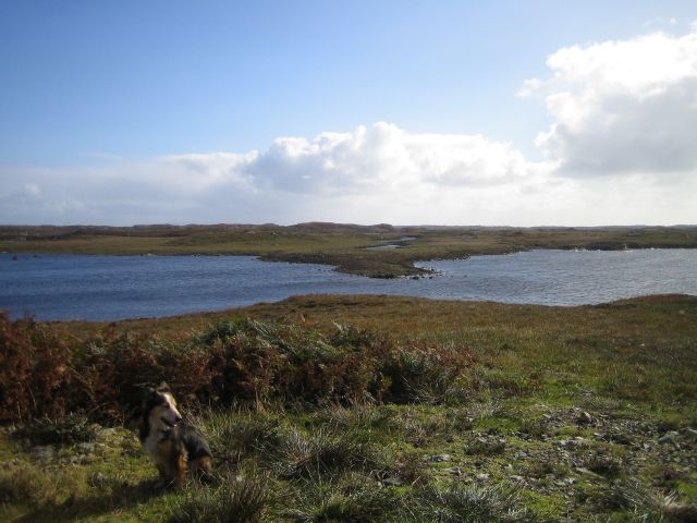
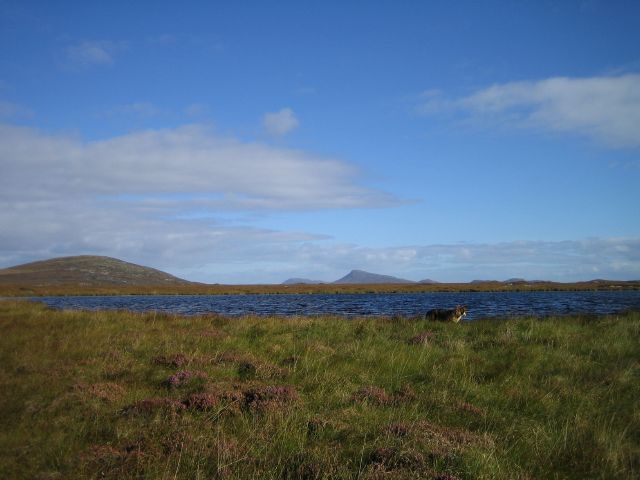
The island is known for its stunning natural beauty, with rugged coastlines, sandy beaches, and vast expanses of moorland. It is also home to several freshwater lochs, providing opportunities for fishing and water-based activities. The landscape is dotted with small crofts and traditional cottages, showcasing the island's agricultural heritage.

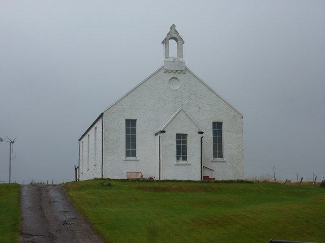
In terms of infrastructure, Benbecula offers basic amenities such as shops, post offices, and a small hospital. The island is also served by a primary school and a secondary school, ensuring educational facilities for its residents.

Benbecula is a popular destination for outdoor enthusiasts, offering opportunities for walking, cycling, and birdwatching. The island is particularly renowned for its diverse birdlife, including species like the golden eagle and the elusive corncrake. Additionally, the surrounding waters are rich in marine life, making it a great spot for fishing and wildlife spotting.

Transportation to and from the island is facilitated by regular ferry services, connecting Benbecula to the mainland and other nearby islands. The closest airport, Benbecula Airport, offers flights to destinations such as Glasgow and Stornoway.

Overall, Benbecula is a picturesque island that offers a tranquil and scenic escape for visitors, with its unspoiled landscapes, rich wildlife, and close-knit community.

If you have any feedback on the listing, please let us know in the comments section below.

Benbecula Images

Images are sourced within 2km of 57.440672/-7.3107511 or Grid Reference NF8151. Thanks to Geograph Open Source API. All images are credited.

Flag irises and Loch Ba Una By the track to Sgaraileod.
Flag irises and Loch Ba Una
By the track to Sgaraileod.
The track to Sgaraileod Loch Ba Una to the right.
The track to Sgaraileod
Loch Ba Una to the right.
The track to Sgaraileod The island-dotted Loch Heirmeadail ahead to the right.
The track to Sgaraileod
The island-dotted Loch Heirmeadail ahead to the right.
Loch Ba Una
Loch Ba Una
Loch Theirmeadail This photo was taken on my visit to Ruaval (Ruabhal), the highest point on Benbecula. The hills in the far distance comprise the Hecla / Beinn Mhor group, about 20km away on South Uist.
Loch Theirmeadail
This photo was taken on my visit to Ruaval (Ruabhal), the highest point on Benbecula. The hills in the far distance comprise the Hecla / Beinn Mhor group, about 20km away on South Uist.
Griminish: Benbecula parish church Situated centrally on the island, this church is dated AD1885 below the little tower.
Griminish: Benbecula parish church
Situated centrally on the island, this church is dated AD1885 below the little tower.
Benbecula War Memorial See also <a href="https://www.geograph.org.uk/photo/4244201">NF8051 : Benbecula War Memorial</a> and <span class="nowrap"><a title="http://warmemscot.s4.bizhat.com/warmemscot-post-31198.html" rel="nofollow ugc noopener" href="http://warmemscot.s4.bizhat.com/warmemscot-post-31198.html">Link</a><img style="margin-left:2px;" alt="External link" title="External link - shift click to open in new window" src="https://s1.geograph.org.uk/img/external.png" width="10" height="10"/></span>
Benbecula War Memorial
Benbecula War Memorial A sadly high number of Great War casualties, given the size of the island. Mostly Cameron Highlanders, the various battalions of which took part in most of the major battles of the war.

See also <a href="https://www.geograph.org.uk/photo/4244159">NF8051 : Benbecula War Memorial</a> and <span class="nowrap"><a title="http://warmemscot.s4.bizhat.com/warmemscot-post-31198.html" rel="nofollow ugc noopener" href="http://warmemscot.s4.bizhat.com/warmemscot-post-31198.html">Link</a><img style="margin-left:2px;" alt="External link" title="External link - shift click to open in new window" src="https://s1.geograph.org.uk/img/external.png" width="10" height="10"/></span>
Benbecula War Memorial
A sadly high number of Great War casualties, given the size of the island. Mostly Cameron Highlanders, the various battalions of which took part in most of the major battles of the war. See also NF8051 : Benbecula War Memorial and LinkExternal link
Loch Olabhat Loch Olavat for those of us with no Gaelic. Like many lochs on Benbecula it is difficult to say where the loch ends and the surrounding bog begins, squelch! The white specks in the foreground are water lilies.
Loch Olabhat
Loch Olavat for those of us with no Gaelic. Like many lochs on Benbecula it is difficult to say where the loch ends and the surrounding bog begins, squelch! The white specks in the foreground are water lilies.
Loch Mhic Mharcuis
Loch Mhic Mharcuis
Looking West from the A851 In the mid foreground is Loch Olabhat and in the distance Griminis. Neither of which are really the subject. It's really just the view.
Looking West from the A851
In the mid foreground is Loch Olabhat and in the distance Griminis. Neither of which are really the subject. It's really just the view.
Fishing Boat On the shore of Loch Olabhat (Olavat) looking towards the hills of South Uist.
Fishing Boat
On the shore of Loch Olabhat (Olavat) looking towards the hills of South Uist.
Lochs and Moorland Island scattered lochs and moorland in the centre of Benbecula with South Uist in the background.
Lochs and Moorland
Island scattered lochs and moorland in the centre of Benbecula with South Uist in the background.
There's lovely for you! Typical Benbecula (Benbeculan, Benbeculaianian??) flora along the eastern shore of Loch nan Clach Corr.
There's lovely for you!
Typical Benbecula (Benbeculan, Benbeculaianian??) flora along the eastern shore of Loch nan Clach Corr.
Moorland Track Near loch Ba Una
Moorland Track
Near loch Ba Una
Loch Ba Una
Loch Ba Una
Loch Theirmeadail
Loch Theirmeadail
Lochan Un-named lochan perched on the top of a low boggy hill.
Lochan
Un-named lochan perched on the top of a low boggy hill.
Show me another place!

Benbecula is located at Grid Ref: NF8151 (Lat: 57.440672, Lng: -7.3107511)

Unitary Authority: Na h-Eileanan an Iar

Police Authority: Highlands and Islands

What 3 Words

///detergent.fillers.test. Near Balivanich, Na h-Eileanan Siar

Related Wikis

Uist

Uist is a group of six islands that are part of the Outer Hebridean Archipelago, which is part of the Outer Hebrides of Scotland. North Uist and South...

Benbecula

Benbecula ( ; Scottish Gaelic: Beinn nam Fadhla or Beinn na Faoghla) is an island of the Outer Hebrides in the Atlantic Ocean off the west coast of Scotland...

Borve Castle, Benbecula

Borve Castle, also known as Castle Wearie, and Caisteal Bhuirgh in Scottish Gaelic, is a ruined 14th-century tower house, located at the south-west of...

Grimsay (South East Benbecula)

Grimsay, south east of Benbecula is a tidal island of the Outer Hebrides. It is connected to Benbecula by a causeway which carries the B891. In the 2001...

Have you been to Benbecula?

Leave your review of Benbecula below (or comments, questions and feedback).