Loch nan Clachan

Lake, Pool, Pond, Freshwater Marsh in Inverness-shire

Scotland

Loch nan Clachan

Unnamed loch on Benbecula
Unnamed loch on Benbecula Credit: Hugh Venables

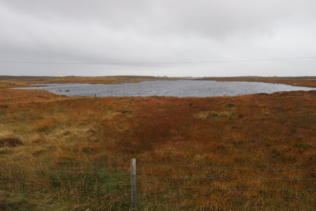
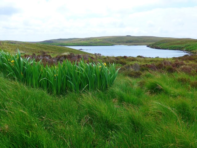
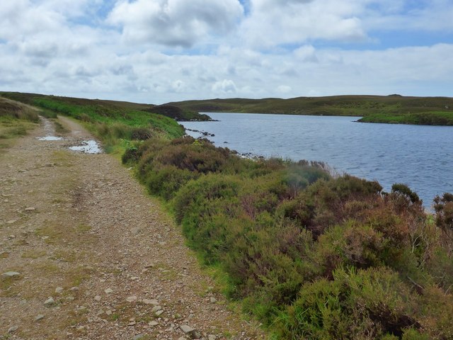
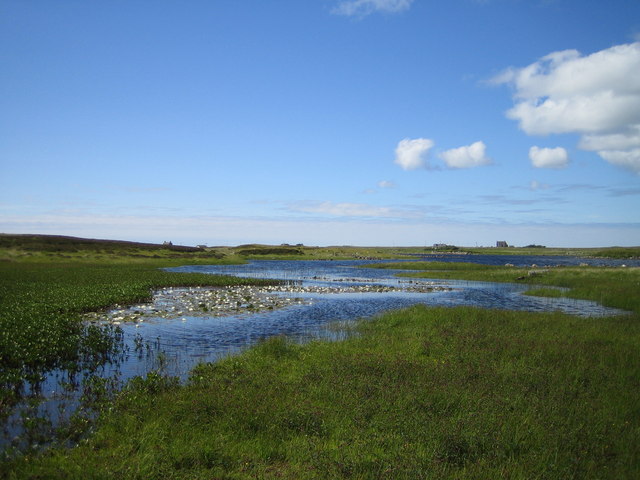
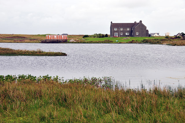
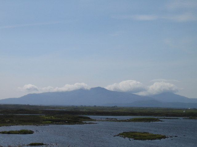
Loch nan Clachan is a picturesque freshwater lake located in Inverness-shire, Scotland. Nestled amidst the stunning Scottish Highlands, this tranquil body of water offers a serene escape for nature enthusiasts and tranquility seekers.

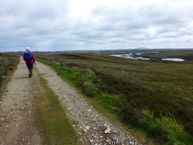
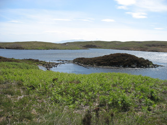
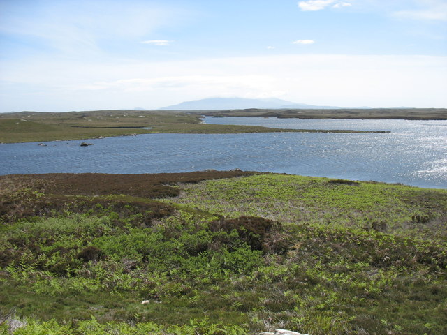
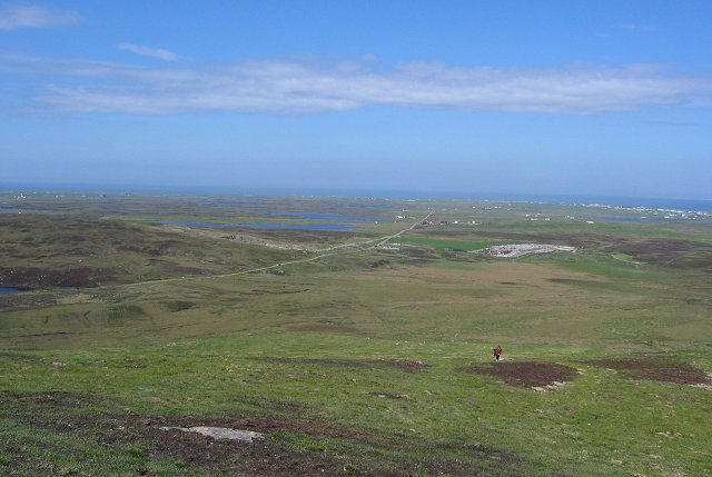
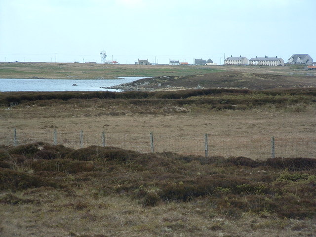
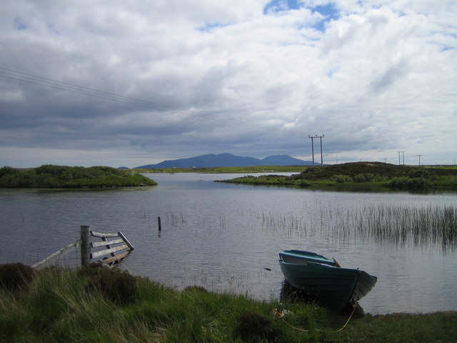
Covering an area of approximately 50 acres, Loch nan Clachan is surrounded by rolling hills and lush greenery, providing a picturesque backdrop for visitors. The lake is fed by several small streams and springs, ensuring a constant flow of fresh water. The water itself is crystal clear, allowing visitors to observe the diverse aquatic life thriving within its depths.

The surrounding area is teeming with wildlife, making Loch nan Clachan a haven for birdwatchers and nature lovers. Common sightings include waterfowl such as ducks, swans, and herons, as well as various species of fish, including trout and salmon. The lake is also home to a variety of plant life, including water lilies and reeds, creating a vibrant ecosystem.

Visitors to Loch nan Clachan can enjoy a range of activities. Fishing is a popular pastime, with anglers casting their lines in search of the lake's abundant fish population. The calm waters are also perfect for boating and kayaking, allowing visitors to explore the lake and its surroundings at their own pace.

Overall, Loch nan Clachan offers a peaceful retreat in the heart of Inverness-shire's natural beauty. Its idyllic setting, diverse wildlife, and recreational opportunities make it a must-visit destination for those seeking tranquility and a connection with nature.

If you have any feedback on the listing, please let us know in the comments section below.

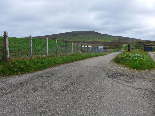
Loch nan Clachan Images

Images are sourced within 2km of 57.445744/-7.3191327 or Grid Reference NF8151. Thanks to Geograph Open Source API. All images are credited.

Unnamed loch on Benbecula
The road to the Benbecula dump This is the approach to the island's recycling centre and municipal waste.

Ruabhal, 124 metres high and Benbecula's highest peak, lies ahead.
The road to the Benbecula dump
This is the approach to the island's recycling centre and municipal waste. Ruabhal, 124 metres high and Benbecula's highest peak, lies ahead.
Flag irises and Loch Ba Una By the track to Sgaraileod.
Flag irises and Loch Ba Una
By the track to Sgaraileod.
The track to Sgaraileod Loch Ba Una to the right.
The track to Sgaraileod
Loch Ba Una to the right.
The track to Sgaraileod The island-dotted Loch Heirmeadail ahead to the right.
The track to Sgaraileod
The island-dotted Loch Heirmeadail ahead to the right.
Loch Ba Una
Loch Ba Una
Loch Theirmeadail This photo was taken on my visit to Ruaval (Ruabhal), the highest point on Benbecula. The hills in the far distance comprise the Hecla / Beinn Mhor group, about 20km away on South Uist.
Loch Theirmeadail
This photo was taken on my visit to Ruaval (Ruabhal), the highest point on Benbecula. The hills in the far distance comprise the Hecla / Beinn Mhor group, about 20km away on South Uist.
The end of the walk from Ruaval (Ruabhal) ! Even in the Outer Hebrides, rubbish has to go somewhere. This site is, from most perspectives, quite unobtrusive: and, importantly, it does not obstruct access to Ruaval, the highest point of Benbecula.
The end of the walk from Ruaval (Ruabhal) !
Even in the Outer Hebrides, rubbish has to go somewhere. This site is, from most perspectives, quite unobtrusive: and, importantly, it does not obstruct access to Ruaval, the highest point of Benbecula.
Griminish: Benbecula parish church Situated centrally on the island, this church is dated AD1885 below the little tower.
Griminish: Benbecula parish church
Situated centrally on the island, this church is dated AD1885 below the little tower.
Benbecula War Memorial See also <a href="https://www.geograph.org.uk/photo/4244201">NF8051 : Benbecula War Memorial</a> and <span class="nowrap"><a title="http://warmemscot.s4.bizhat.com/warmemscot-post-31198.html" rel="nofollow ugc noopener" href="http://warmemscot.s4.bizhat.com/warmemscot-post-31198.html">Link</a><img style="margin-left:2px;" alt="External link" title="External link - shift click to open in new window" src="https://s1.geograph.org.uk/img/external.png" width="10" height="10"/></span>
Benbecula War Memorial
Benbecula War Memorial A sadly high number of Great War casualties, given the size of the island. Mostly Cameron Highlanders, the various battalions of which took part in most of the major battles of the war.

See also <a href="https://www.geograph.org.uk/photo/4244159">NF8051 : Benbecula War Memorial</a> and <span class="nowrap"><a title="http://warmemscot.s4.bizhat.com/warmemscot-post-31198.html" rel="nofollow ugc noopener" href="http://warmemscot.s4.bizhat.com/warmemscot-post-31198.html">Link</a><img style="margin-left:2px;" alt="External link" title="External link - shift click to open in new window" src="https://s1.geograph.org.uk/img/external.png" width="10" height="10"/></span>
Benbecula War Memorial
A sadly high number of Great War casualties, given the size of the island. Mostly Cameron Highlanders, the various battalions of which took part in most of the major battles of the war. See also NF8051 : Benbecula War Memorial and LinkExternal link
Loch Olabhat Loch Olavat for those of us with no Gaelic. Like many lochs on Benbecula it is difficult to say where the loch ends and the surrounding bog begins, squelch! The white specks in the foreground are water lilies.
Loch Olabhat
Loch Olavat for those of us with no Gaelic. Like many lochs on Benbecula it is difficult to say where the loch ends and the surrounding bog begins, squelch! The white specks in the foreground are water lilies.
Modern South Uist house Moss Cottage seen across Loch a' Ghara chruaidh.
Modern South Uist house
Moss Cottage seen across Loch a' Ghara chruaidh.
Hunger Road on Benbecula This old road, now supplanted by the A865, crosses the middle of the island.
Hunger Road on Benbecula
This old road, now supplanted by the A865, crosses the middle of the island.
On Ruabhal Ruabhal is the Ben in Benbecula. The only hill of any size on the island. It's an easy walk up from just past the island's landfill site and gives a lovely view over the Uists.
On Ruabhal
Ruabhal is the Ben in Benbecula. The only hill of any size on the island. It's an easy walk up from just past the island's landfill site and gives a lovely view over the Uists.
Looking West from the A851 In the mid foreground is Loch Olabhat and in the distance Griminis. Neither of which are really the subject. It's really just the view.
Looking West from the A851
In the mid foreground is Loch Olabhat and in the distance Griminis. Neither of which are really the subject. It's really just the view.
Fishing Boat On the shore of Loch Olabhat (Olavat) looking towards the hills of South Uist.
Fishing Boat
On the shore of Loch Olabhat (Olavat) looking towards the hills of South Uist.
Lochs and Moorland Island scattered lochs and moorland in the centre of Benbecula with South Uist in the background.
Lochs and Moorland
Island scattered lochs and moorland in the centre of Benbecula with South Uist in the background.
Show me another place!

Loch nan Clachan is located at Grid Ref: NF8151 (Lat: 57.445744, Lng: -7.3191327)

Unitary Authority: Na h-Eileanan an Iar

Police Authority: Highlands and Islands

What 3 Words

///booklets.bake.advancing. Near Balivanich, Na h-Eileanan Siar

Related Wikis

Uist

Uist is a group of six islands that are part of the Outer Hebridean Archipelago, which is part of the Outer Hebrides of Scotland. North Uist and South...

Benbecula

Benbecula ( ; Scottish Gaelic: Beinn nam Fadhla or Beinn na Faoghla) is an island of the Outer Hebrides in the Atlantic Ocean off the west coast of Scotland...

Borve Castle, Benbecula

Borve Castle, also known as Castle Wearie, and Caisteal Bhuirgh in Scottish Gaelic, is a ruined 14th-century tower house, located at the south-west of...

Uachdar

Uachdar (Scottish Gaelic: An t-Uachdar [ən̪ˠ ˈt̪ʰuəxkəɾ]) is a settlement on the Outer Hebridean Island of Benbecula. Uachdar is within the parish of South...

Nearby Amenities

Located within 500m of 57.445744,-7.3191327
Power: pole
Lat/Long: 57.4484118/-7.3258424
Power: pole
Lat/Long: 57.4474593/-7.325955
Power: pole
Lat/Long: 57.4466785/-7.325998
Power: pole
Lat/Long: 57.4459338/-7.3261052
Power: pole
Lat/Long: 57.4444977/-7.3262286
Power: pole
Lat/Long: 57.4436764/-7.3263328
Power: pole
Lat/Long: 57.4453192/-7.326158
The data included in this document is from www.openstreetmap.org. The data is made available under ODbL.

Have you been to Loch nan Clachan?

Leave your review of Loch nan Clachan below (or comments, questions and feedback).