Eilean an Staoir

Island in Inverness-shire

Scotland

Eilean an Staoir

Beach at Aisgernis
Beach at Aisgernis Credit: Sandy Gerrard

Eilean an Staoir is a small island located in Inverness-shire, in the Scottish Highlands. Situated in the picturesque waters of Loch a' Bhraoin, it is surrounded by stunning natural beauty and offers a tranquil retreat for nature enthusiasts and those seeking a peaceful getaway.

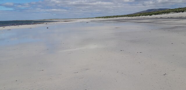
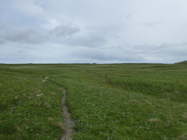
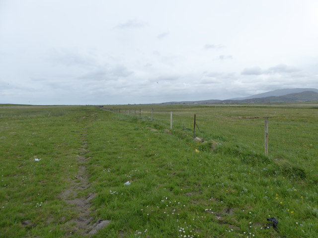
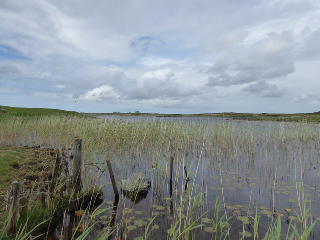
Covering an area of approximately 11 acres, Eilean an Staoir is characterized by its rugged terrain and lush vegetation. The island is predominantly covered in heather and grasses, with scattered patches of trees providing shelter and shade. Its rocky shoreline adds to its charm, offering breathtaking views of the surrounding loch and the distant mountains.

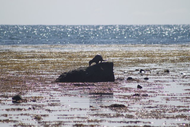
In terms of wildlife, Eilean an Staoir is a haven for various bird species. The island is home to migratory birds such as greylag geese, whooper swans, and golden plovers, making it an ideal spot for birdwatching enthusiasts. Otters can also be spotted in the surrounding waters, adding to the island's diverse ecosystem.

Access to Eilean an Staoir is primarily by boat, as there are no bridges connecting it to the mainland. Visitors can take a leisurely boat ride from nearby Ullapool or hire a private boat to reach the island. Camping is permitted on the island, allowing visitors to fully immerse themselves in its natural beauty and tranquility.

Overall, Eilean an Staoir is a hidden gem in Inverness-shire, offering a unique and unspoiled island experience. With its stunning landscape, diverse wildlife, and peaceful atmosphere, it is a must-visit destination for nature lovers and those seeking solace in the Scottish Highlands.

If you have any feedback on the listing, please let us know in the comments section below.

Eilean an Staoir Images

Images are sourced within 2km of 57.207509/-7.4131293 or Grid Reference NF7325. Thanks to Geograph Open Source API. All images are credited.

Beach at Aisgernis
Beach at Aisgernis
Two Kingspan/Proven turbines Beside the South Uist Museum.
Two Kingspan/Proven turbines
Beside the South Uist Museum.
Road approaching a  causeway across Loch Chill Donnain
Road approaching a causeway across Loch Chill Donnain
Angling Boat, Upper Kildonan
Path on the machair, Askernish
Fence on the edge of the machair, Askernish
Ruined house at Frobost
Reeds, Loch Chill Donnain
Old walls above Loch Àird an Sgairbh
Dun, Loch na Muilne The OS map identifies this small island in Loch na Muilne as the site of a dun.   It appears that the island can be reached by a causeway or series of stepping stones.
Dun, Loch na Muilne
The OS map identifies this small island in Loch na Muilne as the site of a dun. It appears that the island can be reached by a causeway or series of stepping stones.
Visiting Flora MacDonald's birthplace
Trolaisgeir A view from the top of the dunes where traffic from Cill Donnain arrives at the shore.
Trolaisgeir
A view from the top of the dunes where traffic from Cill Donnain arrives at the shore.
Otter seen at Askernish Otter spotted on rocks by the beach at Askernish as the tide was going out.
Otter seen at Askernish
Otter spotted on rocks by the beach at Askernish as the tide was going out.
Mill Loch Dun A ruined dun in Loch na Muilne. <span class="nowrap"><a title="https://canmore.org.uk/site/9846/south-uist-kildonan-mill-loch" rel="nofollow ugc noopener" href="https://canmore.org.uk/site/9846/south-uist-kildonan-mill-loch">Link</a><img style="margin-left:2px;" alt="External link" title="External link - shift click to open in new window" src="https://s1.geograph.org.uk/img/external.png" width="10" height="10"/></span>
Mill Loch Dun
A ruined dun in Loch na Muilne. LinkExternal link
Flora Macdonald Memorial Cairn Cairn erected to memory of Flora Macdonald. <span class="nowrap"><a title="https://canmore.org.uk/site/9848/south-uist-milton-flora-macdonald-memorial" rel="nofollow ugc noopener" href="https://canmore.org.uk/site/9848/south-uist-milton-flora-macdonald-memorial">Link</a><img style="margin-left:2px;" alt="External link" title="External link - shift click to open in new window" src="https://s1.geograph.org.uk/img/external.png" width="10" height="10"/></span>
Flora Macdonald Memorial Cairn
Cairn erected to memory of Flora Macdonald. LinkExternal link
South Uist  Gaelic  Arts Community Centre and Museum by the A865
South Uist Gaelic Arts
Community Centre and Museum by the A865
Trolaisgeir One of the series of fine sandy beaches which line the west coast of South Uist.
Trolaisgeir
One of the series of fine sandy beaches which line the west coast of South Uist.
Flora Macdonald's birthplace, South Uist
Show me another place!

Eilean an Staoir is located at Grid Ref: NF7325 (Lat: 57.207509, Lng: -7.4131293)

Unitary Authority: Na h-Eileanan an Iar

Police Authority: Highlands and Islands

What 3 Words

///memory.broads.lifestyle. Near Lochboisdale, Na h-Eileanan Siar

Related Wikis

Milton (South Uist)

Milton (Scottish Gaelic: Geàrraidh Bhailteas) is the name of a tack or tenant farm on the island of South Uist in the Outer Hebrides, Scotland. It was...

Askernish

Askernish (Scottish Gaelic: Àisgearnais, Aisgernis) is a crofting community on South Uist, in the Outer Hebrides, Scotland. Askernish is in the parish...

Bornish

Bornish (Scottish Gaelic: Bòrnais) is a village and community council area on South Uist in the Outer Hebrides, Scotland. Bornish is also within the civil...

Cladh Hallan

Cladh Hallan (Scottish Gaelic: Cladh Hàlainn, Scottish Gaelic pronunciation: [kʰl̪ˠɤɣ ˈhaːl̪ˠɪɲ]) is an archaeological site on the island of South Uist...

Nearby Amenities

Located within 500m of 57.207509,-7.4131293
Barrier: cattle_grid
Lat/Long: 57.2097336/-7.4123383
Description: Hebridean Way - Fallen over
Hiking: yes
Information: guidepost
Tourism: information
Lat/Long: 57.2104864/-7.4188525
Power: pole
Lat/Long: 57.2105377/-7.408607
Power: pole
Lat/Long: 57.2105435/-7.4093956
Power: pole
Lat/Long: 57.2104389/-7.4102807
Power: pole
Lat/Long: 57.2102646/-7.4094197
Power: pole
Lat/Long: 57.2105043/-7.4074161
Power: pole
Lat/Long: 57.2105944/-7.4111095
Passing Place
Lat/Long: 57.2096712/-7.4104819
Barrier: cattle_grid
Lat/Long: 57.2098056/-7.4077219
Barrier: cattle_grid
Lat/Long: 57.2036794/-7.4123288
The data included in this document is from www.openstreetmap.org. The data is made available under ODbL.

Have you been to Eilean an Staoir?

Leave your review of Eilean an Staoir below (or comments, questions and feedback).