Gèarum Mòr

Island in Inverness-shire

Scotland

Gèarum Mòr

Sotun Summit, Berneray/Bearnaraigh A five island expedition from Castlebay on Boy James. This is a picture of the misty grassy summit of Berneray/Bearnaraigh called Sotan. Although a rock 2 metres north of lighthouse perimeter wall at NL 54867 80229 is highest point but not yet officially ratified.
Name: Sotan
Hill number: 1632
Height: 193m / 633ft
Area: 24D: Barra to Barra Head
Class: Ma,1
Grid ref: NL 55353 79980
Summit feature: no feature
Drop: 193m
Col: Sea
Sotun Summit, Berneray/Bearnaraigh Credit: Rude Health

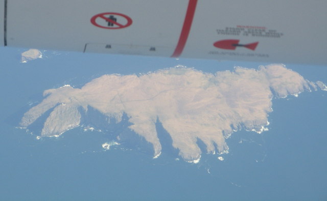
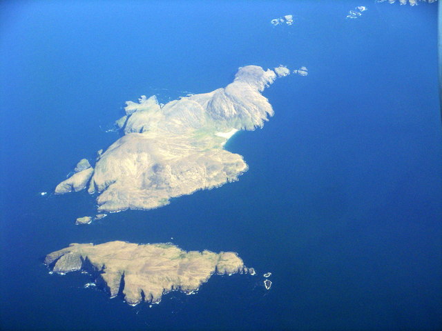
Gèarum Mòr is a small island located off the west coast of Scotland, specifically in the county of Inverness-shire. It is situated in the Inner Hebrides, a group of islands known for their stunning natural beauty and rich cultural heritage. The island covers an area of approximately 5 square miles and is surrounded by the crystal-clear waters of the Atlantic Ocean.

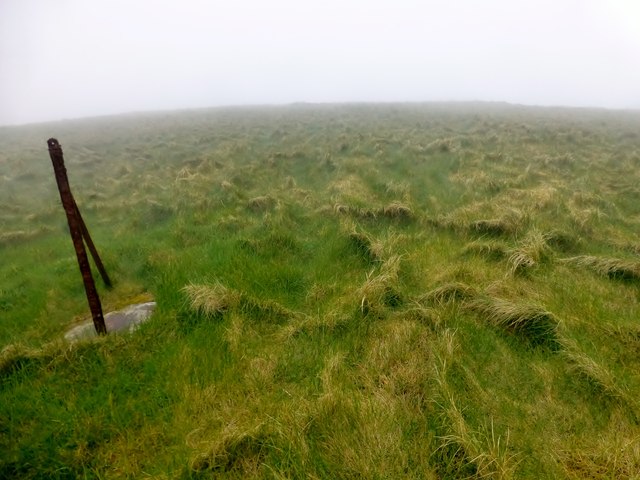
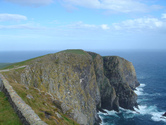
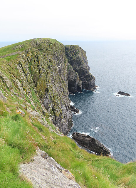
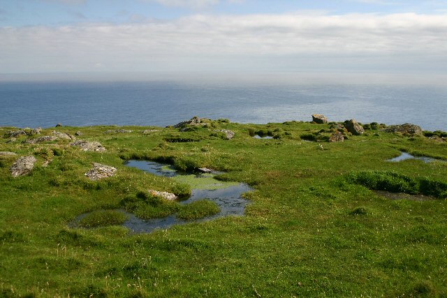
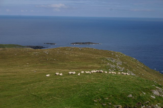
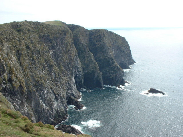
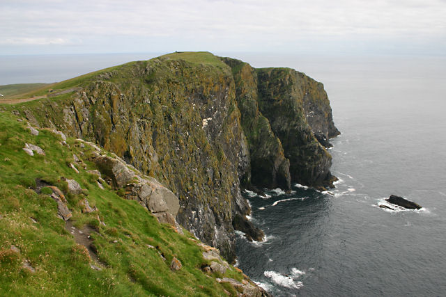
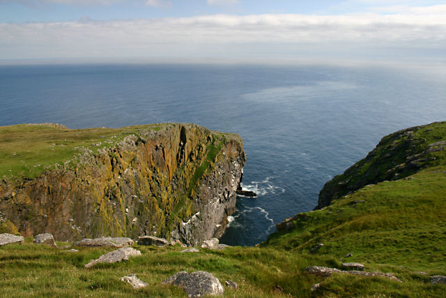
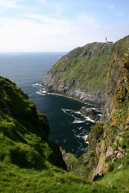
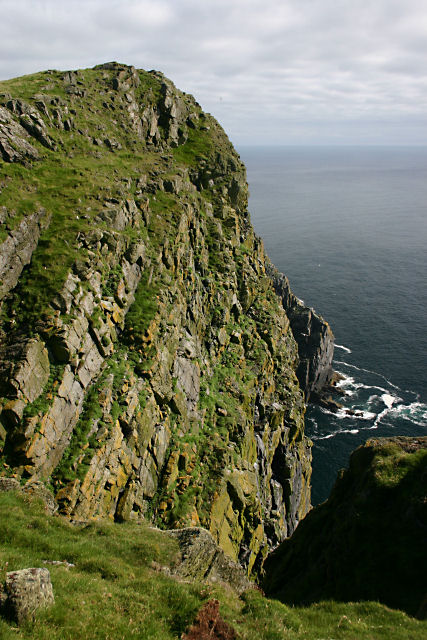
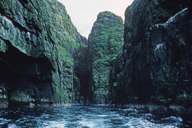
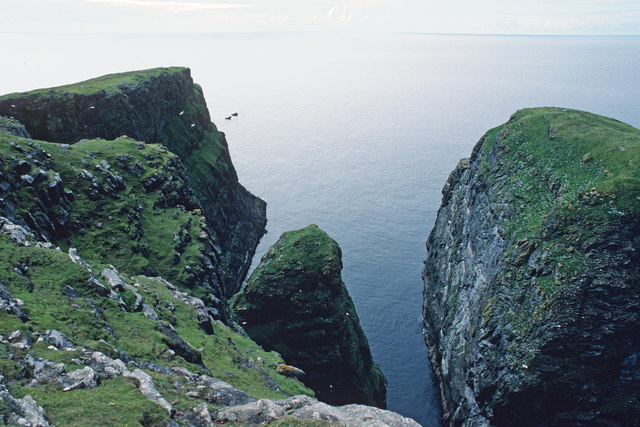
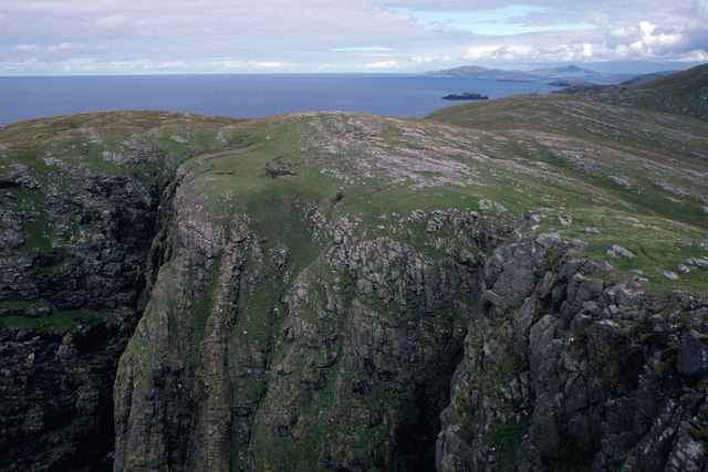
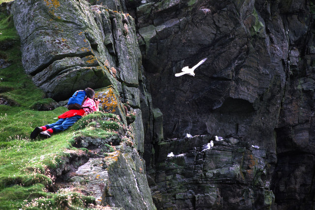
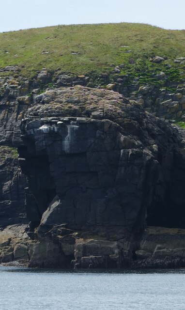
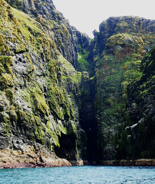
Gèarum Mòr is characterized by its rugged and dramatic landscape, with towering cliffs, rocky shores, and rolling hills dominating the scenery. The island is covered in a patchwork of heather moorland, grassy meadows, and scattered pockets of woodland. It is home to a variety of wildlife, including red deer, otters, and numerous bird species, making it a popular spot for nature enthusiasts and birdwatchers.

The island has a small population, with only a handful of residents calling it home year-round. The main settlement on Gèarum Mòr is a picturesque village, with traditional cottages and a small harbor where fishing boats and pleasure craft can be seen bobbing in the water. The community is tightly knit, and visitors can expect a warm welcome and a friendly atmosphere.

For those seeking outdoor activities, Gèarum Mòr offers ample opportunities for hiking, wildlife spotting, and exploring the coastline. The island's rugged terrain is ideal for adventurous walkers, and there are several well-marked trails that showcase the island's natural beauty. The surrounding waters also provide excellent conditions for water sports such as kayaking and sailing.

Overall, Gèarum Mòr is a hidden gem in Inverness-shire, offering visitors a chance to immerse themselves in Scotland's wild and untamed landscapes while experiencing the warmth and hospitality of a tight-knit island community.

If you have any feedback on the listing, please let us know in the comments section below.

Gèarum Mòr Images

Images are sourced within 2km of 56.794115/-7.6557933 or Grid Reference NL5481. Thanks to Geograph Open Source API. All images are credited.

Sotun Summit, Berneray/Bearnaraigh A five island expedition from Castlebay on Boy James. This is a picture of the misty grassy summit of Berneray/Bearnaraigh called Sotan. Although a rock 2 metres north of lighthouse perimeter wall at NL 54867 80229 is highest point but not yet officially ratified.
Name: Sotan
Hill number: 1632
Height: 193m / 633ft
Area: 24D: Barra to Barra Head
Class: Ma,1
Grid ref: NL 55353 79980
Summit feature: no feature
Drop: 193m
Col: Sea
Sotun Summit, Berneray/Bearnaraigh
A five island expedition from Castlebay on Boy James. This is a picture of the misty grassy summit of Berneray/Bearnaraigh called Sotan. Although a rock 2 metres north of lighthouse perimeter wall at NL 54867 80229 is highest point but not yet officially ratified. Name: Sotan Hill number: 1632 Height: 193m / 633ft Area: 24D: Barra to Barra Head Class: Ma,1 Grid ref: NL 55353 79980 Summit feature: no feature Drop: 193m Col: Sea
Berneray/Bearnaraigh - an aerial view from the south From about 36000ft heading west, about 30min after leaving Edinburgh
Berneray/Bearnaraigh - an aerial view from the south
From about 36000ft heading west, about 30min after leaving Edinburgh
Sotan, Berneray Seen from near the lighthouse. Sotan is a couple of metres higher than the lighthouse, and the highest point of the island.
Sotan, Berneray
Seen from near the lighthouse. Sotan is a couple of metres higher than the lighthouse, and the highest point of the island.
Sloc na Sealbhaig The precipitous cliffs east of the lighthouse on Berneray.
Sloc na Sealbhaig
The precipitous cliffs east of the lighthouse on Berneray.
Mullach a' Lusgan, Berneray These rock pools are on top of the cliffs at Barra Head, the southernmost point of the Outer Hebrides.
Mullach a' Lusgan, Berneray
These rock pools are on top of the cliffs at Barra Head, the southernmost point of the Outer Hebrides.
Cuiveg Point, Berneray In Gaelic, 'Rubha Cuabhaig', this south-eastern tip of Berneray is populated only by a flock of extremely shaggy sheep.
Cuiveg Point, Berneray
In Gaelic, 'Rubha Cuabhaig', this south-eastern tip of Berneray is populated only by a flock of extremely shaggy sheep.
Sloc na Sealbhaig This inlet is at the foot of the 180m cliffs to the south east of the lighthouse. Just round the cliffs is Barra Head, the most southerly point on Berneray, which is the most southerly island in the Outer Hebrides (not on Barra at all).
Sloc na Sealbhaig
This inlet is at the foot of the 180m cliffs to the south east of the lighthouse. Just round the cliffs is Barra Head, the most southerly point on Berneray, which is the most southerly island in the Outer Hebrides (not on Barra at all).
Barra Head, Berneray The southernmost point of the Outer Hebrides.
Barra Head, Berneray
The southernmost point of the Outer Hebrides.
Sloc Voacligeo, Berneray This inlet lies to the west of Barra Head.
Sloc Voacligeo, Berneray
This inlet lies to the west of Barra Head.
Sloc na Sealbhaig, Berneray Steep cliffs on Berneray's southern coast. The lighthouse at Skate Point can be seen in the distance.
Sloc na Sealbhaig, Berneray
Steep cliffs on Berneray's southern coast. The lighthouse at Skate Point can be seen in the distance.
Headland immediately west of Barra Head, Berneray Almost the southernmost tip of the Outer Hebrides (Barra Head, just to the east, is the southernmost point).
Headland immediately west of Barra Head, Berneray
Almost the southernmost tip of the Outer Hebrides (Barra Head, just to the east, is the southernmost point).
Passage beside Arnamuil and Mingulay Looking back after the fastest left turn by a boat I have experienced. The channel narrows to just a little wider than a small 20-passenger boat.  Bob Jones shared the same experience from August 2006.  <a href="https://www.geograph.org.uk/photo/228967">NL5482 : Natural arch, Mingulay</a>
Passage beside Arnamuil and Mingulay
Looking back after the fastest left turn by a boat I have experienced. The channel narrows to just a little wider than a small 20-passenger boat. Bob Jones shared the same experience from August 2006. NL5482 : Natural arch, Mingulay
Passage between Arnamuil and Gunamuil Later that day we were to sail up the passage.  Dun Mingulay lies at the end of the left ridge.
Passage between Arnamuil and Gunamuil
Later that day we were to sail up the passage. Dun Mingulay lies at the end of the left ridge.
Cliffs of Mingulay Precipitous cliffs descending to narrow channels.
Cliffs of Mingulay
Precipitous cliffs descending to narrow channels.
Birdwatching on the Mingulay cliffs A very calm day so no problems for the birds foraging.
Birdwatching on the Mingulay cliffs
A very calm day so no problems for the birds foraging.
Mingulay/Miughlaigh and Berneray/Bearnaraigh An aerial view from the south. Mingulay is the larger of the two islands.
Mingulay/Miughlaigh and Berneray/Bearnaraigh
An aerial view from the south. Mingulay is the larger of the two islands.
Gèarum Beag - Sphinx-like rock This rock feature looks to me as though Marty Feldman had posed for a Scottish version of the Sphinx.
Gèarum Beag - Sphinx-like rock
This rock feature looks to me as though Marty Feldman had posed for a Scottish version of the Sphinx.
Mingulay - Sloc Hèisegeo The west coast of Mingulay has amazing cliff scenery such as this at Sloc Hèisegeo.
Mingulay - Sloc Hèisegeo
The west coast of Mingulay has amazing cliff scenery such as this at Sloc Hèisegeo.
Show me another place!

Gèarum Mòr is located at Grid Ref: NL5481 (Lat: 56.794115, Lng: -7.6557933)

Unitary Authority: Na h-Eileanan an Iar

Police Authority: Highlands and Islands

What 3 Words

///flask.received.logo. Near CastleBay, Na h-Eileanan Siar

Related Wikis

Barra Head Lighthouse

Barra Head Lighthouse on Barra Head identifies the southern entrance to The Minch, roughly halfway between the Eilean Glas and Rinns of Islay lighthouses...

Arnamul

Arnamul (Scottish Gaelic: Arnamuil) is a stack off the west coast of Mingulay in the Western Isles, Scotland. Although precipitous, sheep were grazed on...

Barra Head

Barra Head, also known as Berneray (Scottish Gaelic: Beàrnaraigh; Scots: Barra Heid), is the southernmost island of the Outer Hebrides in Scotland. Within...

Barra Isles

The Barra Isles, also known as the Bishop's Isles, are a small archipelago in the Outer Hebrides of Scotland. They lie south of the island of Barra, for...

Nearby Amenities

Located within 500m of 56.794115,-7.6557933
Rubha Liath
Natural: cape
Lat/Long: 56.7961761/-7.6535683
The data included in this document is from www.openstreetmap.org. The data is made available under ODbL.

Have you been to Gèarum Mòr?

Leave your review of Gèarum Mòr below (or comments, questions and feedback).