Lindsey Tye

Settlement in Suffolk Babergh

England

Lindsey Tye

Road Junction Road junction on minor country road near to Semer, Suffolk.
Road Junction Credit: Keith Evans

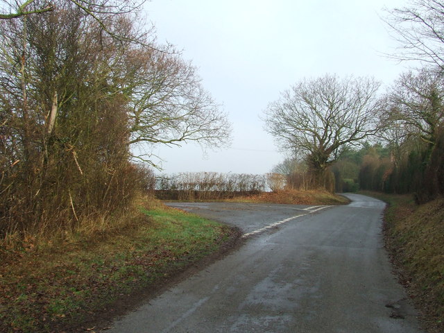
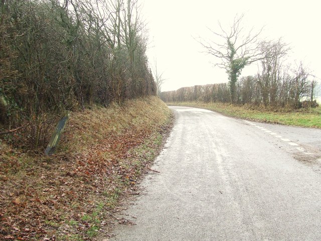
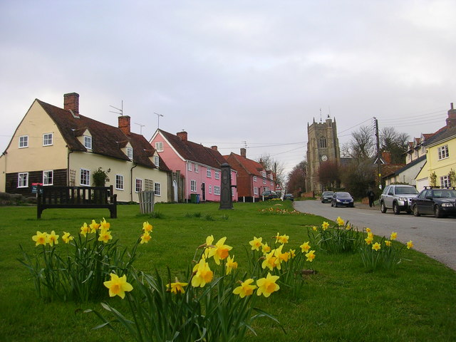
Lindsey Tye is a small village located in the county of Suffolk, England. Situated approximately 8 miles northeast of the town of Ipswich, it falls within the civil parish of Witnesham. Lindsey Tye is surrounded by picturesque countryside, characterized by rolling green fields, meandering streams, and wooded areas, offering residents and visitors a tranquil and scenic environment.

The village itself is relatively small, with a tight-knit community of around 200 residents. Lindsey Tye exudes a charming rural atmosphere, with quaint cottages and traditional architecture dotted throughout the area. The village is known for its sense of community spirit, with various social events and activities regularly organized for residents to enjoy.

Although Lindsey Tye is primarily a residential area, it benefits from its proximity to the town of Ipswich, which provides convenient access to a wider range of amenities and services. Ipswich offers a diverse array of shops, restaurants, and entertainment options, ensuring that residents have everything they need within easy reach.

The surrounding countryside offers ample opportunities for outdoor activities, such as hiking, cycling, and horseback riding, making Lindsey Tye an ideal location for nature enthusiasts. Additionally, the village is well-connected to transportation networks, with good road links to nearby towns and villages, allowing for easy commuting and exploration of the wider Suffolk region.

Overall, Lindsey Tye is a charming and peaceful village, offering residents a close-knit community, beautiful countryside surroundings, and convenient access to nearby amenities.

If you have any feedback on the listing, please let us know in the comments section below.

Lindsey Tye Images

Images are sourced within 2km of 52.074201/0.891358 or Grid Reference TL9845. Thanks to Geograph Open Source API. All images are credited.

Road Junction Road junction on minor country road near to Semer, Suffolk.
Road Junction
Road junction on minor country road near to Semer, Suffolk.
Remains Of A Finger Post The remains of a wooden finger post at road junction near to Semer, Suffolk. For overall view of its location see <a title="https://www.geograph.org.uk/photo/2785275" href="https://www.geograph.org.uk/photo/2785275">Link</a>
Remains Of A Finger Post
The remains of a wooden finger post at road junction near to Semer, Suffolk. For overall view of its location see Link
Road Junction Road junction with the remains of an old wooden finger post on the left near to Semer, Suffolk. For close up view of the post see <a title="https://www.geograph.org.uk/photo/2785267" href="https://www.geograph.org.uk/photo/2785267">Link</a>
Road Junction
Road junction with the remains of an old wooden finger post on the left near to Semer, Suffolk. For close up view of the post see Link
A1141 near Semer The A1141 is a single carriageway cross-country road in Suffolk. It starts at a 'give-way' junction on the Hadleigh Bypass (A1071) and then winds 13½ miles through Suffolk, passing through the villages of Monks Eleigh and Brent Eleigh before reaching Lavenham, a popular tourist destination. It then passes through the hamlet of Cross Green until it ends at another 'give way' junction with the A134  near Bradfield Combust.

More information at <span class="nowrap"><a title="http://www.sabre-roads.org.uk/wiki/index.php?title=A1141" rel="nofollow ugc noopener" href="http://www.sabre-roads.org.uk/wiki/index.php?title=A1141">Link</a><img style="margin-left:2px;" alt="External link" title="External link - shift click to open in new window" src="https://s1.geograph.org.uk/img/external.png" width="10" height="10"/></span>  SABRE Wiki.
A1141 near Semer
The A1141 is a single carriageway cross-country road in Suffolk. It starts at a 'give-way' junction on the Hadleigh Bypass (A1071) and then winds 13½ miles through Suffolk, passing through the villages of Monks Eleigh and Brent Eleigh before reaching Lavenham, a popular tourist destination. It then passes through the hamlet of Cross Green until it ends at another 'give way' junction with the A134 near Bradfield Combust. More information at LinkExternal link SABRE Wiki.
A1141, Minor Crossroads near Semer The A1141 is a single carriageway cross-country road in Suffolk. It starts at a 'give-way' junction on the Hadleigh Bypass (A1071) and then winds 13½ miles through Suffolk, passing through the villages of Monks Eleigh and Brent Eleigh before reaching Lavenham, a popular tourist destination. It then passes through the hamlet of Cross Green until it ends at another 'give way' junction with the A134  near Bradfield Combust.

More information at <span class="nowrap"><a title="http://www.sabre-roads.org.uk/wiki/index.php?title=A1141" rel="nofollow ugc noopener" href="http://www.sabre-roads.org.uk/wiki/index.php?title=A1141">Link</a><img style="margin-left:2px;" alt="External link" title="External link - shift click to open in new window" src="https://s1.geograph.org.uk/img/external.png" width="10" height="10"/></span>  SABRE Wiki.
A1141, Minor Crossroads near Semer
The A1141 is a single carriageway cross-country road in Suffolk. It starts at a 'give-way' junction on the Hadleigh Bypass (A1071) and then winds 13½ miles through Suffolk, passing through the villages of Monks Eleigh and Brent Eleigh before reaching Lavenham, a popular tourist destination. It then passes through the hamlet of Cross Green until it ends at another 'give way' junction with the A134 near Bradfield Combust. More information at LinkExternal link SABRE Wiki.
Minor road junction near Common Farm
Mini-valley near Lindsey One of many small valleys in the area created by the streams that eventually flow into the river Brett. Although watercourse seen here appeared to be dried out today, it is one of several that feed the watersplash at Kersey further downstream.
Mini-valley near Lindsey
One of many small valleys in the area created by the streams that eventually flow into the river Brett. Although watercourse seen here appeared to be dried out today, it is one of several that feed the watersplash at Kersey further downstream.
Houses in Church Road, Lindsey Taken from just south of St Peter's church.
Houses in Church Road, Lindsey
Taken from just south of St Peter's church.
View east from Church Road, Lindsey Shows scenery typical of this part of Suffolk with undulating arable fields dotted with woodlands and incised by small valleys.
View east from Church Road, Lindsey
Shows scenery typical of this part of Suffolk with undulating arable fields dotted with woodlands and incised by small valleys.
St Peter, Lindsey - interior looking west Most of the church dates from the early C14 and remains unspoiled by subsequent modernisation.
St Peter, Lindsey - interior looking west
Most of the church dates from the early C14 and remains unspoiled by subsequent modernisation.
St Peter, Lindsey - interior looking east Most of the church dates from the early C14 and remains unspoiled by subsequent modernisation.
St Peter, Lindsey - interior looking east
Most of the church dates from the early C14 and remains unspoiled by subsequent modernisation.
St Peter, Lindsey - south-eastern elevation Most of the church dates from the early C14 and remains unspoiled by subsequent modernisation. The west tower was removed in 1836 and replaced with a weather-boarded turret.
St Peter, Lindsey - south-eastern elevation
Most of the church dates from the early C14 and remains unspoiled by subsequent modernisation. The west tower was removed in 1836 and replaced with a weather-boarded turret.
St Peter, Lindsey - north-eastern elevation Most of the church dates from the early C14 and remains unspoiled by subsequent modernisation. The west tower was removed in 1836 and replaced with a weather-boarded turret.
St Peter, Lindsey - north-eastern elevation
Most of the church dates from the early C14 and remains unspoiled by subsequent modernisation. The west tower was removed in 1836 and replaced with a weather-boarded turret.
Chelsworth: 'The Lodge'
Lindsey Tye: Clay Hill
Chelsworth: Clay Hill
Chelsworth: The road to Chelsworth
Show me another place!

Lindsey Tye is located at Grid Ref: TL9845 (Lat: 52.074201, Lng: 0.891358)

Administrative County: Suffolk

District: Babergh

Police Authority: Suffolk

What 3 Words

///meals.menswear.encodes. Near Bildeston, Suffolk

Nearby Locations

Lindsey Lindsey Tye

Related Wikis

Lindsey, Suffolk

Lindsey is a small village and a civil parish, located in mid-to-south Suffolk, under the purview of Babergh District Council. == Layout == The parish...

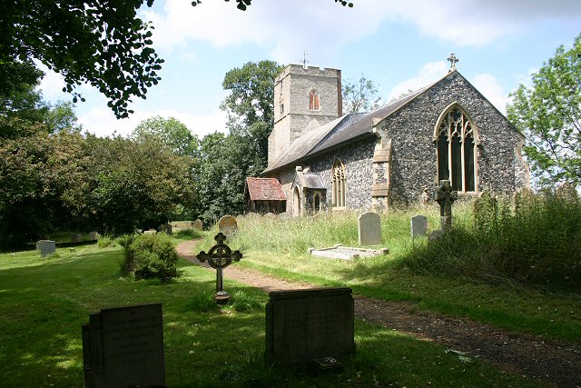
St James' Chapel, Lindsey

St James' Chapel is a 13th-century chapel located near the village of Lindsey, Suffolk, England. Built in 1250 of flint, brick and stone, the small church...

Monks Eleigh

Monks Eleigh is a village and a civil parish in Babergh, Suffolk, United Kingdom, situated on the tributary to the River Brett in a rural area. The parish...

Semer, Suffolk

Semer is a small village and civil parish in Suffolk, England. Located adjacent to a bridge over the River Brett on the B1115 between Hadleigh and Stowmarket...

Nearby Amenities

Located within 500m of 52.074201,0.891358
Bus Stop
Red Rose
Naptan AtcoCode: 390010465
Naptan Bearing: N
Naptan CommonName: Red Rose
Naptan Indicator: opp
Naptan Landmark: Red Rose
Naptan NaptanCode: sufagjmg
Naptan Street: Unclassified
Naptan Verified: no
Shelter: no
Source: naptan_import
Lat/Long: 52.074512/0.8915577
Red Rose
Naptan AtcoCode: 390010466
Naptan Bearing: S
Naptan BusStopType: CUS
Naptan CommonName: Red Rose
Naptan Indicator: o/s
Naptan Landmark: Red Rose
Naptan NaptanCode: sufagjmj
Naptan Street: Unclassified
Naptan Verified: no
Source: naptan_import
Lat/Long: 52.074484/0.8915997
Post Box
Collection Times: Mo-Fr 09:00; Sa 07:00
Operator: Royal Mail
Operator Wikidata: Q638098
Post Box Mounting: pier
Post Box Type: lamp
Ref: IP7 1095D
Royal Cypher: EIIR
Royal Cypher Wikidata: Q33102113
Source: survey
Survey Date: 2023-05-14
Lat/Long: 52.0747275/0.8918278
The data included in this document is from www.openstreetmap.org. The data is made available under ODbL.

Have you been to Lindsey Tye?

Leave your review of Lindsey Tye below (or comments, questions and feedback).