Bow Hills

Range Of Mountains, Range Of Hills in Yorkshire Richmondshire

England

Bow Hills

Eroding sandstone on Scargill High Moor The prominent escarpment  at the top of Scargill High Moor is formed in the unnamed sandstone that lies just below the Little Limestone, towards the bottom of the Stainmore Group, of Pendleian age in the Carboniferous. It's part of what older ones among us will remember as being the Millstone Grit series. At the top of the slope, blocks of sandstone are weathering out, and have little or no peat drift covering them. Just back from the edge, a path links lines of grouse butts, making for surprisingly easy and pleasant walking. Even beyond the last grouse butt (some way to the west) the path continues as a gamekeeper's access, somewhat narrower but still giving mostly easy footing.
Eroding sandstone on Scargill High Moor Credit: Andy Waddington

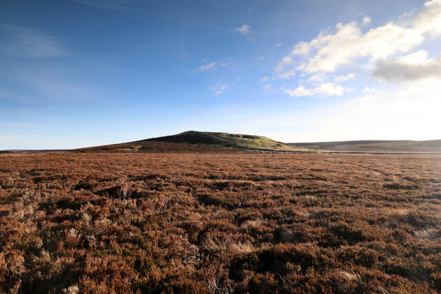
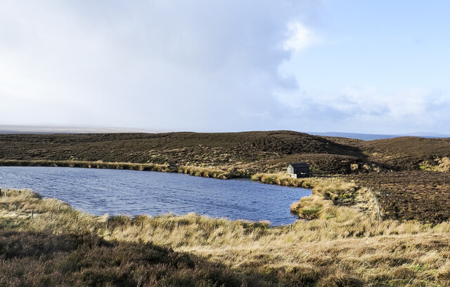
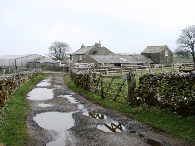
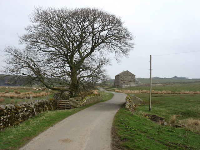
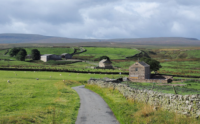
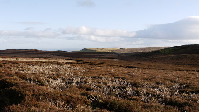
Bow Hills is a range of hills located in the county of Yorkshire, England. Situated in the northern part of the county, Bow Hills are part of the larger Pennine Range, which stretches across the northern part of England. The hills are known for their picturesque landscapes, offering breathtaking views of the surrounding countryside.

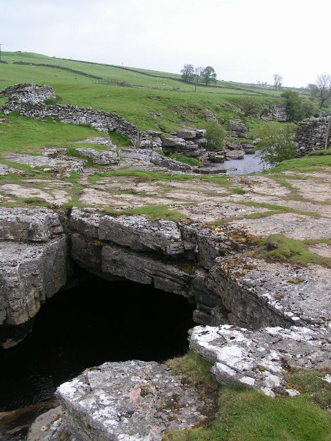
With an elevation ranging from approximately 300 to 500 meters (1000 to 1600 feet), Bow Hills are not classified as mountains but rather as a range of hills. However, their steep slopes and rugged terrain give them a mountainous appearance. The hills are composed mostly of sedimentary rocks, such as sandstone and limestone, which have shaped their distinctive features over millions of years.

Bow Hills are home to a diverse range of flora and fauna, with heather moorlands covering the higher slopes and grasslands dominating the lower areas. The hills provide habitat for various bird species, including grouse, curlews, and skylarks, making them a popular destination for birdwatchers.

The area surrounding Bow Hills also holds historical significance, with evidence of human occupation dating back thousands of years. Ancient burial mounds and stone circles can be found in the vicinity, providing insights into the lives of early settlers.

Bow Hills attract outdoor enthusiasts who enjoy activities such as hiking, mountain biking, and horseback riding. Numerous footpaths traverse the hills, offering opportunities for exploration and enjoyment of the natural beauty. The hills also form part of the Pennine Way, a long-distance footpath that stretches over 400 kilometers (250 miles) across the Pennine Range.

Overall, Bow Hills in Yorkshire offer a captivating and diverse landscape, providing visitors with both natural beauty and historical intrigue.

If you have any feedback on the listing, please let us know in the comments section below.
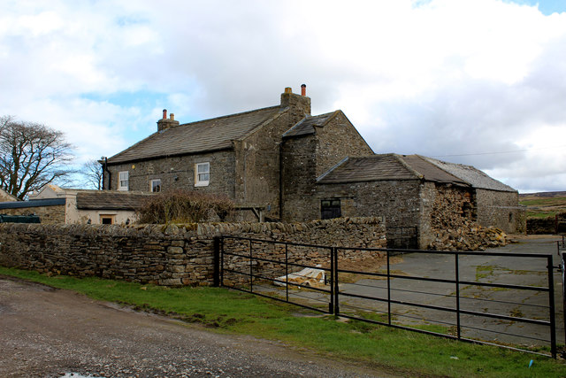
Bow Hills Images

Images are sourced within 2km of 54.477275/-2.0445814 or Grid Reference NY9709. Thanks to Geograph Open Source API. All images are credited.

Eroding sandstone on Scargill High Moor The prominent escarpment  at the top of Scargill High Moor is formed in the unnamed sandstone that lies just below the Little Limestone, towards the bottom of the Stainmore Group, of Pendleian age in the Carboniferous. It's part of what older ones among us will remember as being the Millstone Grit series. At the top of the slope, blocks of sandstone are weathering out, and have little or no peat drift covering them. Just back from the edge, a path links lines of grouse butts, making for surprisingly easy and pleasant walking. Even beyond the last grouse butt (some way to the west) the path continues as a gamekeeper's access, somewhat narrower but still giving mostly easy footing.
Eroding sandstone on Scargill High Moor
The prominent escarpment at the top of Scargill High Moor is formed in the unnamed sandstone that lies just below the Little Limestone, towards the bottom of the Stainmore Group, of Pendleian age in the Carboniferous. It's part of what older ones among us will remember as being the Millstone Grit series. At the top of the slope, blocks of sandstone are weathering out, and have little or no peat drift covering them. Just back from the edge, a path links lines of grouse butts, making for surprisingly easy and pleasant walking. Even beyond the last grouse butt (some way to the west) the path continues as a gamekeeper's access, somewhat narrower but still giving mostly easy footing.
North towards Citron Seat From the Gilmonby road, a bridleway heads south as a good track, and where it splits, the branch to Citron Seat (the small dark-topped hill right on centre in this view) continues very clear, though, like the southern branch, it ends very abruptly at no particularly obvious destination (just at a change of local authority administering the definitive rights of way map). The southern branch passes through this view just at the foot of the slope, though you'd hardly know it. Since it terminates abruptly at the boundary wall and fails to enter the Yorkshire Dales National park, its original destination is unclear, but somewhere in upper Arkengarthdale seems likely, perhaps joining the public footpath which also started life as a bridleway until it hit the National Park frontier. One suspects some severe laxity in recording the rights of way after the 1949 Countryside Act.
North towards Citron Seat
From the Gilmonby road, a bridleway heads south as a good track, and where it splits, the branch to Citron Seat (the small dark-topped hill right on centre in this view) continues very clear, though, like the southern branch, it ends very abruptly at no particularly obvious destination (just at a change of local authority administering the definitive rights of way map). The southern branch passes through this view just at the foot of the slope, though you'd hardly know it. Since it terminates abruptly at the boundary wall and fails to enter the Yorkshire Dales National park, its original destination is unclear, but somewhere in upper Arkengarthdale seems likely, perhaps joining the public footpath which also started life as a bridleway until it hit the National Park frontier. One suspects some severe laxity in recording the rights of way after the 1949 Countryside Act.
Tarnhow Hill Although apparently a very minor eminence on the map, Tarnhow Hill seems quite prominent across the otherwise rather flat bit of moorland above Bleakhow Edge (itself a rather over-grandiose name for a short steep slope with a few sandstone boulders). There's a small crag or perhaps a quarry, which I would have guessed was formed in the Little Limestone, but BGS sheet 41 (Kirkby Stephen) shows it as Richmond Chert, a little above the limestone. It also shows Tarnhow Hill covered in drift with no actual bedrock showing, which is clearly not the case, so I withhold judgement on which bed is outcropping, as I suspect that the mappers, like myself today, may not have trekked over to the hill and examined it in detail. The drystone wall which crosses its shoulder, marks the post-1974 border between North Yorkshire and County Durham (prior to that, the boundary was along the River Tees, further north) and is also the frontier of the Yorkshire Dales National Park. A number of rights of way either change status to lesser rights, or terminate abruptly on that border, suggesting that within the Park (in 1949 it was all the North Riding) recording of existing paths was far more lax than outside on the definitive map. Given the time it took for the 1949 Act to result in these definitive maps, it is possible that the discrepancy lay between the post-1974 county authorities.
Tarnhow Hill
Although apparently a very minor eminence on the map, Tarnhow Hill seems quite prominent across the otherwise rather flat bit of moorland above Bleakhow Edge (itself a rather over-grandiose name for a short steep slope with a few sandstone boulders). There's a small crag or perhaps a quarry, which I would have guessed was formed in the Little Limestone, but BGS sheet 41 (Kirkby Stephen) shows it as Richmond Chert, a little above the limestone. It also shows Tarnhow Hill covered in drift with no actual bedrock showing, which is clearly not the case, so I withhold judgement on which bed is outcropping, as I suspect that the mappers, like myself today, may not have trekked over to the hill and examined it in detail. The drystone wall which crosses its shoulder, marks the post-1974 border between North Yorkshire and County Durham (prior to that, the boundary was along the River Tees, further north) and is also the frontier of the Yorkshire Dales National Park. A number of rights of way either change status to lesser rights, or terminate abruptly on that border, suggesting that within the Park (in 1949 it was all the North Riding) recording of existing paths was far more lax than outside on the definitive map. Given the time it took for the 1949 Act to result in these definitive maps, it is possible that the discrepancy lay between the post-1974 county authorities.
Gamekeeper's path on White Crag Moss Beyond the last grouse butt on Scargill High Moor, the broad footpath serving those butts (used by off-road vehicles, one suspects) shrinks to just a footpath, though the occasional fat tyre track does suggest something motorised occasionally passes this way. Lots of predator traps and grouse medication trays imply the primary purpose is for gamekeeper's access, but being along the top of the sandstone outcrop where the peat is shallow or absent, the path is surprisingly easy underfoot and the views north over the Greta valley are rather fine.
Gamekeeper's path on White Crag Moss
Beyond the last grouse butt on Scargill High Moor, the broad footpath serving those butts (used by off-road vehicles, one suspects) shrinks to just a footpath, though the occasional fat tyre track does suggest something motorised occasionally passes this way. Lots of predator traps and grouse medication trays imply the primary purpose is for gamekeeper's access, but being along the top of the sandstone outcrop where the peat is shallow or absent, the path is surprisingly easy underfoot and the views north over the Greta valley are rather fine.
Seven Hills Tarn Seven Hills Tarn sits among a group of heathery knolls known as Seven Hills which lie to the north-west of Citron Seat. A small shed is at the north side of the water; it's rather decrepit externally and worse inside. The shed has what must have been a landing stage for birds, probably doves or pigeons, a feature seen at similar buildings on a number of grouse moors.
Seven Hills Tarn
Seven Hills Tarn sits among a group of heathery knolls known as Seven Hills which lie to the north-west of Citron Seat. A small shed is at the north side of the water; it's rather decrepit externally and worse inside. The shed has what must have been a landing stage for birds, probably doves or pigeons, a feature seen at similar buildings on a number of grouse moors.
Citron Seat Citron Seat is a modest moorland hill with a distinctively pointed summit. The view is from the north-west, over a bog, across which runs a collapsing wooden fence.
Citron Seat
Citron Seat is a modest moorland hill with a distinctively pointed summit. The view is from the north-west, over a bog, across which runs a collapsing wooden fence.
Sleightholme Farm The Pennine Way passes along this track.
Sleightholme Farm
The Pennine Way passes along this track.
Kingdom Lodge, Sleightholme Bar Gap Farm is on the horizon to the right. The lane runs to Gilmonby and Bowes.
Kingdom Lodge, Sleightholme
Bar Gap Farm is on the horizon to the right. The lane runs to Gilmonby and Bowes.
The Seven Hills Seen from near Bar Gap, these hills are not quite as imposing as those in Rome!
The Seven Hills
Seen from near Bar Gap, these hills are not quite as imposing as those in Rome!
Cotron Seat Citron Seat near Bowes
Cotron Seat
Citron Seat near Bowes
Sleightholme Farm For northbound Pennine Way walkers this comes as a welcome relief - being the first sign of civilisation since the long trek from Tan Hill Inn.
Sleightholme Farm
For northbound Pennine Way walkers this comes as a welcome relief - being the first sign of civilisation since the long trek from Tan Hill Inn.
Seven Hills Tarn
Seven Hills Tarn
Buildings at Sleightholme The most distant is Sleightholme Farm, the two nearer buildings are both barn conversions; the middle one is Kingdom Lodge, the nearer barn is a recent development.
Buildings at Sleightholme
The most distant is Sleightholme Farm, the two nearer buildings are both barn conversions; the middle one is Kingdom Lodge, the nearer barn is a recent development.
Citron Seat Citron Seat is a minor but abrupt rise along a moorland ridge above Gilmonby Moor on the south side of the valley of the River Greta.
Citron Seat
Citron Seat is a minor but abrupt rise along a moorland ridge above Gilmonby Moor on the south side of the valley of the River Greta.
Heather moorland on north side of Hazel Bush Hill Hazel Bush Hill is an insignificant eminence of heather moorland to the east of the minor rise of Citron Seat; land on the north side of the hill is seen here, the view being eastwards.
Heather moorland on north side of Hazel Bush Hill
Hazel Bush Hill is an insignificant eminence of heather moorland to the east of the minor rise of Citron Seat; land on the north side of the hill is seen here, the view being eastwards.
Several of Seven Hills Seven Hills is/are a feature to the south of the minor road reaching Sleightholme from Bowes. The hills are very minor features and the number to be counted depends upon the viewer's position and what they consider to constitute an individual hill! The view here is in the 'alpenglow' of an early January, late afternoon, from the road near to the farm at Bar Gap.
Several of Seven Hills
Seven Hills is/are a feature to the south of the minor road reaching Sleightholme from Bowes. The hills are very minor features and the number to be counted depends upon the viewer's position and what they consider to constitute an individual hill! The view here is in the 'alpenglow' of an early January, late afternoon, from the road near to the farm at Bar Gap.
Track and wall over Hazel Bush Hill Looking west towards Citron Seat.
Track and wall over Hazel Bush Hill
Looking west towards Citron Seat.
Citron Seat and its Ordnance Survey Pillar Taken from the east looking up at the pillar.
Citron Seat and its Ordnance Survey Pillar
Taken from the east looking up at the pillar.
Show me another place!

Bow Hills is located at Grid Ref: NY9709 (Lat: 54.477275, Lng: -2.0445814)

Division: North Riding

Administrative County: North Yorkshire

District: Richmondshire

Police Authority: North Yorkshire

What 3 Words

///stylists.overgrown.quest. Near Bowes, Co. Durham

Related Wikis

Sleightholme

Sleightholme is a secluded hamlet on a dead end road in County Durham, England. It lies beside Sleightholme Beck, a tributary of the River Greta. The...

Sleightholme Beck Gorge – The Troughs

Sleightholme Beck Gorge – The Troughs is a Site of Special Scientific Interest in the County Durham district of south-west County Durham, England. The...

Arkengarthdale

Arkengarthdale is a dale, or valley, on the east side of the Pennines in North Yorkshire, England. Running roughly north-west to south-east, it is the...

Hoove

Hoove is a hill in the northern Yorkshire Dales in North Yorkshire, England, near the town of Barnard Castle in County Durham. Its elevation is 554 metres...

God's Bridge

God's Bridge is a Site of Special Scientific Interest in the County Durham district of south-west County Durham, England. It is a natural limestone bridge...

Walney to Wear and Whitby Cycle Route

The Walney to Wear and Whitby Cycle Route (or W2W) is the name of a cross-country cycle route in Northern England. It runs from Walney Island in Cumbria...

National Cycle Route 70

National Cycle Network (NCN) Route 70 is a Sustrans National Route that runs from Walney Island in Cumbria to Sunderland. The route is fully open and signed...

Whaw

Whaw is a hamlet in Arkengarthdale in North Yorkshire, England. It is one of few settlements in the dale and is one of the smallest. Its name derives from...

Nearby Amenities

Located within 500m of 54.477275,-2.0445814
Ling Pulled Hill
Place: locality
Lat/Long: 54.4773731/-2.0510708
Tom Bog Rigg
Place: locality
Lat/Long: 54.4799039/-2.0495473
Low Seavy Rigg
Place: locality
Lat/Long: 54.4779473/-2.0426575
Garded Hill
Place: locality
Lat/Long: 54.4766209/-2.0453445
Bent Hill
Place: locality
Lat/Long: 54.4754863/-2.0439712
High Seavy Rigg
Place: locality
Lat/Long: 54.4760599/-2.0404092
The data included in this document is from www.openstreetmap.org. The data is made available under ODbL.

Have you been to Bow Hills?

Leave your review of Bow Hills below (or comments, questions and feedback).