Pentland Hills

Range Of Mountains, Range Of Hills in Peeblesshire

Scotland

Pentland Hills

Sawmill, Baddinsgill
Sawmill, Baddinsgill Credit: Richard Webb

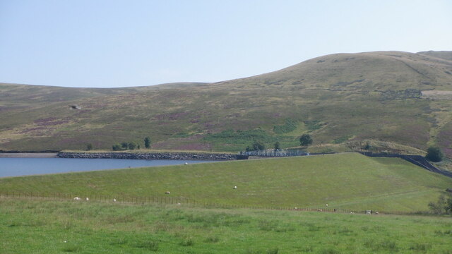
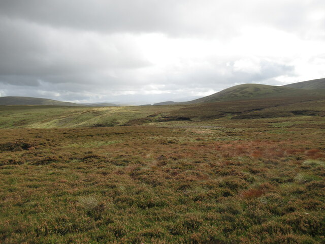
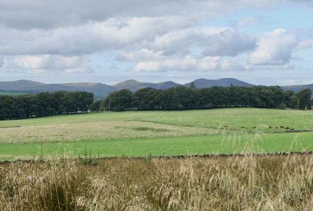
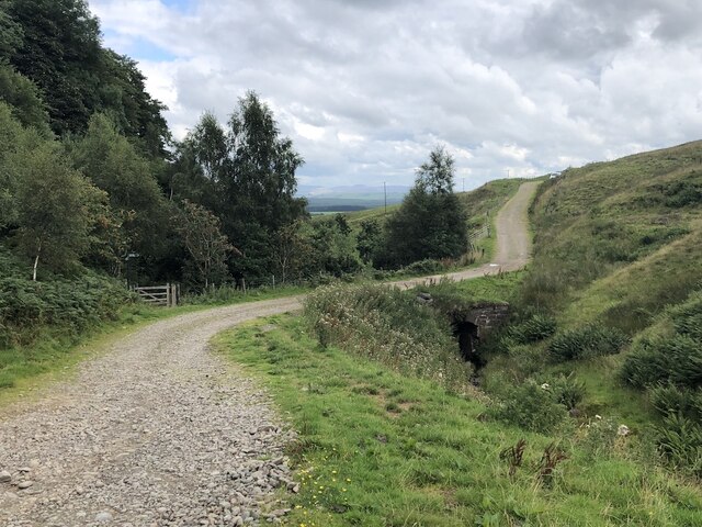
Pentland Hills is a range of hills located in Peeblesshire, Scotland. The hills stretch for approximately 20 miles from southwest of Edinburgh to the town of Biggar in the south. The highest peak in the range is Scald Law, which stands at 579 meters (1,900 feet) above sea level.

The Pentland Hills offer a variety of walking and hiking opportunities for outdoor enthusiasts. The hills are crisscrossed with numerous trails and footpaths, making it a popular destination for walkers, hikers, and cyclists. The range also offers stunning panoramic views of the surrounding countryside, including the city of Edinburgh and the Firth of Forth.

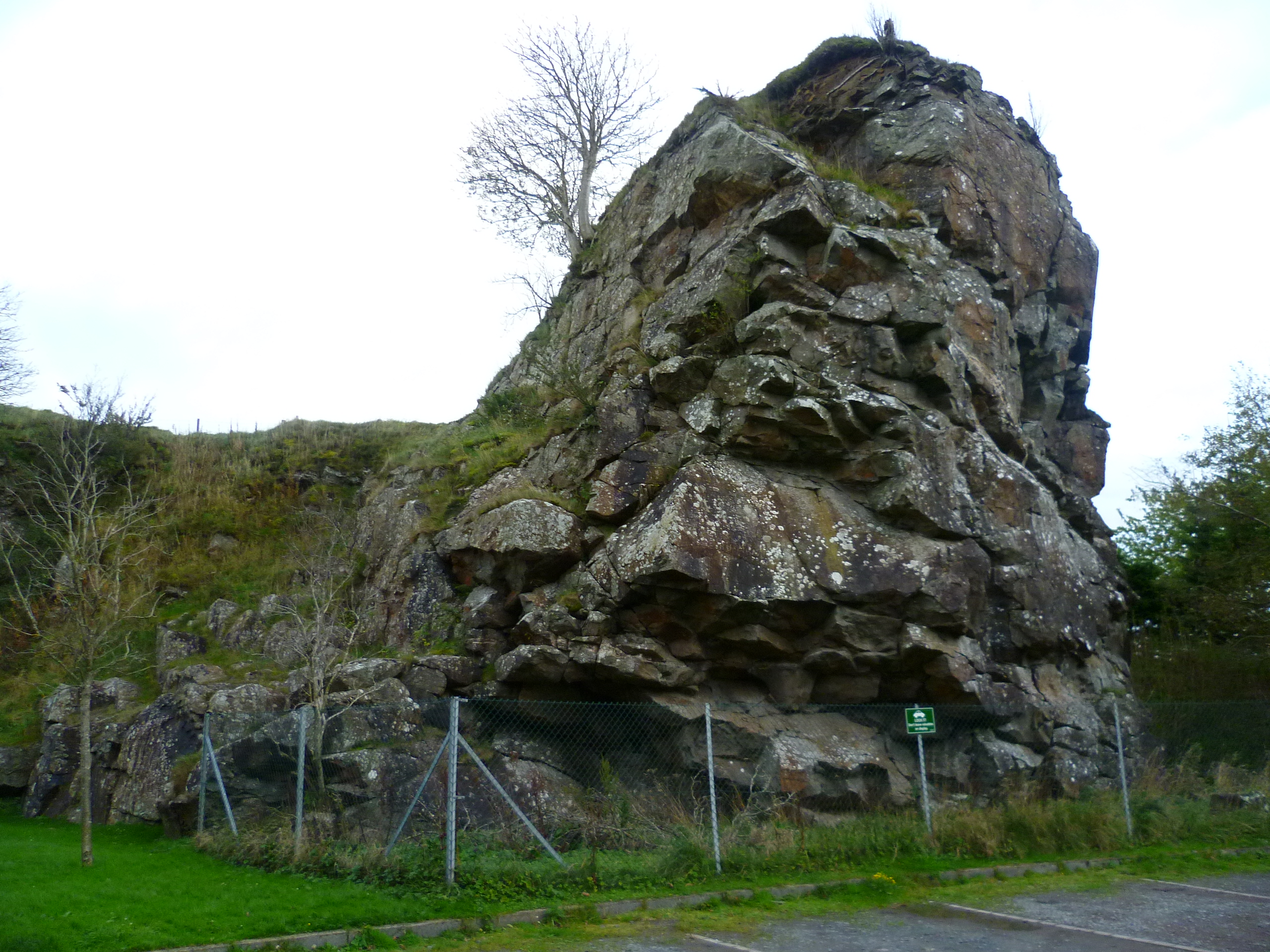
The Pentland Hills are home to a diverse range of flora and fauna, including heather, gorse, and a variety of bird species. The hills are also rich in archaeological sites, with numerous ancient burial mounds and stone circles scattered throughout the landscape.

Overall, Pentland Hills is a beautiful and diverse range of hills that offers something for everyone, whether you are looking for a challenging hike or a leisurely stroll in nature.

If you have any feedback on the listing, please let us know in the comments section below.

Pentland Hills Images

Images are sourced within 2km of 55.793668/-3.3810102 or Grid Reference NT1356. Thanks to Geograph Open Source API. All images are credited.

Sawmill, Baddinsgill
The dam, Baddinsgill Reservoir
Log stacks, Thieves Road
Pentland Hills near Baddinsgill Reservoir A field almost surrounded by a shelter belt.
Pentland Hills near Baddinsgill Reservoir
A field almost surrounded by a shelter belt.
Thieves Road The track that crosses the pass at Cauldstane Slap with East Cairn Hill in the background.
Thieves Road
The track that crosses the pass at Cauldstane Slap with East Cairn Hill in the background.
Quarry on Muckle Knock A rather uncomfortable stony road runs to the quarry. After the quarry there is a lovely grassy track into the moors below West Cairn Hill.
Quarry on Muckle Knock
A rather uncomfortable stony road runs to the quarry. After the quarry there is a lovely grassy track into the moors below West Cairn Hill.
The Baddinsgill Burn, Pentland Hills 2009 view here: <a href="https://www.geograph.org.uk/photo/1209261">NT1155 : Valley of the Baddinsgill Burn</a>
The Baddinsgill Burn, Pentland Hills
Track on Muckle Knock A very enjoyable grassy track - it leads nowhere. The early part is horribly stony but pass the quarry and you are rewarded.
Track on Muckle Knock
A very enjoyable grassy track - it leads nowhere. The early part is horribly stony but pass the quarry and you are rewarded.
Summit, Muckle Knock I am still finding the odd Pentland summit that I have not visited. Good view through to The Kips.
Summit, Muckle Knock
I am still finding the odd Pentland summit that I have not visited. Good view through to The Kips.
Log pile with buried roadsign Baddinsgill, Pentland Hills.
Log pile with buried roadsign
Baddinsgill, Pentland Hills.
Heather moorland near the Ravendean Burn Viewed from the Thieves' Road, the old drove road that crosses this tract of moorland.
Heather moorland near the Ravendean Burn
Viewed from the Thieves' Road, the old drove road that crosses this tract of moorland.
Sheep grazing near Baddinsgill Farm The smoke is coming from a chimney at a timber and firewood business that operates from this site.
Sheep grazing near Baddinsgill Farm
The smoke is coming from a chimney at a timber and firewood business that operates from this site.
The Pentland Hills From Portmore Estate
The Pentland Hills
From Portmore Estate
Baddinsgill Reservoir spillway
Steadings, Fairliehope
Red Angus cattle, Fairliehope
Bridge over the Fairliehope Burn A path for the north end of Carlops leaves here while an easier route on the road comes out at the southern end of the village by the carpark.
Bridge over the Fairliehope Burn
A path for the north end of Carlops leaves here while an easier route on the road comes out at the southern end of the village by the carpark.
Baddinsgill Reservoir dam The lower slopes of Mount Maw rise beyond.
Baddinsgill Reservoir dam
The lower slopes of Mount Maw rise beyond.
Show me another place!

Pentland Hills is located at Grid Ref: NT1356 (Lat: 55.793668, Lng: -3.3810102)

Unitary Authority: The Scottish Borders

Police Authority: The Lothians and Scottish Borders

What 3 Words

///scarf.nips.ideals. Near West Linton, Scottish Borders

Nearby Locations

Pentland Hills

Related Wikis

Baddinsgill Reservoir

Baddinsgill Reservoir is a small reservoir in the Scottish Borders area of Scotland close to Carlops, West Linton, and the boundary with Midlothian. It...

Baddinsgill

Baddinsgill is a hamlet in the Scottish Borders area of Scotland. The Baddinsgill Reservoir is a few hundred metres north of the hamlet. == See also... ==

Pentland Hills

The Pentland Hills are a range of hills southwest of Edinburgh, Scotland. The range is around twenty miles (thirty kilometres) in length, and runs southwest...

Carlops

Carlops (Scottish Gaelic: Leum na Caillich) is a small village in the Pentland Hills, within the Scottish Borders area of Scotland, close to the boundary...

Have you been to Pentland Hills?

Leave your review of Pentland Hills below (or comments, questions and feedback).