Clwydian Range

Range Of Mountains, Range Of Hills in Flintshire

Wales

Clwydian Range

Looking down on the Afon Disgynfa Descending northeast below the impressive ramparts of the iron-age hill fort Penycloddiau, one is soon away from the network of paths, though there is a track shown on the OS map some way to the east, dropping down to a public footpath which crosses the valley a considerable distance below. From this point (just inside the square) it is almost a hundred metres vertical back up to the fort, perhaps explaining why it seems to have been so little visited by geograph aficionados!
Looking down on the Afon Disgynfa Credit: Andy Waddington

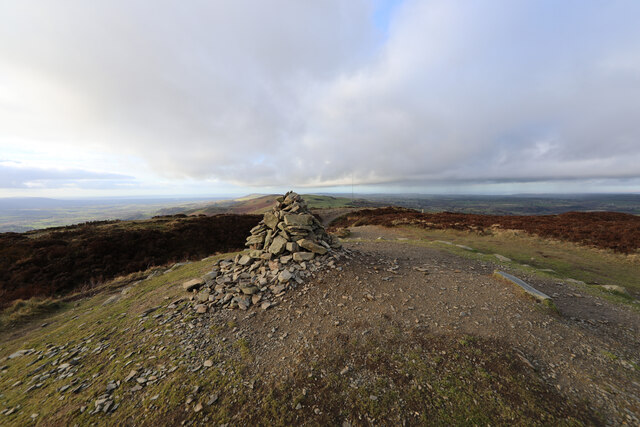
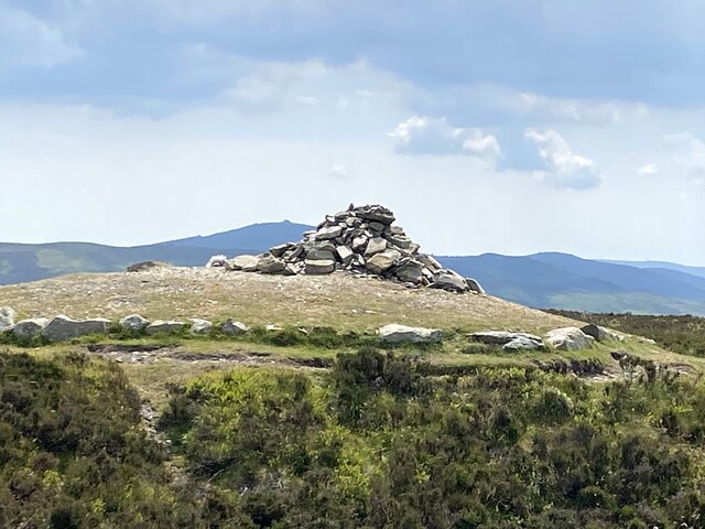
The Clwydian Range is a designated Area of Outstanding Natural Beauty located in Flintshire, Wales. Comprising a series of hills and small mountains, the range stretches for approximately 35 kilometers from Prestatyn in the north to Llandegla in the south. The highest point in the range is Moel Famau, which stands at 554 meters above sea level.

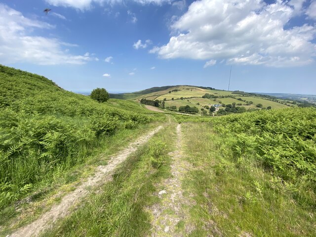
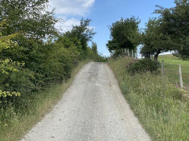
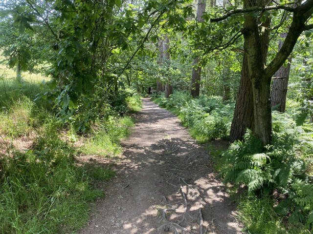
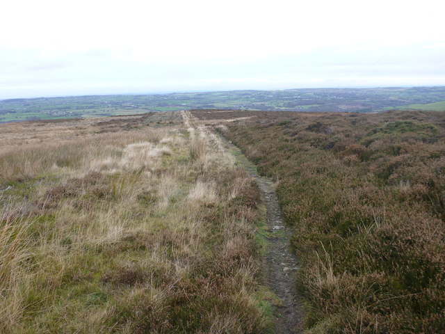
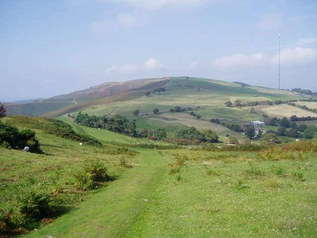
The landscape of the Clwydian Range is characterized by rolling hills, heather-clad moorland, and ancient woodlands. The range is home to a variety of wildlife, including red kites, buzzards, and peregrine falcons. Visitors to the area can enjoy a network of well-maintained footpaths and bridleways, making it a popular destination for walkers, cyclists, and horse riders.

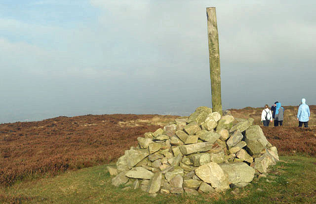
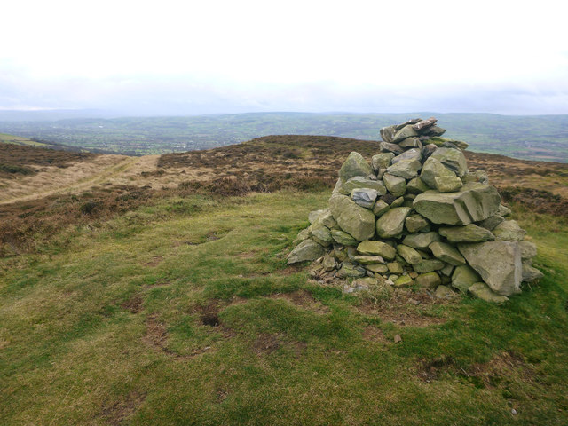
The Clwydian Range offers stunning panoramic views across the surrounding countryside, including the Dee Valley and the Vale of Clwyd. The range is also home to several historic sites, including Iron Age hillforts and medieval castles. Overall, the Clwydian Range is a peaceful and picturesque area, perfect for those looking to escape the hustle and bustle of city life and immerse themselves in the natural beauty of the Welsh countryside.

If you have any feedback on the listing, please let us know in the comments section below.

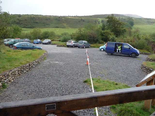
Clwydian Range Images

Images are sourced within 2km of 53.206074/-3.3071321 or Grid Reference SJ1268. Thanks to Geograph Open Source API. All images are credited.

Looking down on the Afon Disgynfa Descending northeast below the impressive ramparts of the iron-age hill fort Penycloddiau, one is soon away from the network of paths, though there is a track shown on the OS map some way to the east, dropping down to a public footpath which crosses the valley a considerable distance below. From this point (just inside the square) it is almost a hundred metres vertical back up to the fort, perhaps explaining why it seems to have been so little visited by geograph aficionados!
Looking down on the Afon Disgynfa
Descending northeast below the impressive ramparts of the iron-age hill fort Penycloddiau, one is soon away from the network of paths, though there is a track shown on the OS map some way to the east, dropping down to a public footpath which crosses the valley a considerable distance below. From this point (just inside the square) it is almost a hundred metres vertical back up to the fort, perhaps explaining why it seems to have been so little visited by geograph aficionados!
Windbreak NE of Penycloddiau With a southwesterly wind, this side of Penycloddiau, well below the ramparts of the iron-age hill fort, is fairly sheltered already, but this cruciform windbreak will provide additional protection in virtually any wind direction. Being well off the beaten paths along the tops and round the fort, it's likely to be far more used by livestock than by walkers having lunch, so I'm sure sheep find themselves grateful for having a farmer with enough benevolence to provide such a well-built and maintained structure.
Windbreak NE of Penycloddiau
With a southwesterly wind, this side of Penycloddiau, well below the ramparts of the iron-age hill fort, is fairly sheltered already, but this cruciform windbreak will provide additional protection in virtually any wind direction. Being well off the beaten paths along the tops and round the fort, it's likely to be far more used by livestock than by walkers having lunch, so I'm sure sheep find themselves grateful for having a farmer with enough benevolence to provide such a well-built and maintained structure.
Inner rampart, Penycloddiau The inner of three concentric ramparts surrounding the iron-age hill fort of Penycloddiau is the highest, and would no doubt form a convenient place to fire arrows at attackers struggling to climb the lower, outer ramparts just below. The peak seen in the distance to the south is Moel Arthur, another hill fort, though a smaller and rounder one. Four and a half, and six kilometres further south again are two more large hill forts. All overlook the rich agricultural lands of the Clwyd valley to the west and the more northerly pair also overlook lands to the northeast.
Inner rampart, Penycloddiau
The inner of three concentric ramparts surrounding the iron-age hill fort of Penycloddiau is the highest, and would no doubt form a convenient place to fire arrows at attackers struggling to climb the lower, outer ramparts just below. The peak seen in the distance to the south is Moel Arthur, another hill fort, though a smaller and rounder one. Four and a half, and six kilometres further south again are two more large hill forts. All overlook the rich agricultural lands of the Clwyd valley to the west and the more northerly pair also overlook lands to the northeast.
High point of Penycloddiau Just inside of the northernmost ramparts of Penycloddiau, and a few metres off the main Offa's Dyke path, this cairn marks a local high spot, possibly the highest point within the iron-age hill fort, and commanding a fine view to Moel y Parc to the north as well as over surrounding lands to both east and west. The thin vertical line showing just to the right of the cairn in this view is the Moel y Parc TV transmitter mast, a very twentieth-century intrusion into the scene.
High point of Penycloddiau
Just inside of the northernmost ramparts of Penycloddiau, and a few metres off the main Offa's Dyke path, this cairn marks a local high spot, possibly the highest point within the iron-age hill fort, and commanding a fine view to Moel y Parc to the north as well as over surrounding lands to both east and west. The thin vertical line showing just to the right of the cairn in this view is the Moel y Parc TV transmitter mast, a very twentieth-century intrusion into the scene.
Offa's Dyke path descending SE from Penycloddiau Offa's Dyke path now lies just inside the forestry boundary fence separating it from the open fell above, grazed by sheep. Although it's a long distance path, at this time of year it seems mostly to be favoured by dog walkers (such as myself) whilst joggers and mountain bikers use the bigger tracks in the forestry area below. It's a convenient route not only for multi-day walkers, but also to reach the iron-age hill fort of Penycloddiau (behind the photographer) from the small parking area at the col on the narrow road from Llangwyfan to Nannerch.
Offa's Dyke path descending SE from Penycloddiau
Offa's Dyke path now lies just inside the forestry boundary fence separating it from the open fell above, grazed by sheep. Although it's a long distance path, at this time of year it seems mostly to be favoured by dog walkers (such as myself) whilst joggers and mountain bikers use the bigger tracks in the forestry area below. It's a convenient route not only for multi-day walkers, but also to reach the iron-age hill fort of Penycloddiau (behind the photographer) from the small parking area at the col on the narrow road from Llangwyfan to Nannerch.
Sinking sun over the Vale of Clwyd Descending via Offa's Dyke path from a visit to the iron-age hill fort of Penycloddiau, one is perched high enough on the ridge to see over the extensive foresttry to the more distant vista over the Vale of Clwyd. In early March the sun sets early and is sinking into a bank of broken cloud presaging a brief showery interlude before another glorious sunny day on the morrow.
Sinking sun over the Vale of Clwyd
Descending via Offa's Dyke path from a visit to the iron-age hill fort of Penycloddiau, one is perched high enough on the ridge to see over the extensive foresttry to the more distant vista over the Vale of Clwyd. In early March the sun sets early and is sinking into a bank of broken cloud presaging a brief showery interlude before another glorious sunny day on the morrow.
Penycloddiau summit cairn Moel Famau on the left horizon.
Penycloddiau summit cairn
Moel Famau on the left horizon.
Descending northwards from Penycloddiau On the Offa's Dyke Path. Moel y Parc in the distance.
Descending northwards from Penycloddiau
On the Offa's Dyke Path. Moel y Parc in the distance.
Unsurfaced road near Nant Coed-y-mynydd
Ascending Penycloddiau hill fort The last stile before the summit.
Ascending Penycloddiau hill fort
The last stile before the summit.
Woodland track in Coed Llangwyfan
Cairn on Moel y Parc
Footpath to Afon Wen On Access Land northeast of Moel y Parc, there are a plethora of footpaths, some far better-defined than others. This is the main one heading from the summit, across the moor and eventually down to Afon Wen. Not far beyond the limit of vision in this photo, the path meets the access land boundary on the right, where a part of it turns right and becomes not just a footpath but a public footpath, ie. a right of way under the 1949 Countryside Act, rather than the more recent CROW act which established the right to roam across the summit area.
Footpath to Afon Wen
On Access Land northeast of Moel y Parc, there are a plethora of footpaths, some far better-defined than others. This is the main one heading from the summit, across the moor and eventually down to Afon Wen. Not far beyond the limit of vision in this photo, the path meets the access land boundary on the right, where a part of it turns right and becomes not just a footpath but a public footpath, ie. a right of way under the 1949 Countryside Act, rather than the more recent CROW act which established the right to roam across the summit area.
Moel y Parc cairn Shunned by walkers on the Offa's Dyke Long Distance Footpath, Moel y Parc is the northernmost summit of this long section of ridge. The cairn seen here is on the spot marked as a tumulus on the map, so I presume that the green grassy mound is ancient, though the cairn itself looks modern. The path seen on the left heads down to the southwest to cross a well-defined bridleway at a minor col, and either direction at this junction will take one back to the Offa's Dyle and Clwydian Way routes as they head down into the Wheeler valley.
Moel y Parc cairn
Shunned by walkers on the Offa's Dyke Long Distance Footpath, Moel y Parc is the northernmost summit of this long section of ridge. The cairn seen here is on the spot marked as a tumulus on the map, so I presume that the green grassy mound is ancient, though the cairn itself looks modern. The path seen on the left heads down to the southwest to cross a well-defined bridleway at a minor col, and either direction at this junction will take one back to the Offa's Dyle and Clwydian Way routes as they head down into the Wheeler valley.
Llangwyfan car park Today part of the car park is coned off in preparation for a series of mountain bike races occurring in the surrounding lanes, forestry tracks and hillsides. A marshall prepares a van based checkpoint.
Llangwyfan car park
Today part of the car park is coned off in preparation for a series of mountain bike races occurring in the surrounding lanes, forestry tracks and hillsides. A marshall prepares a van based checkpoint.
After the rain, Coed Llangwyfan in the Clwydian Hills A morning rain shower has passed over and now some warm sunshine sets off a cloud of condensing air below the fir trees on Offa's Dyke Path.
After the rain, Coed Llangwyfan in the Clwydian Hills
A morning rain shower has passed over and now some warm sunshine sets off a cloud of condensing air below the fir trees on Offa's Dyke Path.
Heather on Penycloddiau in September The Clwydian Hills are coated in beautiful heather in August and September, here clothing the side of the restored Bronze Age burial cairn in a royal purple.
Heather on Penycloddiau in September
The Clwydian Hills are coated in beautiful heather in August and September, here clothing the side of the restored Bronze Age burial cairn in a royal purple.
View northwards to the sea from Penycloddiau The summits of the Clwydians here carry far reaching views, in this case to the sea off Rhyl and the windfarms beyond, as well as over the wide Vale of Clwyd to the west.
View northwards to the sea from Penycloddiau
The summits of the Clwydians here carry far reaching views, in this case to the sea off Rhyl and the windfarms beyond, as well as over the wide Vale of Clwyd to the west.
Show me another place!

Clwydian Range is located at Grid Ref: SJ1268 (Lat: 53.206074, Lng: -3.3071321)

Unitary Authority: Denbighshire

Police Authority: North Wales

What 3 Words

///inflating.addicted.earth. Near Denbigh, Denbighshire

Nearby Locations

Clwydian Range

Related Wikis

Penycloddiau

Penycloddiau is a hill in Flintshire, Wales, and one of five Marilyns in the Clwydian Range. The hill, like Foel Fenlli and Moel Arthur to the south,...

Aled Rural District

Aled was a rural district in the administrative county of Denbighshire, Wales, from 1935 to 1974. The district was created by a county review order in...

Moel-y-Parc transmitting station

The Moel-y-Parc transmitting station is situated on Moel y Parc, a hill in north-east Wales at the northern end of the Clwydian range, close to the town...

Moel y Parc

Moel y Parc (sometimes written as Moel-y-Parc) is a hill on the border between Denbighshire and Flintshire in Wales. It is one of the Clwydian Hills, rising...

Nearby Amenities

Located within 500m of 53.206074,-3.3071321
Natural: spring
Lat/Long: 53.2026499/-3.3031083
Natural: spring
Lat/Long: 53.202369/-3.3029703
The data included in this document is from www.openstreetmap.org. The data is made available under ODbL.

Have you been to Clwydian Range?

Leave your review of Clwydian Range below (or comments, questions and feedback).