Campsie Fells

Range Of Mountains, Range Of Hills in Stirlingshire

Scotland

Campsie Fells

Fenceline from Hart Hill Looking towards Earl's Seat in the distance
Fenceline from Hart Hill Credit: Chris Upson

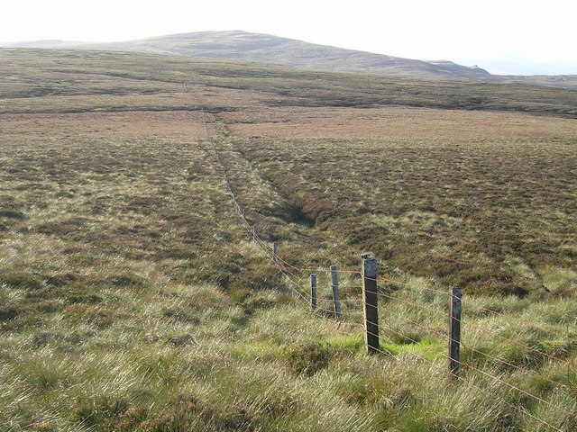
Campsie Fells is a range of hills located in Stirlingshire, Scotland. The hills cover an extensive area, stretching from the town of Lennoxtown in the west to Fintry in the east. The highest point in the range is Earl's Seat, which stands at an elevation of 578 meters (1,896 feet) above sea level.

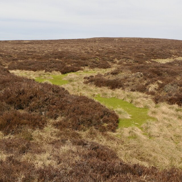
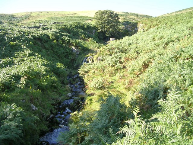
The landscape of Campsie Fells is characterized by rolling hills, heather-covered moorland, and rocky outcrops. The hills offer a variety of walking and hiking opportunities, with several well-marked trails crisscrossing the area. Many of these trails offer stunning views of the surrounding countryside, including the nearby cities of Glasgow and Stirling.

The Campsie Fells are a popular destination for outdoor enthusiasts, attracting hikers, mountain bikers, and birdwatchers throughout the year. The area is also home to a wide variety of wildlife, including red deer, mountain hares, and various species of birds.

Overall, Campsie Fells is a beautiful and diverse range of hills that offers something for everyone, whether you're looking for a challenging hike or a peaceful stroll in the countryside.

If you have any feedback on the listing, please let us know in the comments section below.

Campsie Fells Images

Images are sourced within 2km of 56.019601/-4.233124 or Grid Reference NS6082. Thanks to Geograph Open Source API. All images are credited.

Fenceline from Hart Hill Looking towards Earl's Seat in the distance
Fenceline from Hart Hill
Looking towards Earl's Seat in the distance
Almeel Burn, Campsie Fells
Remote top in the Campsies This 489m summit in the Campsie Fells must be one of the most rarely visited.
Remote top in the Campsies
This 489m summit in the Campsie Fells must be one of the most rarely visited.
Holehead Looking over the obscured Crow Road with the radar visible on the summit. The facing hillside has been planted with trees.
Holehead
Looking over the obscured Crow Road with the radar visible on the summit. The facing hillside has been planted with trees.
Southern slopes of Holehead Outer Black Hill, mostly grassy ground.
Southern slopes of Holehead
Outer Black Hill, mostly grassy ground.
Moorland, Outer Black Hill Southern slopes of Holehead. No longer grazed although a few sheep have found their way in.
Moorland, Outer Black Hill
Southern slopes of Holehead. No longer grazed although a few sheep have found their way in.
Outer Black Hill Southern slopes of Holehead.
Outer Black Hill
Southern slopes of Holehead.
Outer Black Hill Southern slopes of Holehead, now only grazed by a few stray sheep.
Outer Black Hill
Southern slopes of Holehead, now only grazed by a few stray sheep.
Sheep, Alvain Burn The southern slopes of Holehead are partly forested and no longer formally used for livestock grazing. This lot however have got in.
Sheep, Alvain Burn
The southern slopes of Holehead are partly forested and no longer formally used for livestock grazing. This lot however have got in.
Alvain Burn Above where it forms a gorge through the Campsie scarp. West of the burn is a big area of blanket bog while the east side is grassy and better drained.
Alvain Burn
Above where it forms a gorge through the Campsie scarp. West of the burn is a big area of blanket bog while the east side is grassy and better drained.
Inner Black Hill Campsie moorland.
Inner Black Hill
Campsie moorland.
Inner Black Hill Campsie moorland
Inner Black Hill
Campsie moorland
Above the Alvain Burn There are a few sheep about, but the land here is in the care of whatever the Forestry Commission is currently calling itself and partly planted with trees with livestock supposedly excluded.
Above the Alvain Burn
There are a few sheep about, but the land here is in the care of whatever the Forestry Commission is currently calling itself and partly planted with trees with livestock supposedly excluded.
Bog on Hart Hill Much of Hart Hill is covered in deep peat with heather cover. There are scattered self seeded Sitka spruce trees.
Bog on Hart Hill
Much of Hart Hill is covered in deep peat with heather cover. There are scattered self seeded Sitka spruce trees.
Peat grough, Hart Hill Much of Hart Hill is covered in deep peat with heather cover.
Peat grough, Hart Hill
Much of Hart Hill is covered in deep peat with heather cover.
Heather on Hart Hill Much of Hart Hill is covered in deep peat with heather cover.
Heather on Hart Hill
Much of Hart Hill is covered in deep peat with heather cover.
Hart Hill Covered in heather and blanket peat bog.
Hart Hill
Covered in heather and blanket peat bog.
Bog west of Holehead Holehead is mostly grassy, but the western side is covered in deep dissected peat. Fortunately this visit was during a dry spell.
Bog west of Holehead
Holehead is mostly grassy, but the western side is covered in deep dissected peat. Fortunately this visit was during a dry spell.
Show me another place!

Campsie Fells is located at Grid Ref: NS6082 (Lat: 56.019601, Lng: -4.233124)

Unitary Authority: Stirling

Police Authority: Forth Valley

What 3 Words

///poets.airtime.wolf. Near Lennoxtown, East Dunbartonshire

Nearby Locations

Campsie Fells Hart Hill

Related Wikis

Campsie, East Dunbartonshire

Campsie is a civil parish in East Dunbartonshire, Scotland. The parish was formerly part of Stirlingshire. == Settlements == Auchenreoch Clachan of Campsie...

Aldessan Burn

Located in East Dunbartonshire, the Aldessan Burn (Scottish Gaelic: Allt Easain, meaning "burn of the falls"; also known as the Kirk Burn) is formed as...

Clachan of Campsie

Clachan of Campsie or Campsie Glen (Scottish Gaelic: Clachan Chamais) is a settlement in the East Dunbartonshire area of Scotland. It was formerly part...
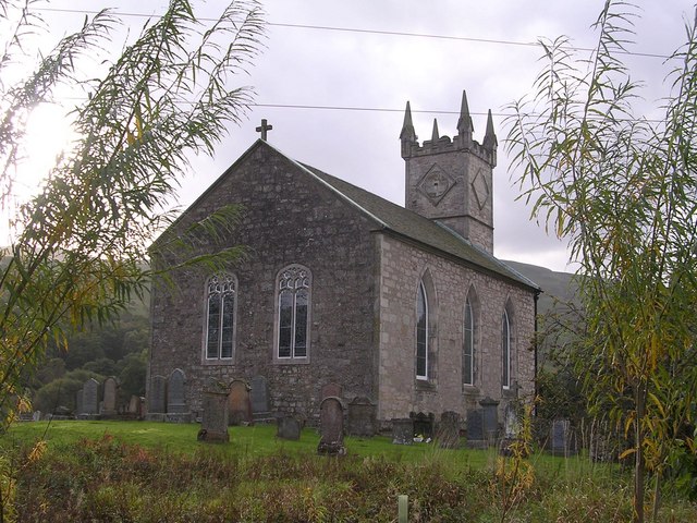
Fintry Kirk

Fintry Kirk is in the village of Fintry in Stirlingshire, Scotland. Fintry is a Church of Scotland Parish in the Presbytery of Stirling. The kirk is located...

Have you been to Campsie Fells?

Leave your review of Campsie Fells below (or comments, questions and feedback).