Barton

Settlement in Oxfordshire Oxford

England

Barton

Santander Bank branch in Headington (1) Located at 116 London Road Ox3 9AS, this branch is closing after today ie Thursday 12th August 2021. The closure notice can be seen to the right of the entrance and ATM cashpoint.
Santander Bank branch in Headington (1) Credit: David Hillas

Barton is a small village located in Oxfordshire, England. Situated just two miles south of the historic city of Oxford, it falls within the district of South Oxfordshire. Despite its close proximity to the city, Barton maintains a distinct rural charm and tranquil atmosphere.

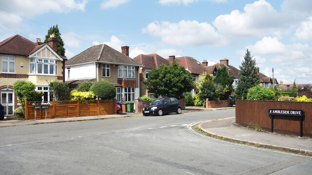
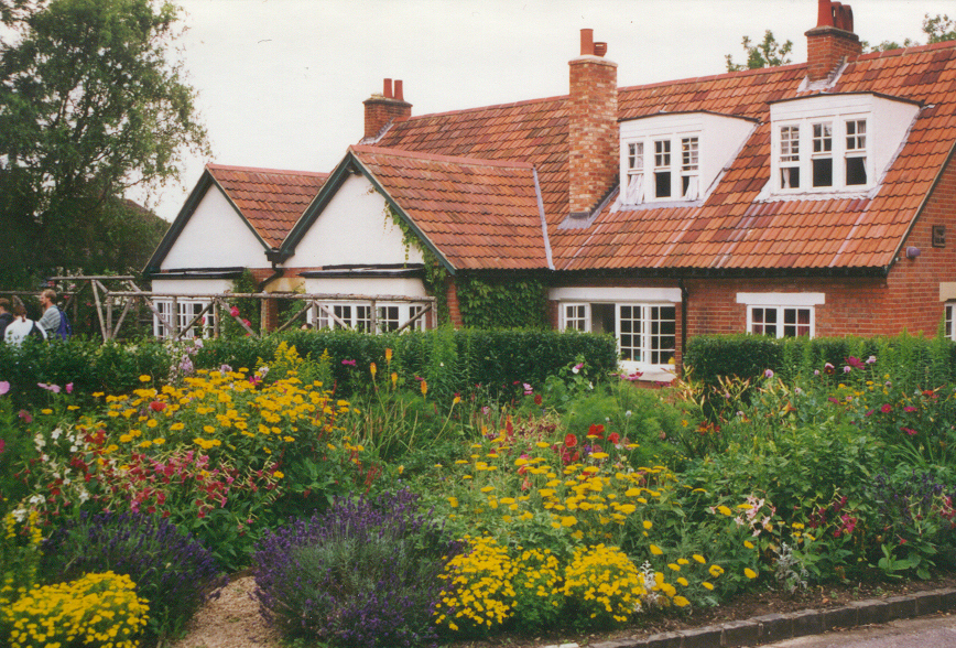
The village is nestled amidst picturesque countryside, with rolling hills, meandering streams, and lush green fields surrounding it. Barton is known for its idyllic scenery, making it a popular destination for nature lovers and outdoor enthusiasts. The village offers a variety of walking and cycling routes, allowing visitors to explore the beautiful surroundings.

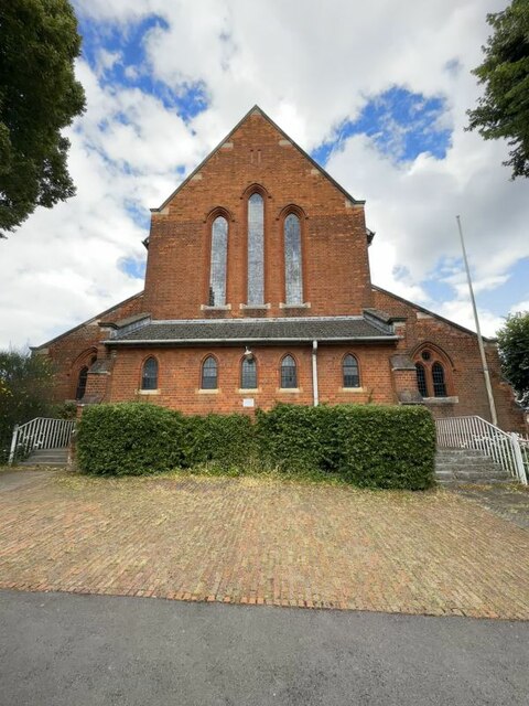
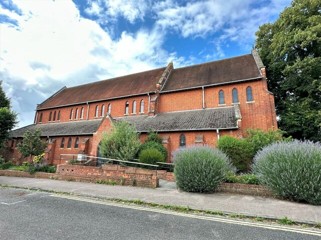
Barton boasts a rich history, with evidence of human habitation dating back to Roman times. The village features several historic landmarks, including St. Mary's Church, a Grade II listed building that dates back to the 12th century. The church is known for its stunning architecture and houses a collection of beautiful stained glass windows.

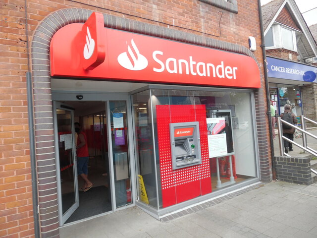
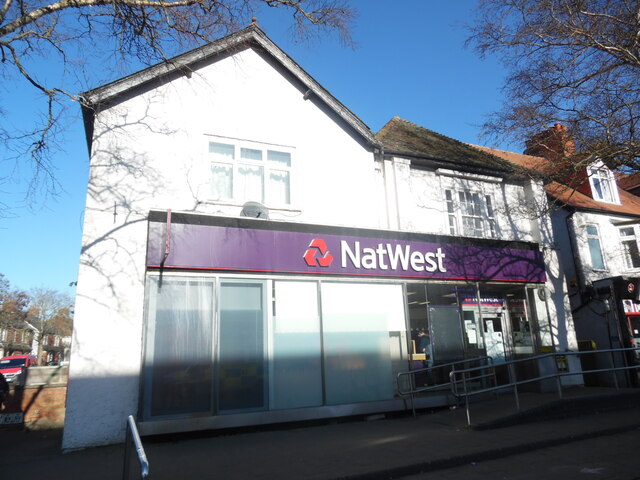
In terms of amenities, Barton offers a range of facilities to cater to its residents. It has a primary school, a village hall, and a local pub that serves as a central meeting point for the community. Additionally, the village is well-connected to the nearby city of Oxford, providing easy access to a wider range of amenities, including shops, restaurants, and cultural attractions.

Overall, Barton, Oxfordshire is a picturesque village that seamlessly combines rural charm with close proximity to a major city. Its beautiful surroundings, rich history, and convenient location make it an attractive place to live or visit.

If you have any feedback on the listing, please let us know in the comments section below.

Barton Images

Images are sourced within 2km of 51.76657/-1.2015 or Grid Reference SP5507. Thanks to Geograph Open Source API. All images are credited.

Santander Bank branch in Headington (1) Located at 116 London Road Ox3 9AS, this branch is closing after today ie Thursday 12th August 2021. The closure notice can be seen to the right of the entrance and ATM cashpoint.
Santander Bank branch in Headington (1)
Located at 116 London Road Ox3 9AS, this branch is closing after today ie Thursday 12th August 2021. The closure notice can be seen to the right of the entrance and ATM cashpoint.
Santander Bank branch in Headington (2) Located at 116 London Road, this branch is closing permanently after today ie Thursday 12th July 2021. It is one of 111 such branches closing in the Summer 2021. A Cancer Research UK shop can be seen to the right of the photo.
Santander Bank branch in Headington (2)
Located at 116 London Road, this branch is closing permanently after today ie Thursday 12th July 2021. It is one of 111 such branches closing in the Summer 2021. A Cancer Research UK shop can be seen to the right of the photo.
Closure Notice at Santander Bank, Headington This notice is on the window of the Santander Bank branch at 116 London Road. It has the following wording:

             We're sorry that this branch is permanently
             closing on 12 August 2021 at 2.00pm

             Your nearest Santander branch(es):
             . Santander House, Carfax, Oxford OX1 1HB
             . 23 Bury Street, Abingdon OX14 3QT

             We look forward to welcoming you there.
Closure Notice at Santander Bank, Headington
This notice is on the window of the Santander Bank branch at 116 London Road. It has the following wording: We're sorry that this branch is permanently closing on 12 August 2021 at 2.00pm Your nearest Santander branch(es): . Santander House, Carfax, Oxford OX1 1HB . 23 Bury Street, Abingdon OX14 3QT We look forward to welcoming you there.
Bowness Avenue Bus Stop B4495 near John Radcliffe Hospital.
Bowness Avenue Bus Stop
B4495 near John Radcliffe Hospital.
Corner of Ambleside Drive The junction of Ambleside Drive with Eden Drive, part of an estate developed in the 1950s where all the street names have a Lake District connection.
Corner of Ambleside Drive
The junction of Ambleside Drive with Eden Drive, part of an estate developed in the 1950s where all the street names have a Lake District connection.
Trees along Ambleside Drive Part of an estate developed in the 1950s where all the street names have a Lake District connection.
Trees along Ambleside Drive
Part of an estate developed in the 1950s where all the street names have a Lake District connection.
Street View The Google street view car driving away from the traffic lights along Hedley Way in Headington
Street View
The Google street view car driving away from the traffic lights along Hedley Way in Headington
Houses on North Way, Barton, Oxford
Quarry Hollow Play Area with children playing in the snow This old quarry was known locally as Munts's, the name of the builder whose yard it was when he built many of the houses in the area in the 1920s.
Quarry Hollow Play Area with children playing in the snow
This old quarry was known locally as Munts's, the name of the builder whose yard it was when he built many of the houses in the area in the 1920s.
NatWest Bank branch, Headington Located at 91 London Road OX3 9AF, this bank is due to be closed on Tuesday 7th February 2023, one of 43 such branches to face closure between January and March 2023. Stephen Road can just be seen to the left of the photo.
NatWest Bank branch, Headington
Located at 91 London Road OX3 9AF, this bank is due to be closed on Tuesday 7th February 2023, one of 43 such branches to face closure between January and March 2023. Stephen Road can just be seen to the left of the photo.
Closure Notice at NatWest Bank branch, Headington This notice is on the front of the NatWest Bank branch at 91 London Road. It has the following wording:

                       OPENING HOURS
                        HEADINGTON

                    MONDAY: 10AM-2PM
                    TUESDAY: 10AM-12PM

                    FROM WEDNESDAY
                    ONWARDS THIS BRANCH
                    WILL BE PERMANENTLY
                    CLOSED.

                    THANK YOU FROM NATWEST
                    HEADINGTON STAFF.
Closure Notice at NatWest Bank branch, Headington
This notice is on the front of the NatWest Bank branch at 91 London Road. It has the following wording: OPENING HOURS HEADINGTON MONDAY: 10AM-2PM TUESDAY: 10AM-12PM FROM WEDNESDAY ONWARDS THIS BRANCH WILL BE PERMANENTLY CLOSED. THANK YOU FROM NATWEST HEADINGTON STAFF.
Valentia Road by London Road, Headington
Shops on London Road, Headington
Copse Lane, New Marston New Marston is an Oxford suburb to the north-east of the city centre, mainly developed from about 1930 onwards. Here on Copse lane, the warning sign refers to New Marston Primary School which originally opened in 1948 as New Marston Junior Mixed & Infant School.
Copse Lane, New Marston
New Marston is an Oxford suburb to the north-east of the city centre, mainly developed from about 1930 onwards. Here on Copse lane, the warning sign refers to New Marston Primary School which originally opened in 1948 as New Marston Junior Mixed & Infant School.
All Saints Headington The west end of All Saints Headington
All Saints Headington
The west end of All Saints Headington
War memorial at All Saints War Memorial outside All Saints Church in Headington
War memorial at All Saints
War Memorial outside All Saints Church in Headington
All Saints Church All Saints church from All Saints Road in Headington
All Saints Church
All Saints church from All Saints Road in Headington
Show me another place!

Barton is located at Grid Ref: SP5507 (Lat: 51.76657, Lng: -1.2015)

Administrative County: Oxfordshire

District: Oxford

Police Authority: Thames Valley

What 3 Words

///dinner.tube.market. Near Cowley, Oxfordshire

Related Wikis

Barton, Oxfordshire

Barton is a suburb of Oxford, England on the city's eastern edge. Barton is just outside the Northern-by-pass, north of Headington Roundabout where the...

A.F.C. Hinksey

A.F.C. Hinksey was an English football club in Oxford. The club last played in the Hellenic Football League Division One East and folded in 2014. ��2...

Headington Amateurs F.C.

Headington Amateurs Football Club is a football club based in Headington, in Oxford, England. Affiliated to the Oxfordshire County Football Association...

Headington Quarry

Headington Quarry is a residential district of Oxford, England, located east of Headington and west of Risinghurst, just inside the Oxford ring road in...

Nearby Amenities

Located within 500m of 51.76657,-1.2015
Crossing
Button Operated: yes
Crossing: traffic_signals
Crossing Island: no
Crossing Ref: pelican
Tactile Paving: yes
Traffic Signals Sound: yes
Traffic Signals Vibration: yes
Lat/Long: 51.7625182/-1.1995797
Barton
Is In: Oxfordshire, England, UK
Place: suburb
Wikipedia: en:Barton, Oxfordshire
Lat/Long: 51.7671649/-1.1961204
Turning Circle
Lat/Long: 51.7647292/-1.2026457
Turning Circle
Lat/Long: 51.7644628/-1.2023374
Turning Circle
Turning Circle: circle
Lat/Long: 51.7650712/-1.2045216
Turning Circle
Lat/Long: 51.7650747/-1.2020064
Source: survey
Lat/Long: 51.7650124/-1.2001886
Crossing
Crossing: unmarked
Crossing Island: no
Crossing Markings: no
Lat/Long: 51.7629554/-1.1974676
Turning Circle
Turning Circle: circle
Lat/Long: 51.763894/-1.1993369
Traffic Calming: hump
Lat/Long: 51.7653536/-1.2075862
Traffic Calming: hump
Lat/Long: 51.7656044/-1.2063543
Traffic Calming: hump
Lat/Long: 51.765936/-1.2050752
Turning Circle
Turning Circle: square
Lat/Long: 51.7666807/-1.2018527
Turning Circle
Turning Circle: circle
Lat/Long: 51.7670959/-1.2018993
Turning Circle
Turning Circle: knuckle
Lat/Long: 51.7664537/-1.2041338
Turning Circle
Turning Circle: knuckle
Lat/Long: 51.7681631/-1.2044149
Turning Circle
Lat/Long: 51.7674218/-1.2032486
Turning Circle
Lat/Long: 51.7696665/-1.2025494
Turning Circle
Lat/Long: 51.7688497/-1.2034966
Turning Circle
Turning Circle: y-head
Lat/Long: 51.7684548/-1.1998388
Turning Circle
Turning Circle: hammer
Lat/Long: 51.7681959/-1.1988431
Turning Circle
Lat/Long: 51.768107/-1.19777
Crossing: informal
Lat/Long: 51.7661698/-1.1950111
Turning Circle
Turning Circle: circle
Lat/Long: 51.7655203/-1.1966268
Crossing
Crossing: unmarked
Crossing Island: yes
Lat/Long: 51.7636806/-1.1962251
Crossing
Crossing: unmarked
Crossing Island: no
Crossing Markings: no
Tactile Paving: no
Lat/Long: 51.7633389/-1.1976026
Turning Circle
Turning Circle: hammer
Lat/Long: 51.7681127/-1.1966638
Barrier: cycle_barrier
Bicycle: yes
Foot: yes
Lat/Long: 51.7634031/-1.1975021
Barrier: cycle_barrier
Bicycle: yes
Foot: yes
Lat/Long: 51.76356/-1.1969847
Post Box
Collection Times: Mo-Fr 17:15; Sa 11:45
Operator: Royal Mail
Operator Type: private
Operator Wikidata: Q638098
Ref: OX3 777
Royal Cypher: GVIR
Lat/Long: 51.7652118/-1.1955363
Barrier: cycle_barrier
Cycle Barrier: double
Cycle Barrier Installation: fixed
Foot: yes
Lat/Long: 51.7651734/-1.1955743
Barrier: cycle_barrier
Foot: yes
Lat/Long: 51.7646273/-1.1958873
Barrier: cycle_barrier
Cycle Barrier: double
Cycle Barrier Installation: fixed
Foot: yes
Lat/Long: 51.7656626/-1.1952979
Barrier: cycle_barrier
Cycle Barrier: double
Cycle Barrier Installation: fixed
Foot: yes
Lat/Long: 51.7661088/-1.1950438
Barrier: cycle_barrier
Foot: yes
Lat/Long: 51.7668147/-1.1946386
Barrier: cycle_barrier
Cycle Barrier: double
Cycle Barrier Installation: fixed
Foot: yes
Lat/Long: 51.766266/-1.1949452
Post Box
Brand: Royal Mail
Brand Wikidata: Q638098
Brand Wikipedia: en:Royal Mail
Check Date: 2021-07-31
Collection Times: Mo-Fr 09:00; Sa 07:00
Drive Through: no
Operator: Royal Mail
Operator Type: private
Operator Wikidata: Q638098
Post Box Apertures: 1
Post Box Design: type_b
Post Box Type: pillar
Ref: OX3 149D
Royal Cypher: EIIR
Royal Cypher Wikidata: Q33102113
Lat/Long: 51.7661981/-1.2033327
Barrier: cycle_barrier
Bicycle: yes
Cycle Barrier: double
Cycle Barrier Installation: fixed
Foot: yes
Material: steel
Maxwidth Physical: 1.16
Opening: 1.16
Overlap: 0
Spacing: 1.94
Vehicle: no
Wheelchair: yes
Lat/Long: 51.7660116/-1.2026
Barrier: cycle_barrier
Bicycle: yes
Cycle Barrier: double
Cycle Barrier Installation: fixed
Foot: yes
Material: steel
Maxwidth Physical: 1.29
Opening: 1.29
Overlap: 0
Spacing: 2.0
Vehicle: no
Wheelchair: yes
Lat/Long: 51.765722/-1.203192
Barrier: cycle_barrier
Bicycle: yes
Foot: yes
Material: steel
Maxwidth Physical: 1.23
Opening: 1.23
Overlap: 0
Spacing: 1.79
Vehicle: no
Wheelchair: yes
Lat/Long: 51.7656624/-1.2027277
Barrier: cycle_barrier
Bicycle: no
Cycle Barrier: double
Cycle Barrier Installation: fixed
Foot: yes
Lat/Long: 51.7666463/-1.2029793
Barrier: cycle_barrier
Bicycle: no
Cycle Barrier: double
Cycle Barrier Installation: fixed
Foot: yes
Lat/Long: 51.766747/-1.2035686
Barrier: cycle_barrier
Bicycle: no
Cycle Barrier: double
Cycle Barrier Installation: fixed
Foot: yes
Lat/Long: 51.7667357/-1.2033473
Turning Circle
Lat/Long: 51.7673571/-1.2045685
Barrier: cycle_barrier
Bicycle: no
Cycle Barrier: double
Cycle Barrier Installation: fixed
Foot: yes
Lat/Long: 51.7683825/-1.204589
Barrier: cycle_barrier
Bicycle: no
Cycle Barrier: double
Cycle Barrier Installation: fixed
Foot: yes
Lat/Long: 51.7674264/-1.2026892
Barrier: cycle_barrier
Bicycle: no
Cycle Barrier: double
Cycle Barrier Installation: fixed
Foot: yes
Lat/Long: 51.76757/-1.2025626
Barrier: cycle_barrier
Bicycle: no
Cycle Barrier: double
Cycle Barrier Installation: fixed
Foot: yes
Lat/Long: 51.7672633/-1.2040968
Barrier: cycle_barrier
Bicycle: no
Foot: yes
Lat/Long: 51.7680472/-1.2016143
Barrier: cycle_barrier
Bicycle: no
Foot: yes
Lat/Long: 51.7679535/-1.2017792
Recycling
Location: overground
Recycling Cans: yes
Recycling Glass: yes
Recycling Paper: yes
Recycling Type: container
Lat/Long: 51.7677131/-1.1959794
Doctors
Hedena Health Ltd. Barton
Addr City: Oxford
Addr Housename: Barton Neighbourhood Centre
Addr Postcode: OX3 9LS
Addr Suburb: Barton
Healthcare: doctor
Phone: +44 1865 227788
Website: https://www.nhs.uk/services/clinic/barton-surgery/RNUHA
Lat/Long: 51.7678198/-1.196282
Post Box
Collection Times: Mo-Fr 16:30; Sa 12:00
Post Box Design: type_k
Post Box Type: pillar
Ref: OX3 662D
Royal Cypher: EIIR
Royal Cypher Wikidata: Q33102113
Lat/Long: 51.7676284/-1.1962132
Bicycle Parking
Bicycle Parking: stands
Capacity: 6
Covered: no
Lat/Long: 51.7676104/-1.1961918
Bicycle Parking
Bicycle Parking: stands
Capacity: 12
Covered: no
Lat/Long: 51.7678374/-1.1962124
Police
Barton Neighbourhood Police Office
Operator: Thames Valley Police
Operator Wikidata: Q8578453
Lat/Long: 51.7679971/-1.1962031
Bicycle Parking
Capacity: 10
Lat/Long: 51.7681578/-1.1965928
Barrier: bollard
Bicycle: yes
Bollard: removable
Foot: yes
Lat/Long: 51.767438/-1.1995609
Noexit: yes
Lat/Long: 51.7671786/-1.1996514
Barrier: entrance
Lat/Long: 51.7683635/-1.1982104
Barrier: entrance
Lat/Long: 51.7684132/-1.1986163
Leisure: pitch
Sport: soccer
Lat/Long: 51.7688276/-1.1991593
Created By: osm2go v0.6.13-maemo1
Lat/Long: 51.7695547/-1.200036
Barrier: cycle_barrier
Bicycle: yes
Cycle Barrier: double
Cycle Barrier Installation: fixed
Foot: yes
Note: padlocked open currently
Lat/Long: 51.7677041/-1.1998279
Barrier: cycle_barrier
Bicycle: yes
Cycle Barrier: diagonal
Cycle Barrier Installation: fixed
Foot: yes
Lat/Long: 51.7682677/-1.2037494
Noexit: yes
Lat/Long: 51.7676575/-1.204624
Post Box
Collection Times: Mo-Fr 17:15; Sa 11:45
Operator: Royal Mail
Operator Type: private
Operator Wikidata: Q638098
Ref: OX3 776
Lat/Long: 51.7690848/-1.2029707
Barrier: cycle_barrier
Bicycle: yes
Cycle Barrier: double
Cycle Barrier Installation: fixed
Foot: yes
Lat/Long: 51.7692808/-1.2033447
Barrier: cycle_barrier
Bicycle: no
Foot: yes
Lat/Long: 51.7699501/-1.2029971
Turning Circle
Lat/Long: 51.7645097/-1.1966036
Barrier: cycle_barrier
Bicycle: yes
Foot: yes
Lat/Long: 51.7695503/-1.2032351
Barrier: entrance
Lat/Long: 51.7656773/-1.2026751
Bus Stop
Edgecombe Road
Bench: no
Bin: yes
Bus: yes
Covered: no
Naptan AtcoCode: 340000015FOX
Naptan Bearing: NW
Naptan CommonName: Edgecombe Road
Naptan Indicator: Opposite
Naptan Landmark: Edgecombe Road
Naptan NaptanCode: oxfamjdt
Naptan PlusbusZoneRef: OXFD
Naptan Street: Enstone Road
Naptan Verified: no
Passenger Information Display: no
Public Transport: platform
Ref: 69326538
Shelter: no
Source: naptan_import
Lat/Long: 51.7638814/-1.1970158
Bus Stop
Gladstone Road
Bench: no
Bus: yes
Covered: no
Local Ref: opp
Naptan AtcoCode: 340001308OPP
Naptan Bearing: E
Naptan CommonName: Gladstone Road
Naptan Indicator: Opposite
Naptan Landmark: Gladstone Road
Naptan NaptanCode: oxfajmpj
Naptan PlusbusZoneRef: OXFD
Naptan Street: Gladstone Road
Naptan Verified: no
Passenger Information Display: no
Public Transport: platform
Ref: OXFAJMPJ
Route Ref: 8;14;275;280;700;H5;X8
Shelter: no
Source: naptan_import
Lat/Long: 51.7622926/-1.2017419
Bus Stop
Green Road Roundabout
Alt Name: Green Road Roundabout E-bound
Bench: yes
Bin: yes
Covered: yes
Lit: yes
Local Ref: E-bound
Naptan AtcoCode: 340001310NRC
Naptan Bearing: E
Naptan CommonName: Green Rd Roundabout
Naptan Indicator: Northfield Road corner
Naptan Landmark: Green Road Roundabout
Naptan NaptanCode: oxfajmtp
Naptan PlusbusZoneRef: OXFD
Naptan Street: Green Road
Naptan Verified: no
Passenger Information Display: no
Public Transport: platform
Ref: 69325687
Route Ref: 8;N8;14;275;280;the airline LGW;the airline LHR;N8;Oxford Tube;400;BROOKESbusU1;X8;700;H5
Shelter: yes
Source: naptan_import
Tactile Paving: no
Lat/Long: 51.7626529/-1.1991939
Bus Stop
Green Road Roundabout
Bench: yes
Bin: yes
Bus: yes
Covered: yes
Lit: yes
Naptan AtcoCode: 340001310ONR
Naptan Bearing: W
Naptan CommonName: Green Rd Roundabout
Naptan Indicator: opposite Northfield Road
Naptan Landmark: Green Road Roundabout
Naptan NaptanCode: oxfajmtm
Naptan PlusbusZoneRef: OXFD
Naptan Street: Green Road
Naptan Verified: no
Public Transport: platform
Ref: 69325686
Route Ref: 8;14;275;280;700;N8;400;BROOKESbusU1;X8;Oxford Tube
Shelter: yes
Source: naptan_import
Tactile Paving: no
Lat/Long: 51.7625313/-1.1989807
Bus Stop
Barton Village Road
Bench: no
Bin: yes
Bus: yes
Covered: no
Lit: yes
Local Ref: NW-bound
Naptan AtcoCode: 340001327CNR
Naptan Bearing: NW
Naptan CommonName: Barton Village Road
Naptan Indicator: Aldbarton Drive Corner
Naptan Landmark: Aldbarton Drive
Naptan NaptanCode: oxfajgam
Naptan PlusbusZoneRef: OXFD
Naptan Street: Barton Village Road
Naptan Verified: no
Passenger Information Display: yes
Public Transport: platform
Route Ref: H5;8;N17;X3
Shelter: no
Source: naptan_import
Tactile Paving: no
Lat/Long: 51.7681726/-1.2038452
Bus Stop
Atkinson Close
Bench: no
Bin: yes
Bus: yes
Covered: no
Naptan AtcoCode: 340001328OPA
Naptan Bearing: E
Naptan CommonName: Atkinson Close
Naptan Indicator: Opposite
Naptan Landmark: Fettiplace Road
Naptan NaptanCode: oxfajgaj
Naptan PlusbusZoneRef: OXFD
Naptan Street: Fettiplace Road
Naptan Verified: no
Passenger Information Display: no
Public Transport: platform
Ref: 69325425
Route Ref: H5;X3
Shelter: no
Source: naptan_import
Lat/Long: 51.769336/-1.2039528
Bus Stop
Poundfield Close
Bench: yes
Bin: yes
Bus: yes
Covered: yes
Naptan AtcoCode: 340001329OPP
Naptan Bearing: E
Naptan CommonName: Poundfield Close
Naptan Indicator: Corner
Naptan Landmark: Poundfield Close
Naptan NaptanCode: oxfajgag
Naptan PlusbusZoneRef: OXFD
Naptan Street: Fettiplace Road
Naptan Verified: no
Public Transport: platform
Ref: 69325424
Route Ref: 8;N8;H5;X3
Shelter: yes
Source: naptan_import
Lat/Long: 51.76802/-1.1990406
Bus Stop
Underhill Circus
Bench: yes
Bin: yes
Bus: yes
Covered: yes
Naptan AtcoCode: 340001330RBT
Naptan Bearing: E
Naptan CommonName: Underhill Circus
Naptan Indicator: Roundabout
Naptan Landmark: Alden Crescent
Naptan NaptanCode: oxfajgad
Naptan PlusbusZoneRef: OXFD
Naptan Street: Alden Crescent
Naptan Verified: no
Public Transport: platform
Ref: 69325423
Route Ref: 8;N8;H5;X3
Shelter: yes
Source: naptan_import
Lat/Long: 51.7678718/-1.1955688
Bus Stop
North Way
Bench: yes
Bin: yes
Bus: yes
Covered: yes
Lit: yes
Local Ref: W-bound
Naptan AtcoCode: 340001331OPP
Naptan Bearing: NW
Naptan CommonName: North Way
Naptan Indicator: Opp Wick Close
Naptan Landmark: Wick Close
Naptan NaptanCode: oxfajdwt
Naptan PlusbusZoneRef: OXFD
Naptan Street: North Way
Naptan Verified: no
Note: 2023-10-29: was "Wick Close" until very recently. The passenger information display has been updated to match Naptan since Sept 2023. Still keeping the old_name though.
Old Name: Wick Close
Passenger Information Display: yes
Public Transport: platform
Ref: 69325398
Route Ref: H5;8;N17;X3
Shelter: yes
Source: naptan_import
Tactile Paving: no
Lat/Long: 51.7660101/-1.2022933
Post Box
Brand: Royal Mail
Brand Wikidata: Q638098
Brand Wikipedia: en:Royal Mail
Check Date: 2021-06-29
Collection Times: Mo-Fr 16:45; Sa 11:45
Drive Through: no
Operator: Royal Mail
Operator Type: private
Operator Wikidata: Q638098
Post Box Apertures: 1
Post Box Type: lamp
Ref: OX3 107
Royal Cypher: EIIR
Royal Cypher Wikidata: Q33102113
Lat/Long: 51.763036/-1.2047123
Post Box
Brand: Royal Mail
Brand Wikidata: Q638098
Brand Wikipedia: en:Royal Mail
Check Date: 2021-06-29
Collection Times: Mo-Fr 09:00; Sa 07:00
Drive Through: no
Operator: Royal Mail
Operator Type: private
Operator Wikidata: Q638098
Post Box Apertures: 1
Post Box Type: lamp
Ref: OX3 117D
Royal Cypher: EIIR
Royal Cypher Wikidata: Q33102113
Lat/Long: 51.7625097/-1.200261
Crossing
Crossing Island: no
Crossing Markings: yes
Crossing Signals: no
Tactile Paving: yes
Lat/Long: 51.7621717/-1.2027239
Crossing
Bicycle: yes
Crossing: uncontrolled
Crossing Island: no
Tactile Paving: yes
Lat/Long: 51.762124/-1.2021628
Traffic Calming: hump
Lat/Long: 51.7657316/-1.2035826
Crossing
Bicycle: yes
Button Operated: yes
Crossing: traffic_signals
Crossing Markings: dots
Crossing Ref: toucan
Tactile Paving: yes
Lat/Long: 51.7628959/-1.197346
Turning Circle
Turning Circle: knuckle
Lat/Long: 51.7641967/-1.2002976
Turning Circle
Lat/Long: 51.7643753/-1.2018388
Turning Circle
Lat/Long: 51.7648626/-1.2012946
Barrier: cycle_barrier
Bicycle: yes
Cycle Barrier: single
Cycle Barrier Installation: fixed
Foot: yes
Material: metal
Lat/Long: 51.7669668/-1.201947
Turning Circle
Lat/Long: 51.7642211/-1.198608
Turning Circle
Lat/Long: 51.7649761/-1.2001007
Traffic Signals
Traffic Signals: signal
Lat/Long: 51.7632222/-1.1969069
Traffic Signals
Traffic Signals: signal
Lat/Long: 51.7633328/-1.1969081
Bench
Backrest: yes
Lat/Long: 51.7640918/-1.2042482
Bench
Backrest: yes
Lat/Long: 51.7639503/-1.2042082
Bench
Backrest: yes
Lat/Long: 51.763546/-1.2025386
Bench
Backrest: yes
Lat/Long: 51.7626408/-1.1991918
Turning Circle
Lat/Long: 51.7635925/-1.2021568
Entrance: home
Note: terrace entrance for 58 Barton Village Road
Lat/Long: 51.7650596/-1.2027707
Addr City: Oxford
Addr Country: GB
Addr Housenumber: 114,118,122
Addr Street: Barton Road
Entrance: staircase
Lat/Long: 51.7653301/-1.2023706
Addr City: Oxford
Addr Country: GB
Addr Housenumber: 124,120,116
Addr Street: Barton Road
Entrance: staircase
Lat/Long: 51.7653337/-1.2023347
Addr City: Oxford
Addr Country: GB
Addr Housenumber: 128,132,136
Addr Street: Barton Road
Entrance: staircase
Lat/Long: 51.7653036/-1.2026326
Addr City: Oxford
Addr Country: GB
Addr Housenumber: 126,130,134
Addr Street: Barton Road
Entrance: staircase
Lat/Long: 51.7653/-1.2026683
Turning Circle
Lat/Long: 51.764791/-1.2011338
Addr City: Oxford
Addr Country: GB
Addr Housenumber: 50,52,54,56
Addr Street: Barton Road
Entrance: staircase
Lat/Long: 51.7651052/-1.2029432
Addr City: Oxford
Addr Country: GB
Addr Housenumber: 42,44,46,48
Addr Street: Barton Road
Lat/Long: 51.7649614/-1.2031552
Addr City: Oxford
Addr Country: GB
Addr Housenumber: 58,60,62,64
Addr Street: Barton Road
Entrance: staircase
Lat/Long: 51.7649843/-1.2027525
Addr City: Oxford
Addr Country: GB
Addr Housenumber: 92,96,100
Addr Street: Barton Road
Entrance: staircase
Lat/Long: 51.7651286/-1.2013714
Addr City: Oxford
Addr Country: GB
Addr Housenumber: 90,94,98
Addr Street: Barton Road
Entrance: staircase
Lat/Long: 51.7651241/-1.2014166
Addr City: Oxford
Addr Country: GB
Addr Housenumber: 80,84,88
Addr Street: Barton Road
Entrance: staircase
Lat/Long: 51.7650971/-1.2016886
Addr City: Oxford
Addr Country: GB
Addr Housenumber: 78,82,86
Addr Street: Barton Road
Entrance: staircase
Lat/Long: 51.7650935/-1.2017252
Addr City: Oxford
Addr Country: GB
Addr Housenumber: 66,70,74
Addr Street: Barton Road
Entrance: staircase
Lat/Long: 51.7650458/-1.202399
Addr City: Oxford
Addr Country: GB
Addr Housenumber: 68,72,76
Addr Street: Barton Road
Entrance: staircase
Lat/Long: 51.7650483/-1.2023643
Addr City: Oxford
Addr Country: GB
Addr Housenumber: 104,108,112
Addr Street: Barton Road
Entrance: staircase
Lat/Long: 51.7652567/-1.2020237
Addr City: Oxford
Addr Country: GB
Addr Housenumber: 102,106,110
Addr Street: Barton Road
Entrance: staircase
Lat/Long: 51.76528/-1.2020297
Board Type: notice
Information: board
Operator: Bradley & Gladstone Tenant and Residents' Association
Tourism: information
Lat/Long: 51.762998/-1.2029765
Addr City: Oxford
Addr Country: GB
Addr Housenumber: 32A
Addr Street: Ash Grove
Entrance: home
Lat/Long: 51.7644508/-1.2056432
Addr City: Oxford
Addr Country: GB
Addr Housenumber: 32B
Addr Street: Ash Grove
Entrance: home
Lat/Long: 51.7644685/-1.2056279
Bench
Backrest: yes
Lat/Long: 51.762342/-1.2002946
Entrance: secondary
Lat/Long: 51.7679926/-1.1961757
Noexit: yes
Lat/Long: 51.7682602/-1.1974474
Noexit: yes
Lat/Long: 51.7682888/-1.1978457
Waste Basket
Lat/Long: 51.7702485/-1.2046923
Noexit: yes
Lat/Long: 51.7680065/-1.2045821
Crossing: informal
Lat/Long: 51.7680527/-1.2049999
Turning Circle
Lat/Long: 51.7676145/-1.2051588
Turning Circle
Turning Circle: knuckle
Lat/Long: 51.7675931/-1.2004608
Noexit: yes
Lat/Long: 51.7665779/-1.203351
Noexit: yes
Lat/Long: 51.7666555/-1.203241
Addr City: Oxford
Addr Flats: 1
Addr Housenumber: 9
Addr Street: Barton Village Road
Entrance: yes
Lat/Long: 51.7665529/-1.2030858
Addr City: Oxford
Addr Flats: 2
Addr Housenumber: 9
Addr Street: Barton Village Road
Entrance: yes
Lat/Long: 51.766587/-1.2030087
Bench
Lat/Long: 51.7666045/-1.2014573
Bench
Backrest: no
Lat/Long: 51.7703644/-1.2054086
Recycling
Clothing Bank
Recycling Type: container
Lat/Long: 51.7625252/-1.2002615
Leisure: fitness_station
Sport: fitness
Lat/Long: 51.7684967/-1.1979917
Leisure: fitness_station
Sport: fitness
Lat/Long: 51.7693321/-1.1997439
Bench
Lat/Long: 51.7691604/-1.1987763
Waste Basket
Waste: dog_excrement
Lat/Long: 51.7693076/-1.1992937
Waste Basket
Lat/Long: 51.7693165/-1.1993267
Leisure: fitness_station
Sport: fitness
Lat/Long: 51.7690601/-1.1984744
Atm
Lat/Long: 51.7674981/-1.1960988
Bench
Backrest: yes
Lat/Long: 51.7677139/-1.1963817
Waste Basket
Waste: dog_excrement
Lat/Long: 51.7668244/-1.2006178
Waste Basket
Lat/Long: 51.7668078/-1.2009544
Barrier: bollard
Lat/Long: 51.7656725/-1.198533
Barrier: bollard
Bollard: removable
Lat/Long: 51.7656879/-1.1985236
Barrier: bollard
Lat/Long: 51.7657013/-1.1985152
Addr City: Oxford
Addr Housenumber: 3A
Addr Street: Burchester Avenue
Entrance: yes
Lat/Long: 51.7652104/-1.1981251
Addr City: Oxford
Addr Housenumber: 13A
Addr Street: Burchester Avenue
Entrance: yes
Lat/Long: 51.7655372/-1.197902
Addr City: Oxford
Addr Housenumber: 19A
Addr Street: Burchester Avenue
Entrance: yes
Lat/Long: 51.7657661/-1.1977053
Addr City: Oxford
Addr Housenumber: 27A
Addr Street: Burchester Avenue
Entrance: yes
Lat/Long: 51.7660083/-1.1974962
Addr City: Oxford
Addr Housenumber: 35A
Addr Street: Burchester Avenue
Entrance: yes
Lat/Long: 51.7662643/-1.1973145
Addr City: Oxford
Addr Housenumber: 43A
Addr Street: Burchester Avenue
Entrance: yes
Lat/Long: 51.7665036/-1.1970697
Addr City: Oxford
Addr Flats: 2;5-6
Addr Housenumber: 28
Addr Street: Burchester Avenue
Entrance: yes
Lat/Long: 51.7661897/-1.1966476
Addr City: Oxford
Addr Flats: 1;4
Addr Housenumber: 28
Addr Street: Burchester Avenue
Entrance: yes
Lat/Long: 51.7661331/-1.1966961
Addr City: Oxford
Addr Flats: d
Addr Housenumber: 2
Addr Street: Brampton Road
Entrance: yes
Lat/Long: 51.7652286/-1.1974367
Addr City: Oxford
Addr Flats: c
Addr Housenumber: 2
Addr Street: Brampton Road
Entrance: yes
Lat/Long: 51.7652243/-1.1974226
Addr City: Oxford
Addr Housenumber: 24A
Addr Street: North Way
Entrance: yes
Lat/Long: 51.765032/-1.1983362
Entrance: main
Lat/Long: 51.7657553/-1.1993504
Entrance: main
Lat/Long: 51.765637/-1.1995303
Entrance: main
Lat/Long: 51.7653855/-1.1992745
Entrance: main
Lat/Long: 51.7654501/-1.1994911
Entrance: main
Lat/Long: 51.7659449/-1.1995968
Entrance: main
Lat/Long: 51.7657476/-1.1997188
Entrance: main
Lat/Long: 51.7656485/-1.1999706
Entrance: main
Lat/Long: 51.7657205/-1.200235
Entrance: main
Lat/Long: 51.7662244/-1.1998828
Entrance: main
Lat/Long: 51.766096/-1.2001705
Entrance: main
Lat/Long: 51.7659068/-1.200261
Traffic Signals
Traffic Signals: signal
Lat/Long: 51.7628615/-1.1974123
Addr City: Oxford
Addr Housenumber: 45A
Addr Street: Fettiplace Road
Entrance: yes
Lat/Long: 51.7691616/-1.2021749
Noexit: yes
Lat/Long: 51.7678818/-1.2000451
Entrance: main
Lat/Long: 51.7678944/-1.199763
Entrance: main
Lat/Long: 51.7679451/-1.2
Noexit: yes
Lat/Long: 51.7673373/-1.1991821
Waste Basket
Lat/Long: 51.7673199/-1.1959662
Waste Basket
Lat/Long: 51.7673527/-1.1957503
Waste Basket
Lat/Long: 51.7675286/-1.1961968
Waste Basket
Lat/Long: 51.7674577/-1.1960849
Place Of Worship
Barton Community Church
Addr City: Oxford
Addr Housename: Barton Neighbourhood Centre
Addr Postcode: OX3 9LS
Addr Suburb: Barton
Religion: christian
Website: https://www.bartoncommunitychurch.org/
Lat/Long: 51.7679231/-1.1962493
Direction: 165
Generator Method: photovoltaic
Generator Output Electricity: yes
Generator Solar Modules: 6
Generator Source: solar
Generator Type: solar_photovoltaic_panel
Location: roof
Power: generator
Lat/Long: 51.7636812/-1.2005529
Direction: 255
Generator Method: photovoltaic
Generator Output Electricity: yes
Generator Solar Modules: 8
Generator Source: solar
Generator Type: solar_photovoltaic_panel
Location: roof
Power: generator
Lat/Long: 51.7637302/-1.2000159
Direction: 170
Generator Method: photovoltaic
Generator Output Electricity: yes
Generator Solar Modules: 16
Generator Source: solar
Generator Type: solar_photovoltaic_panel
Location: roof
Power: generator
Lat/Long: 51.7648668/-1.2018047
Direction: 170
Generator Method: photovoltaic
Generator Output Electricity: yes
Generator Solar Modules: 8
Generator Source: solar
Generator Type: solar_photovoltaic_panel
Location: roof
Power: generator
Lat/Long: 51.7656133/-1.2045562
Direction: 120
Generator Method: photovoltaic
Generator Output Electricity: yes
Generator Solar Modules: 12
Generator Source: solar
Generator Type: solar_photovoltaic_panel
Location: roof
Power: generator
Lat/Long: 51.7648473/-1.2046737
Generator Method: photovoltaic
Generator Output Electricity: yes
Generator Solar Modules: 10
Generator Source: solar
Generator Type: solar_photovoltaic_panel
Location: roof
Power: generator
Tilted: no
Lat/Long: 51.7648441/-1.2044433
Direction: 170
Generator Method: photovoltaic
Generator Output Electricity: yes
Generator Solar Modules: 16
Generator Source: solar
Generator Type: solar_photovoltaic_panel
Location: roof
Power: generator
Lat/Long: 51.7646857/-1.2038961
Direction: 170
Generator Method: photovoltaic
Generator Output Electricity: yes
Generator Solar Modules: 16
Generator Source: solar
Generator Type: solar_photovoltaic_panel
Location: roof
Power: generator
Lat/Long: 51.7646307/-1.2038799
Direction: 170
Generator Method: photovoltaic
Generator Output Electricity: yes
Generator Solar Modules: 16
Generator Source: solar
Generator Type: solar_photovoltaic_panel
Location: roof
Power: generator
Lat/Long: 51.7645731/-1.2038676
Direction: 170
Generator Method: photovoltaic
Generator Output Electricity: yes
Generator Solar Modules: 16
Generator Source: solar
Generator Type: solar_photovoltaic_panel
Location: roof
Power: generator
Lat/Long: 51.7645/-1.2038458
Direction: 170
Generator Method: photovoltaic
Generator Output Electricity: yes
Generator Solar Modules: 16
Generator Source: solar
Generator Type: solar_photovoltaic_panel
Location: roof
Power: generator
Lat/Long: 51.7644386/-1.2038381
Direction: 170
Generator Method: photovoltaic
Generator Output Electricity: yes
Generator Solar Modules: 16
Generator Source: solar
Generator Type: solar_photovoltaic_panel
Location: roof
Power: generator
Lat/Long: 51.7643644/-1.2038263
Direction: 170
Generator Method: photovoltaic
Generator Output Electricity: yes
Generator Solar Modules: 16
Generator Source: solar
Generator Type: solar_photovoltaic_panel
Location: roof
Power: generator
Lat/Long: 51.7643075/-1.2038153
Direction: 170
Generator Method: photovoltaic
Generator Output Electricity: yes
Generator Solar Modules: 8
Generator Source: solar
Generator Type: solar_photovoltaic_panel
Location: roof
Power: generator
Lat/Long: 51.7645208/-1.204856
Direction: 170
Generator Method: photovoltaic
Generator Output Electricity: yes
Generator Solar Modules: 16
Generator Source: solar
Generator Type: solar_photovoltaic_panel
Location: roof
Power: generator
Lat/Long: 51.7644643/-1.2048439
Direction: 170
Generator Method: photovoltaic
Generator Output Electricity: yes
Generator Solar Modules: 16
Generator Source: solar
Generator Type: solar_photovoltaic_panel
Location: roof
Power: generator
Lat/Long: 51.7644129/-1.2048278
Direction: 170
Generator Method: photovoltaic
Generator Output Electricity: yes
Generator Solar Modules: 16
Generator Source: solar
Generator Type: solar_photovoltaic_panel
Location: roof
Power: generator
Lat/Long: 51.7643589/-1.2048171
Direction: 170
Generator Method: photovoltaic
Generator Output Electricity: yes
Generator Solar Modules: 16
Generator Source: solar
Generator Type: solar_photovoltaic_panel
Location: roof
Power: generator
Lat/Long: 51.764284/-1.2047114
Direction: 170
Generator Method: photovoltaic
Generator Output Electricity: yes
Generator Solar Modules: 16
Generator Source: solar
Generator Type: solar_photovoltaic_panel
Location: roof
Power: generator
Lat/Long: 51.7642135/-1.2046993
Direction: 170
Generator Method: photovoltaic
Generator Output Electricity: yes
Generator Solar Modules: 16
Generator Source: solar
Generator Type: solar_photovoltaic_panel
Location: roof
Power: generator
Lat/Long: 51.7640467/-1.2046658
Direction: 170
Generator Method: photovoltaic
Generator Output Electricity: yes
Generator Solar Modules: 16
Generator Source: solar
Generator Type: solar_photovoltaic_panel
Location: roof
Power: generator
Lat/Long: 51.7638642/-1.2046534
Direction: 170
Generator Method: photovoltaic
Generator Output Electricity: yes
Generator Solar Modules: 6
Generator Source: solar
Generator Type: solar_photovoltaic_panel
Location: roof
Power: generator
Lat/Long: 51.7637153/-1.204506
Direction: 170
Generator Method: photovoltaic
Generator Output Electricity: yes
Generator Solar Modules: 6
Generator Source: solar
Generator Type: solar_photovoltaic_panel
Location: roof
Power: generator
Lat/Long: 51.7637228/-1.2044161
Power: substation
Substation: minor_distribution
Lat/Long: 51.7695278/-1.2058481
Direction: 185
Generator Method: photovoltaic
Generator Output Electricity: yes
Generator Solar Modules: 10
Generator Source: solar
Generator Type: solar_photovoltaic_panel
Location: roof
Power: generator
Lat/Long: 51.7677815/-1.1946757
Direction: 210
Fixme: survey for panel count
Generator Method: photovoltaic
Generator Output Electricity: yes
Generator Solar Modules: 11
Generator Source: solar
Generator Type: solar_photovoltaic_panel
Location: roof
Power: generator
Lat/Long: 51.7668698/-1.1953107
Direction: 200
Fixme: survey for panel count
Generator Method: photovoltaic
Generator Output Electricity: yes
Generator Solar Modules: 13
Generator Source: solar
Generator Type: solar_photovoltaic_panel
Location: roof
Power: generator
Lat/Long: 51.7663046/-1.1961365
Direction: 190
Fixme: survey for panel count
Generator Method: photovoltaic
Generator Output Electricity: yes
Generator Solar Modules: 16
Generator Source: solar
Generator Type: solar_photovoltaic_panel
Location: roof
Power: generator
Lat/Long: 51.7653349/-1.1947882
Direction: 175
Fixme: survey for panel count
Generator Method: photovoltaic
Generator Output Electricity: yes
Generator Solar Modules: 10
Generator Source: solar
Generator Type: solar_photovoltaic_panel
Location: roof
Power: generator
Lat/Long: 51.7653088/-1.196299
Direction: 205
Generator Method: photovoltaic
Generator Output Electricity: yes
Generator Solar Modules: 16
Generator Source: solar
Generator Type: solar_photovoltaic_panel
Location: roof
Power: generator
Lat/Long: 51.763899/-1.1959454
Direction: 200
Generator Method: photovoltaic
Generator Output Electricity: yes
Generator Solar Modules: 72
Generator Source: solar
Generator Type: solar_photovoltaic_panel
Location: roof
Power: generator
Lat/Long: 51.767728/-1.1965691
Traffic Calming: island
Lat/Long: 51.7671531/-1.1961302
Direction: 100
Fixme: survey for panel count
Generator Method: photovoltaic
Generator Output Electricity: yes
Generator Solar Modules: 8
Generator Source: solar
Generator Type: solar_photovoltaic_panel
Location: roof
Power: generator
Lat/Long: 51.7670369/-1.1980014
Direction: 280
Fixme: survey for panel count
Generator Method: photovoltaic
Generator Output Electricity: yes
Generator Solar Modules: 8
Generator Source: solar
Generator Type: solar_photovoltaic_panel
Location: roof
Power: generator
Lat/Long: 51.7670428/-1.198061
Direction: 280
Fixme: survey for panel count
Generator Method: photovoltaic
Generator Output Electricity: yes
Generator Solar Modules: 8
Generator Source: solar
Generator Type: solar_photovoltaic_panel
Location: roof
Power: generator
Lat/Long: 51.7671802/-1.19827
Direction: 100
Fixme: survey for panel count
Generator Method: photovoltaic
Generator Output Electricity: yes
Generator Solar Modules: 8
Generator Source: solar
Generator Type: solar_photovoltaic_panel
Location: roof
Power: generator
Lat/Long: 51.7671744/-1.1982103
Direction: 225
Generator Method: photovoltaic
Generator Output Electricity: yes
Generator Solar Modules: 10
Generator Source: solar
Generator Type: solar_photovoltaic_panel
Location: roof
Power: generator
Lat/Long: 51.7683916/-1.2009774
Direction: 225
Generator Method: photovoltaic
Generator Output Electricity: yes
Generator Solar Modules: 10
Generator Source: solar
Generator Type: solar_photovoltaic_panel
Location: roof
Power: generator
Lat/Long: 51.7685709/-1.2012853
Direction: 225
Generator Method: photovoltaic
Generator Output Electricity: yes
Generator Solar Modules: 10
Generator Source: solar
Generator Type: solar_photovoltaic_panel
Location: roof
Power: generator
Lat/Long: 51.7686836/-1.2008151
Direction: 215
Generator Method: photovoltaic
Generator Output Electricity: yes
Generator Solar Modules: 20
Generator Source: solar
Generator Type: solar_photovoltaic_panel
Location: roof
Power: generator
Lat/Long: 51.7699322/-1.2016889
Direction: 190
Generator Method: photovoltaic
Generator Output Electricity: yes
Generator Solar Modules: 10
Generator Source: solar
Generator Type: solar_photovoltaic_panel
Location: roof
Power: generator
Lat/Long: 51.7697903/-1.2019762
Direction: 190
Generator Method: photovoltaic
Generator Output Electricity: yes
Generator Solar Modules: 10
Generator Source: solar
Generator Type: solar_photovoltaic_panel
Location: roof
Power: generator
Lat/Long: 51.7697973/-1.2020538
Direction: 190
Generator Method: photovoltaic
Generator Output Electricity: yes
Generator Solar Modules: 10
Generator Source: solar
Generator Type: solar_photovoltaic_panel
Location: roof
Power: generator
Lat/Long: 51.7698027/-1.2021438
Direction: 190
Generator Method: photovoltaic
Generator Output Electricity: yes
Generator Solar Modules: 10
Generator Source: solar
Generator Type: solar_photovoltaic_panel
Location: roof
Power: generator
Lat/Long: 51.76981/-1.2022216
Direction: 190
Generator Method: photovoltaic
Generator Output Electricity: yes
Generator Solar Modules: 10
Generator Source: solar
Generator Type: solar_photovoltaic_panel
Location: roof
Power: generator
Lat/Long: 51.7697897/-1.2031782
Direction: 190
Generator Method: photovoltaic
Generator Output Electricity: yes
Generator Solar Modules: 10
Generator Source: solar
Generator Type: solar_photovoltaic_panel
Location: roof
Power: generator
Lat/Long: 51.7698195/-1.2034945
Direction: 190
Generator Method: photovoltaic
Generator Output Electricity: yes
Generator Solar Modules: 10
Generator Source: solar
Generator Type: solar_photovoltaic_panel
Location: roof
Power: generator
Lat/Long: 51.76995/-1.2036341
Direction: 195
Generator Method: photovoltaic
Generator Output Electricity: yes
Generator Solar Modules: 10
Generator Source: solar
Generator Type: solar_photovoltaic_panel
Location: roof
Power: generator
Lat/Long: 51.7685799/-1.2045334
Direction: 185
Generator Method: photovoltaic
Generator Output Electricity: yes
Generator Solar Modules: 10
Generator Source: solar
Generator Type: solar_photovoltaic_panel
Location: roof
Power: generator
Lat/Long: 51.7672211/-1.2021773
Direction: 75
Generator Method: photovoltaic
Generator Output Electricity: yes
Generator Solar Modules: 4
Generator Source: solar
Generator Type: solar_photovoltaic_panel
Location: roof
Power: generator
Lat/Long: 51.7636892/-1.2052277
Fixme: solar panels?
Lat/Long: 51.7636776/-1.2052951
Direction: 165
Generator Method: photovoltaic
Generator Output Electricity: yes
Generator Solar Modules: 2
Generator Source: solar
Generator Type: solar_photovoltaic_panel
Location: roof
Power: generator
Lat/Long: 51.7636547/-1.205196
Fixme: sollar panels?
Lat/Long: 51.7630817/-1.1996232
Direction: 255
Generator Method: photovoltaic
Generator Output Electricity: yes
Generator Solar Modules: 6
Generator Source: solar
Generator Type: solar_photovoltaic_panel
Location: roof
Power: generator
Lat/Long: 51.7637267/-1.2004819
Barrier: bollard
Bollard: removable
Motor Vehicle: emergency
Lat/Long: 51.7688307/-1.2053045
Barrier: bollard
Bicycle: yes
Bollard: fixed
Foot: yes
Vehicle: destination
Lat/Long: 51.7689981/-1.2067918
Barrier: bollard
Bicycle: yes
Bollard: fixed
Foot: yes
Lat/Long: 51.7689203/-1.2056844
Barrier: bollard
Lat/Long: 51.7691803/-1.2056853
Shelter
Shelter Type: public_transport
Lat/Long: 51.7626616/-1.1991198
Waste Basket
Waste: trash
Lat/Long: 51.7623219/-1.2015213
Communication Mobile Phone: yes
Man Made: mast
Material: metal
Tower Construction: freestanding
Tower Type: communication
Lat/Long: 51.7635688/-1.1964684
Man Made: mast
Operator: O2
Tower Type: communication
Lat/Long: 51.7659623/-1.2014125
Barrier: kerb
Kerb: flush
Tactile Paving: no
Lat/Long: 51.7626767/-1.1990661
Crossing: unmarked
Note: no tactiles, dropped kerb on bus stop side only
Lat/Long: 51.7627007/-1.1990692
Crossing
Crossing Island: no
Crossing Markings: no
Crossing Signals: no
Tactile Paving: yes
Lat/Long: 51.7642214/-1.2035701
Barrier: bollard
Bollard: removable
Motor Vehicle: emergency
Lat/Long: 51.7688044/-1.2049635
Defibrillator
Defibrillator Location: Outside wall left of main entrance
Emergency: defibrillator
Indoor: no
Lat/Long: 51.7677818/-1.196396
Waste Disposal
Lat/Long: 51.7650562/-1.2034254
Recycling
Recycling Type: container
Lat/Long: 51.7650624/-1.2033758
Entrance: home
Note: terrace entrance for (?)42 Barton Village Road
Lat/Long: 51.7649498/-1.2032733
Entrance: home
Note: terrace entrance for (?)44 Barton Village Road
Lat/Long: 51.7649684/-1.2030842
Entrance: home
Note: terrace entrance for (?)52 Barton Village Road
Lat/Long: 51.7651078/-1.2029143
Entrance: home
Note: terrace entrance for (?)50 Barton Village Road
Lat/Long: 51.7650954/-1.2030486
Entrance: home
Note: terrace entrance for 68 Barton Village Road
Lat/Long: 51.76506/-1.2022517
Entrance: main
Lat/Long: 51.7645235/-1.2030749
Crossing
Crossing: uncontrolled
Crossing Markings: no
Lat/Long: 51.7649907/-1.2038425
Crossing
Crossing: uncontrolled
Crossing Markings: no
Kerb: yes
Lat/Long: 51.765326/-1.2030515
Crossing
Crossing: uncontrolled
Crossing Markings: surface
Lat/Long: 51.7694742/-1.204995
Crossing
Crossing: uncontrolled
Crossing Markings: surface
Lat/Long: 51.7694371/-1.2058731
Crossing
Crossing: uncontrolled
Lat/Long: 51.7694002/-1.2056795
Crossing
Crossing: uncontrolled
Crossing Markings: surface
Lat/Long: 51.7694329/-1.2049378
Bicycle Parking
Access: private
Bicycle Parking: stands
Capacity: 10
Covered: yes
Lat/Long: 51.7643778/-1.1960085
Bicycle Parking
Access: private
Bicycle Parking: stands
Capacity: 10
Covered: yes
Lat/Long: 51.7641543/-1.1960765
Crossing
Crossing: uncontrolled
Crossing Markings: surface
Lat/Long: 51.7694733/-1.2057358
Library
Barton Library
Addr City: Oxford
Addr Housename: Barton Neighbourhood Centre
Addr Postcode: OX3 9LS
Addr Street: Underhill Circus
Addr Suburb: Barton
Opening Hours: Mo 14:00-17:30; Tu-Fr 09:00-17:30
Website: https://www.oxfordshire.gov.uk/residents/libraries/find-library/barton-library
Lat/Long: 51.7678495/-1.1964811
Access: yes
Door: sliding
Entrance: main
Wheelchair: yes
Lat/Long: 51.7678018/-1.1963843
Crossing
Crossing: uncontrolled
Lat/Long: 51.765309/-1.2075684
Crossing
Crossing: uncontrolled
Lat/Long: 51.7655713/-1.2063377
Barton Community Association Youth Club
Club: youth
Lat/Long: 51.7678959/-1.1962635
Entrance: secondary
Lat/Long: 51.7678943/-1.1962278
Entrance: secondary
Lat/Long: 51.7679173/-1.1962156
Man Made: surveillance
Surveillance: outdoor
Surveillance Type: camera
Lat/Long: 51.7678618/-1.1962239
The data included in this document is from www.openstreetmap.org. The data is made available under ODbL.

Have you been to Barton?

Leave your review of Barton below (or comments, questions and feedback).