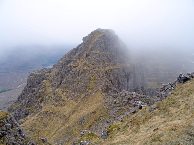
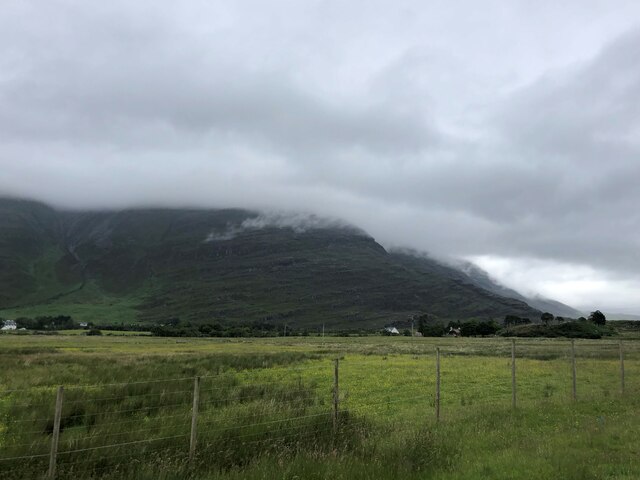
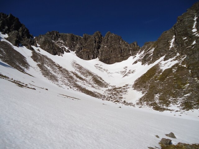
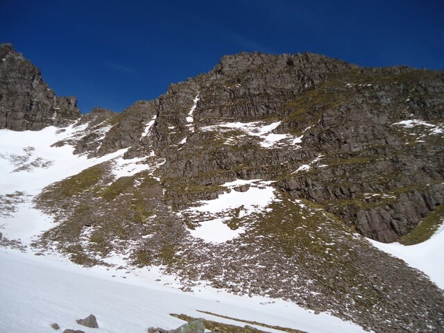
Liathach

Range Of Mountains, Range Of Hills in Ross-shire

Scotland

Liathach

Am Fasarinen This is the distinctly airy ground between the 2 main summits of Liathach known as the Am Fasarinen Pinnacles. As parts are a Grade 2 scramble I am using the contour path as I have my canine friend with me. You can just about see this path half way up the peak on the left hand side. It's not for the faint hearted!
Am Fasarinen Credit: Adam Ward

The requested URL returned error: 429 Too Many Requests

If you have any feedback on the listing, please let us know in the comments section below.
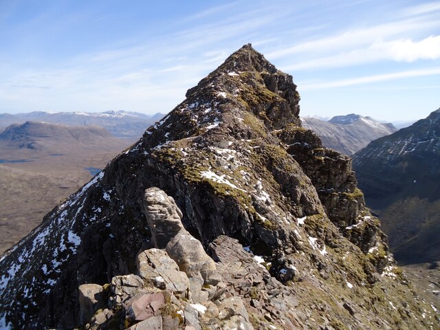
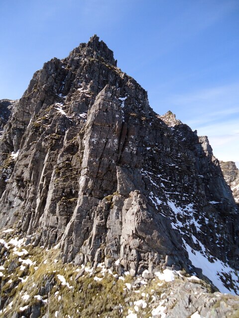
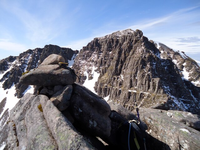
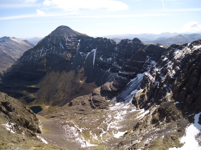
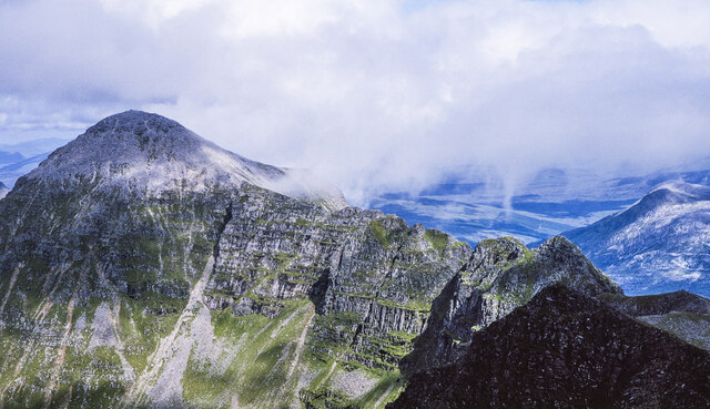
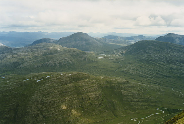
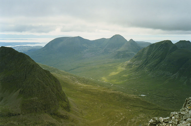
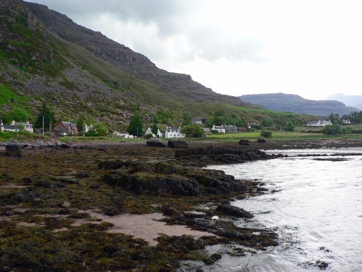
Liathach Images

Images are sourced within 2km of 57.561432/-5.4865132 or Grid Reference NG9157. Thanks to Geograph Open Source API. All images are credited.

Am Fasarinen This is the distinctly airy ground between the 2 main summits of Liathach known as the Am Fasarinen Pinnacles. As parts are a Grade 2 scramble I am using the contour path as I have my canine friend with me. You can just about see this path half way up the peak on the left hand side. It's not for the faint hearted!
Am Fasarinen
This is the distinctly airy ground between the 2 main summits of Liathach known as the Am Fasarinen Pinnacles. As parts are a Grade 2 scramble I am using the contour path as I have my canine friend with me. You can just about see this path half way up the peak on the left hand side. It's not for the faint hearted!
A896 passing Glen Cottage The A896 runs 32 miles from Strathcarron to Kinlochewe.
<span class="nowrap"><a title="https://www.sabre-roads.org.uk/wiki/index.php?title=A896" rel="nofollow ugc noopener" href="https://www.sabre-roads.org.uk/wiki/index.php?title=A896">Link</a><img style="margin-left:2px;" alt="External link" title="External link - shift click to open in new window" src="https://s1.geograph.org.uk/img/external.png" width="10" height="10"/></span>
A896 passing Glen Cottage
The A896 runs 32 miles from Strathcarron to Kinlochewe. LinkExternal link
A896 The A896 runs 32 miles from Strathcarron to Kinlochewe.
<span class="nowrap"><a title="https://www.sabre-roads.org.uk/wiki/index.php?title=A896" rel="nofollow ugc noopener" href="https://www.sabre-roads.org.uk/wiki/index.php?title=A896">Link</a><img style="margin-left:2px;" alt="External link" title="External link - shift click to open in new window" src="https://s1.geograph.org.uk/img/external.png" width="10" height="10"/></span>
A896
The A896 runs 32 miles from Strathcarron to Kinlochewe. LinkExternal link
A896, Glen Torridon The A896 runs 32 miles from Strathcarron to Kinlochewe.
<span class="nowrap"><a title="https://www.sabre-roads.org.uk/wiki/index.php?title=A896" rel="nofollow ugc noopener" href="https://www.sabre-roads.org.uk/wiki/index.php?title=A896">Link</a><img style="margin-left:2px;" alt="External link" title="External link - shift click to open in new window" src="https://s1.geograph.org.uk/img/external.png" width="10" height="10"/></span>
A896, Glen Torridon
The A896 runs 32 miles from Strathcarron to Kinlochewe. LinkExternal link
A896 The A896 runs 32 miles from Strathcarron to Kinlochewe.
<span class="nowrap"><a title="https://www.sabre-roads.org.uk/wiki/index.php?title=A896" rel="nofollow ugc noopener" href="https://www.sabre-roads.org.uk/wiki/index.php?title=A896">Link</a><img style="margin-left:2px;" alt="External link" title="External link - shift click to open in new window" src="https://s1.geograph.org.uk/img/external.png" width="10" height="10"/></span>
A896
The A896 runs 32 miles from Strathcarron to Kinlochewe. LinkExternal link
Liathach in the mist Liathach rises to 1,054m but poor visibility denies us that view. Torridon village is at its foot
Liathach in the mist
Liathach rises to 1,054m but poor visibility denies us that view. Torridon village is at its foot
Allt an Tuill Bhain
Allt an Tuill Bhain
The Northern Corrie of Mullach an Rathain, Liathach Climbing to the dip (right of centre) is probably the easiest way of gaining the Munro Top, Meall Dearg.
The Northern Corrie of Mullach an Rathain, Liathach
Climbing to the dip (right of centre) is probably the easiest way of gaining the Munro Top, Meall Dearg.
Meall Dearg from the Northern Corrie of Mullach an Rathain It may seem easy to climb up to the right, but it is better to make for the gap first.
Meall Dearg from the Northern Corrie of Mullach an Rathain
It may seem easy to climb up to the right, but it is better to make for the gap first.
Approaching the summit of Meall Dearg From the col separating it from Mullach an Rathain.
Approaching the summit of Meall Dearg
From the col separating it from Mullach an Rathain.
The Northern Pinnacles of Mullach an Rathain Visiting Meall Dearg (behind the camera) from the main ridge requires a descent of this ridge.  It is a set of pinnacles, and there seems to be no bypass route.  And then you might have to climb back up again!
The Northern Pinnacles of Mullach an Rathain
Visiting Meall Dearg (behind the camera) from the main ridge requires a descent of this ridge. It is a set of pinnacles, and there seems to be no bypass route. And then you might have to climb back up again!
The summit of Meall Dearg, Liathach With a GPS checking the location.

Mullach an Rathain and the Northern Pinnacles are to the right.
The summit of Meall Dearg, Liathach
With a GPS checking the location. Mullach an Rathain and the Northern Pinnacles are to the right.
Liathach from Meall Dearg Spidean a' Choire Leith, the highest point of Liathach at 1055m, is prominent on the left. In the centre are the pinnacles of Am Fasarinen. These provide an interesting but exposed scramble if walking between the two Munros. There is a bypass path on the south side of Am Fasarinen, not visible here, but this path, though technically easier, is even more exposed!

Below is the upper part of Coire na Caime.
Liathach from Meall Dearg
Spidean a' Choire Leith, the highest point of Liathach at 1055m, is prominent on the left. In the centre are the pinnacles of Am Fasarinen. These provide an interesting but exposed scramble if walking between the two Munros. There is a bypass path on the south side of Am Fasarinen, not visible here, but this path, though technically easier, is even more exposed! Below is the upper part of Coire na Caime.
Knolls along ridge east from Mullach an Rathain Mullach an Rathain is a Munro, one of two along the ridge of Liathach. Spidean a' Choire Lèith, the far dome is the other, and is higher. There are many lesser peaks along the connecting ridge which forms the back wall to Coire na Caime.
Knolls along ridge east from Mullach an Rathain
Mullach an Rathain is a Munro, one of two along the ridge of Liathach. Spidean a' Choire Lèith, the far dome is the other, and is higher. There are many lesser peaks along the connecting ridge which forms the back wall to Coire na Caime.
View south from Am Fasarinen With Maol Chinn-dearg prominent in the distance.
View south from Am Fasarinen
With Maol Chinn-dearg prominent in the distance.
Looking down Coire Mhic Nòbuil Taken from the summit of Spidean a' Choire Lèith, with Beinn Alligin in the distance.
Looking down Coire Mhic Nòbuil
Taken from the summit of Spidean a' Choire Lèith, with Beinn Alligin in the distance.
A896 Glen Cottage This is Glen Cottage and wood in Glen Torridon from west near deer grid below Liathach.
A896 Glen Cottage
This is Glen Cottage and wood in Glen Torridon from west near deer grid below Liathach.
Liathach runs down to the A896 In his 'Place-names of Ross & Cromarty' Watson talks of Liathach being 'the hoary place' on page 210 but then goes on to evaluate the attendant peaks.
Liathach runs down to the A896
In his 'Place-names of Ross & Cromarty' Watson talks of Liathach being 'the hoary place' on page 210 but then goes on to evaluate the attendant peaks.
Show me another place!

Liathach is located at Grid Ref: NG9157 (Lat: 57.561432, Lng: -5.4865132)

Unitary Authority: Highland

Police Authority: Highlands and Islands

What 3 Words

///vast.huddled.acclaimed. Near Kinlochewe, Highland

Related Wikis

Liathach

Liathach (Scottish Gaelic for 'the hoary place'; pronounced [ˈʎiəhəx]) is a mountain in the Torridon Hills, in the Northwest Highlands of Scotland. It...

Torridon

Torridon (Scottish Gaelic: Toirbheartan) is a small village in the Northwest Highlands of Scotland. However the name is also applied to the area surrounding...

Torridon Hills

The Torridon Hills surround Torridon village in the Northwest Highlands of Scotland. The name is usually applied to the mountains to the north of Glen...

Beinn Dearg (Torridon)

Beinn Dearg is the fourth highest of the Torridon Hills in the highlands of Scotland. Beinn Dearg offers all the typical features of a Torridon hill, with...

Nearby Amenities

Located within 500m of 57.561432,-5.4865132
Mullach an Rathain
Description: Summit of the row of pinnacles
Ele: 1023
Marilyn: yes
Munro: yes
Munro Number: M108
Natural: peak
Prominence: 152
Source: survey
Wikidata: Q13129542
Lat/Long: 57.5609005/-5.4924941
Meall Dearg
Natural: peak
Source: GPS
Wikidata: Q20598117
Lat/Long: 57.5632166/-5.4894721
Ele: 895
Natural: saddle
Lat/Long: 57.5626083/-5.4907198
The data included in this document is from www.openstreetmap.org. The data is made available under ODbL.

Have you been to Liathach?

Leave your review of Liathach below (or comments, questions and feedback).