Beinn Bharrain

Range Of Mountains, Range Of Hills in Buteshire

Scotland

Beinn Bharrain

Beinn Bharrain The higher NE top is on the left. 
In the background is the highest range of Arran hills, extending from Caisteal Abhail (centre) to Beinn Tarsuinn (right).
Beinn Bharrain Credit: Ian Taylor

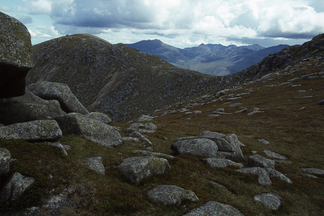
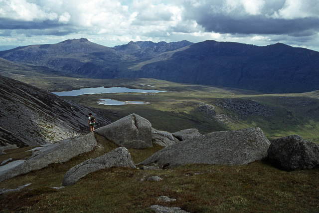
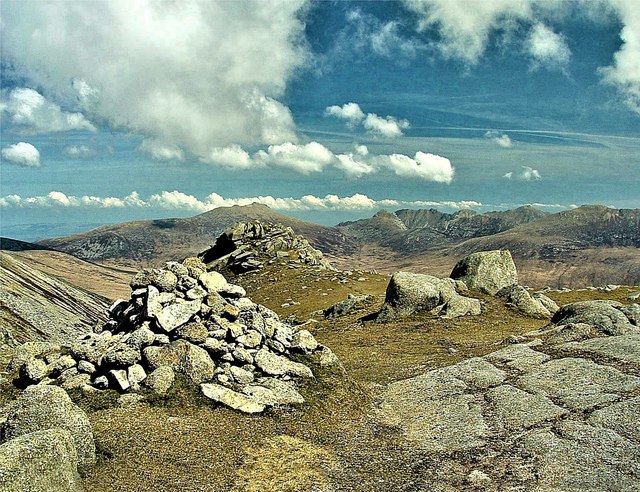
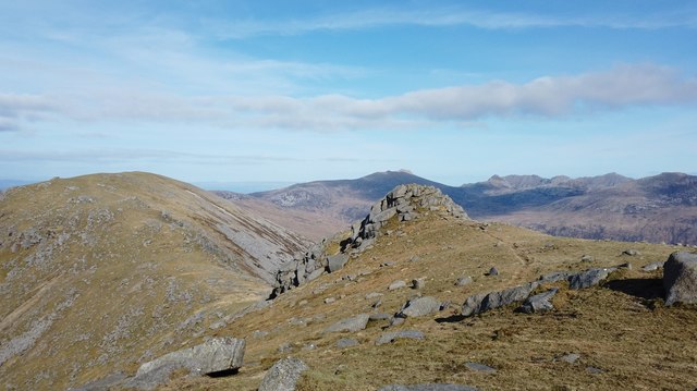
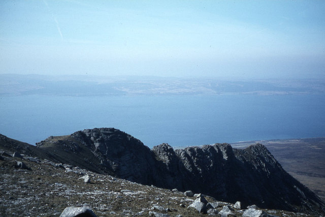
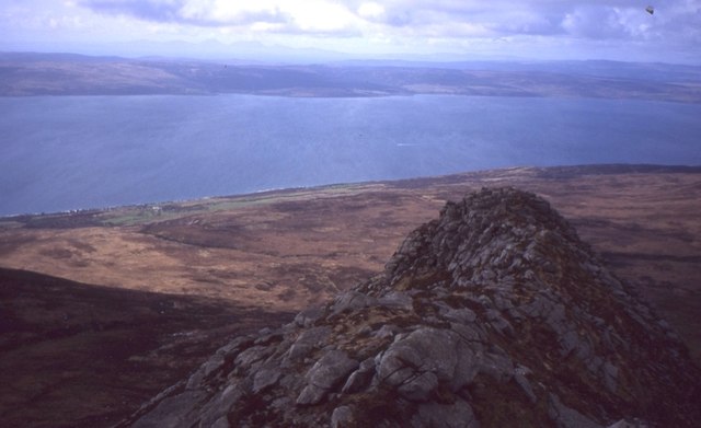
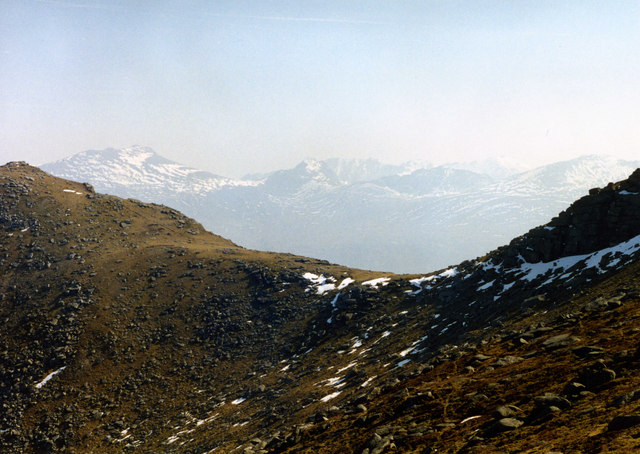
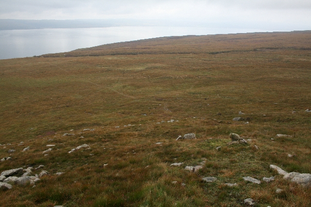
Beinn Bharrain is a prominent range of mountains located in the region of Buteshire, on the Isle of Arran in Scotland. This range of hills stretches for approximately 7 kilometers and is part of the larger mountainous landscape of the island.

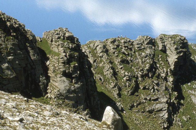
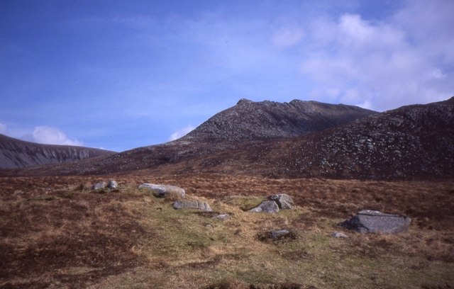
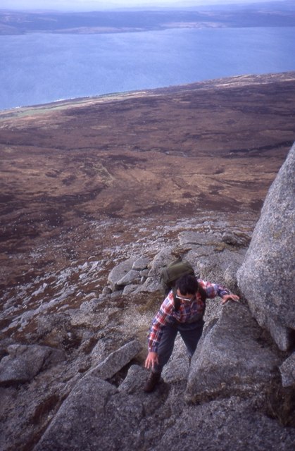
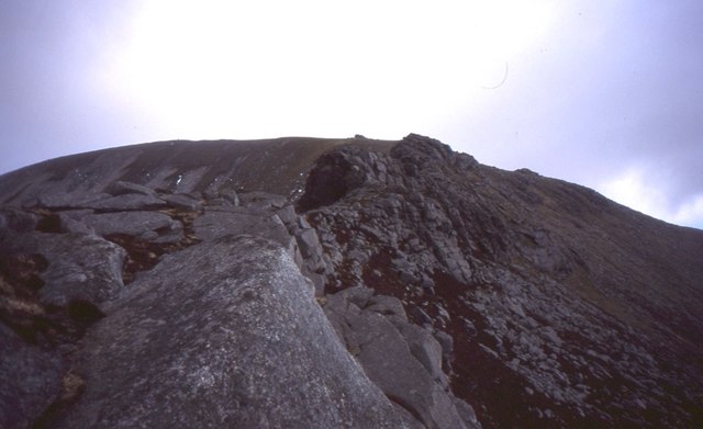
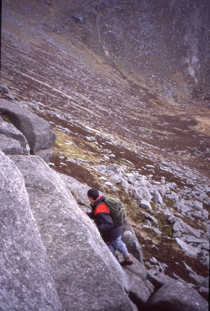
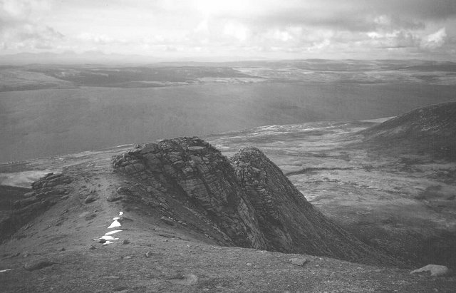
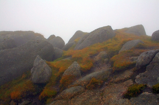
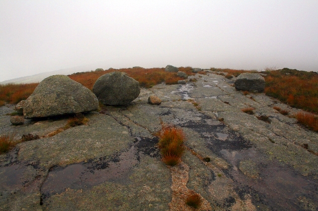
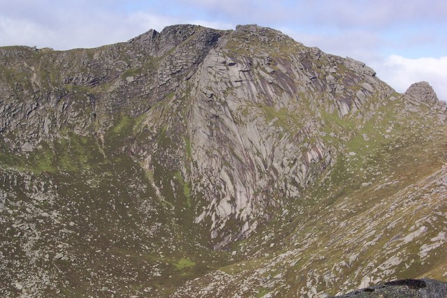
The highest peak in the Beinn Bharrain range stands at an impressive 721 meters above sea level, offering breathtaking panoramic views of the surrounding area. The terrain is mostly rugged and rocky, with steep slopes and craggy cliffs, making it a challenging yet rewarding destination for hiking enthusiasts.

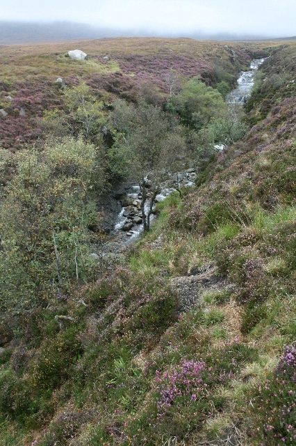
The range is characterized by its diverse flora and fauna, with heather-covered slopes and scattered patches of woodland providing habitats for a variety of species. The area is known for its rich biodiversity, including rare plants and several bird species, making it an attractive location for nature lovers and birdwatchers.

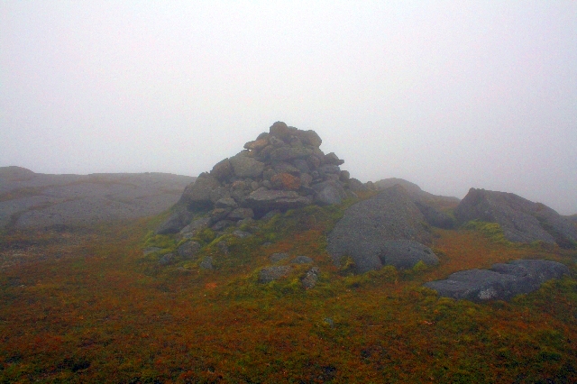
Beinn Bharrain also holds historical significance, as it is home to several ancient archaeological sites. The remnants of Iron Age forts and burial cairns can be found scattered throughout the range, offering a glimpse into the island's ancient past.

The range is easily accessible, with well-marked trails and paths leading to the summit. Hikers can choose from a range of routes, each offering a different level of difficulty and duration. The stunning views, dramatic landscapes, and rich history make Beinn Bharrain a popular destination for outdoor enthusiasts and those seeking a unique experience in the heart of Buteshire.

If you have any feedback on the listing, please let us know in the comments section below.

Beinn Bharrain Images

Images are sourced within 2km of 55.630669/-5.3409789 or Grid Reference NR8942. Thanks to Geograph Open Source API. All images are credited.

Beinn Bharrain The higher NE top is on the left. 
In the background is the highest range of Arran hills, extending from Caisteal Abhail (centre) to Beinn Tarsuinn (right).
Beinn Bharrain
The higher NE top is on the left. In the background is the highest range of Arran hills, extending from Caisteal Abhail (centre) to Beinn Tarsuinn (right).
East from Beinn Bharrain View from the SW top towards Loch Tanna and Dubh Loch. 
In the background is the highest range of Arran hills, extending from Caisteal Abhail (centre left) to Caisteal an Fhinn (right).
East from Beinn Bharrain
View from the SW top towards Loch Tanna and Dubh Loch. In the background is the highest range of Arran hills, extending from Caisteal Abhail (centre left) to Caisteal an Fhinn (right).
Beinn Bharrain - Casteal na h-Iolaire Casteal na h-Iolaire is the 717m top of Beinn Bharrain
Beinn Bharrain - Casteal na h-Iolaire
Casteal na h-Iolaire is the 717m top of Beinn Bharrain
Top of Casteal na h-Iolaire Looking from the top of Casteal na h-Iolaire looking towards Mullach Buidhe.
Top of Casteal na h-Iolaire
Looking from the top of Casteal na h-Iolaire looking towards Mullach Buidhe.
Rocky spur northwest from Mullach Buidhe
Rocky ridge on Beinn Bharrain
North ridge Mullach Buidhe There is some fine scrambling on this granite ridge which is a pleasant surprise as these western hills are mostly evenly weathered and smooth.
North ridge Mullach Buidhe
There is some fine scrambling on this granite ridge which is a pleasant surprise as these western hills are mostly evenly weathered and smooth.
Moorland above of Pirnmill Heading for Beinn Bharrain and its fine North Ridge.
Moorland above of Pirnmill
Heading for Beinn Bharrain and its fine North Ridge.
North ridge, Mullach Buidhe A granite ridge above Pirnmill. Gives a good scramble.
North ridge, Mullach Buidhe
A granite ridge above Pirnmill. Gives a good scramble.
North Ridge, Mullach Buidhe A short but high quality scrambling route on Arran's quieter side.
North Ridge, Mullach Buidhe
A short but high quality scrambling route on Arran's quieter side.
Scrambling, Beinn Bharrain On the north ridge of Mullach Buidhe.
Scrambling, Beinn Bharrain
On the north ridge of Mullach Buidhe.
North Ridge of Beinn Bharrain. The western hills of Arran are not as popular as the group around Glen Rosa and Glen Sannox. The granite here is fine grained and weathers to rounded hills.  There is still this ridge which gives an exciting scramble.
Taken from above the difficulties with a view over to Kintyre and Jura.
North Ridge of Beinn Bharrain.
The western hills of Arran are not as popular as the group around Glen Rosa and Glen Sannox. The granite here is fine grained and weathers to rounded hills. There is still this ridge which gives an exciting scramble. Taken from above the difficulties with a view over to Kintyre and Jura.
Beinn Bharrain Arran's better known hills to the east.
Beinn Bharrain
Arran's better known hills to the east.
Spot Height 711 on Beinn Bharrain. This is the first high point met when coming from Mullach Buide.
Spot Height 711 on Beinn Bharrain.
This is the first high point met when coming from Mullach Buide.
Cairn on Beinn Bharrain. Shown as spot height 717 on the 1:25,000 map.
Cairn on Beinn Bharrain.
Shown as spot height 717 on the 1:25,000 map.
Boulders and Slabs North of Casteal na h-Iolaire These slabs are nice and dry and horizontal, so no problem walking on them.  Find them wet and at an angle and they are treacherous.
Boulders and Slabs North of Casteal na h-Iolaire
These slabs are nice and dry and horizontal, so no problem walking on them. Find them wet and at an angle and they are treacherous.
Allt Gobhlach. Looking across from the lower slopes of Beinn Bharrain.
Allt Gobhlach.
Looking across from the lower slopes of Beinn Bharrain.
Allt Gobhlach. A burn that draws its waters from the corries beneath Beinn Bharrain, Mulach Buide and Beinn Bhreac and delivers them into the Kilbrannan Sound and Pirnmill.
Allt Gobhlach.
A burn that draws its waters from the corries beneath Beinn Bharrain, Mulach Buide and Beinn Bhreac and delivers them into the Kilbrannan Sound and Pirnmill.
Show me another place!

Beinn Bharrain is located at Grid Ref: NR8942 (Lat: 55.630669, Lng: -5.3409789)

Unitary Authority: North Ayrshire

Police Authority: Ayrshire

What 3 Words

///revamping.myself.wolves. Near Lochranza, North Ayrshire

Related Wikis

Beinn Bharrain

Beinn Bharrain (721 m) is a mountain on the Isle of Arran, Scotland, located in the far northwest of the Island. Despite being less frequently visited...

Pirnmill

Pirnmill (Scottish Gaelic: Muileann nam Piùirneachan) is a small village on the north-west coast of the Isle of Arran, Scotland. The village is situated...

Whitefarland

Whitefarland (Scottish Gaelic: An Aoirinn) is a clachan on the Isle of Arran in the Firth of Clyde, Scotland. It is located approximately 1 mile (2 kilometres...

Kilbrannan Sound

Kilbrannan Sound (Scottish Gaelic: An Caolas Branndanach) is a marine water body that separates the Kintyre Peninsula of Scotland from the island of Arran...

Beinn Tarsuinn (Corbett)

Beinn Tarsuinn is a mountain on the Isle of Arran, Scotland. It is the southernmost of the four Corbetts on the island, lying between Glen Rosa to the...

Catacol Bay

Catacol Bay (Scottish Gaelic: Catagal bhàigh) is a small shallow-curved tidal, 310° facing, rocky coastal embayment located on the northwest tip of the...

Catacol

Catacol (Scottish Gaelic: Catagal) is a small village on the Isle of Arran, Scotland. == Geography == Catacol is located on the north west side of the...

Caisteal Abhail

Caisteal Abhail is a mountain on the Isle of Arran in Scotland. It is the northernmost Corbett on the island. The mountain forms the main part of a view...

Nearby Amenities

Located within 500m of 55.630669,-5.3409789
Beinn Bharrain
Alt Name: Mullach Buidhe
Corbett: no
Ele: 717
Graham: yes
Marilyn: yes
Munro: no
Natural: peak
Prominence: 385
Wikidata: Q24656733
Wikipedia: en:Beinn Bharrain
Lat/Long: 55.6278628/-5.3436053
Man Made: survey_point
Lat/Long: 55.633152/-5.3346699
Mullach Buidhe
Ele: 721
Natural: peak
Source: local knowledge
Lat/Long: 55.633135/-5.3346618
Man Made: cairn
Lat/Long: 55.627943/-5.343684
Man Made: cairn
Lat/Long: 55.6331297/-5.334631
The data included in this document is from www.openstreetmap.org. The data is made available under ODbL.

Have you been to Beinn Bharrain?

Leave your review of Beinn Bharrain below (or comments, questions and feedback).