Wickhambreaux Valley

Valley in Kent Canterbury

England

Wickhambreaux Valley

Preston Grange, Grove Road This was the same house at <a href="https://www.geograph.org.uk/photo/6419495">TR2461 : Preston Grange, Grove Road</a> before its construction has been completed. Preston Grange is the name, which has been given to the development.
Preston Grange, Grove Road Credit: John Baker

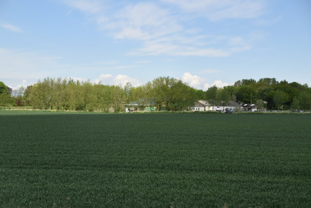
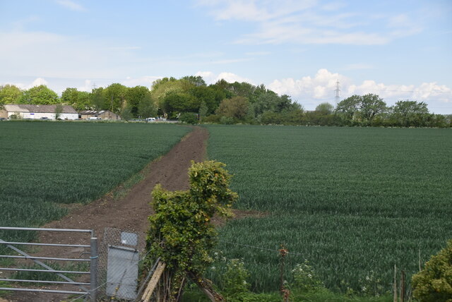
Wickhambreaux Valley, located in the county of Kent, is a picturesque and charming valley that offers a serene and peaceful environment. This beautiful valley is nestled between the villages of Wickhambreaux and Littlebourne, just a few miles southeast of the historic city of Canterbury.

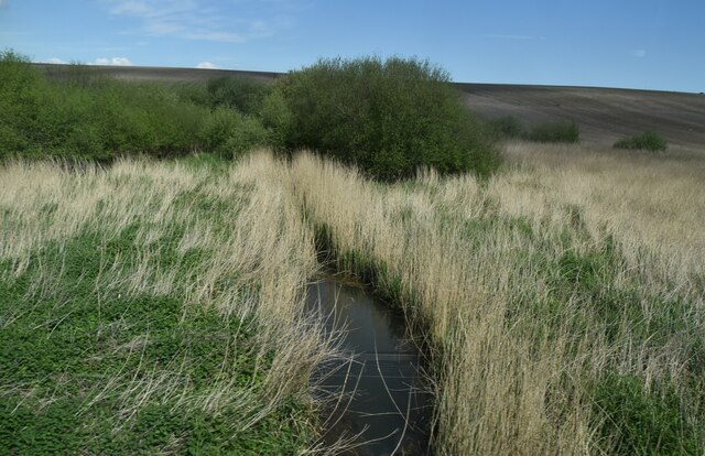
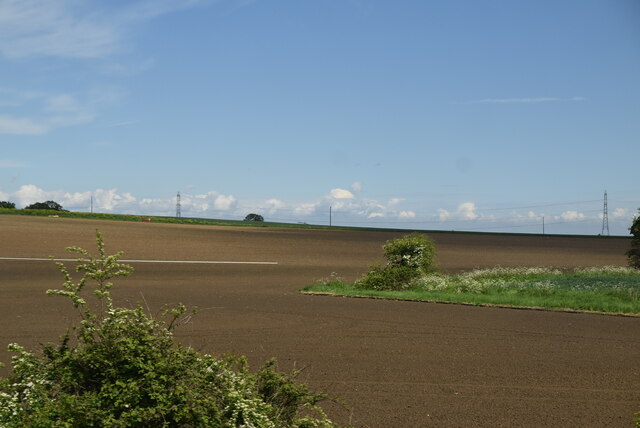
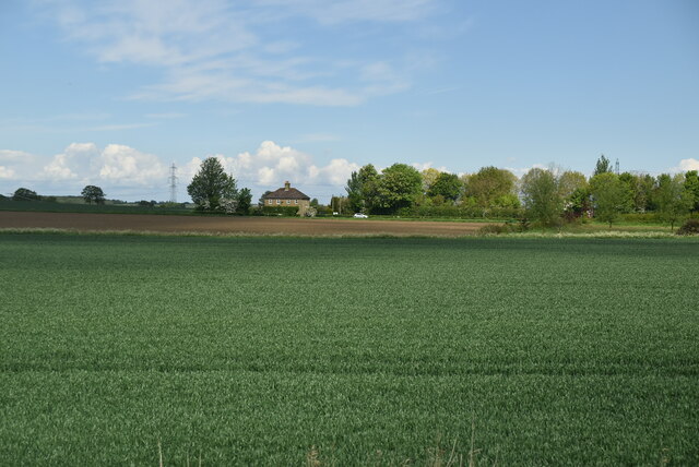
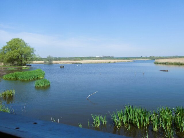
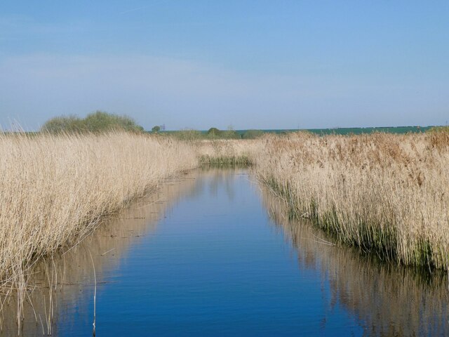
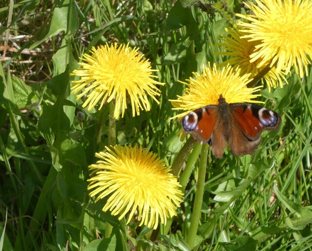
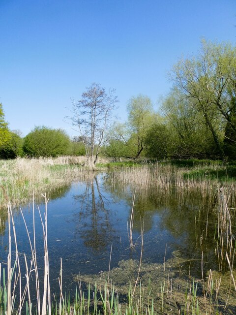
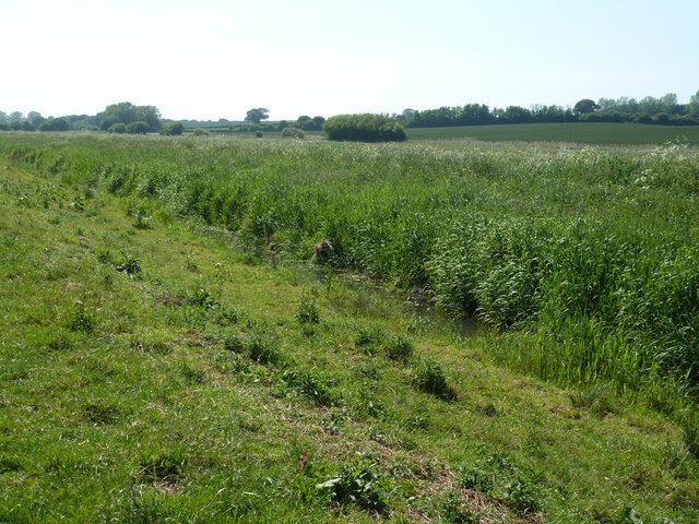
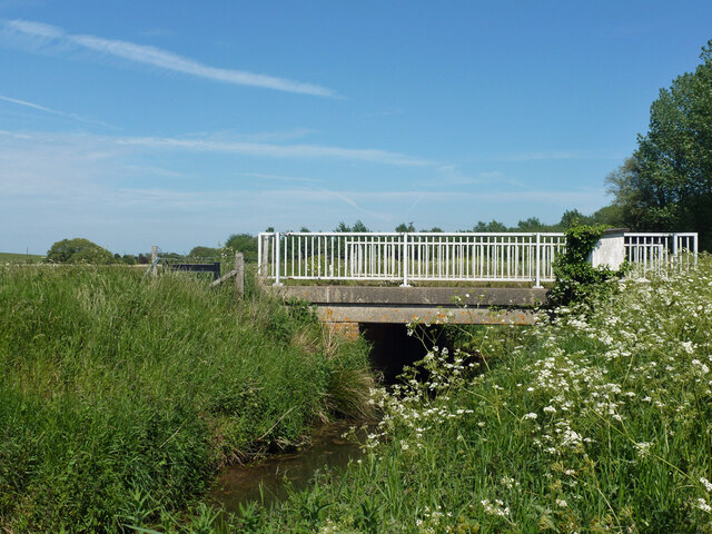
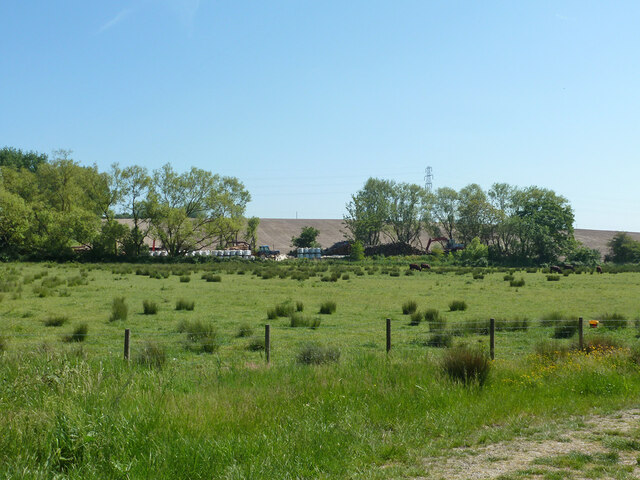
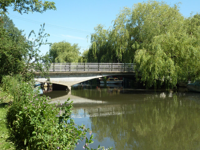
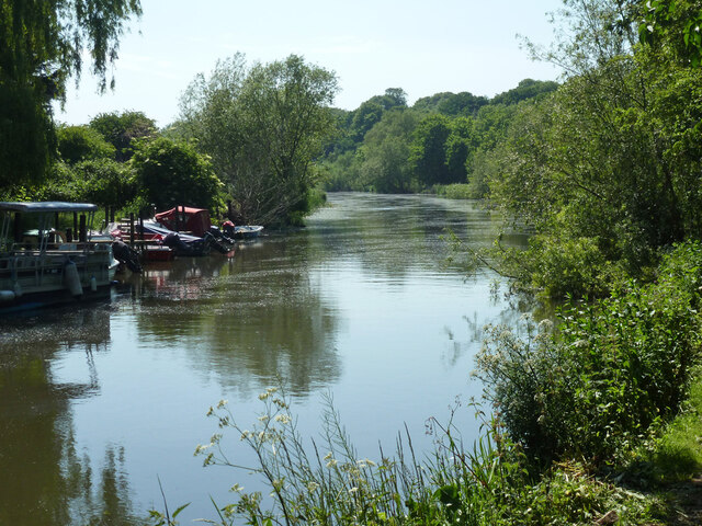
The valley is characterized by its rolling hills, lush green fields, and meandering river, the Little Stour. The river, with its crystal-clear waters, adds to the beauty of the landscape and provides a habitat for various wildlife species, including ducks, swans, and otters.

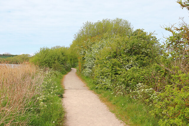
Wickhambreaux Valley is renowned for its idyllic countryside scenery, attracting nature lovers, hikers, and photographers alike. The valley boasts a network of footpaths and trails that offer stunning views of the surrounding countryside, making it a popular destination for outdoor enthusiasts.

Not only is the valley a haven for nature enthusiasts, but it also holds historical significance. The area is dotted with ancient buildings and landmarks, including the Grade I listed St Andrew's Church in Wickhambreaux, which dates back to the 12th century. These historical sites provide a glimpse into the rich heritage of the region.

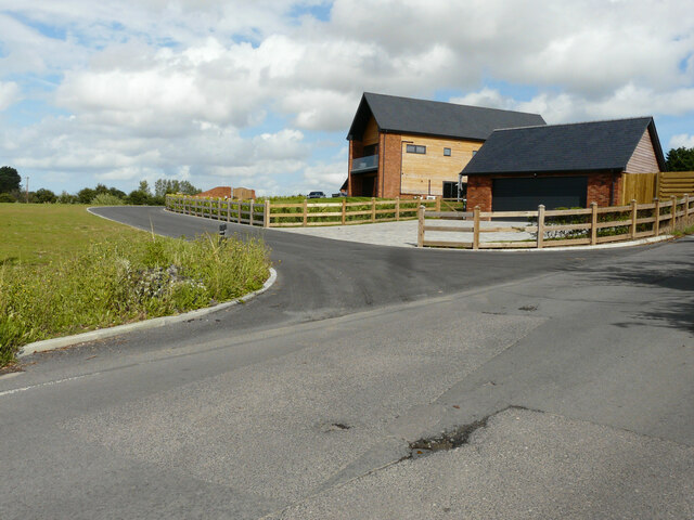
Furthermore, Wickhambreaux Valley is home to a vibrant community, with several small farms and country houses dotted throughout the area. The local residents take great pride in maintaining the beauty of the valley and preserving its natural heritage.

In conclusion, Wickhambreaux Valley in Kent is a stunning and tranquil destination, offering a perfect blend of natural beauty and historical charm. Whether it's exploring the picturesque countryside, immersing oneself in the rich history, or simply enjoying the peacefulness, Wickhambreaux Valley is a must-visit for those seeking an escape from the hustle and bustle of everyday life.

If you have any feedback on the listing, please let us know in the comments section below.

Wickhambreaux Valley Images

Images are sourced within 2km of 51.316671/1.2041826 or Grid Reference TR2362. Thanks to Geograph Open Source API. All images are credited.

Preston Grange, Grove Road This was the same house at <a href="https://www.geograph.org.uk/photo/6419495">TR2461 : Preston Grange, Grove Road</a> before its construction has been completed. Preston Grange is the name, which has been given to the development.
Preston Grange, Grove Road
This was the same house at TR2461 : Preston Grange, Grove Road before its construction has been completed. Preston Grange is the name, which has been given to the development.
Drainage channel
Drainage channel
Farmland in Stour Valley
Arable fields
Arable fields
Wall End Farm
Wall End Farm
Footpath crossing field
Stodmarsh National Nature Reserve View from Reedbed Hide on the south side of the reserve.
Stodmarsh National Nature Reserve
View from Reedbed Hide on the south side of the reserve.
Stodmarsh National Nature Reserve View from the footpath of one of the drainage ditches through the reedbeds.
Stodmarsh National Nature Reserve
View from the footpath of one of the drainage ditches through the reedbeds.
Stodmarsh National Nature reserve Dandelions and peacock butterfly by one of the footpaths.
Stodmarsh National Nature reserve
Dandelions and peacock butterfly by one of the footpaths.
Stodmarsh National Nature Reserve Southern end of a lake in the reserve.
Stodmarsh National Nature Reserve
Southern end of a lake in the reserve.
Robin in the car park of Stodmarsh National Nature Reserve Robins and blue tits are fed by visitors and, therefore, become extremely tame. They appear so friendly but, of course, it's cupboard love.
Robin in the car park of Stodmarsh National Nature Reserve
Robins and blue tits are fed by visitors and, therefore, become extremely tame. They appear so friendly but, of course, it's cupboard love.
Lampen Wall Path in Stodmarsh Nature Reserve.
Lampen Wall
Path in Stodmarsh Nature Reserve.
Nethergong Penn A rather overgrown but important drainage channel.
Nethergong Penn
A rather overgrown but important drainage channel.
Bridge over Nethergong Penn The road crossing is Nethergong Hill, at least to the right. It becomes Sandpit Hill somewhere to the left.
Bridge over Nethergong Penn
The road crossing is Nethergong Hill, at least to the right. It becomes Sandpit Hill somewhere to the left.
Bagged firewood site near Nethergong Farm A deduction from the stacks of timber and a great many white bags.
Bagged firewood site near Nethergong Farm
A deduction from the stacks of timber and a great many white bags.
Bridge over Great Stour, Grove Ferry Aside from a temporary WWII military bridge, soon perversely dismantled, there was no bridge here until 1963. Before, there was a one-at-a-time vehicle ferry.
Bridge over Great Stour, Grove Ferry
Aside from a temporary WWII military bridge, soon perversely dismantled, there was no bridge here until 1963. Before, there was a one-at-a-time vehicle ferry.
Great Stour upstream of Grove Ferry
Railway west of Grove Ferry level crossing The Ashford to Ramsgate line.
Railway west of Grove Ferry level crossing
The Ashford to Ramsgate line.
Show me another place!

Wickhambreaux Valley is located at Grid Ref: TR2362 (Lat: 51.316671, Lng: 1.2041826)

Administrative County: Kent

District: Canterbury

Police Authority: Kent

What 3 Words

///inherits.sobered.fend. Near Wingham, Kent

Nearby Locations

Grove Wickhambreaux Valley

Related Wikis

Grove Ferry Picnic Area

The Grove Ferry Picnic Area is near Upstreet, in Kent, England, on the site of an old hand-drawn ferry that once crossed the River Stour here. The area...

Grove Ferry and Upstreet railway station

Grove Ferry and Upstreet was a railway station in east Kent. It was opened by South Eastern Railway (SER), on the Ashford to Ramsgate (via Canterbury West...

Upstreet

Upstreet is a village in the civil parish of Chislet in Kent, England. It is in the local government district of Canterbury, and the electoral ward of...

Preston-next-Wingham

Preston or Preston-next-Wingham is a civil parish and village in the valley of the Little Stour in the Dover District of Kent, England. The village is...

Nearby Amenities

Located within 500m of 51.316671,1.2041826
Information: map
Tourism: information
Lat/Long: 51.3151477/1.2009348
Information: map
Tourism: information
Lat/Long: 51.3137549/1.1987286
Tourism: picnic_site
Lat/Long: 51.320296/1.2048886
Barrier: kissing_gate
Lat/Long: 51.3138633/1.19891
Barrier: stile
Lat/Long: 51.3130307/1.2004167
Barrier: kissing_gate
Lat/Long: 51.3138253/1.1988154
Barrier: kissing_gate
Lat/Long: 51.3143904/1.2072585
Viewing Mound
Tourism: viewpoint
Lat/Long: 51.3204346/1.2051852
Barrier: kissing_gate
Lat/Long: 51.31664/1.2024864
Barrier: stile
Lat/Long: 51.3132575/1.2001745
Bench
Lat/Long: 51.3204096/1.2051658
Bench
Lat/Long: 51.3204144/1.2052135
The data included in this document is from www.openstreetmap.org. The data is made available under ODbL.

Have you been to Wickhambreaux Valley?

Leave your review of Wickhambreaux Valley below (or comments, questions and feedback).